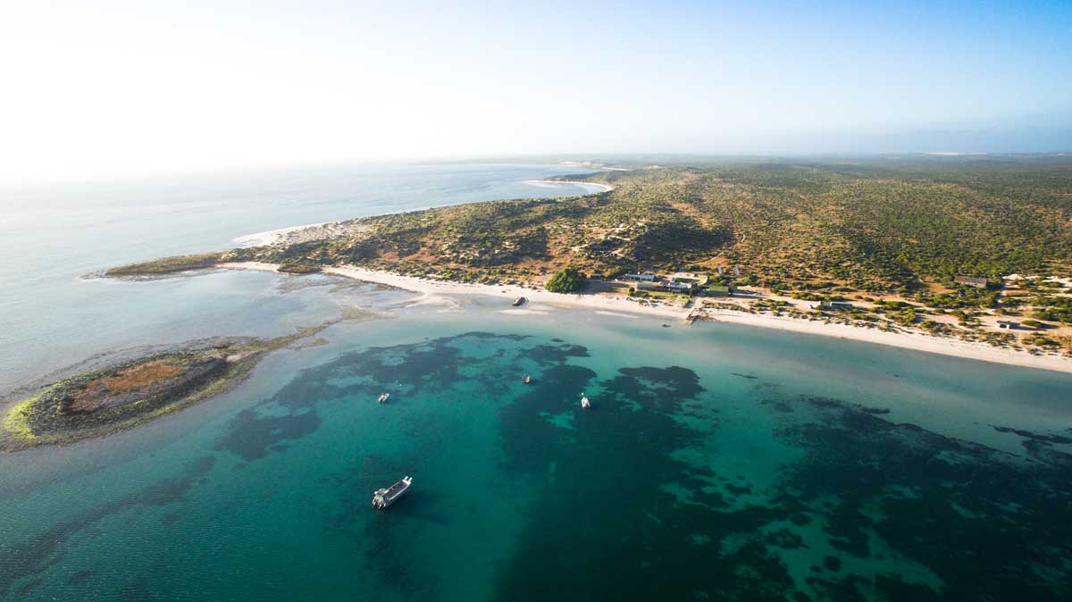
Dirk Hartog Island, Western Australia
Dirk Hartog - 1616
 On its second voyage to the East Indies, the Dutch trading vessel Eendracht, flying the Dutch East india Company flag, set sail on 23rd January, 1616 from Holland. However, the 700 hundred tonne vessel became separated from the rest of the fleet in a storm near the Cape of Good Hope and continued the voyage alone.
Its skipper, Dirk Hartog, appears to be one of the first Dutch skippers to test a new route to the East Indies which took full advantage of the westerlies to the east of the Cape of Good Hope, rather than turning north and following Africa's east coast. Much to his surprise Hartog sighted islands off the coast of the Southland on his journey. He anchored in a bay near one of these islands (later to be named in his honour) on 25th October, 1616.
He came ashore at what today is known as Turtle Bay, and recorded his visit on a flattened pewter plate which he nailed to a post on the clifftop of Cape Inscription. The translation of the inscription reads: "Gilles Miebas of Leige; Skipper Dirck Hatichs of Amsterdam. She set sail again for Bantam on the 27th do. Sub cargo Jan Stins; Upper Steersman Pieter E. Doores of Bil. Dated 1616".
J van Roosenbergh (Wapen Van Hoorn) - 1622
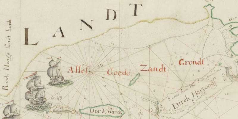
In the same year that the British ship Trial ran aground and broke up, the Dutch VOC ship Wapen van Hoorn (weapon of Hoorn) was almost shipwrecked on the west coast of Australia. Wapen van Hoorn was a wooden fluyt with a tonnage of between 400 and 600, built in the Dutch Republic in 1619. During its second voyage it grounded on the west coast of Australia, making it about the tenth Dutch ship to make landfall on Australian soil. It departed Texel for Batavia on 26th December 1621. In June 1622 "at night in a hard wind", the ship ran aground near Shark Bay. It was eventually refloated, and arrived in Batavia on 22nd July 1622. The vessel departed Batavia under Captain Pieter Gerritsz.The Wapen Van Hoorn departed Texel on 19th February 1627 under the command of David Pieterszoon de Vries on its third voyage to Batavia. It stayed at the Cape of Good Hope from 16 July to 7 August. In September it made landfall at Shark Bay, noting corrections to Dirk Hartog's chart of the location. It arrived at Batavia on 13 October. It appears to have remained in the Indies from then on.
Grooten Broeck - 1631
The VOC ship Grooten Broeck (Great Brook) sailed along the coast of Eendracht's Land from Cape Leeuwin to Dirk Hartog Island on the way to Batavia. No landings or incidents were reported.Willem de Vlamingh - 1697
 Three Dutch ships sailed under the command of Willem de Vlamingh in May 1996 from Amsterdam in search of the remains of a number of Dutch ships which had vanished without trace on their journey to the East Indies. On 30th January 1697, de Vlamingh sighted another island which he thought to be Dirk Hartog's Island. The Geelvinck and Nijptang were sent ahead to circumnavigate the island and find a good anchorage. On 3rd February, the boats returned and the First Mate reported a startling discovery. When he had climbed a hill to get a better view, he had found a pole with a pewter plate half hidden in the sand. The writings on it stated that it had been left behind by Dirk Hartog in 1616. de Vlamingh replaced it with one of his own which included Hartog's inscription. The location, named Cape Inscription, was later marked by a monument. It was now certain that de Vlamingh had landed on Dirk Hartog island and the next day the ships sailed into a sheltered lagoon.
William Dampier - 1699
 In August 1699 Captain William Dampier anchored in Shark Bay and surveyed the northern end of Dirk Hartog Island, however he apparently did not come across Vlamingh's plate which had been mounted on a pole there some two years earlier. He spent nine days in the Shark Bay area before sailing north around North West Cape. Dampier left no record of his visit, but did give the place the name Shark Bay.
Dampier's observations ensured that no one in Britain took any great interest in Australia for the next century: "New Holland is a very large tract of land. It is not yet determined whether it is an island or a main Continent..... This part of it that we saw is all low even land with sandy banks against the sea...... The land is of a dry sandy Soil, destitute of Water, except you make wells, yet producing divers sorts of Trees; but the Woods are not thick, nor the trees very big.....We saw no Trees that bore Fruit or Berries. We saw no sort of Animal.....Here are a few small Land-birds... The Inhabitants of this Country are the miserablest People in the World.... And setting aside their human Shape, they differ but little from Brutes.... Their Eye-lids are always half close, to keep out the Flies out of their Eyes..... They have great Bottle Noses, pretty full Lips and wide Mouths.... They have no sort of Cloaths, but a piece of the Rind of a tree...to cover their nakedness. They have no Houses, but lye in open air without any covering, the earth being their Bed, and Heaven their Canopy...... Their only Food is a small sort of Fish... they have no Instruments to catch great Fish..... so that their chiefest dependence is upon what the Sea leaves in their Wares".
Saint-Alouarn - 1772
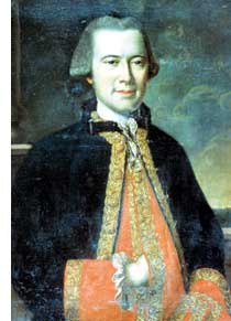 In 1772, an expedition led by Yves-Joseph de Kerguelen-Tremarec left Ile de France (Mauritius) in command of the 24-gun flute Fortune and the 16-gun storeship (gabare) Gros-Ventre, commanded by Capt. Louis Francois Marie Aleno de Saint-Alouarn, having been commissioned by King Louis XV to discover the Southern Continent Frenchman Jean Binot Paulmier De Gonneville claimed to have visited in 1504 for France.
On 11 February 1772, de Kerguelen-Tremarec, after sailing his two ships in the southern Indian Ocean, the expedition sighted a large mountainous island that Kerguelen took for Australia (the island was later named after him). The two ships lost sight of each other during bad weather. After a party from Fortune had made a brief visit to the island, Kerguelen returned to France.
After also landing a party on the island, Saint-Alouarn continued towards Australia and a rendezvous point at Cape Leeuwin, arranged earlier with Kerguelen.
On 17 March he arrived off a bay (later Flinders Bay), near Cape Leeuwin With no sign of Kerguelen, Saint-Alouarn followed the coast northward as far as Shark Bay, anchoring off Turtle Bay at the north end of Dirk Hartog Island in Shark Bay.
Being too ill himself to leave the vessel, his second in command, Lieut. M. de Mingot, went ashore, raised the French flag and read a statement claiming possession of all the land to the north and east of Shark Bay for King Louis XV of France. This was the first formal European claim of possession of Western Australia - two years after James Cook had claimed the eastern section of Australia for Great Britain, and sixteen years before the arrival of the First Fleet!
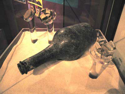
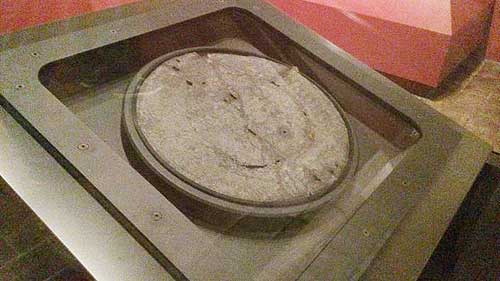
The bottle and two french coins buried by the Louis de Saint-Alouarn Expedition in 1772
According to the custom of his time, he buried, at the foot of a tree, a bottle containing two silver six "écus" (coins) worth six Livres tournois (Francs), as well as a parchment documenting the claim. They fired the traditional rounds of ammunition to mark the event. At the same time, Etienne de Rosily-Mesros plotted the coastline and drew up a map as evidence of their visit.
Most of the crew, including Lieut. de Mingot, died on the voyage home to France. On his return, St Alouarn, himself hospitalised and in poor health, dictated a letter to Kerguelen, advising that he had taken possession of western New Holland. Saint-Alouarn failed to recover and died on 27 October. His claim was never acknowledged by the French authorities - it may have not been passed on to the powers that be, or it could have been brushed aside as the ramblings a delirious, dying man.
St Alouarn's act of possssion took place in sight of Cape Inscription, where in 1696 the Dutch mariner Willem de Vlamingh had left a commemorative plate recording his visit and that of Dirk Hartog in 1616. It is not known whether or not Saint-Allouarn knew the significance of the location, but indications are that he did not. He left Vlamingh's pewter plate undisturbed and there is nothing in the ship's journal to indicate he knew the significance of the site.
A year before de Kerguelen-Tremarec and Saint-Allouarn left France on their expedition into the Southern Hemisphere, an associate of Kerguelen-Tremarec, Marc-Joseph Marion du Fresne, also left Mauritius for the Southern Hemisphere, but his destination was the South Pacific. As Saint-Allouarn was sailing the west coast of the Australian mainland, du Fresne was sailing the south coast of Tasmania.
14 days before Saint-Allouarn's crew went ashore at Shark Bay and claimed the western half of the Australian continent for France, du Fresne went ashore at Blackmans Bay and claimed Tasmania (then called Van Diemen's Land) for France. Ironically, both men died before being able to tell the French Government that a large part of Australia was now theirs. Consequently, it would be the English and not the French who, on 2nd May 1829, would take definitive possession of West Australia.

Louis de Freycinet - 1801
 In 1801 the Island was again visited, this time by a major French expedition led by Nicolas Baudin. Expedition members of the Naturaliste, under the command of Jacques Félix Emmanuel Hamelin, found Vlamingh's plate almost buried in the sand, its post having long ago rotted away. The crew brought their find back to the Naturaliste, but Hamelin felt it would be sacrilege to remove the plate from the Island.
He made a careful copy of the inscription, then ordered it be returned from where it was found, although his young officers – including Louis de Freycinet - felt it should be taken to France.
Louis de Freycinet felt so strongly that such a trophy should be taken back to Europe, returned fourteen years to Dirk Hartog Island under the command of his own ship, the Uranie. He sent a boat ashore to recover Vlamingh's plate and substituted it with a a lead plate recording his own visit, which has never been found. After being shipwrecked in the Falkland Islands the plate and other materials from the Uranie voyage were later transferred to another ship and taken to France, where it was presented to the Academie Francaise in Paris.
His journal makes no mention of Saint-Alouarn's bottle, which indicates that he was either not aware of its existence, or did not believe the validity of Saint-Alouarn's claim.
Marking the location in 1938, the Commonwealth government commemorated Dirk Hartog's landing with a brass plaque. Just short of 60 years later, on 12 February 1997, the then premier of Western Australia, Richard Court, unveiled a bronze plaque to mark the tricentennial of Vlamingh's visit. The plaques are located near the Cape Inscription lighthouse.
Saint-Alouarn's Bottle
During the late 20th century, several expeditions were launched in an attempt to find the site and physical evidence of Saint-Alouarn's death-bed claim. The site was not located until January 1998, when an expedition led by amateur archaeologists visited Dirk Hartog Island and found an écu coin with the head of Louis XV, dated 1766, embedded into a lead bottle seal at Turtle Bay. The site was inspected and the find confirmed by staff of the Western Australian Maritime Museum.Searches continued for the bottle containing the document proclaiming France's annexation of Western Australia. In April 1998, a WA Maritime Museum expedition, including archaeologists and remote sensing specialists, located a bottle, capped with a lead seal surrounding another écu; however, the bottle contained only sand. A comprehensive excavation of the site failed to locate any further artefacts.
There is anecdotal evidence that the proclamation had been found decades earlier by a stock worker, and was kept at the homestead of a sheep station operating on Dirk Hartog Island at the time, but was later lost in a fire.
Even without the written evidence, the proof is there in the two coins and an old French wine bottle that during the reign of King Louis XV, a French navigator really had taken possession of half the Australian continent.
Hartog's plate

Dirk Hartog's plate on display in the Rijksmuseum, Amsterdam
The Hartog plate was taken to Batavia (Jakarta) in 1697 and from there sent by the Governor General to VOC's headquarters in Holland a year later. Currently the Hartog plate is in the Rijksmuseum in Amsterdam, The Netherlands.
Vlamingh's plate
Vlamingh's plate on display in the WA Maritime Museum, Fremantle, Western Australia
In 1940, after being lost for more than a century, Vlamingh's plate was discovered on the bottom shelf of a small room mixed up with old copper engraving plates. After the liberation of Paris the discovery of the plate was announced and the Australian Ambassador requested its return as a goodwill gesture.
In recognition of Australian losses in the defence of France during the two world wars, the French Ambassador to Australia presented the plate to the Prime Minister of Australia, Ben Chifley, in May 1947, who received it on behalf of the Commonwealth. In 1950 it was returned to Western Australia, where it can be seen in the Shipwrecks Galleries of the Maritime Museum in Fremantle.
The posts
 The posts themselves still pose a number of queries. From the historical data it appears certain that three posts were erected at Cape Inscription (by Hartog, de Vlamingh and Hamelin), with another (by Hamelin) possibly on the north-east point or eastern coast of Dirk Hartog Island. Only two posts have been recovered from Cape Inscription and are permanent exhibits in the Shipwreck Galleries of the Western Australian Museum.
These are believed to be the Rottnest Island pine (callitris) post erected by de Vlamingh and the 'oak' (de Freycinet), 'fir' (Cunningham) or 'Baltic pine' post placed by Hamelin to support the de Vlamingh plate. However, no record of any timber analyses of these posts can be located in the museum to confirm their species identification. Nor is there any record of what may have happened to the original Hartog post, reported by Cunningham and French accounts to be of oak.
The 1801 French accounts of the discovery of the de Vlamingh plate and its re-erection appear to vary slightly. Whether the plate was re-attached to its existing post, or whether Hamelin had a new post made, appears debatable from the various accounts: Levillain's infers the former; Hamelin (1801), de Freycinet (1827) and Péron (1807) the latter, de Freycinet remarking that the new post for the de Vlamingh plate was of oak. None of them comment on whether there was more than one post at the site - as one would expect if the remains of Hartog's original post of 'oak' had still been lying around.

Archeological excavation on the posts site in 2006