Koetong Trestle Bridges, Vic
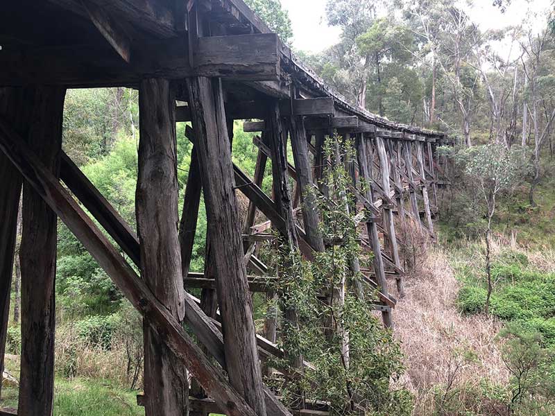
The village Koetong is home to the spectacular Edgars Road Trestle Bridge and the 77 metre long Boggy Creek Trestle Bridge. The historic wooden Boggy Creek Trestle Bridge is four kilometres from Koetong and was built in 1915 for use by the railway. Today, the Boggy Creek Trestle Bridge has been faithfully restored and boasts a picnic table here and a short scenic walk. Spanning the deep gully carved by Boggy Creek, the bridge remains intact. The structural engineering is readily observed. Be mindful however, the bridge is not safe to walk on.
Park along the unsealed road that approaches the day picnic area. After turning off the Murray Valley Highway onto Firebrace Track, the approach road is accessed by driving straight on from Firebrace Track instead of taking its first right hand turn. Please note that the picnic area at the end of this road is not suitable for turning a caravan around.
Boggy Creek Trestle Bridge
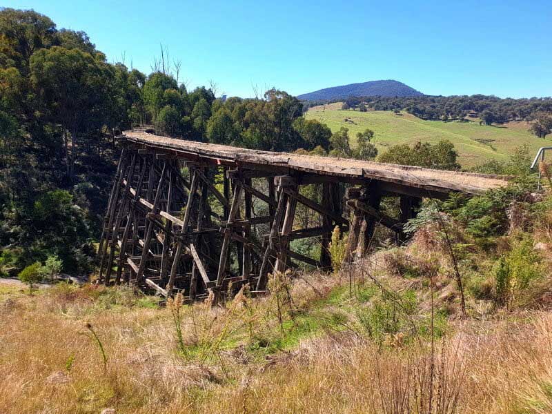
The Edgars Road Trestle Bridge is located in Koetong and has also been recently restored. Volunteers have spent many hours on this old wooden trestle rail bridge, one of the highlights of the Upper Murray section of the High Country Rail Trail. It is popular with artists and photographers as well as those seeking a short, scenic walk or ride.
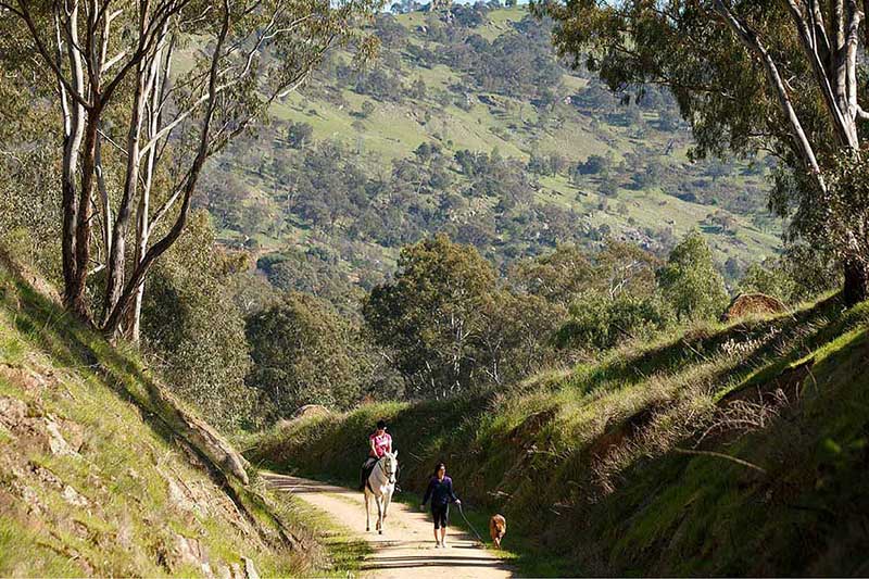
Koetong is a beautiful area situated on the Murray Valley Highway approximately half way between Tallangatta and Corryong. Surrounded by cows grazing on rolling hills and lush pine plantations, the Koetong Pub is the perfect place to stop for a hearty country meal or a light refreshment. The pub dates from the early 1870's, when tin and gold mining were carried out in the area. Koetong provides access to the Mount Lawson State Park which covers 13,150 hectares and is known for its steep slopes and rocky bluffs. There are several walking tracks and four wheel drive tracks in the National Park.
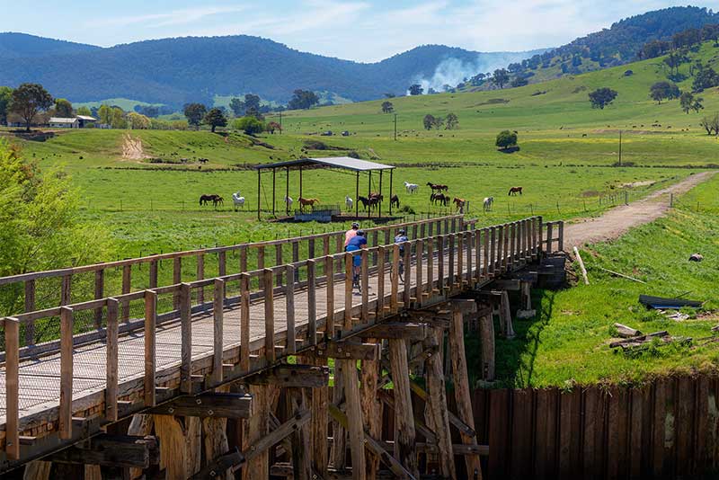
The High Country Rail Trail
The High Country Rail Trail runs from Koetong to Shelley and can be accessed from Edgar's road at Koetong. This 22km long section of Rail Trail includes both trestle rail bridges mentioned above and terminates at the old Shelley Station, after winding its way through natural forest and pine plantation areas.
The trail follows the alignment of the Wodonga to Cudgewa railway line is a closed railway line, that branched off the main North East line at Wodonga and ran east to a final terminus at Cudgewa. In 1919, the line was used to carry materials for the construction of Hume Weir, and three years later a spur line connecting Ebden to the weir was opened.
Part of the line was converted to dual gauge in 1944 to serve freight depots around Bandiana. In the early 1950s, the volume of Hume Reservoir was increased, with the railway around Tallangatta relocated to avoid the rising waters. In the 1960s, Cudgewa became the railhead of materials for the Snowy Mountains Scheme. The line had 1 in 30 grades, with T class T413 becoming the regular diesel locomotive on the line after purchase in 1967, as it was the only locomotive of the class with dynamic brakes.
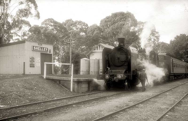
K 167 at Shelley on a fan trip, Sept 18 1965. Pphoto: courtesy John Ward
The last passenger service from Wodonga to Tallangatta ran on 30 September 1961 with a 102hp Walker railmotor. On 21 April 1978, the last regular goods train ran, with closure of the line on 1 March 1981, except for the short section to Bandiana. From 1995, it was a standard gauge track only. The Wodonga-Bandiana section closed on 1 September 2009 as part of the Wodonga Rail Bypass project. The section of the line between Wodonga and Tallangatta has now been converted into the High Country Rail Trail. On 20 October 2012, a new bridge opened over the Hume Weir using the existing piers.
Travel Australia

