
Today, when you cross the vast deserts of Central Australia aboard The Ghan train, you do so seated in a soft armchair in air-conditioned comfort. But in the early days of The Ghan, it was quite a different story. This narrow-gauge line it first travelled on lay well over 100km east of the current one, and was no pleasure trip. Rattling through flood-prone country, sometimes at walking pace, travel could be delayed for up to a week and - so the story goes - the crew sometimes had to shoot game to feed the passengers.
The service started in 1879 when the first 40 kilometres of track was laid between Port Augusta and Quorn. The line was built in stages through the Flinders Ranges, Marree and Oodnadatta over a period of 50 years, finally reaching Alice Springs in 1929. Building this iron strip through to the centre was epic - and maintaining it on the edge of Lake Eyre with its sandy soil and habit of flooding was a constant job.
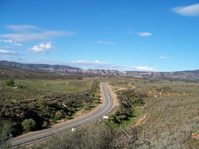
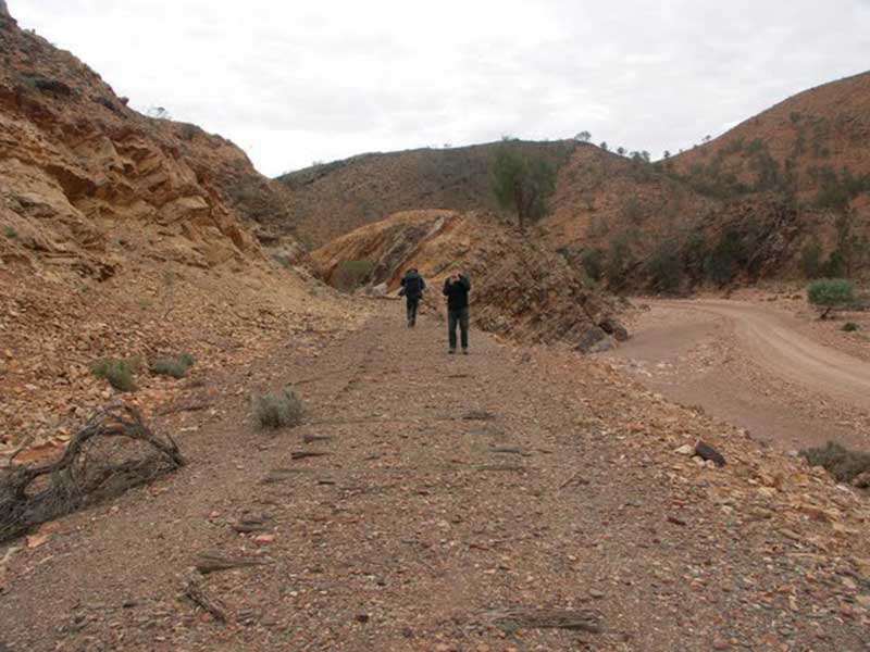
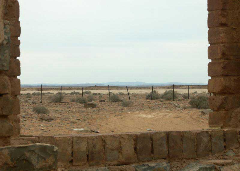
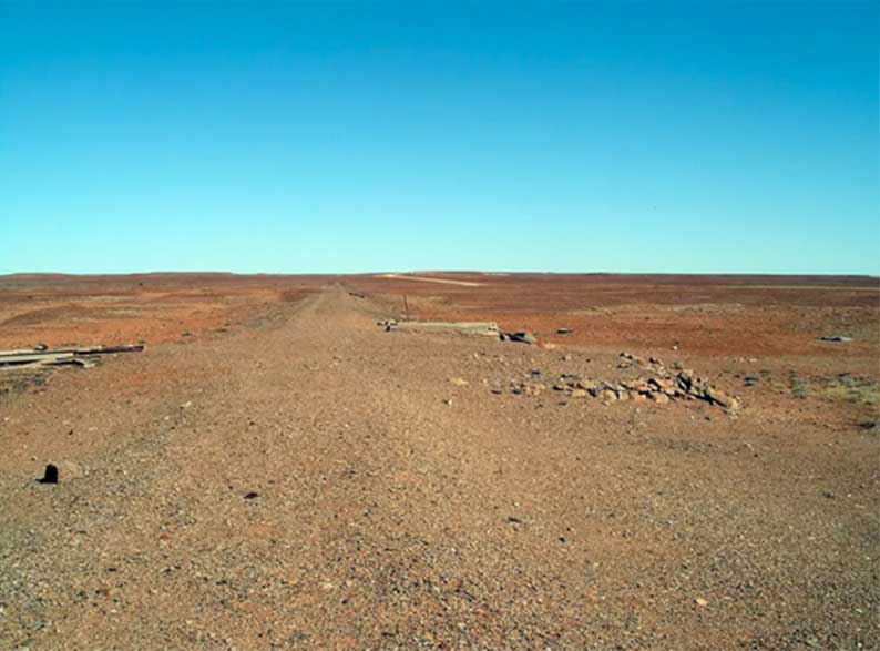
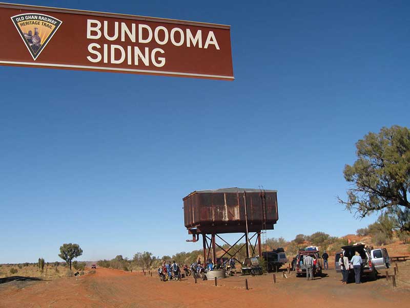
It is possible to follow the path of the old Ghan train along what is known as the Old Ghan Railway Heritage Trail, but a 4-wheel drive vehicle is recommended. It does get travelled in sedans but needs the utmost care. It is best test travelled from April to September and takes a week or more. The drive begins at Port Augusta, South Australia, and finishes at Alice Springs, Northern Territory. Length: 1,050 km. The Oodnadatta Track follows closely a similar route as the Old Ghan Railway and is often used to follow the path taken by the old line through South Australia.
The route is an adventure of historical interest with railway sidings, stone railway buildings, track remnants, bridges and railway infrastructure. The route was also followed by the Overland Telegraph in 1872 and that linked Australia with the rest of the world for the first time with telegraph communication under the sea. Telegraph Repeater Station ruins and settlements are also on route. One of the main reasons the route evolved is it also follows the natural artesian springs that surface from the Great Artesian Basin, so providing water at regular intervals. You can visit the Bubbler and Blanches Cup to name two.
The railway from Port Augusta through the Pichi Richi Pass to Quorn opened in 1879, and was part of the first stage of the Great Northern Railway that was intended to link Port Augusta with Darwin. Commander Mathew Flinders and his crew were the first Europeans to behold the majestic beauty of the Flinders Ranges, the largest and most spectacular mountain range in South Australia. He was the first of many explorers to whom the Pass became the grand entance to the Flinders Ranges. So many that Depot Springs became an important water source for explorers looking to cross the great treeless plain (Nullarbor) or search for the giant inland sea.
Mount Brown, Tickle Belly Hills’ neighbouring peak was named by Flinders after the ships Botanist, Robert Brown. Bullock teams regularly traversed Pichi Richi Pass, the drivers’ fighting a constant battle against animal and elements to transport their goods. Towns throughout the Pass were once located 10km apart; the distance a Bullock team could travel through this rough terrain in one day – as long as they did not get caught in a flash flood, break a wheel spoke or lose their team! Whatever their plight they always managed to rise to the occasion – and the call of the pub in the next town to carry them through. The township of Pichi Richi, now ruined, even had its own brewery.
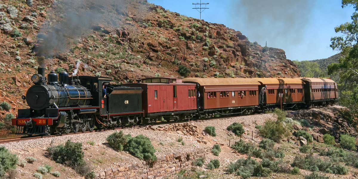
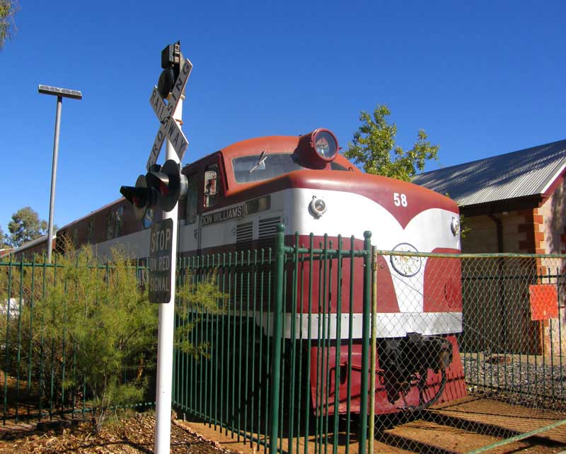
Pichi Richi Railway's restored NSU52, crossing Saltia bridge near Quorn in October 2019, is only one of two NSU class locos in operation
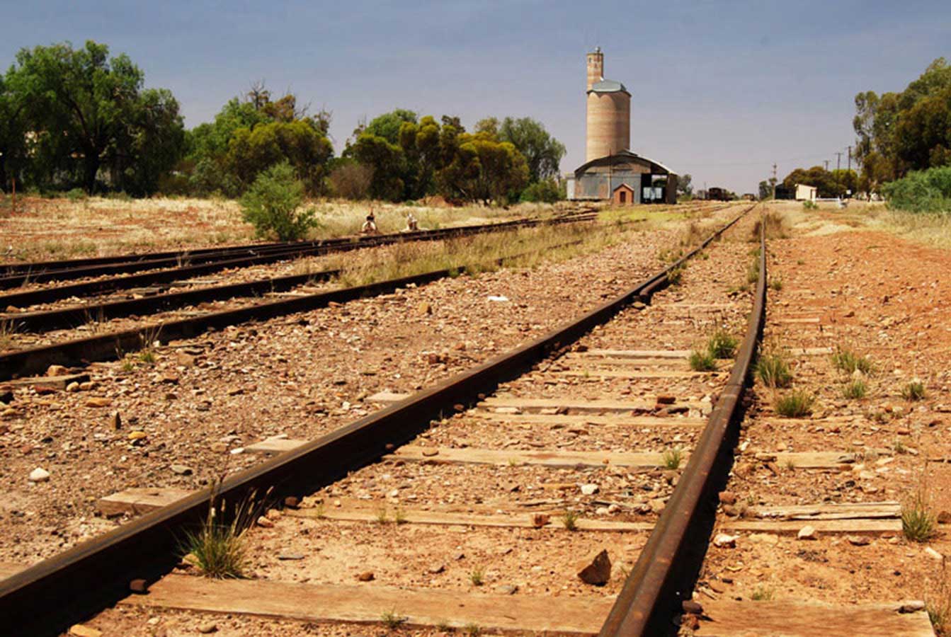
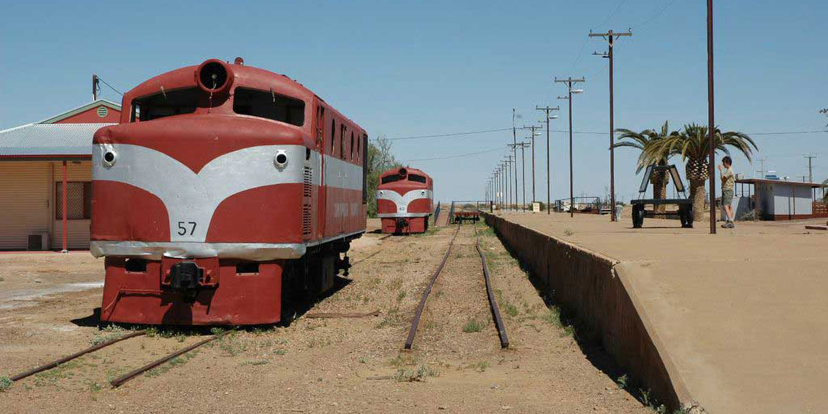
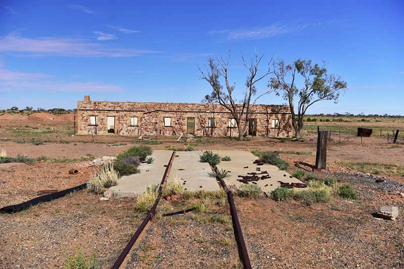
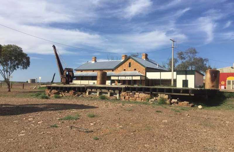
The first section of the original Ghan line to be built winded its way through Pichi Pichi Pass to the Flinders Ranges town of Quorn. This section of line, between Port Augusta and Quorn, is now used by the Pichi Richi Tourist Railway. This historic railway is a working railway museum which features restored steam trains, diesel rail-cars and carriages from the original Ghan railway. The train operates a three hour journey through the Pichi Pass to Wool Shed Flat on weekends between March and November. Quorn Railway Station is now a Ghan railway museum.
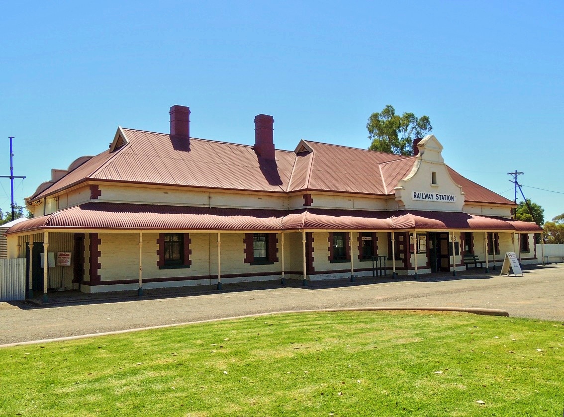
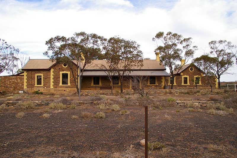
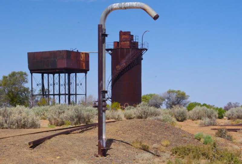
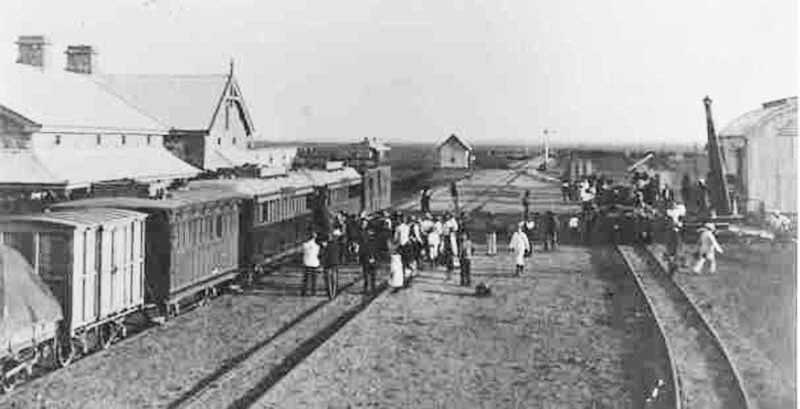
Quorn Railway Station has a significant if not colourful role in railway history in South Australia. It was planned as a railway junction for rail traffic travelling north-south and east-west across the continent and for the transport of minerals from the Flinders Ranges. The prospect of opening rich agricultural lands on the Willochra Plain was an added incentive. The Great Northern Railway, later known as the Central Australia Railway, reached Quorn from Port Augusta in 1879.
In 1917, Quorn became the crossroads of any north-south (on the Central Australian Railway to Oodnadatta) or east-west travel in Australia, when the Trans-Australian Railway was completed between Port Augusta and Kalgoorlie. This made Quorn an important town, given that any person travelling east-west or north-south in Australia would need to pass through Quorn. As a result, many fine buildings were built as the town expanded.
The railway station was built in 1884 after the original timber building burnt down. The original Ghan train passed through Hawker until 1956. Hawker then operated the local line until 1970 when the station finally closed and fell into disrepair. In 1989 the station was restored to become the Old Ghan Restaurant and Gallery. The station and goods shed are heritage listed.

Hawker was a thriving railway town from the 1880s until 1956 as it was on the famous Ghan railway line, until the route was moved further west when the line was upgraded from a narrow gauge to a broad gauge line.Today, Hawker is known as the hub of the Flinders Ranges and is an ideal base to see the Central Flinders Ranges. The spectacular country of Arkaroola is north of Hawker in the Northern Flinders Ranges, to get there turn off the Hawker to Lyndhurst road at Copley. Arkaroola is approximately one and a half to two hours travel east of Copley. It is worth a visit when visiting the Flinders Ranges, a visitor should allow about 2-3 days for a visit to this part of the Flinders.
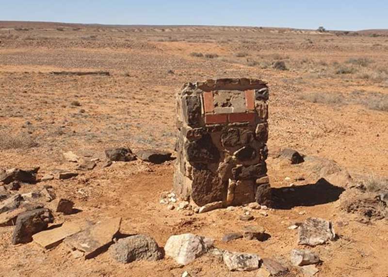
The original Merna Mora homestead was situated near the Ghan Railway Line about 6 kms from the existing homestead in the Flinders Ranges. Built entirely of local stone it was once home to a family of 15. It would have been constructed in the early 1900's. The lime kilns here were built to help with the construction of the Railway line.
Limestone bearing deposits were burnt in these kilns to produce lime to aid in the construction of bridges and culverts. Cement was not available and the Chinese were adept in procuring lime from the local dolomite deposits. These are remnants of the Mern Merna Railway Siding. As many as seven families lived here and part of the building comprised the Mern Merna School.
From the 1880s, Brachina was a small siding on the Old Ghan narrow gauge line. But in 1955 the new standard gauge line from Stirling North traversing the plains to the west of the Flinders Ranges arrived, avoiding the difficult Pichi Richi Pass and Quorn, and temporarily Brachina became a trans-shipping point. This in itself was hardly special, but full narrow gauge coal and stock trains were not unloaded, but simply run up onto standard gauge flat cars fitted with narrow gauge track and carried 'piggy-back' to the south. This rather novel process continued until the standard gauge reached its next staging point to the north in late 1956.
Beltana Railway Station
Beltana boomed with the arrival of the railway in 1881, and with an influx of mining families following the failure of the nearby Sliding Rock copper mine. By the mid-1880s the town had its own brewery, general store and a school. The railway station is one of a number of historic buildings in the town. The town has hosted horse racing since 1876, and the annual picnic races and gymkhana and biennial pastoral field day are still continued.
Remnants of the old Ghan alignment
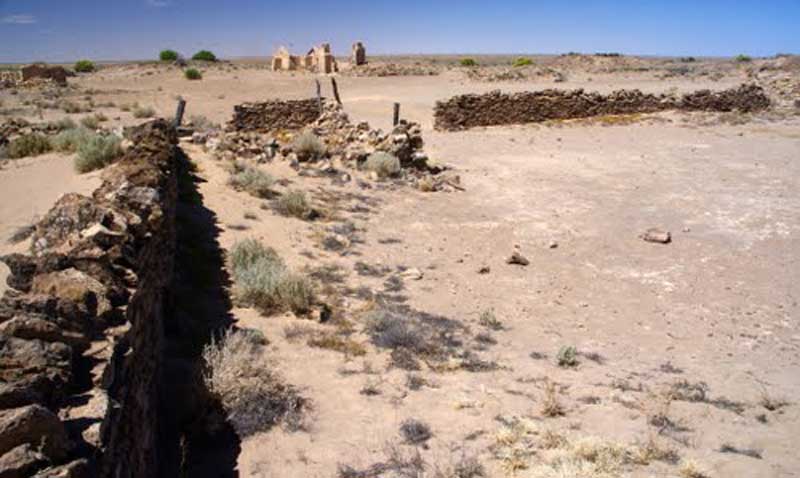
Beltana is one of the truly remarkable outback settlements in South Australia. Beltana is known for continuing to exist long after the reasons for its existence had ceased. The town's history began in the 1870s with the advent of copper mining in the area, construction of the Australian Overland Telegraph Line and The Ghan railway and began to decline in 1941 with the beginning of coal mining at Leigh Creek. The fortune of the town was sealed by the 1983 realignment of the main road away from the town. The town, adjacent cemetery and railway structures are now part of a designated State Heritage Area declared in 1987.
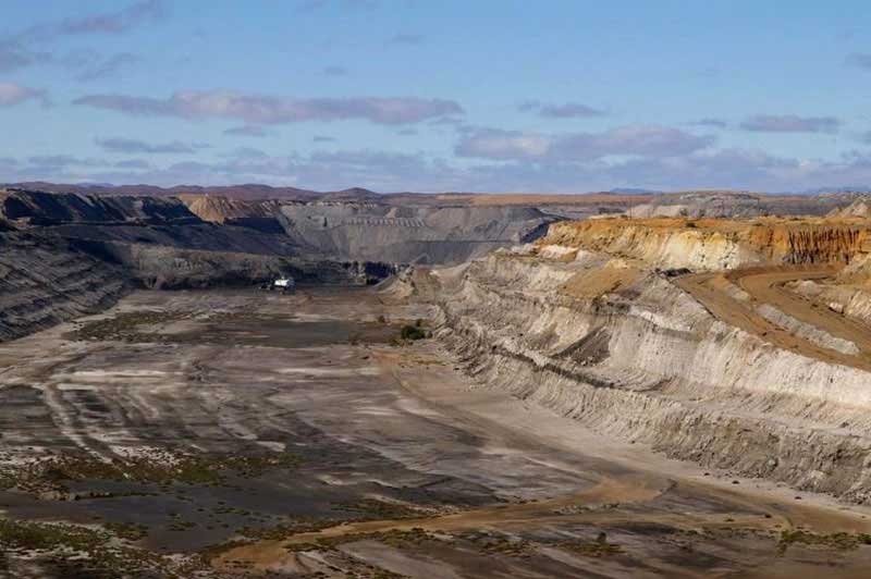
Being located in arid countryside, little use of the land was made by white settlers until 1856 when cattle man Harry Leigh arrived in the area in 1856. Though its presence had been known about for many years, the coal deposits of the area were surveyed and assessed for their mining potential in 1888. It was not until during World War II, when Adelaide was racked with power failures in the middle of a coal shortage, that the coal of Leigh Creek was first mined.
The town prospered as work on the mine progressed and the Port Augusta power station opened (1954). The barren streets were planted with thousands of trees and by the mid-1960s it had around 2,000 residents. The large open-cut coalfield eventually consumed the original township, about 13km away, and in 1982 residents moved to the new township that is officially called Leigh Creek South. In the 1990s mining systems changed and the workforce dropped from 750 people to around 250 workers with the town population dropping from around 3,000 to below 1,000 people. The mine closed in 2015 as the Port Augusta power stations prepared for shutdown in 2016
.
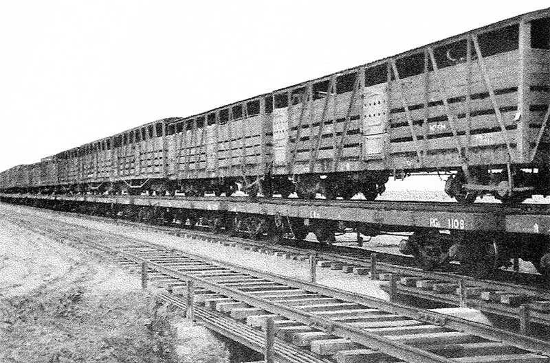
A complete narrow gauge trains being piggy-backed on standard gauge flatbed cars, 1955
As a result of the opening up of the Leigh Creek Coalfield in the late 1940s and capacity restrictions on the existing narrow gauge Central Australia Railway via the Flinders Ranges, Marree and Quorn, a new standard gauge line was built, opening on 17 May 1956 from Stirling North on the outskirts of Port Augusta to Telford Cut and on 27 July 1957 to Marree. The line was extended to Marree because of the volume of cattle traffic coming off the Birdsville Track. For a brief period, complete narrow gauge trains were piggy-backed on standard gauge flatbed cars up to Marree and then rolled off to continue on the old line to Alice Springs.
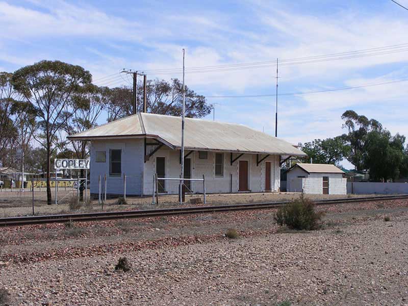
The town was originally built to support Leigh's Creek coal mine, however the coal was not mined in a significant commercial manner until 1943 in an effort to make South Australia more self-sufficient for its energy needs. Long before mining commences, Copley was a Ghan railway settlement. It sits at the crossroads of the Strzlecki and Oodnadatta Tracks in the midst of the spectacular Northern Flinders Ranges, 6 kms north of Leigh Creek township.
There are numerous Aboriginal cultural sites in the Copley region. The Munyi Aboriginal engravings site are 70 km east). Nepabunna Cultural Area containing mythological sites of the Adnjamathanha people (50 km east) Pinda Springs (50 km south-east) is an Aboriginal occupation site. Prism Hill Aboriginal site (50 km east)has three rock shelters with paintings. Ram Paddock Gate Historical Site containes the last traditional Aboriginal camping ground in the Flinders Ranges (30 km east). Red Gorge Historical Reserve has Aboriginal engravings.
Lyndhurst was first a siding on the Great Northern Railway (1878) and was served by the north-south rail line until the Ghan route moved west of here in 1980. Lyndhurst initially served as a freight centre for the railways that were connected in 1882. The township was surveyed and proclaimed in 1896. At the end of that year, legendary teamster Jack Edwards carted the wood and iron hotel from Mt Freeling by donkey wagon. He rebuilt it and stayed on for years as publican. Lyndhurst today is a sprawling settlement near the junction of the Oodnadatta/Birdsville and Strzelecki Tracks, being at the southern end of the latter.
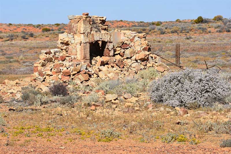
Found on the edge of the desert in the far north of South Australia, Farina is situated on the aligmnent of the original Ghan railway, 26 km north of Lyndhurst and 55 km south of Marree where the Oodnadatta and Birdsville Tracks commence. The town was the railhead from Port Augusta from May 1882 until 1884 when the line was extended first to Marree and then Alice Springs.
One of the more unusual cargoes embarked at Farina railway station was South Australia's biggest meteorite. The 1.2 tonne Murnpeowie iron Meteorite was dragged out of the desert north-east of here about a century ago; and can be seen today at the South Australian Museum in Adelaide. The town is no longer inhabited, with the closest residents now living at Farina station, visible to the west of the town. The last resident died in 1960. The post office closed in the 1960s. In its heyday, the town had two hotels (the Transcontinental and the Exchange), a bakery, grain store, two breweries, a general store, post office, Anglican church, five blacksmiths and a school. Today nothing but stone ruins and the elevated railway water tank remain of the township. A bush camping area is maintained by the owners of the present-day Farina station.
Marree survives as a small community at the junction of the infamous Oodnadatta Track and the Birdsville Track. It is the centre for an area which, though arid saltbush country, has produced good wool. Like much of inland Australia, Marree has a very hot and dry climate in a desert environment. Temperatures above 40 °C have been recorded in every month between October and April and rainfall is extremely erratic, falling mostly in brief heavy downpours experienced 1-5 times per year, or when cold fronts in winter manage to penetrate far north enough into the Tirari Desert.

The Overland Telegraph line reached Hergott Springs in 1872. The railway arrived 11 years later. Due to anti-German feelings during World War I, the town was changed from Hergott Springs to Marree. For 20 years, Marree was a major break-of-guage station on the Ghan line. At Marree railway station, two locomotives and some rolling stock sit opposite the platform. Railway relics alongside the Oodnadatta Track between Marree and William Creek are mostly sleepers scattered in piles amongst scrub and dust. Surprisingly it is permissible to collect the sleepers for use as firewood; most of the track was stripped and recycled for track in Queensland after the line was closed.
Wangianna Siding is located about 35km north of Marree. The old fettlers’ accommodation still stands and is in relatively good repair compared to other along the track. All other structures are, however, long gone. The remains of old sleepers, left behind when the track was lifted years ago, follow the line of the railway.
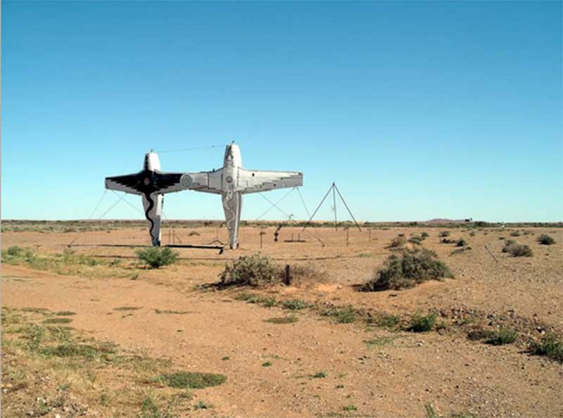
16km beyond Wangianna at Alberrie Creek Siding is one of its the most unusual – and most recent – landmarks along the track - Mutonia Sculpture Park The workmanship of a former mechanic, Robin Cooke, its artworks were apparently inspired by “mad Max”. Here, all sorts of weird and wonderful installations have been created out of waste or unwanted materials. “Plane Henge”, two Cessnas standing Christ-like on their tails touching wingtip to wingtip, is the most well known works of art in this unique park.
Callanna, just 14 km out of Marree, is the site of Bopeechee Siding, first of many relics of the Old Ghan railway line to come. A rusty water tower and pipe is all that is left. These railway sidings were the watering places for the steam locomotives of the old Ghan railway. Fettlers were built around these water supplies.
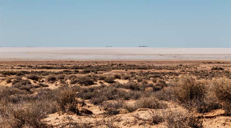
The line here is quite close to Lake Eyre South. There is a viewing point (with interpretive signs about geology, history, flora etc) about halfway between Marree and William Creek just past Fred Springs. Lake Eyre is probably the most famous feature along the Oodnadatta Track. The usually dry salt lake covers an area of 9700 km² and is up to 15m below sea level. You can't appreciate the dimensions of Lake Eyre from this viewing point, so it is best to take a scenic flight from Marree or William Creek. Warning! Don’t even think about driving out on the lake, even if it looks dry. Your car will break through the saline crust, and you will get bogged in the mud. When we stopped here, we could see 4WD tracks heading down to the edge but no tracks on the salt lake itself.
Near Stuart Creek a 6km. section of the original Ghan line remains at the old Curdimurka Siding, located on the Oodnadatta Track. Three old settlers cottages, a water tank and sheds have been retained by the Ghan Preservation Society Association of SA. An artesian bore is adjacent to the siding. Curdimurka hosts a biannual outback ball that raises money for the Ghan Railway Preservation Society. It is 104 kilometres from Marree, a few kilometres west of Lake Eyre and miles from just about everywhere else. The last train passed through Curdimurka in 1980.
Nearby Stuart Creek Bridge is the second-longest bridge on the former railway line at 433 metres. Built in 1877/1888 it is now on the Australian Heritage Database and the State Heritage Register.Stuart Creek is named after John McDouall Stuart the surveyor and explorer who was the first known European to reach the centre of Australia in 1860. Stuart's greatest achievement was the south to north crossing of the continent and back again in 1861-62. While on his expeditions, he found permanent water near Curdimurka which made future passage through the centre of Australia possible. A route through to the Northern Territory was discovered and the Overland Telegraph Line was built in 1872. The telegraph linked South Australia to the rest of the world.
The Curdimurka Outback Ball was a big event in the 1980s and 1990s. People flew in from all around the country to dance the night away, and to camp in the dust after the party. The Curdimurka Ball raised money for the Ghan Railway Preservation Society, an organisation that preserved what was left from the old Ghan railway line.
The remains of a fettler's cottage can be seen at Margaret Siding. Constant upkeep of the line was needed to keep it open, and this was the task of the fettler gangs who lived along the line, and responded quickly when repairs were needed. This included damage from flash flooding, sand storms and the warping of track on days of intense heat. Between 10 to 15 men was the normal size for each gang. Margaret Siding is 624 km north of Adelaide and 110 km from Andamooka.
The ruins of the old railway siding at Coward Springs is an oasis in the desert with warm water emerging and forming an extensive pond. Date palms, remnants of an old plantation, provide a refuge for many birds which frequent the area. A commercial campsite with limited facilities operates from May to October.
Steam locomotive ash deposit pit at Coward Springs siding
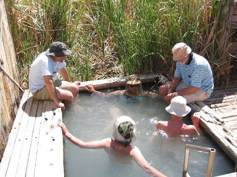
Coward Springs was named in 1858 by Peter Warburton after Corporal Thomas Coward, one of the members of the exploration party. This was once a little settlement with railway houses, hotel, hospital and a store. Only the the stationmaster's house and a cottage remain. Coward Springs had a school from 1888 to 1890. The government bore was completed on 16 July 1886. Coward Springs currently provides pleasant camping facilities, an open-air spa, and historical features.
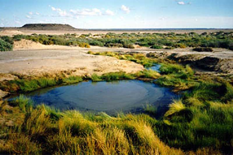
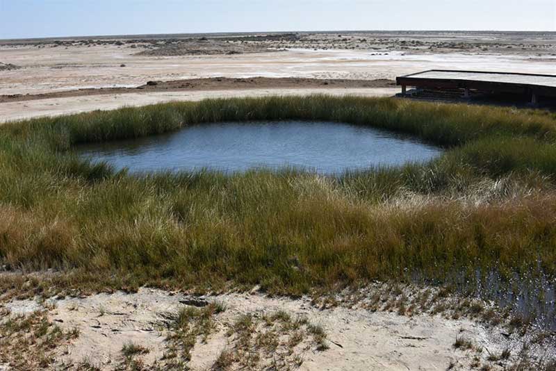
Bubbler Mound Springs
Mound springs take their name from the distinctive mounds that build up around some springs. With water flowing fromthe top of the mound and out onto the surrounding plains, they form a truly surreal landscape. Springs can be fresh or salty, and can be warm or even hot, as the water comes from deep underground where it isheated by the earth’s mantle and high pressures. The springs are believed to have been flowing here for between one and two million years and are home to a huge diversity of faunafound nowhere else on the planet.
Blanche Cup
The Bubbler Mound Springs and Blanche Cup Mound Springs are 6km. South of the track adjacent to Coward Springs and are among the most spectacular in the area. Interpretive signs inform the visitor of their significance. Water for the Ghan was not extracted from the mound springs but from deep underground bores. Visiting the sidings you can see water softener tanks built to remove the harmful minerals from the bore water that caused heavy scaling on the boilers of the steam-trains.
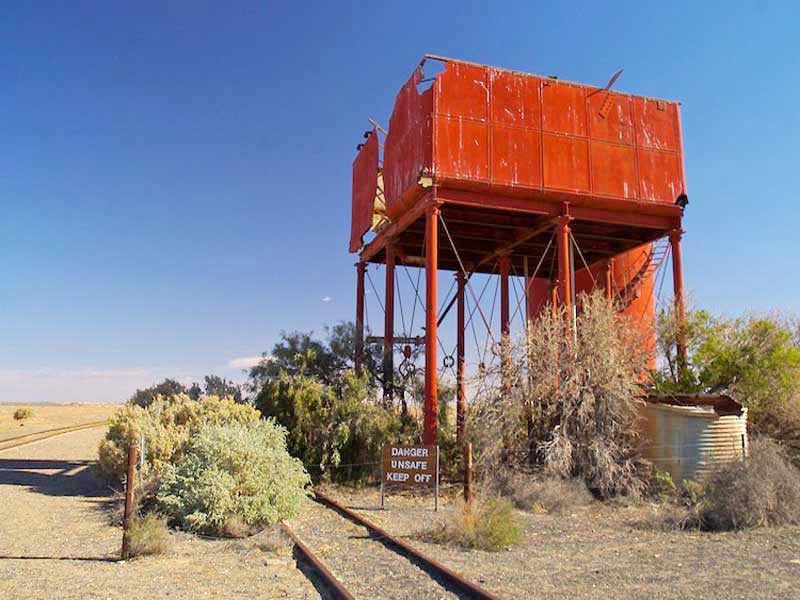
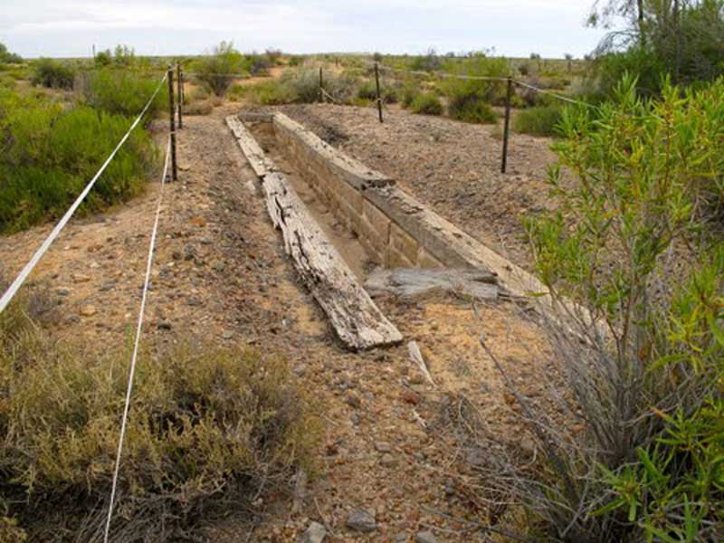
The old Beresford railway siding was one of the sites along the line which had giant water softeners to prepare water for the steam locomotives. During World War II the rail line was pressed to its limits and freshwater was limited. The de-mineralisation towers were built to remove salt from bore water so that it could be used by the trains. In addition to the water softeners there are some fettlers cottages adjacent to the Oodnadatta Track, but little else. The square tank contained the water for the steam engines.
Stockyard ruins at Strangways Springs
Strangways is another historic site about two kilometres west of the Oodnadatta Track. Strangways Springs were named by explorer Warburton in 1858 while surveying the Overland Telegraph Line route. It was chosen as a site for a repeater station in 1870 and the ruins of this, and the early station is still visible. About 38 km south of William Creek, this national heritage site is the abandoned wool producers village near a large number of Mould Springs. The parking area is just in front of the village on the hill. A short walk will lead you along the abandoned houses, where information panels provide details. Two longer walks along the spring moulds explain about the geology and other features such as the woolshed.

Strangways Spring Station
The locality is named after Henry Bull Templar Strangways (1832 – 1920), the son of a pioneer and explorer, Henry Bull Strangways of Shapwick, Somerset, England. He went to Adelaide in 1857, was elected to the South Australian House of Assembly for Encounter Bay in January 1858, and became Attorney-General of South Australia in the First Reynolds Ministry from May 1860 to May 1861. Strangways became Commissioner of Crown Lands and Immigration until October 1861.
On 3 November 1868 he became Premier and Attorney-General. The Strangways Land Act of 1869 enabled the purchase of land for farmers, allowing for closer settlement in areas of the province suited to more intensive agriculture, rather than vast pastoral runs on uncleared land leased from the government. However large areas of South Australia were not suited for smaller landholdings and closer settlements; droughts and poor seasons could lead to ruin of the farmers where land blocks were too small. Those who could afford it, bought neighbours' properties. Over the following century, legislation progressively lessened the conditions and restrictions which brought about closer settlement.
A former Fettlers campsite with ruins. Here, the Irrapatana sand hills are stretching to the horizon along the track for around 5 km. The dunes and sandy ridges are outliers of the Simpson desert.
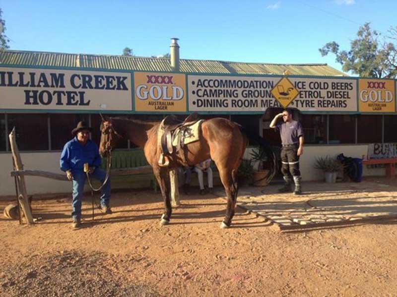
William Creek is the entry point from Coober Pedy to Lake Eyre in the Tirari Desert. William Creek offers the only petrol station between Marree, Coober Pedy and Oodnadatta on the Oodnadatta Track and has a campground, two motels and one of the world's most remote pubs. The world's largest cattle station is located in nearby Anna Creek Station and the Woomera Prohibited Area, is also nearby.
The William Creek Hotel is a destination in itself. Mementos from travellers around the world adorn the walls of the iconic pub and historic memorabilia are dotted around the main restaurant. Have a beer in this famed Outback pub - and tick the William Creek Hotel off your bucket list! The pub here features a dining room made completely out of the railway sleepers from the Old Ghan. Every square inch of wall and ceiling space of the bar area is covered with business cards, pictures, knickers and G strings.
Developed during the 1960s, the British designed and built the 13-metre three-stage satellite launcher, named Back Arrow, was used for four launches at the Woomera Rocket Range in South Australa between 1969 and 1971. Its final flight was the first and only successful orbital launch to be conducted by the United Kingdom, and placed the Prospero satellite into low Earth orbit.
![]()
Black Arrow launch at Wommera Rocket Range. Photo: Mary Evans Public Library
Loaded with enough kerosene to give it the best part of 80,000 lbs of thrust, the second Back Arrow blasted off from the Woomera rocket range in South Australia 4th March 1970. It rose up perfectly, firing into fresh clear spring sky. 130 seconds later eight explosive bolts released the spent first stage of the rocket, which separated and fell back to earth. It landed within Anna Creek Station, and lay there for 50 years before being repatriated back to the UK by space innovation company SkyRora. The relic now stands in their head office in Edinburgh.
![]()
Remains of the first stage of a Black Arrow three stage rocket, showing the eight nozzles of its Gamma engine. Launch R3 was successfully launched from Woomera rocket range in October 1971. This portion of the rocket is now in the Memorial Park at William Creek, South Australia, having been recovered from the surrounding Anna Creek Station. Photo: John Hayman, 2007.
Anna Creek Siding lies of the Oodnadatta Track within Anna Creek Station, which is the world's largest working cattle station. At 30,027 sq. km., it is nearly half the size of Tasmania. Its boundary is north of William Creek. The property was originally established in 1863 but moved to its current location in 1872. It was originally used for sheep, but due to losses from dingo attacks, they switched to cattle. The land occupying the extent of the Anna Creek Station pastoral lease was gazetted as a locality by the Government of South Australia on 26 April 2013 with the name 'Anna Creek'.
Despite its size, in 2007 Anna Creek Station was carrying only 1,500 head of cattle due to the 2000s drought. In 2008, the station was owned by S. Kidman and Co Ltd, there were eight full-time staff and they were destocking all their cattle. They raise Santa Gertrudis cattle as they are suitable for hot, dry climates.

Another old Ghan railway siding near Bungadilla Creek where travellers can see the most southerly species of 'Gidgee Tree'. Edward Creek Station was built in 1889 as one of the more significant maintenance centres along the Great Northern Railway and became a major stopping place between Marree and Oodnadatta during the Second World War.
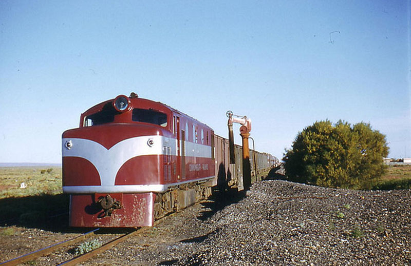
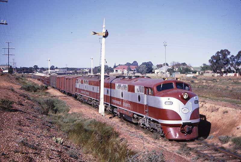
Commonwealth Railways Clyde-built single-cab NJ class loco hauling a goods train through Edwards Creek Siding, 1971
The site is one of the largest and most intact complexes on the Old Ghan line and reflects two phases of accommodation the original station buildings and the upgrading of facilities by the Commonwealth Railways during the wartime emergency of 1942- 44. It contains the only surviving station building on the railway, as well as one of only three Kennicott water softeners in South Australia, a variety of railway technology and the ruins of the largest housing complex on the line.
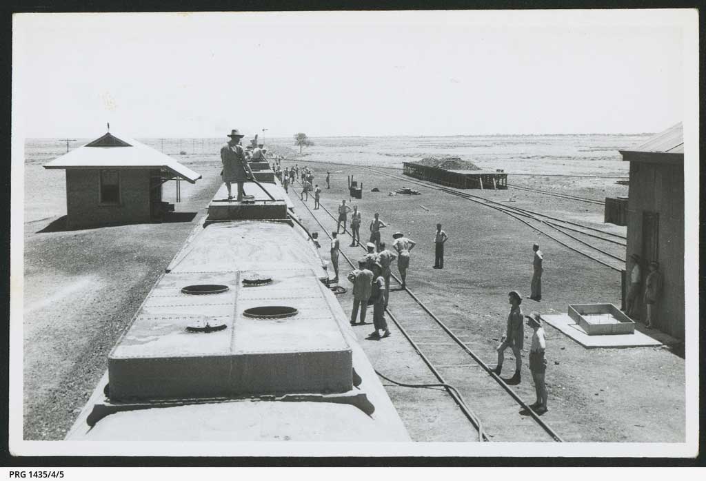
Service personnel at Edward Creek railway siding, during transfer to Darwin - with the photograph taken from the top of one of the carriages looking along the length of the train. The photographs numbered 3-11 are collectively labelled by the photographer as 'cattle - 1st class to Darwin'. A researcher has commented : The photograph was taken at Edward Creek railway siding on the Central Australia Railway [between Marree and Oodnadatta]. Edward Creek was an important stopping point for locomotives and passenger carriages to take on water until the last 'Ghan train' ran in 1980. Photo: State Library South Australia>
The Warrina Siding is a short distance from the Oodnadatta Track and an easy walk to the Old Ruins. A cairn and commemorative plaque at Warrina recalls At Thomas Elder's scientific expedition which left the spot in 1891 on a 6,886 km. journey to Western Australia. Warrina siding is 95.5 kilometres south of Oodnadatta,
Ernest Giles Memorial, Cairn, Peake
Just north of Warrina near the turn-off to the abandoned Peake Telegraph Station is a plaque recording the arrival of explorer Ernest Giles in 1876 from a crossing of the continent from Geraldton in Western Australia. Giles may well be the most under-rated explorer in Australia's brief history and his achievements in remote areas are outstanding.
Peak Hill Telegraphn Station, 1872. Photo: State Library South Australia
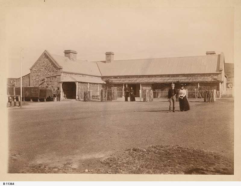
Some 20km. north is the old Peak Hill repeater station and a gold and copper mine. Peake Telegraph Station was completed in 1872 as one of 12 repeater stations established between Adelaide and Darwin. Peake stands just south of Oodnadatta. It is estimated that 36,000 poles and 3,200 kilometres of wire were used in the making of the communication network. This photograph shows groups of people standing in front of the Telegraph Station. The track in is very rough and recommended for 4WD vehicles only. The whole area is of great historical significance and you are requested to respect its historical importance to Australia's Heritage.
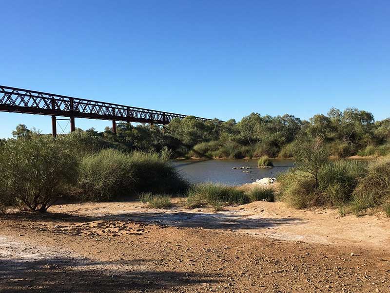
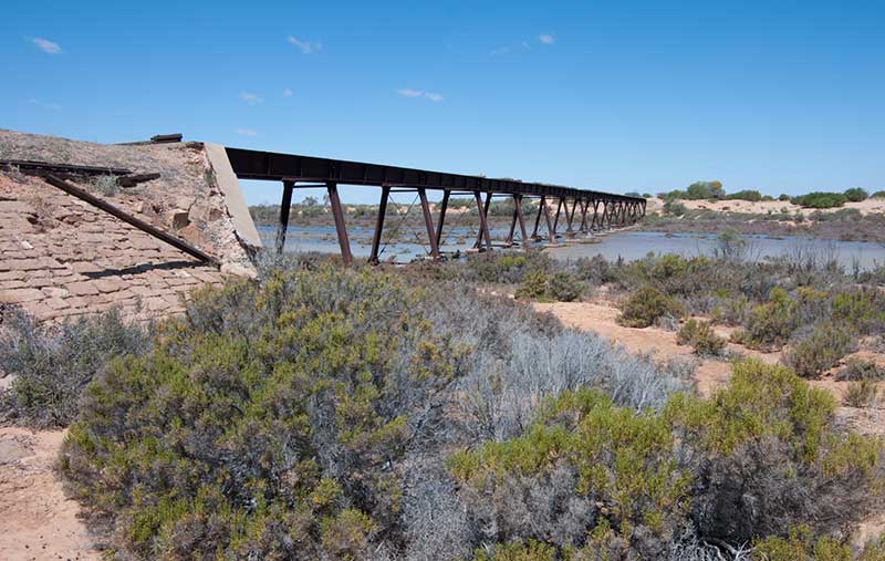
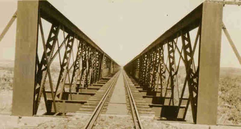
The Algebuckina siding ruins are near the Neales River where there is a permanent waterhole. The bridge over the Neales River is one of the most impressive bridges on the old line. It was opened to traffic in 1892. It consists of 19 spans, At 12 metres above the river and 578 metres in length, it is the longest bridge ever built in South Australia.
A car wreck near the bridge is apparently the remains of a 1948 FJ Holden that was hit by a train half way across the bridge, after the driver attempted to drive across the rail bridge during a flood. The driver said that he did not have the timetable information correct and the train collided with the vehicle, pushing it off the bridge. The rusting wreck of the car is said to be still there.
Small quantities of gold were found here in 1883. More gold was discovered near the same river in 1886. The location looked promising and with several ‘more or less permanent’ diggers, expectations and hopes ran high during a time when work and income were hard to come by in South Australia. Little gold was found after the initial discoveries. Algebuckina may not have lived up to the initial high hopes of some of the diggers, it certainly had created a renewed interest in gold prospecting. In May 1887 about 20 men were still at work on the field. All were getting something, but none were getting much. Only 120 ounces of gold had been obtained so far.
By the middle of 1888 the extension of the Great Northern Railway, which employed some 500 men, had reached Algebuckina and a large number of men had made camp near the waterhole. They were not at all impressed with prospects on the Neales River nor the extremely dry weather and many left for the Broken Hill mines or the ruby fields at the MacDonnell Range. They believed that both places would provide a better income than what they were earning working on the railway or prospecting along the river.
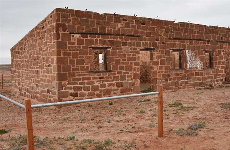
1054 km from Adelaide, Oodnadatta is an historic settlement retaining much of its character from when it was an important rail-head between 1891 and 1929 after the line had been extended extended to Alice Springs. The sandstone railway station remains as a reminder of the heady days when all freight north was disembarked here for transportation by camel to Alice Springs. It contains a collection of historical photographs, memorabilia and Aboriginal artefacts and a preserved portion of the Ghan Railway. There is a hotel, caravan park, general stores, medical services and an airstrip.
Following the closure of the railway line in 1981, Oodnadatta, formerly a government service centre and supply depot for surrounding pastoral properties, became a residential freehold town for Aboriginal people who, moving from cattle work, bought empty houses as railway workers left. Oodnadatta's busiest era was World War II when the Australian Army and the Royal Australian Air Force set up local facilities to service troop trains and fighter aircraft en route to Darwin. Tourist traffic along the Oodnadatta Track and the mining industry keep the village alive. The Aboriginal school is the biggest employer.
The historic railway station (above) is one of the most imposing and enduring buildings in town, together with the goods shed it is on the State Heritage Register. The railway museum is located in the building.
An old Ghan locomotive at Abminga siding in the 1970s
Here one can see the remains of this sidings' coal loading facilities, a water tower as well as what was probably a comprehensive workshop. The trackside is littered with bits of rusty steel and old rail spikes etc.

Abminga Siding
A major railway siding on the Old Ghan Railway. Old six bedroom railway quarters built in 1938 remain, as does a trolley shed, bore shed, water tower and yards. On the east side, there is an elevated concrete water tank from the early steam train days.
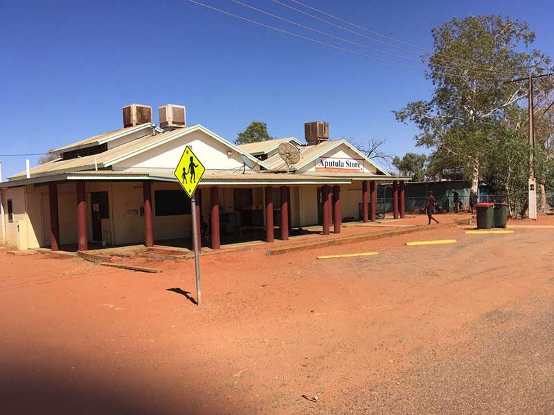
Relics include the remains of the Railway Station and fettler's cottages. The track to Alice Springs follows the old Ghan's path. The track to Rodinga Siding runs mainly on top of the rail easement. In many places the sleepers are still visible under the road surface which is littered with rail spikes and other extraneous lumps of rail associated steel. The old sidings north of Aptula now have signage placed for the Ghan Railway Heritage trail, which tells of conditions experienced by those who lived and worked on the Ghan. Unfortunately, most of the railway relics here have been vandalised or souvenired by past visitors.
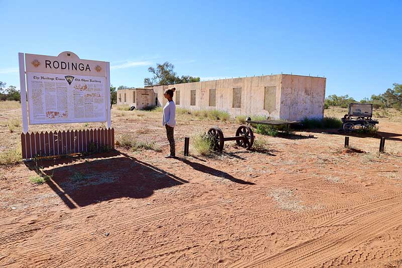
Rodinga Siding is about 140km north of Finke and 90 km south of Alice Springs. It is one of the original fettlers camps established during the construction of the Old Ghan Railway. The fettlers quarters consisting of nine rooms plus a kitchen are of the Ewaninga style of prefabricated concrete. It also provided a stop for the Old Ghan. Only the slab shell of the dining area remains.
A siding and base for maintenance gang that came into operation with the completion of the Alice Springs rail in 1929. The six room bungalow built in 1943 was still listed as a station in 1961. Maintenance gangs were still active here until closure of the rail in 1980. Concrete stumps and foundations are all that remain of the camp. A large elevated water tank for quick-filling of tanks on the trains is the distinctive feature. Water was pumped from Alice Well located a few kilometres over the sand dunes to the west.
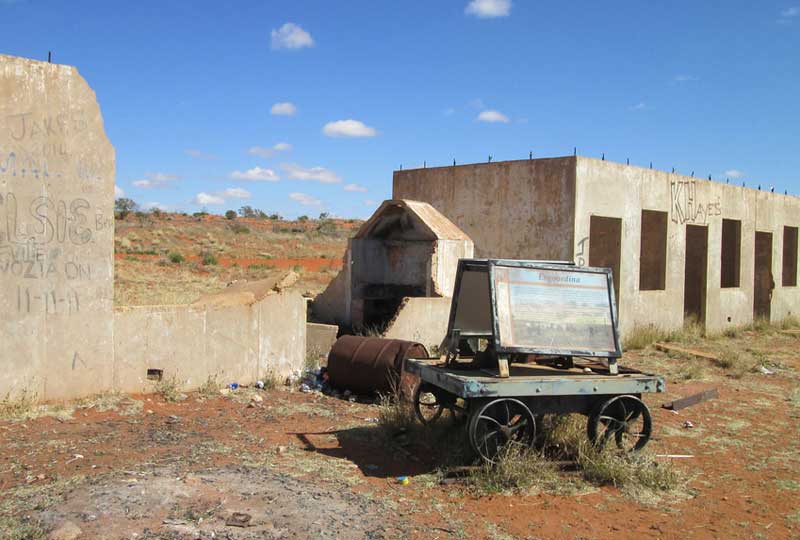
The siding buildings consist of two and three bedroom quarters with kitchen and dining area in the middle. The siding was the base for maintenance gang No. 22. An increase in military traffic in World War II instigated the establishment of a large passing loop in 1941. The Engoordina Siding was listed as a station in 1951 but was closed in March 1959.
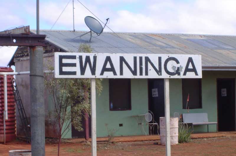
One of the original fettler camps established during the construction of the Old Ghan Railway. Ewaninga Siding was listed as a station in 1930. The old railway line from Macdonnell Siding finishes at this siding. The Ghan Preservation Society runs tours to the site on that line.
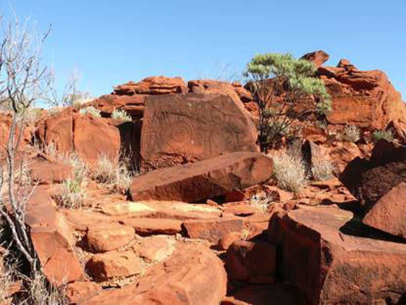
The site is close to the Ewaninga Conservation Reserve, a protected area consisting of an area of low sand dunes, rocky outcrops and a claypan. It is significant because of a large number of Aboriginal rock carvings. The conservation reserve contains many prehistoric abraded and pecked engravings that provide an outstanding example of central Australian rock art. The main feature of the area is a set of about 1000 petroglyphs, distributed among the rock outcrops to the south and south-east of the claypan. Most of the petroglyphs are non-representational, consisting of circles, lines and other geometric motifs, though there are some examples of animal tracks. The motifs have been compared with those found elsewhere in Central Australia and Tasmania. The conservation reserve is considered a significant link to the activities of the early Arrernte people of the region. Permission to access the site has been granted by the Arrente custodians.
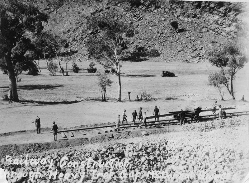
Laying the original railway track through Heavetree Gap, Alice Springs, 1920
The railway to Alice Springs was finally completed in 1929 with the inaugural Ghan service pulling out of Adelaide on 4th August. It carried more than 100 passengers, livestock and supplies.
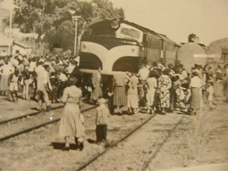
Arrival of the first Ghan rail service into Alice Springs
The Old Ghan Museum, Tea Rooms and Heritage Railway is run by the Ghan Preservation Society. The Museum is housed in the original Macdonnell Siding buildings in Norris Bell Avenue, 8 kilometres south of Alice Springs. Every Sunday the museum operates a tourist railway journey in a train hauled by an old Ghan locomotive along 30km of the original Ghan line to Ewaninga siding.
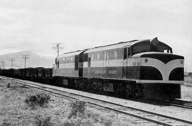
These are the three locomotive classes most commonly associated with the old Ghan and North Australian Railways. For information about all locomotives owned and operated by the Commonwealth Railways, we recommend the excellent Commonwealth Railways Information website.
The Commonwealth Railways NSU class was a class of diesel-electric locomotives built in 1954 and 1955 by the Birmingham Railway Carriage and Wagon Company, England, for the Commonwealth Railways for use on the narrow-gauge Central Australia Railway and North Australia Railway. Initially the fleet worked out of Port Augusta on the narrow gauge. Following the conversion of the Central Australia Railway from Port Augusta to Marree to standard gauge in 1957, two were transferred to the North Australia Railway operating out of Darwin. During the next 17 years locomotives were swapped periodically between the two lines.
In July 1975 all the locomotives were included in the transfer of Commonwealth Railways to Australian National. The NSU fleet remained intact until the Central Australia Railway was superseded by the opening of a new standard-gauge line to Alice Springs in 1980. Two were then transferred to Gladstone for use on the Wilmington line and one to Peterborough for use on the Quorn line. Several others were used by rail retrieval contractors along the Central Australian Railway after it closed. The last was withdrawn in 1987.
Pichi Richi Railway's restored NSU52, crossing Saltia bridge near Quorn in October 2019 in the photo above, is only one of two NSU class locos in operation
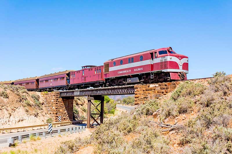
The GM class are a class of diesel locomotives built by Clyde Engineering, Granville for the Commonwealth Railways in several batches between 1951 and 1967. As at January 2014, some remain in service with Genesee & Wyoming Australia and Southern Shorthaul Railroad. Delivered to operate on the standard gauge Trans-Australian Railway, the first entered service in September 1951. Further orders saw 47 in service by December 1967. They operated on all of Commonwealth Railways's standard gauge lines including those to Broken Hill, Alice Springs, Marree and Adelaide when converted to standard gauge in 1970, 1980 and 1982 respectively.
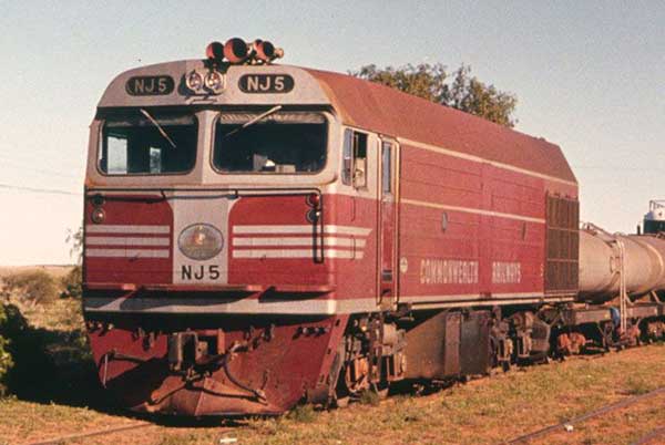
The NJ class are a class of diesel locomotive built in 1971 by Clyde Engineering, Granville for the Commonwealth Railways for use on the Central Australia Railway. In 1969, Commonwealth Railways ordered six single-cab NJ class locomotives from Clyde Engineering for use on the narrow gauge 1,067 mm (3 ft 6 in) Central Australian Railway between Marree and Alice Springs. They hauled freight trains as well as The Ghan passenger train. In July 1975, all were included in the transfer of Commonwealth Railways to Australian National. Following the closure of the Central Australian Railway in December 1980 and their unsuitability for conversion to standard gauge they were transferred by Australian National to the Eyre Peninsula Railway in South Australia.
Design by W3layouts