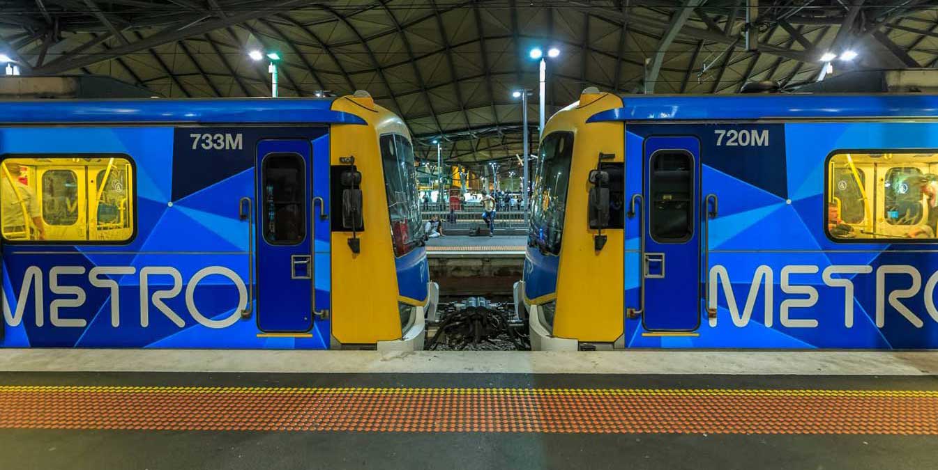
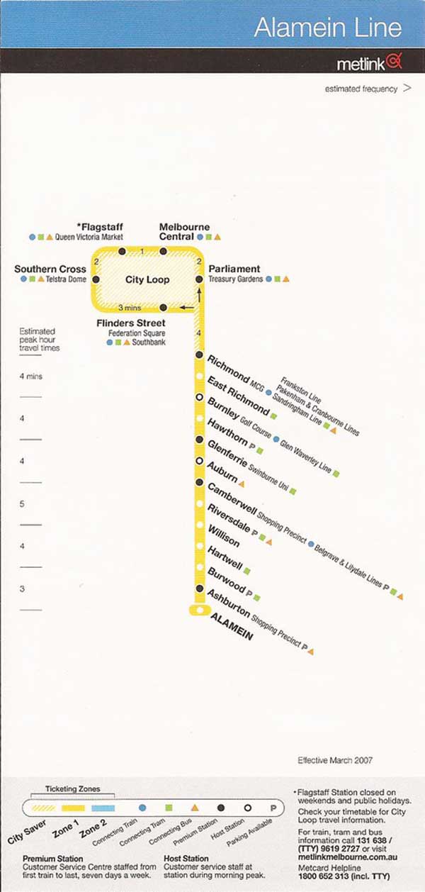
The Alamein line is a commuter railway line is the city's second shortest metropolitan railway line at 14.9 kilometres. The line runs from Flinders Street station in central Melbourne to Alamein station in the east, serving 18 stations via Burnley, Camberwell, Riversdale, and Ashburton. The line operates for approximately 19 hours a day (from approximately 5:00 am to around 12:00 am) with 24 hour service available on Friday and Saturday nights. During peak hours, headways of up to 15 minutes are operated with services every 10–30 minutes during off-peak hours.
Sections of the Alamein line opened as early as 1898, with the line fully extended to Alamein by 1948. The Alamein line was originally part of the Outer Circle line which operated from 1890 until its closure in 1897. The line was built to connect Melbourne with the suburb towns of Camberwell and Ashburton, amongst others previously served by the Outer Circle line. Minor upgrades have occurred since its opening, including historical level crossing removal works and regular infrastructure upgrades.
Services on the Alamein line operate from approximately 5:00 am to around 12:00 am daily. In general, during peak hours, train frequency is 10–20 minutes while services during non-peak hours drop to 20–30 minutes throughout the entire route. Due to the limited number of passengers on the Alamein line, services operate as a shuttle in off-peak times to Camberwell instead of continuing into the central business district. On Friday and Saturday nights, services run 24 hours a day, with 60 minute frequencies available outside of normal operating hours.
Although the Melbourne Cricket Ground is arguably one of the two most important cricket grounds in the world, it is much more than a cricket ground to the people of Melbourne. It is one of the great icons of this city, and even Australia. By the 1950's, Melbourne's reputation as the sports capital of Australia was so firmly entrenched that it was a foregone conclusion that the city would host the 1956 Olympic Games and that the MCG would be the Games' main stadium.
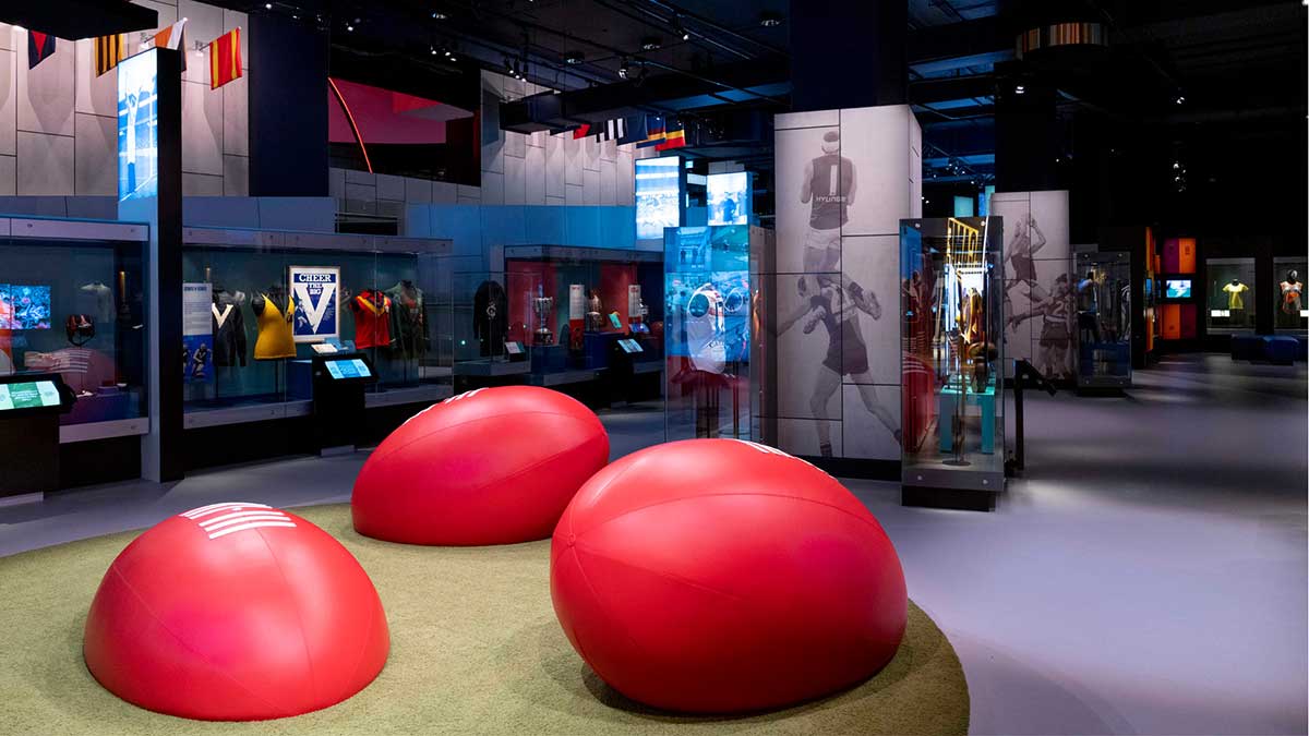
The Melbourne Cricket Ground is home to the Australian Sports Museum (above). Dedicated to Australian sport, there are exhibits for sports such as cricket, Australian rules football, the Summer and Winter Olympic Games, tennis, rugby league, rugby union, soccer, basketball, boxing and netball. The Australian Sports Hall of Fame is also located within the museum along with the Australian Racing Museum and the Melbourne Cricket Club Museum.
The adjoining MCC Museum features exhibitions relating to the history of the Melbourne Cricket Club. On 6 October 2010, the Australian Racing Museum was absorbed into the Australian Sports Museum, which has now resulted in horse racing standing alongside other prominent Australian sports.
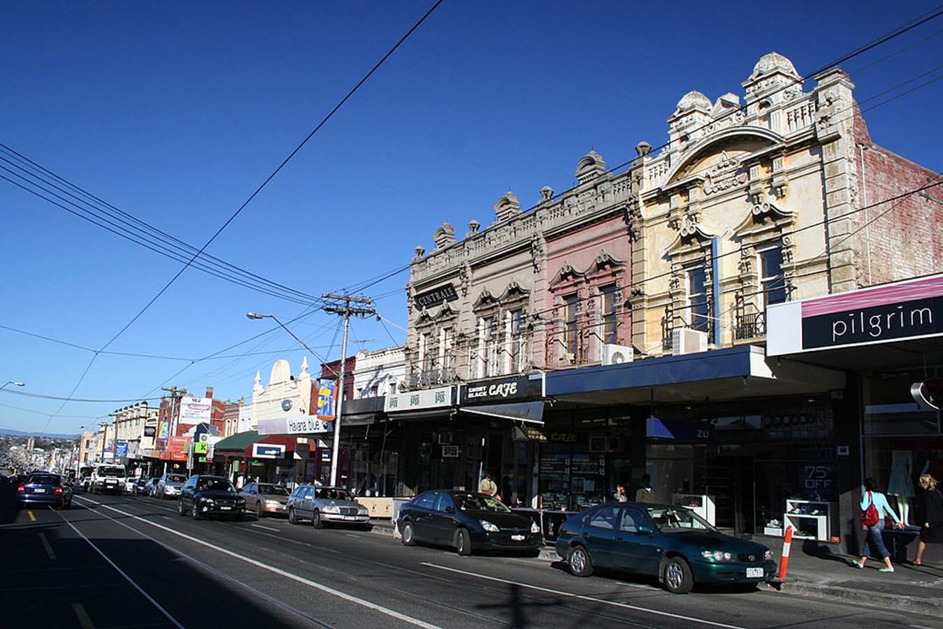
Best known for its bargain designer and seconds shopping along Bridge Road and Swan Street, vibrant Richmond is also the place to go for Greek or Vietnamese food, languid all-day breakfasts and great live music. Though a number of designer and seconds shop have moved out of the area in recent times, there are still plenty there to please the bargain hunter. Church Street is the place to go for designer furniture and objets d'art.
Bars and live music thrive in Richmond, the Corner Hotel being one of Melbourne's most famous intimate live-music venues, hosting big-name bands alongside obscure newcomers. Just across Swan Street, Dizzy's Jazz Club is known for its quality acts. Sip a cocktail in refined surrounds at Der Raum, or celebrate the hops and tour the Carlton and United Breweries' brewhouse in Abbotsford.
Nearby Victoria Street, or Little Saigon, in North Richmond, is the heart of Melbourne's Vietnamese community. Wander among the long stretch of eateries, bakeries, butchers, fishmongers and grocers and grab a bite along the way. Don't expect white linen tablecloths and hovering waiters - Victoria Street is about the hustle and bustle of fast, fresh and exceptional Asian food at a bargain price.
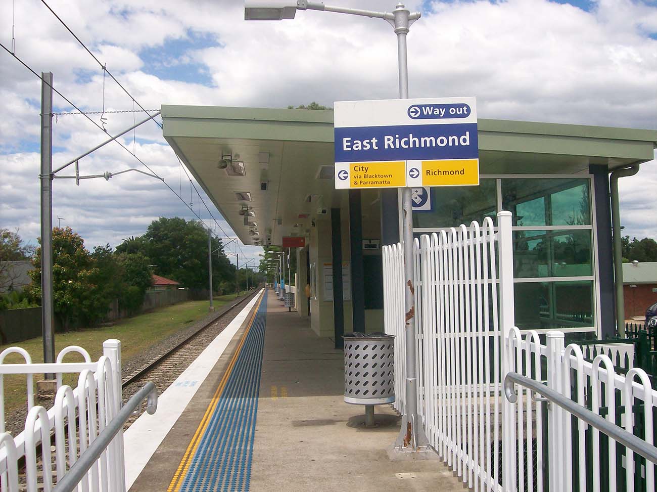
East Richmond station, which services the suburb of Cremorne, opened as Church Street Station on 24 September 1860 on the Melbourne and Suburban Railway Company’s new railway line to Hawthorn, one of Melbourne’s earliest suburban rail services.
Its location at the city end of Melbourne's busiest group of railway lines means that a large number of services pass through the station, but only a limited number stop there, largely because of its proximity to Richmond station, a few hundred metres away in Swan Street.
Services to and from Lilydale and Belgrave do not normally stop at East Richmond. Glen Waverley trains stop there in the off-peak, but trains to and from Glen Waverley in peak hours do not. Most services to and from Alamein, Blackburn and Ringwood stop there.


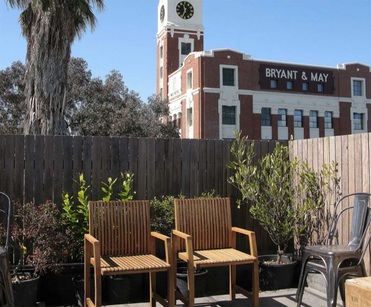
Covering only about a square kilometre, until 1999 Cremorne existed only as a locality in the larger suburb of Richmond., which explains why its railway station is not called Cremorne, but East Richmond. Cremorne's charm is in its rather chaotic mix of uses and the unique character resulting from being 'walled in' by main roads and railways on all sides. There are industrial icons such as Bryant and May and Rosella factories, and the Nylex Clock, side by side with Victorian cottages, modern townhouses, offices and light industries.
Cremorne takes its name from the Cremorne Gardens, an amusement park that occupied a riverfront location in the western half of Cremorne for a period in the mid 19th century. Cremorne was established as six allotments of crown land in 1839 only 5 years after the subdivision of Melbourne's CBD by John Batman. Originally it was used for farming estates, with large villas reminiscent of English estates. It was subdivided in linear strips running from Swan Street to the Yarra River. Cremorne Gardens occupied a river-front location in the western half of Cremorne. The Gardens closed in 1863 and the land was sold for housing and an asylum.
Currently Cremorne has been coined as 'Australian Silicon Valley' due to a concentration of tech industries such as Seek, Disney, Carsales in the precinct.
Half of the Burnley area is public space and ground occupied by the Burnley campus of the Victorian College of Agriculture and Horticulture. The area was named after William Burnley, pioneer land purchaser in Richmond, local councillor and parliamentarian.
In 1838 the area approximating Burnley's present open space lying in a loop of the Yarra River was reserved as the Survey Paddock. The Horticultural Society of Victoria was granted 12 ha. in the Survey Paddock in 1862 for experimental gardens, mainly for acclimatization of exotic fruits, vegetables and flowers. The site was taken over by the State Department of Agriculture in 1891. The balance of the Survey Paddock became Richmond Park, containing the Picnic railway station, east of the present Burnley station, as the entry to a landscaped pleasure ground.
Within walking distance of Burnley station at 22 - 50 Bendigo Street, Richmond, is one of Melbourne's most iconic buildings. Yhe former Wertheim Piano Factory, it better known as GTV 9 Richmond Television City. GTV (General Television Corporation) owned by the Nine Network broadcast shows from its 'Television City' for 54 years. Australia's first official television broadcast was made by GTV 9 from Studio 1 on 27 September 1956. On 28 February 2011, GTV9 broadcast its final live program - the 6pm edition of Nine News from the Richmond studios. It was at this studio that many iconic Australian TV shows, including In Melbourne Tonight, Footy Show, Hey Hey it's Saturday, The Price Is Right, Sale of the Century, The Don Lane Show, The Ernie Sigley Show, The Graham Kennedy Show, The Sullivans and New Faces were created.
6 kilometres east of Melbourne's central business district situated in the City of Boroondara, Hawthorne is generally regarded to be one of Melbourne's surviving bastions of post-Gold Rush expansion and today, one of Melbourne's most affluent and influential suburbs. Land values in the region are among the country's highest, with streets such as Hawthorn Grove, in the prestigious Grace Park Estate, straddling the suburb's northern boundary and Yarra Park's Coppin Grove in the west, located closer to the Yarra River have been arguably the most sought after with properties commanding prices to match.
Hawthorn is particularly noted for the number, range and quality of its restaurants, many of which reflect the strong ethnic diversity of the region. There are also many nightclubs and hotels in the suburb.
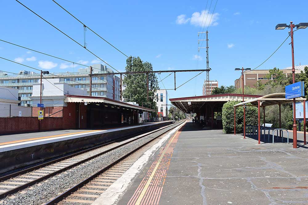
The station serves the nearby Hawthorn campus of Swinburne University of Technology, and is listed on the Victorian Heritage Register. The name of this station recalls Glenferrie Road, a major shopping strip, with two supermarkets, all major banks and many chain and specialty stores. Glenferrie Road itself was named after a property which was purchased by solicitor Peter Ferrie in 1840, who later named the property Glen Ferrie. Glenferrie station opened on 3 April 1882, when the railway line from Hawthorn was extended to Camberwell.
Known for grand, historic residences and tranquil, leafy streets, Camberwell is commonly regarded as one of Melbourne's most prestigious and exclusive suburbs. A feature of Camberwell is the Burke Road shopping strip, which stretches north, approximately 600 m from Camberwell Junction, where three tram routes converge—the 70, 72, and 75. Halfway up the shopping strip is Camberwell railway station, which services the Belgrave, Lilydale, and Alamein train lines. East Camberwell, Riversdale, Willison, and Hartwell stations also lie within the suburb's boundaries.
Camberwell received its name as a result of an early settler being reminded of the way three roads intersected in the south London district of Camberwell. This intersection is now known as Camberwell Junction.
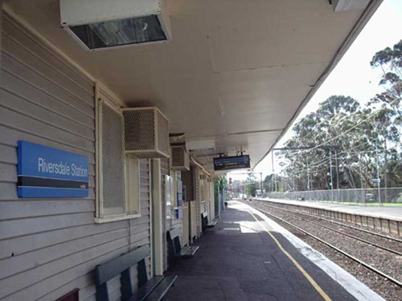
Riversdale railway station serves the eastern Melbourne suburb of Camberwell. Opened on 30 May 1890, it was provisionally called Prospect Hill, however, it has been named Riversdale since it opened. The name derives from the nearby Riversdale Road, itself named by parliamentarian and local resident Matthew O'Grady. O'Grady named it after the fact that the road leads to the valley of the Yarra River. Though it was closed for a year in 1897 and 1898, when the Outer Circle line closed, it reopened soon after due to a public outcry.
Willison railway station, opened on 8 June 1908 as Golf Links, was renamed Willison on 23 July 1936. It serves the eastern Melbourne suburb of Camberwell. The station was provided for the convenience of members of the Riversdale Golf Club, which was originally adjacent to the site. It has been said that influential club members did not appreciate having to walk to either Riversdale or Hartwell, and pressed for a closer alternative. That almost certainly explains why Willison was built so close to Riversdale, being only 400 metres away. The club moved from the site in 1927 and, on 23 July 1936, the station was renamed Willison, after A. J. Willison, a former member of Camberwell Council.
Hartwell is 10 km south-east of Melbourne. Hartwell is centred on its shopping precinct along Toorak Road and contains several areas of heritage buildings. It is not a gazetted suburb in its own right and is mostly located in Camberwell with some areas falling within the boundaries of Burwood. The name arose in a land sale advertisement, but the source of the name is apparently unrecorded. The advertisement predated the residence named Hartwell House (1853) at the corner of Toorak Road and Glencairn Avenue built by James Irwin.
When the Outer Circle railway was opened in 1891 there was a Hartwell station – the present Burwood station. Another station immediately to the north was opened in 1906 and named Hartwell Hill. It became Hartwell when the first one was renamed Burwood. Notwithstanding the opening of the railway line, residential development awaited the extension of the tram along Toorak Road in 1916. The strip shopping centre and subdivisions strengthened in the 1920s.
Burwood and Burwood East extend eastwards from Melbourne, beginning at a distance of about 11 km. from Melbourne's centre and ending 17 km. from the centre, roughly from Warrigal Road to Springvale Road. Burwood's origins were in the village of Ballyshanassy, which was about one kilometre east of Warrigal Road and which was surveyed in 1858. Ballyshanassy's location is identifiable by the Burwood Cemetery, police station and state school (1865-1992, Victorian Heritage Register), along with an unusual road layout off the south side of Burwood Highway. The commercial hub, however, grew around the intersection of Warrigal Road and Burwood Highway, which survives as a strip shopping centre. "Burwood" spread one kilometre westwards from Warrigal Road when the Hartwell Railway Station was renamed Burwood in 1909.
Ashburton, a mostly postwar residential suburb, is 11 km. south east of Melbourne. The locality's name arose when the station on the Outer Circle railway line (1890} was named Ashburton, at the suggestion of a former local councillor, E. Dillon who had lived in Ashburton Terrace, Cork, Ireland. An unrealised objective of the railway line had been to stimulate residential development, but the locality was best known for the Ashburton forest, overlooking Gardiners Creek, as a site for picnics.
The Outer Circle railway, originally from Oakleigh to Melbourne via Fairfield, was abbreviated to spur lines from Camberwell within a few years, northwards to Deepdene and southwards to Ashburton, and no other fixed rail transport was provided for Ashburton. The residential development of Ashburton awaited Melbourne's postwar metropolitan expansion and increased car ownership. Ashburton features a retail area around High Street, has two train stations (Ashburton and Alamein) and contains a branch of the Boroondara Library.
Alamein was the last station to be built on what is now the line of the same name. It was built in 1948 on the reservation of the ill-fated Outer Circle line, the section on which Alamein is now located being closed to all traffic in 1895. The station serviced a new Housing Commission estate that had been opened up to house people that had displaced after the Second World War. The station still bears the name of the estate, which in turn had been named after the battlefield in North Africa.
The Alamein railway line serves part of the City of Boroondara, to the east of the Melbourne central business district. It has six stations and branches from the Belgrave and Lilydale lines at Camberwell station. The line is operated as a shuttle service between Camberwell and Alamein stations during off-peak periods, while trains run the whole distance to Flinders Street Station during peak hours. What is now known as the Alamein line was opened as the Outer Circle Railway between 1890 and 1891. The segment still in use today was opened on 24 March 1890.


Design by W3layouts