
The Belgrave line is the city's fourth-longest metropolitan railway line at 41.8 kilometres. Sections of the Belgrave line opened as early as 1889, with the line fully extended and re-gauged to Belgrave by 1962. The line was built to connect Melbourne and Ringwood with the rural towns of Bayswater, Boronia, Upper Ferntree Gully, and Belgrave, among others.
Since the 2010s, due to the heavily utilised infrastructure of the Belgrave line, significant improvements and upgrades have been made. Different packages of work have upgraded the corridor to replace sleepers, upgraded signalling technology, introduced new rolling stock, and removed seven of the nine remaining level crossings.
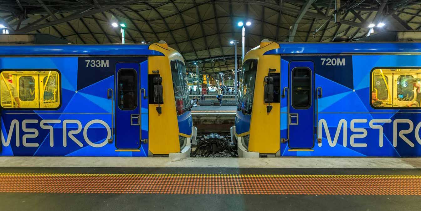
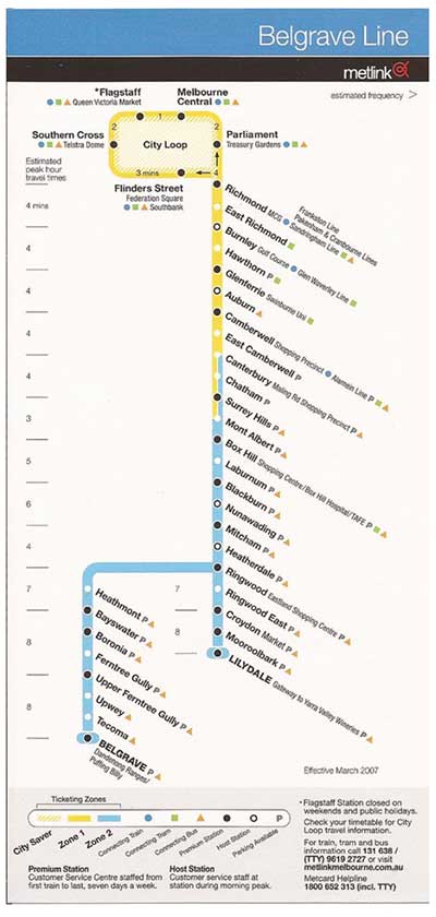
The line runs from Flinders Street station in central Melbourne to Belgrave station in the east, serving 31 stations via Burnley, Box Hill, Ringwood, and Upper Ferntree Gully. Beyond Belgrave, the narrow-gauge line has been restored as the Puffing Billy Railway, which runs tourist services to the original terminus of Gembrook. The line operates for approximately 19 hours a day (from approximately 5:00 am to around 12:00 am) with 24 hour service available on Friday and Saturday nights. During peak hours, headways of up to 15 minutes are operated, with services every 20–30 minutes during off-peak hours.
The underground City Loop is at the centre of Melbourne's busy suburban railway system. It's quite an unusual design, being made up of four completely independent single track tunnels, some of which change direction half way through the day. From Flinders Street station, trains travel across the Flinders Street Railway Viaduct to Southern Cross Station. Upon leaving Southern Cross, trains travel underground through Flagstaff. Melbourne Central and Parliament stations, emerging from the underground loop at East Melbourne.
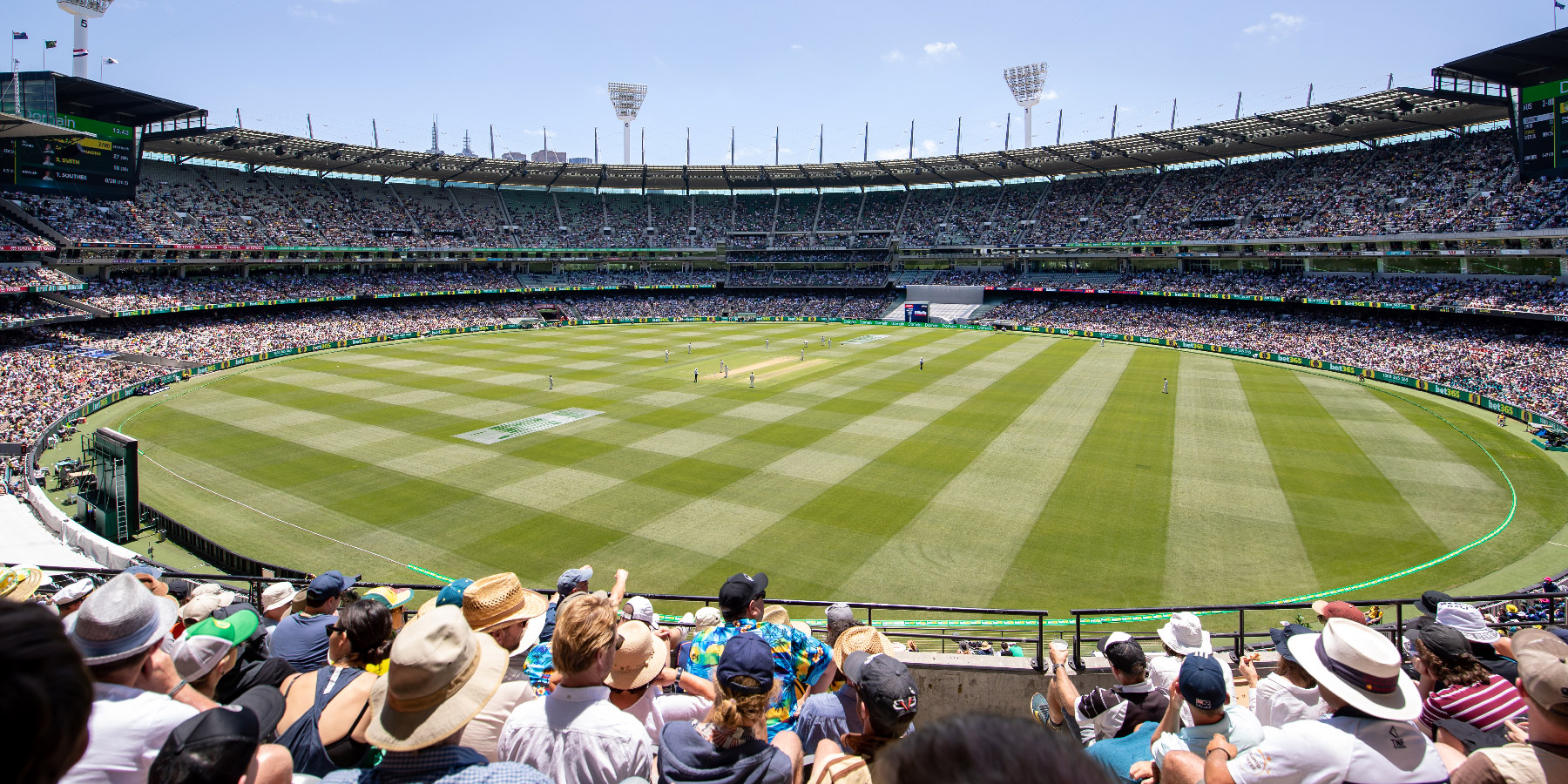
Although the Melbourne Cricket Ground is arguably one of the two most important cricket grounds in the world, it is much more than a cricket ground to the people of Melbourne. It is one of the great icons of this city, and even Australia. By the 1950's, Melbourne's reputation as the sports capital of Australia was so firmly entrenched that it was a foregone conclusion that the city would host the 1956 Olympic Games and that the MCG would be the Games' main stadium.
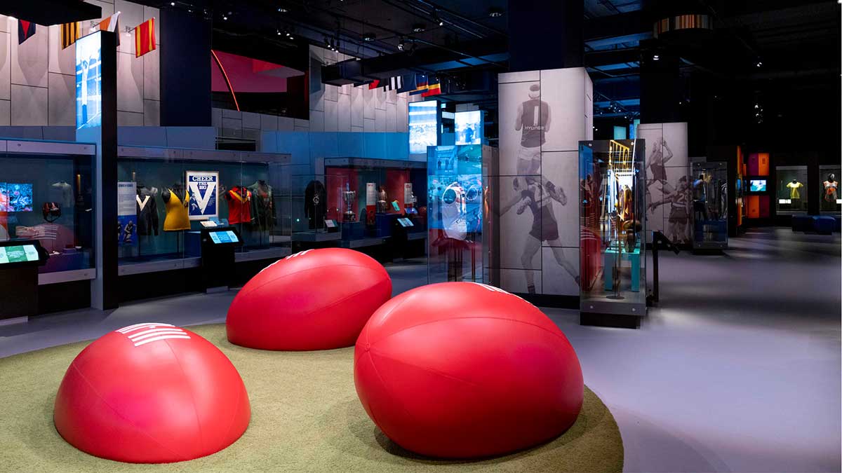
The Melbourne Cricket Ground is home to the Australian Sports Museum (above). Dedicated to Australian sport, there are exhibits for sports such as cricket, Australian rules football, the Summer and Winter Olympic Games, tennis, rugby league, rugby union, soccer, basketball, boxing and netball. The Australian Sports Hall of Fame is also located within the museum along with the Australian Racing Museum and the Melbourne Cricket Club Museum.
The adjoining MCC Museum features exhibitions relating to the history of the Melbourne Cricket Club. On 6 October 2010, the Australian Racing Museum was absorbed into the Australian Sports Museum, which has now resulted in horse racing standing alongside other prominent Australian sports.
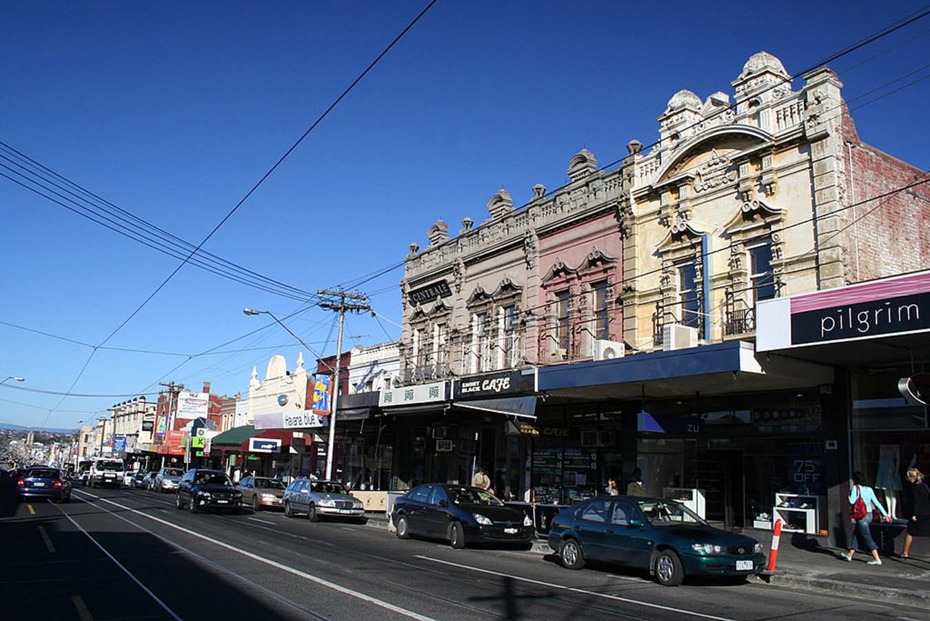
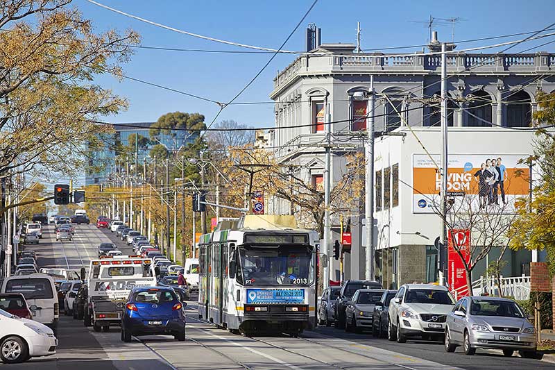
Best known for its bargain designer and seconds shopping along Bridge Road and Swan Street, vibrant Richmond is also the place to go for Greek or Vietnamese food, languid all-day breakfasts and great live music. Though a number of designer and seconds shop have moved out of the area in recent times, there are still plenty there to please the bargain hunter. Church Street is the place to go for designer furniture and objets d'art.
Bars and live music thrive in Richmond, the Corner Hotel being one of Melbourne's most famous intimate live-music venues, hosting big-name bands alongside obscure newcomers. Just across Swan Street, Dizzy's Jazz Club is known for its quality acts. Sip a cocktail in refined surrounds at Der Raum, or celebrate the hops and tour the Carlton and United Breweries' brewhouse in Abbotsford.
Nearby Victoria Street, or Little Saigon, in North Richmond, is the heart of Melbourne's Vietnamese community. Wander among the long stretch of eateries, bakeries, butchers, fishmongers and grocers and grab a bite along the way. Don't expect white linen tablecloths and hovering waiters - Victoria Street is about the hustle and bustle of fast, fresh and exceptional Asian food at a bargain price.
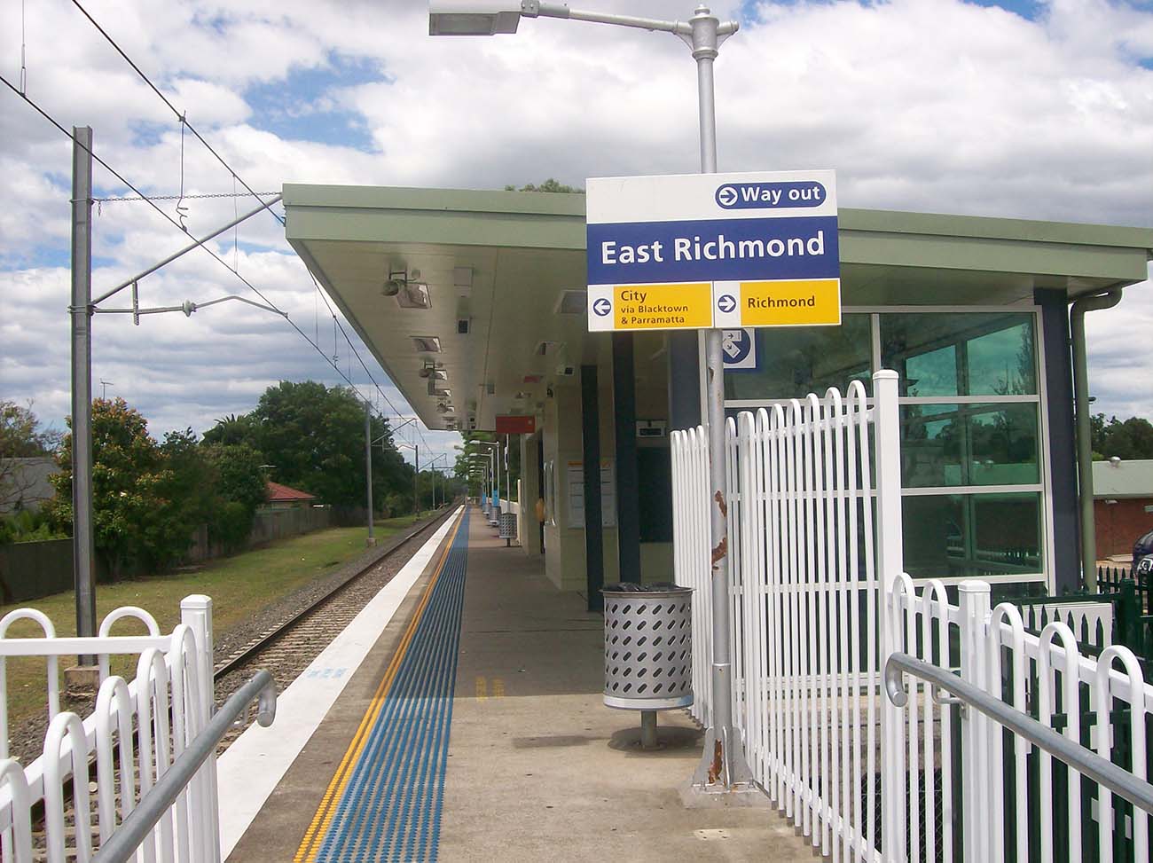
East Richmond station, which services the suburb of Cremorne, opened as Church Street Station on 24 September 1860 on the Melbourne and Suburban Railway Company’s new railway line to Hawthorn, one of Melbourne’s earliest suburban rail services.
Its location at the city end of Melbourne's busiest group of railway lines means that a large number of services pass through the station, but only a limited number stop there, largely because of its proximity to Richmond station, a few hundred metres away in Swan Street.
Services to and from Lilydale and Belgrave do not normally stop at East Richmond. Glen Waverley trains stop there in the off-peak, but trains to and from Glen Waverley in peak hours do not. Most services to and from Alamein, Blackburn and Ringwood stop there.


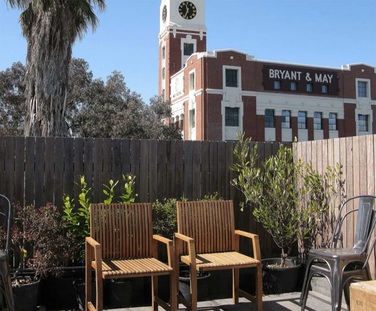
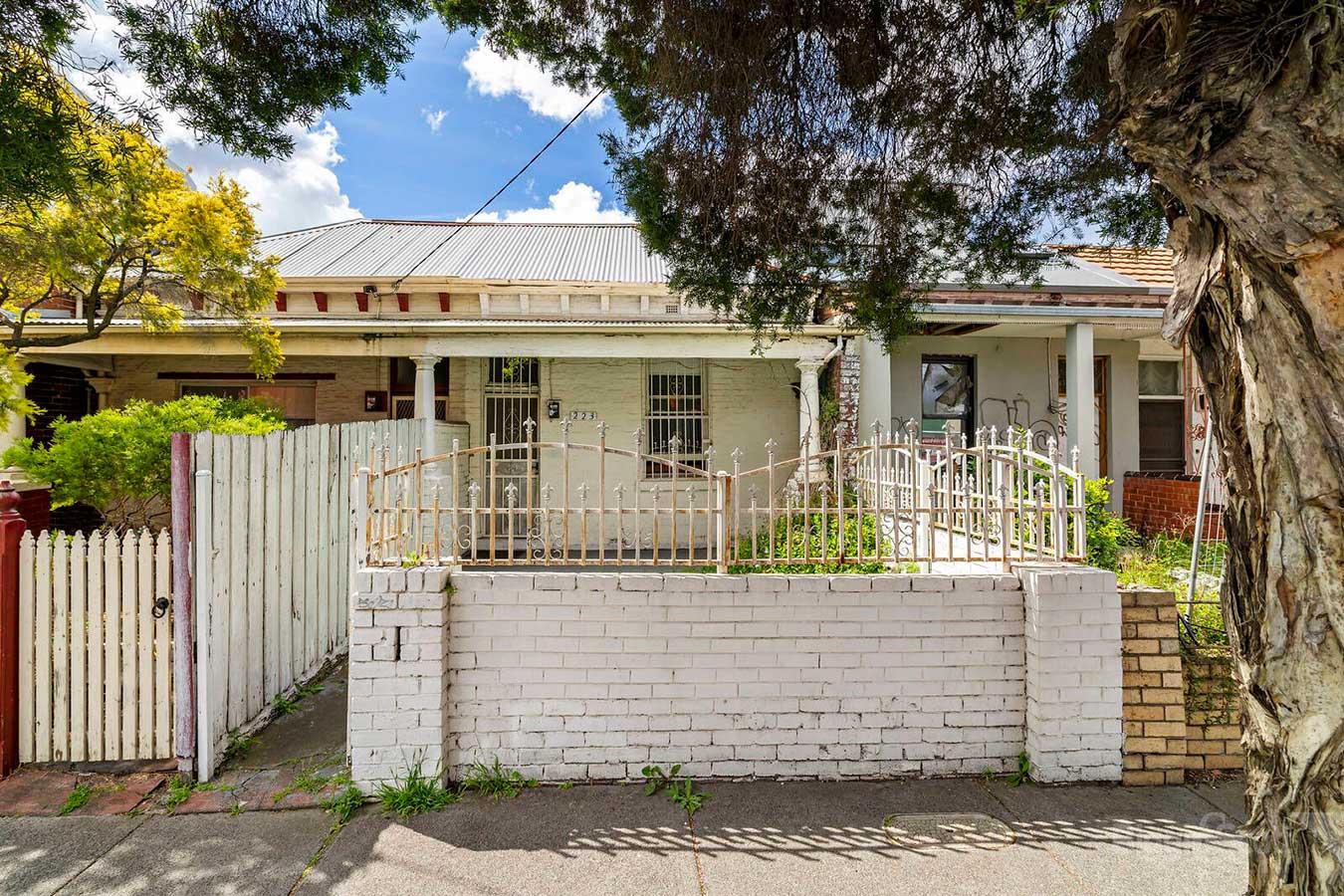
Covering only about a square kilometre, until 1999 Cremorne existed only as a locality in the larger suburb of Richmond., which explains why its railway station is not called Cremorne, but East Richmond. Cremorne's charm is in its rather chaotic mix of uses and the unique character resulting from being 'walled in' by main roads and railways on all sides. There are industrial icons such as Bryant and May and Rosella factories, and the Nylex Clock, side by side with Victorian cottages, modern townhouses, offices and light industries.
Cremorne takes its name from the Cremorne Gardens, an amusement park that occupied a riverfront location in the western half of Cremorne for a period in the mid 19th century. Cremorne was established as six allotments of crown land in 1839 only 5 years after the subdivision of Melbourne's CBD by John Batman. Originally it was used for farming estates, with large villas reminiscent of English estates. It was subdivided in linear strips running from Swan Street to the Yarra River. Cremorne Gardens occupied a river-front location in the western half of Cremorne. The Gardens closed in 1863 and the land was sold for housing and an asylum.
Currently Cremorne has been coined as 'Australian Silicon Valley' due to a concentration of tech industries such as Seek, Disney, Carsales in the precinct.
Half of the Burnley area is public space and ground occupied by the Burnley campus of the Victorian College of Agriculture and Horticulture. The area was named after William Burnley, pioneer land purchaser in Richmond, local councillor and parliamentarian.
In 1838 the area approximating Burnley's present open space lying in a loop of the Yarra River was reserved as the Survey Paddock. The Horticultural Society of Victoria was granted 12 ha. in the Survey Paddock in 1862 for experimental gardens, mainly for acclimatization of exotic fruits, vegetables and flowers. The site was taken over by the State Department of Agriculture in 1891. The balance of the Survey Paddock became Richmond Park, containing the Picnic railway station, east of the present Burnley station, as the entry to a landscaped pleasure ground.
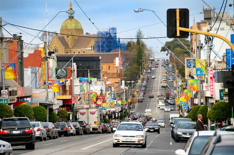
6 kilometres east of Melbourne's central business district situated in the City of Boroondara, Hawthorne is generally regarded to be one of Melbourne's surviving bastions of post-Gold Rush expansion and today, one of Melbourne's most affluent and influential suburbs. Land values in the region are among the country's highest, with streets such as Hawthorn Grove, in the prestigious Grace Park Estate, straddling the suburb's northern boundary and Yarra Park's Coppin Grove in the west, located closer to the Yarra River have been arguably the most sought after with properties commanding prices to match.
Hawthorn is particularly noted for the number, range and quality of its restaurants, many of which reflect the strong ethnic diversity of the region. There are also many nightclubs and hotels in the suburb.
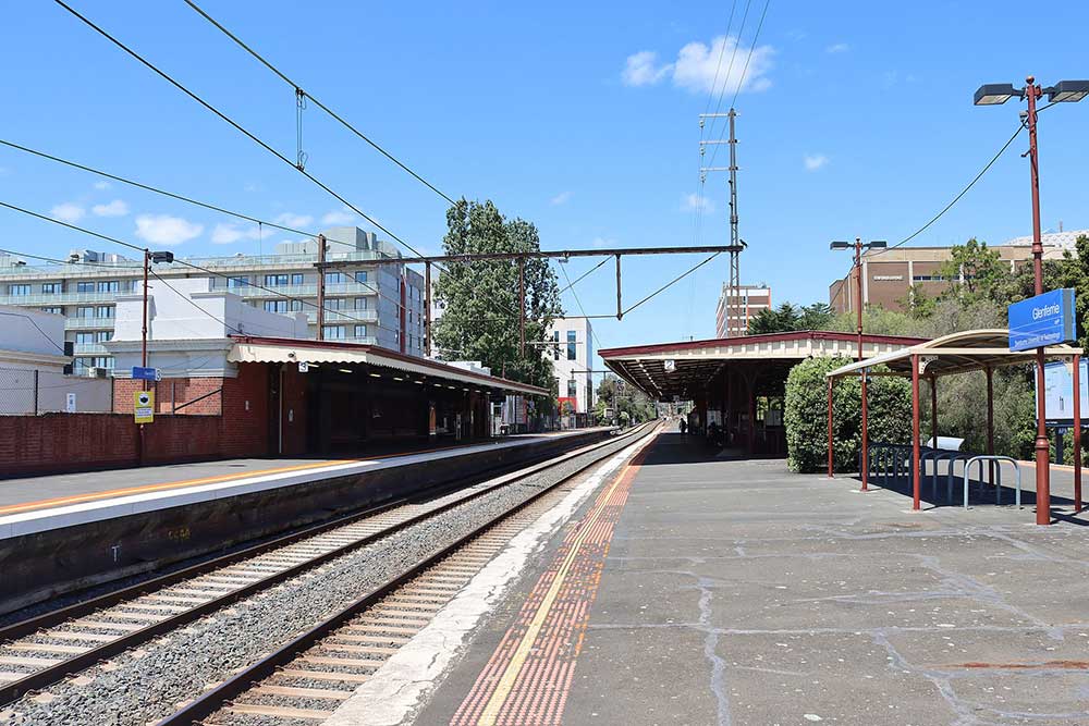
The station serves the nearby Hawthorn campus of Swinburne University of Technology, and is listed on the Victorian Heritage Register. The name of this station recalls Glenferrie Road, a major shopping strip, with two supermarkets, all major banks and many chain and specialty stores. Glenferrie Road itself was named after a property which was purchased by solicitor Peter Ferrie in 1840, who later named the property Glen Ferrie. Glenferrie station opened on 3 April 1882, when the railway line from Hawthorn was extended to Camberwell.
Known for grand, historic residences and tranquil, leafy streets, Camberwell is commonly regarded as one of Melbourne's most prestigious and exclusive suburbs. A feature of Camberwell is the Burke Road shopping strip, which stretches north, approximately 600 m from Camberwell Junction, where three tram routes converge—the 70, 72, and 75. Halfway up the shopping strip is Camberwell railway station, which services the Belgrave, Lilydale, and Alamein train lines. East Camberwell, Riversdale, Willison, and Hartwell stations also lie within the suburb's boundaries.
Camberwell received its name as a result of an early settler being reminded of the way three roads intersected in the south London district of Camberwell. This intersection is now known as Camberwell Junction.
East Camberwell, Hartwell, Riversdale and Willison are four officially named neighbourhoods, within the general area of the railway stations of the same name. The southern areas of the Prospect Hill Precinct (from the south side of Prospect Hill Road to Riversdale Road) were developed for the Riversdale Estate, Kasouka Estate and Gladstone Park Estates from the late nineteenth century. The Kasouka Estate was created in 1891 and included Kasouka Road, Trafalgar, Prospect Hill and Riversdale Roads. Kasouka Road has a high level of visual cohesion and is dominated by Victorian and Edwardian period villas.
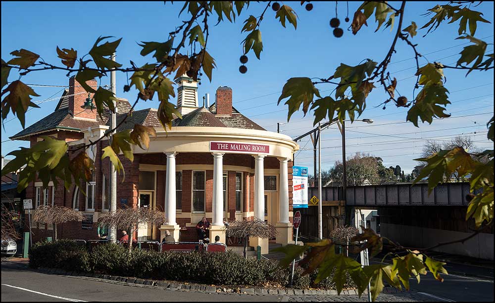
Famed for its leafy green boulevards and substantial, opulent historic residences, Canterbury is one of Melbourne's most expensive and exclusive suburbs. Canterbury is the home to many of Victoria's oldest and most prestigious private schools, including Camberwell Grammar School, Camberwell Girls Grammar School and Strathcona Baptist Girls Grammar School. Other schools include Camberwell High School, Canterbury Girls' Secondary College and Canterbury Primary School. The main shopping area in Canterbury is around the railway station and includes shops in Canterbury Road, as well as Maling Road. Larger shopping centres nearby include Burke Road in Camberwell and Whitehorse Road in Balwyn.
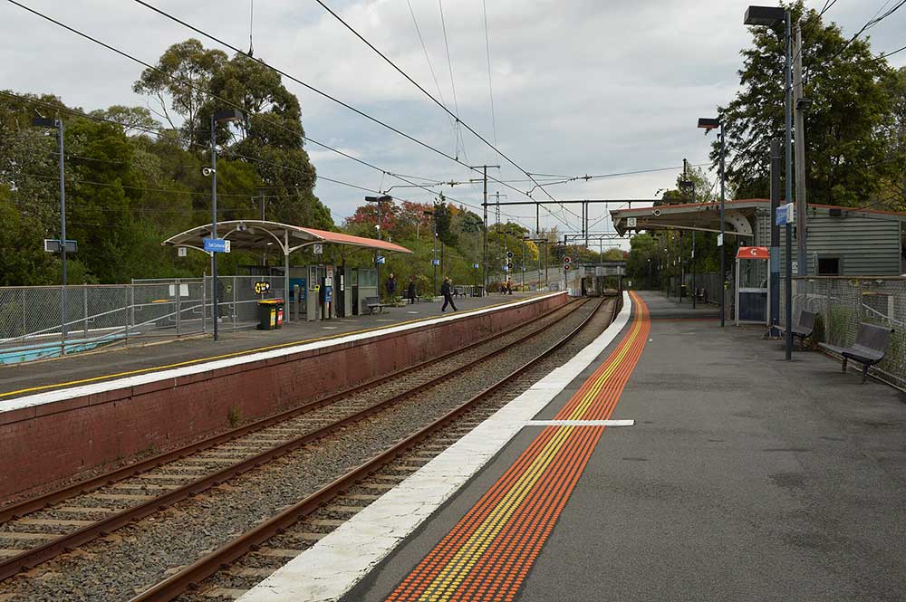
Chatham railway station is located on the Lilydale and Belgrave lines. It serves the eastern Melbourne suburb of Surrey Hills, and it opened on 1 April 1927. The station was named after nearby Chatham Road.
Union railway station, on the Belgrave and Lilydale lines, serves the eastern Melbourne suburb of Mont Albert. Union is a premium status below ground station featuring three platforms, two on an island platform and one side platform. It opened on 22 May 2023 after the closure of Mont Albert and Surrey Hills stations. It was built as part of the Level Crossing Removal Project. The staion's name was selected both to represent the unity of the two stations (Mont Albert and Surrey Hills) and for the nearby Union Road shopping village.
14 kilometres east of the city's Central Business District, Box Hill was founded as a township in the 1850s, and grew over the following century into a small city with its own CBD, its own municipality in the former City of Box Hill, and its own suburbs, including Box Hill North and Box Hill South. In the 1950s, Box Hill was absorbed into Melbourne as part of the eastward expansion of the metropolis. Today, Box Hill is notable for its large Chinese community, being one of the largest in Melbourne, and is home to the city's tallest high-rise buildings outside the CBD.
A major transportation hub for Melbourne's eastern suburbs, Box Hill is home of one of the city's busiest train stations, located beneath Box Hill Central. It is also served by the route 109 tram and numerous bus routes.
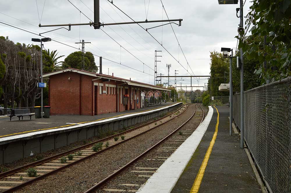
Laburnum railway station serves the eastern Melbourne suburb of Blackburn. Opened on 13 July 1958, the station was named after the locality of Laburnum, itself named after the shrub of the same name. Laburnum was once known for having a sign reading "Toot Toot – drive slowly" under the railway bridge which crosses Laburnum Street, as the street was both narrow and had a sharp bend at that point.
Drivers would often sound their car horns, as instructed by the sign, to warn oncoming, but possibly unseen, traffic that might be approaching the narrow underpass. Infuriated neighbours would frequently attempt to remove the sign by painting over it, but to no avail; the local council would restore the sign every time. When the station was rebuilt following the 2007 grade separation, the road underpass was substantially widened, so the sign was deemed unnecessary and was removed. A plaque commemorating the sign and describing its history was erected, although it too has since been removed.
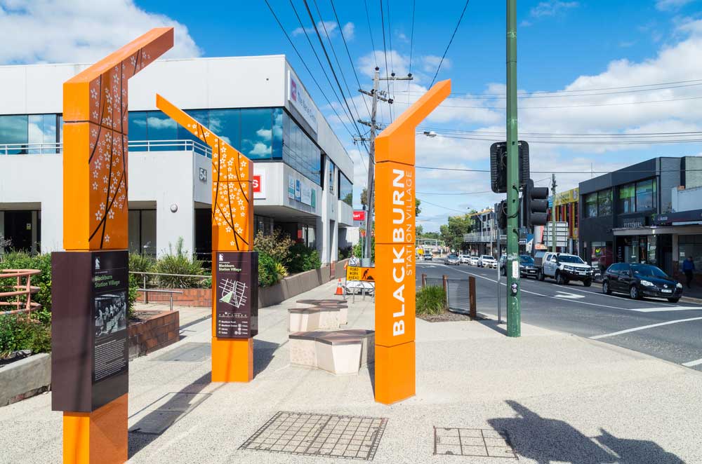
The origin of the name of the Melbourne suburb of Blackburn is not certain, but may have been after an early settler or James Blackburn, who designed Yan Yean Reservoir. It lies within the City of Whitehorse, in Melbourne's eastern suburbs. A large part of Blackburn is of historical significance, as it was built around the artificial Blackburn Lake in 1889, now known as Blackburn Lake Sanctuary, with the lake in the middle of the sanctuary. This was a popular day trip destination by train in the late nineteenth century. Some Australian artists painted in the bush around the Blackburn and Box Hill areas.
18 km east of Melbourne's Central Business District, Nunawading station opened almost six years after the railway line from Camberwell was extended to Lilydale. Like the suburb itself, the name of the station is from an Indigenous word, numphawading, meaning ceremonial ground or battlefield. The settlement immediately adjacent to the station was originally named after Tunstall, England, famous for its potteries. The opening of the Tunstall railway station contributed to the growth of brick and clay industries, with orchards soon following. Tunstall Post Office opened on 1 February 1889 and was renamed Nunawading in 1945.
The period following World War II saw a housing boom in the area, as residential blocks began to replace orchards. Whitehorse Road is the site of the largest retail strip for bulkgoods in Melbourne. The City of Whitehorse has named this strip the Mega Mile, in an attempt to provide brand recognition for retailers. Nunawading is home to a large Pacific Brands clothing factory and a brick factory. The suburb was formerly home to the Winlaton Youth Training Centre, the Wobbies World amusement park, and the Melbourne studios of Network 10 television, where the soap opera Neighbours was filmed.
artists painted in the bush around the Blackburn and Box Hill areas.
20 km east from Melbourne's Central Business District, Mitcham was named after Mitcham Grove, a farm property that was owned by William Slater, who grew roses and herbs for perfumes and remedies. From its settlement in the 1860s, the Mitcham area was generally used for orchards, brickmaking and pottery. However, since the 1950s post war expansion, Mitcham has become a suburban area. The main shopping precinct is centred on the intersection of Whitehorse Road and Mitcham Road and features a supermarket, cafes, fast food outlets and specialty shops.
Heatherdale is a neighbourhood of Mitcham, in Melbourne's eastern suburbs, centred on the Heatherdale railway station, on the Lilydale and Belgrave railway lines. Heatherdale station opened on 7 September 1958, and was named after the locality of the same name, itself named after Heatherdale, a farm that was owned by William Witt.
29 km east of Melbourne's Central Business District, Ringwood village emerged in the mid to late 19th century, following the 1850s land sales. Before this, Ringwood was used primarily for agriculture. The post office opened on 2 August 1875, in the then rural area. Ringwood has been the site of a Cadbury chocolate factory since the company's acquisition of MacRobertson Chocolates in 1967. The factory is the company's second largest in Australia and produces chocolate bars, such as Cherry Ripe and Boost, and Easter eggs.
Ringwood has many parks and reserves, most notably Ringwood Lake, an 8.5-hectare park is used for various recreational activities which includes a lake with bridge, sound shell, mining history display, playground, picnic shelters, barbecues and a bushland walking circuit.
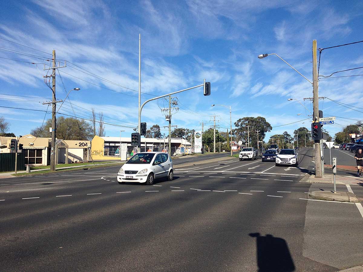
Heathmont was originally covered by hedge-to-hedge apple orchards. The name appears to have come from the rising land in the area having heath or low, shrub-like vegetation on it. The first shop opened in 1923 in front of a house. The population has grown from 600 people in 1953 to 8,787 people in 2001. 24 km east of Melbourne's Central Business District, Heathmont railway station is located just off Canterbury Road (which runs through the heart of the suburb).
A residential and industrial suburb in Melbourne, Victoria, Australia, 27 km east of Melbourne's Central Business District, Bayswater became home to a number of German Templers (just released from the Tatura Internment Camp) after World War II who settled in Bayswater and Boronia. Part of the Temple Society Australia, they built a Community Centre (1961) in Elizabeth Street and a Retirement Village, as well as Nursing Home Tabulam, in partnership with the Australian German Welfare Society (AGWS).
Prior to European settlement, Boronia and surrounding suburbs were often visited by Aboriginals from the Westernport and Yarra Yarra tribes, hunting during the summer months in the Dandenong Ranges and its foothills. In its early days of European settlement, Boronia was predominantly an orchard, flower growing and farming area.
Boronia was named in 1915 by local Councillor A. E. Chandler (prior to this, Boronia was considered part of Bayswater). Chandler named the suburb Boronia after the plant, boronia, which grew on his property at The Basin. The plant was discovered by Ferdinand von Mueller, an Austrian botanist, who came to Australia during the colonial period. Boronia railway station opened in 1920, leading to an influx of residents and Boronia Post Office opened on 1 October 1920. A further influx occurred in the 1960s and 1970s.
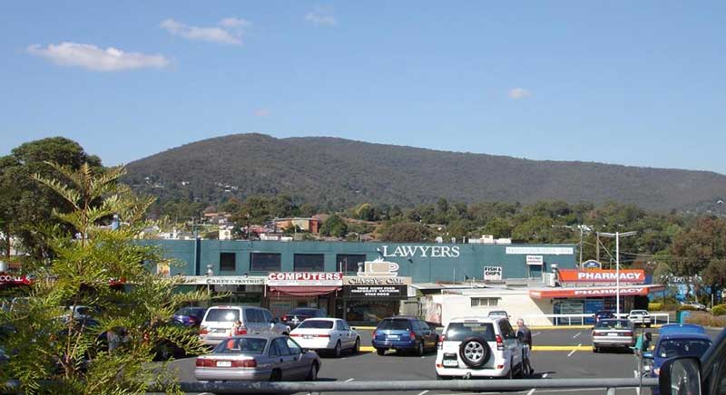
Located 27 km east of Melbourne's Central Business District, Ferntree Gully is 42 minutes (stopping all stations and then express service from Box Hill) to 60 minutes (all stations service) by train from Flinders Street Statio, Melbourne City. Located at the foothills of the Dandenong Ranges, ts boundaries meet Upper Ferntree Gully, a separate but similarly named suburb with the same postcode, Boronia to the North, Scoresby to the West and Lysterfield to the South. The eastern boundary coincides with the Ferntree Gully National Park.The suburb is in a high fire risk area in the vicinity of the Ferntree Gully National Park, however the majority of the suburb is considered low risk.
Now an outer suburb of Melbourne, Upper Ferntree Gully was a farming area in its early days and formed the end of the electric train line from Melbourne. Many Melburnians up to (at least) the 1930s also holidayed in cottages in Upper Ferntree Gully. Holiday makers and day trippers would then make their way by various means of transport to holiday and day tripper locations in the hills. A weekend market is held at the Upper Fern Tree Gully railway station carpark.
Part of the Dandenong Ranges National Park and home to Parks Victoria's Education Centre, Ferntree Gully Park boasts, in addition to natural beauty, the 1,000 Steps. This is popular as both a challenging walk and for those wanting to improve their fitness by ascending the steps at a more vigorous pace. The 1,000 steps now part of the Kokoda Trail (in World War II the Kokoda Track was a field of action for Australian soldiers in Papua New Guinea).
Upwey is a residential suburb in hilly surrounds 34 km. east-south-east of Melbourne and 2 km. west of Belgrave. Until the turn of the century Upwey did not have a separate identity. Until the turn of the 20th century, Upwey was known as Mast Gully, after several ship masts had been cut from trees in the gully in 1850. (Mast Gully Creek and Mast Gully Road remain).
On 18 December 1900, the 2 ft 6 in (762 mm) narrow gauge railway from Upper Ferntree Gully to Gembrook was opened and locals requested the Victorian Railways build a stopping place nearby, and on Monday, 3 June 1901, a station named Upwey was opened. The name was adopted locally, with the Upwey Church of England opening in 1904 and a post office opening on 1 July 1909. During the Great Depression, the Victorian Government opened up Dandenong Ranges to housing and the population of Upwey and the surrounding foothills grew steadily.
There are substantial crown land and recreational reserves in Upwey. The Burrinja Cultural Centre on Glenfern Road, Forest Park Reserve, Ferny Creek Reserve (also known as the Hume St Drainage Reserve), Upwey South Recreational Reserve (including tennis courts), Upwey Recreational Reserve (including the bowls clubs) and Glenfern Valley Bushlands all form public reserves and recreational areas. The Ringwood-Belgrave Rail Trail passes through the Upwey township. Other significant areas adjoin Upwey including Birdsland Reserve and the Dandenong Ranges National Park.
Tecoma is a small suburb, nestled between Belgrave and Upwey, adjoining Sherbrooke Forest to the north. It is historically recognised as a foothill township of the Dandenong Ranges, an area of cultural significance and biodiversity. The suburb is named after the shrub Tecoma that grew in the area when the need was identified for a railway station for the timber mill that occupied the site where Tecoma Primary School now stands.
Belgrave, the gateway to the Dandenong Ranges, offers a dynamic mix of mainstream and alternate options for its visitors. Attracting tourists from far and wide as well as providing for a thriving local community, Belgrave’s shopping precinct is a vibrant hub for shopping and café lifestyle with all the major services anyone could need, all nestled in the beautiful surroundings of the Sherbrooke forest.
Belgrave’s most notable attraction is the heritage narrow gauge, steam-operated Puffing Billy Railway, which was reopened in 1962 – after four years of restoration by volunteers. It travels through 24 kilometres of cool temperate rainforest, semi-urban development and rural farmland between Belgrave and Gembroo. Other nearby attractions include The 1000 Steps, Sherbrooke Forest and Sherbrooke Falls in the Dandenong Ranges National Park.


Design by W3layouts