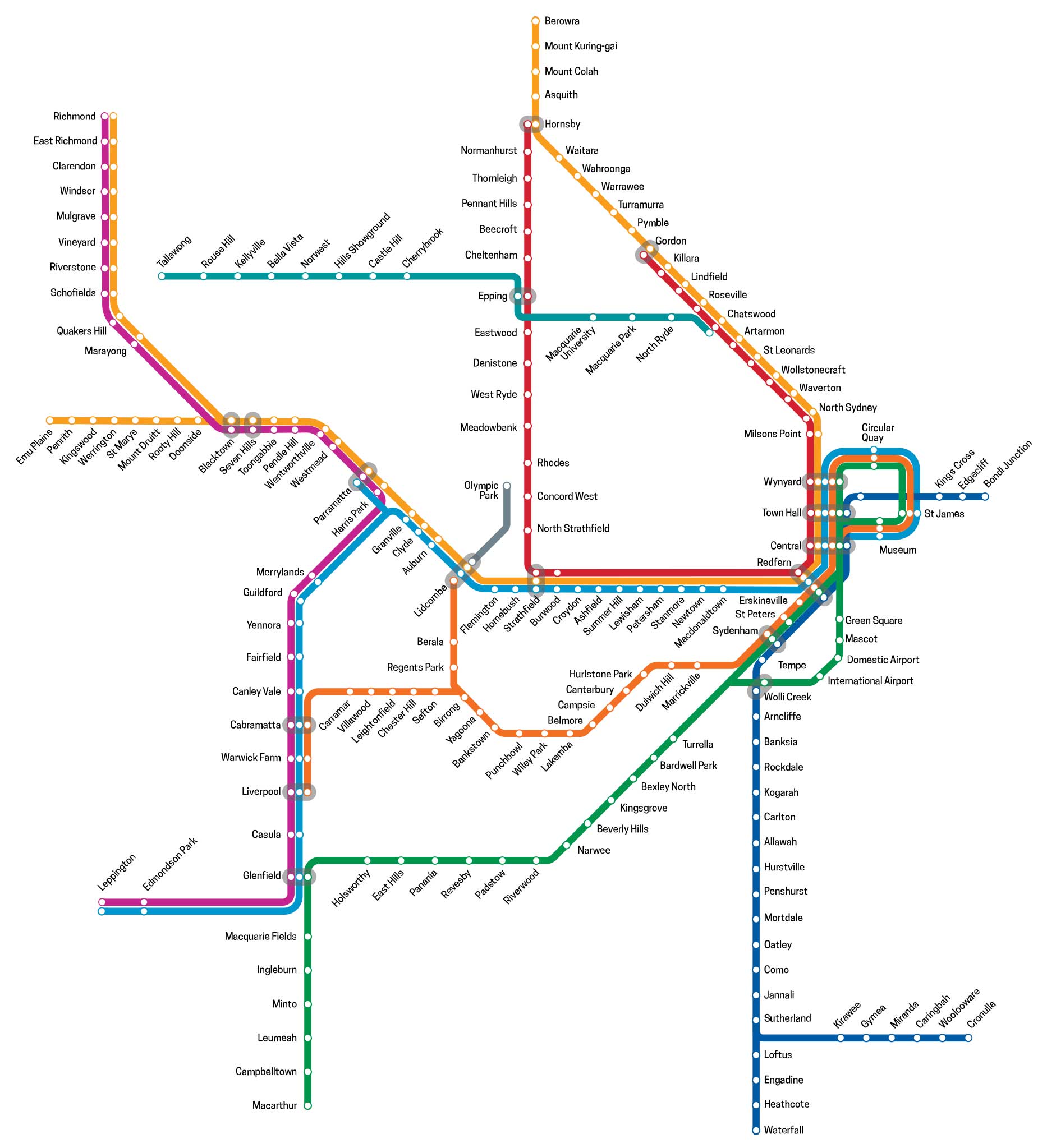
Cumberland Line, Sydney, NSW (T5)
The Cumberland Line (numbered T5, coloured magenta) connects Schofields and Leppington stations in the western suburbs. Limited services extend from Schofields to Richmond. The line opened in 1996, following the construction of a 'Y-link' track between Harris Park and Merrylands stations. The intention of this link was to allow direct services to operate from the south west suburbs to Parramatta and Blacktown without requiring a change of trains at Granville. The line takes its name from the Cumberland Plain on which much of Western Sydney was built.
Physically, the line consists of the Richmond railway line from Schofields/Richmond to Blacktown, the Main Western Line from Blacktown station to Harris Park, and a 'Y-link' connecting to the Old Main South Line between Merrylands and Cabramatta, the Main South Line between Cabramatta and Glenfield, and the South West Rail Link between Edmondson Park and Leppington.
The Journey
Leppington
Leppington takes its name from the property granted to William Cordeaux in 1821, which he named Leppington Park. Cordeaux arrived in the colony in 1817 on the convict transport Friendship to be in charge of the provision section of the Commissariat in Sydney. Leppington Park was a huge two storey home with its own private ballroom. It was built by convict labour and convicts also worked in the fields. The home was destroyed by fire in the 1940s and the army used the site for target practice. The bricks at the base of the outdoor stage at Leppington School came from this building. In 1914 an area of Leppington was subdivided as the Raby Estate, named after the property Raby which covered 3269 acres and was granted to Alexander Riley in 1810.


Edmondson Park
Edmondson Park is believed to be named after John Hurst Edmondson, the first man to win a Victoria Cross in World War II. John, the only son of Joseph William and Maude Elizabeth (nee Hurst), was born in Wagga Wagga in 1914. Shortly afterwards his family moved to a property on what is now Camden Valley Way near the Crossroads in the Liverpool area, which they called Forest Home. Early in 1939, John enlisted as a reserve soldier in the 4th Battalion (The Australian Rifles). He sailed for the Middle East in 1941 where his unit was engaged in the Battle of Tobruk, where he lost his life saving the life of his commanding officer. The posthumous award of the Victoria Cross was presented to John's parents in July 1941.
The area around the family home tended to remain a relatively unknown and undeveloped part of Liverpool. However with increasing development the area will continue to grow.
Glenfield
Glenfield takes its name from a 1500 acre grant, it was named after the village of Glenfield near Leicester, England, the birthplace of grantee and explorer Dr. Charles Throsby, a naval surgeon. Throsby served on Norfolk Island and at Newcastle and was awarded this land grant on his retirement. Ironically, none of present day Glenfield is part of the original Glenfield grant. The Glenfield property was located further north, near Casula, and only came as far south as The Crossroads.
In the 1880s, a railway platform named Glenfield was on the original Glenfield grant and stood close to where the East Hills line branches off the main southern line today. The platform was rarely used so in 1891 it was decided to move this now disused platform down the line to a new subdivision. The Glenfield name was retained for the station and applied to the new housing estate. Glenfield saw its greatest development as a residential area after World War II. Many of Glenfield's streets were named after early residents and family members of the developers. The streets of a 1970s subdivision are named after locations in New Guinea as a result of the town planner involved in the development having been a patrol officer in Papua New Guinea.
Casula
The suburb of Casula's main claim to fame occurred during World War II when a company of 5,000 soldiers stationed here rioted after having their training conditions changed. The soldiers embarked on a drunken brawl which took them into the Sydney city centre, damaging shops, homes and private property on the way. After a night of destroying shops in the city centre, they sobered up the next morning and all but 15 gave themselves up.
Casula takes its name from the property of land grantee Richard Guise, named after the place where he had lived in England. Another grantee was Ebenezer Bunker, a leading businessman in the young colony whose first contact with it was as master of the William and Anne, carrying 188 convicts of the Third Fleet. Bunker saw the colony's potential and returned, establishing numerous businesses including a successful whaling operation.
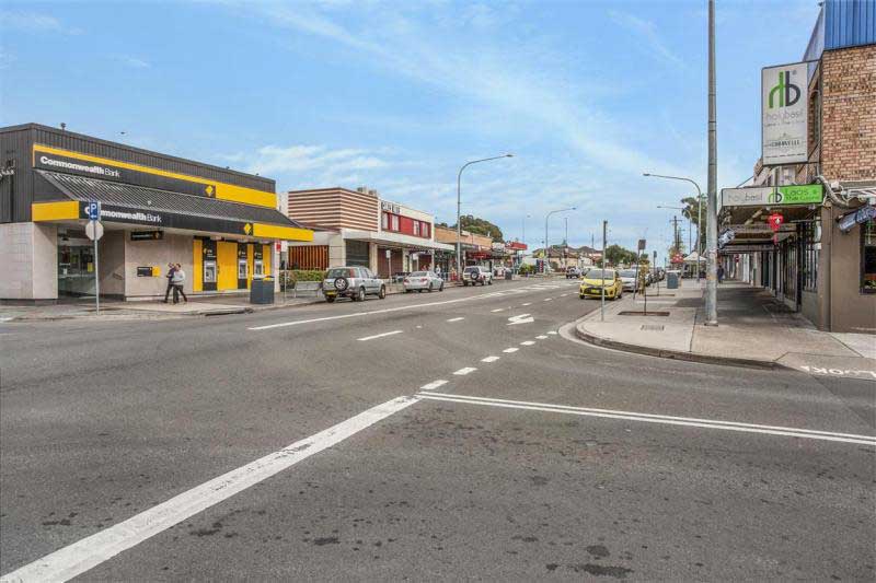
Liverpool
Liverpool is one of a number of towns founded by Gov. Macquarie as a centre for the developing areas to the west of Sydney. At the time of Macquarie's visit, there were already numerous farms established in the area then known as Cow Pastures which is between Liverpool and Camden. Liverpool town centre contains a number of historic buildings dating from Macquarie's time. It remained a centre for a thriving dairy farming industry until well after 1856 when the railway arrived, however from that year it grew significantly as a residential area.
Liverpool - named in honour of Robert Jenkinson, the Earl of Liverpool who, at the time of naming, was Secretary of State for the Colonies and later Prime Minister of England.
Warwick Farm
Among the first European occupants of land here were Irish political prisoners transported to New South Wales because of their involvement in the Irish rebellion of 1798. Grants were made to other transportees, many of whom were not criminals as we understand the term today, having opposed the government on matters of national interest.
Warwick Farm racecourse came into being as a result of numerous farms in the area breeding horses and a course was created to race them. The first race meeting was held in 1889. During World War II, huts were built to create the British Navy shore base HMS Golden Hind. After the war the huts were used as emergency accommodation and named Hargrave Park. Shops and houses now occupy its site.
Warwick Farm is named after the town of Warwick in England by John Hawley Stroud, the superintendent of the Liverpool Orphans School who received a grant covering the site of the Warwick Farm racecourse. He gave the name to his farm and it was later adopted for the whole area.
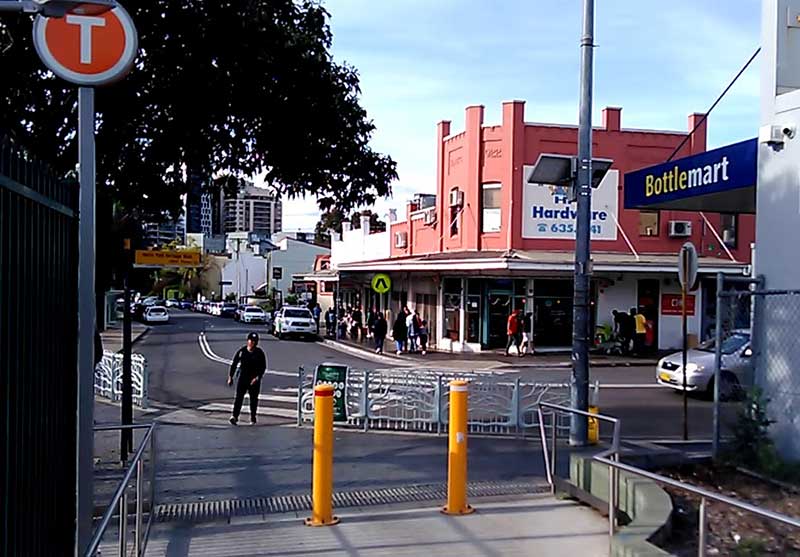
Cabramatta
Cabramatta is a name of Aboriginal origin - 'cabra' (an edible freshwater grub) and 'matta' (place of). A suggestion has also been made that it means 'place at the headwaters' though it is more likely that it is the Aboriginal name for the place at the headwaters (of Cabramatta Creek, which Cabramatta is), which was called Cabramatta, meaning " place where cabra (edible freshwater grub) are found.
Cabramatta's first white settlers were Irish political prisoners who established a camp here. In 1803 a huge tract of land was given to Rev. Samuel Marsden and others to establish an orphanage. The area developed as a prosperous farming community until the arrival of the railway in the 1880s when subdivision began. It is today the centre of Sydney's Vietnmese community.
Canley Vale
The names of Canley Heights and Canley Vale originate from Canley Grange, the name of a property occupied by Sir Henry Parkes' which he named after his birthplace, Canley Moat House, Stoneleigh, Warwickshire. His was the first house in the district. Canley Vale came into being in January 1900 and from that time slowly grew to the suburb it is today. Aboriginal people from the Cabrogal tribe, a sub-group of the Gandangara tribe, have lived in the Fairfield area for over 30 000 years. Canley Vale was once a woodland area and was originally part of the Male Orphan School Estate.
Cabramatta and Canley Vale were regarded as a single community and from the 1920s it was known as Cabravale. In 1899, the municipality of Cabramatta and Canley Vale, which had been established in 1892, was redivided, and the two separate wards were gazetted on 8 January 1900.
Fairfield
Built on land first granted to Captain John Horsley, the name comes from the Mark Lodge Estate which was the home of Capt. Horsley. It is believed that the name was given by a trustee of the Estate who had associations with Fairfield in England. Alternatively it was named after the fair field owned by Gabriel Louis Marie Huon de Kerrileau. Fairfield was also the name of Thomas Ware Smart's home when the railway line was being constructed, and the name was adopted for the station which was in close proximity to the site selected for the station in 1856.
Yennora
The name is taken from an Aboriginal word meaning 'to stroll'. Limited farming had occurred before the opening of the railway platform in 1927 on the Granville to Liverpool line. Major residential development began then and continued until the beginning of World War II.
Guildford
The name is taken from the property of retired army officer Lieut. Samuel North, a 640 acre grant covering the present suburb, which North took possession of in 1817. It is believed his property was named in honour of his great uncle, Lord Frederick North, the Earl of Guildford (right). Brief history: a large tract of land in the suburb's north was reserved by Gov. Phillip for use in the support of teachers and clergy. It was eventually subdivided and sold in 1872. Subdivision throughout the area was stepped up with the opening of the railway station in 1876. The settlement which grew up around the station was called Guildford whereas the original settlement on Woodville Road towards Villawood became known as Old Guildford.
Merrylands
Merrylands is named after the former English home of Arthur Todd Holroyd, a migrant from Britain via New Zealand who entered parliament in 1863 and became the first Mayor. Brief history: much of the area that is today to the south of the railway was first granted to Dr. William Sherwin who named his property Sherwood Forest after the area in England where the outlaw Robin Hood called home. Colonial Judge Advocate Richard Atkins bought land to the north and called it Denham Court. Holroyd bought most of the land in the Merrylands area including this property in 1855 and named it Sherwood Scrubs. He established numerous businesses in the area as well as a dairy farm which he named Merrylands after a family estate in England. Merrylands railway station opened in July 1878.
Harris Park
Harris Park is named after John Harris, surgeon of the New South Wales Corps. John Harris arrived as surgeon to the NSW Corps in 1790 and was granted land near James Ruse's Experimental Farm at Parramatta which he later purchased. Farming was practised on the land until the 1870s when the land was subdivided and sold as town lots under the name Harris Park Estate.
Parramatta
Parramatta holds great significance in the history of Australia, being the first European inland settlement, and the second settlement overall after Sydney Cove to be established by Australia's British colonists of the late 18th century. As one might expect, Parramatta has some excellent examples of early colonial architecture including Old Government House, Elizabeth Farm, St John s Cathedral, the Lancer Barracks and the Linden House Museum.
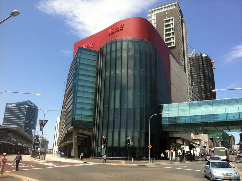
Today's Parramatta is a modern city with a range of cafes and restaurants exploring cuisines from around the globe, large shopping centres, cinemas, theatre and the Rosehill Racecourse. Parramatta is best a understood with a visit to the visitors centre which features Parramatta: People and Place, a major exhibition that traces the development of Parramatta, and can then be explored following a walking map.
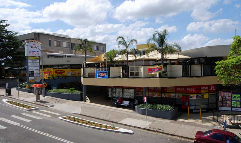
Westmead
Westmead was originally part of the governor's domain at Parramatta set aside by Gov. Phillip. Parramatta Park is all that remains of the domain. The Westmead section of the domain was subdivided and sold between 1859 and 1889, with orchards filling most of the small farms thus created. The railway was put through in 1861 but it wasn't until 1883 that residents successfully petitioned for a station at Westmead. From that time, the slow progression from orchards to residential suburb began.
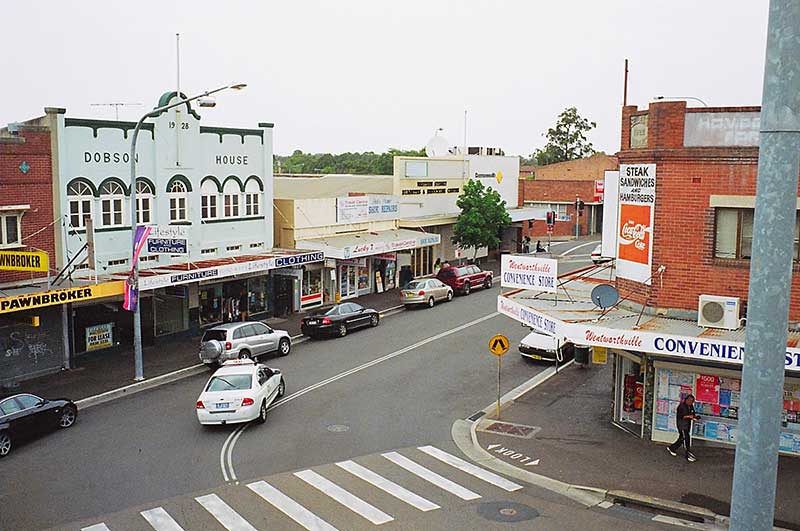
Wentworthville
Wentworthville was named after D'Arcy Wentworth, a colonial surgeon who was not only an important public figure in Parramatta but also a landowner. He took possession of a 2,750 acre estate in 1810 and named the house he built there Wentworth Wood House, after the property of Thomas Wentworth, Earl of Stratford, who was executed on Tower Hill in 1641.
In the 1840s, the area was cleared and many market gardens and poultry farms established. When the railway came through in July 1862, the train did not stop here and it wasn't until 1883 that it became a stop. It was originally called TR Smith's Platform, but was changed to Wentworthville two years later. It was around this time that subdivision for residential development began, turning farmland into suburbia.
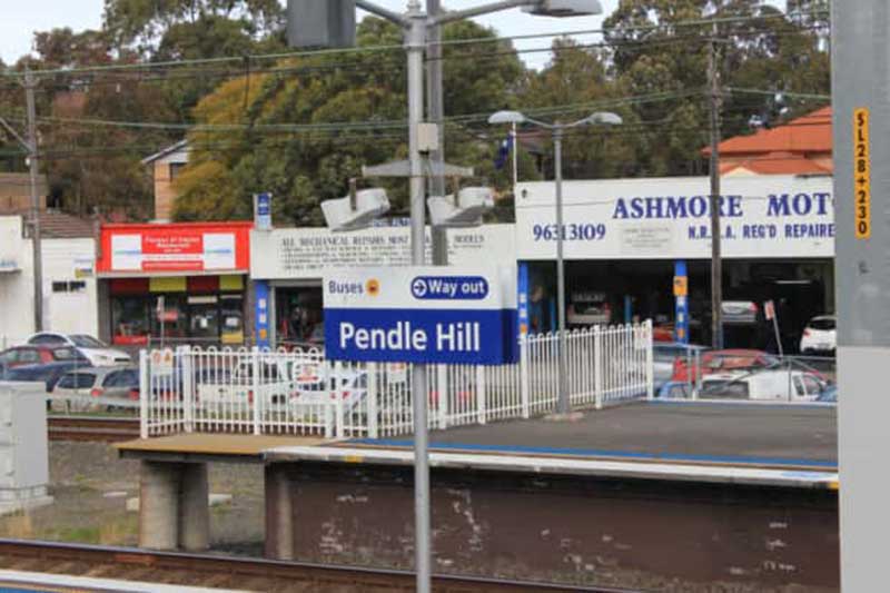
Pendle Hill
Pendle Hill was named after Pendleton (below) in Lancashire, the centre of England's cotton industry. During the 19th Century, many poultry farms were established here.
In 1932, George Bond established a cotton spinning mill here and requested that the railway station be built near his mill and that it be named after Pendleton in Lancashire, England, the centre of Britain's cotton industry. Bond's manufacturing business grew into one of Australia's most well known clothing brands.
Toongabbie
The name Toongabbie is of Aboriginal origin, said to be derived from 'tuga' meaning 'thick wood'. Another source suggests it means 'meeting of the waters' referring to the confluence of Toongabbie Creek and Quarry Creek where the Toongabbie Convict Farm was established in 1791. Thomas Daveney, superintendent of the convicts at Toongabbie, was granted 100 acres near the convict farm site in 1794 as was free settler Andrew Hamilton Hume whose son was born here and grew up to be an explorer.
Major Joseph Foveaux was also granted 1,770 acres but he soon passed it on to John Macarthur in 1801. Twenty years later, after doing nothing with it, he passed it back to the Crown in exchange for his Camden property. The farming community in the area, consisting mainly of orchardists, became one of the most prosperous and successful in the Sydney region.
Seven Hills
Seven Hills is located 27 kilometres north west of the Sydney central business district. Seven Hills was named either because Matthew Pearce's family could see seven hills from their home which was located on the highest point in the area, or that his farm was situated near the seventh hill along the road from Parramatta. The actual seven hills are situated along the Old Windsor Road between Westmead and where today's road intersects Norwest Boulevard, Bella Vista. Pearce had arrived in Sydney as a free settler in 1794. He named his estate Kings Langley after Kings Langley in Hertfordshire, England, where he was said to have been born.
Blacktown
Blacktown was named in recognition of Governor Lachlan Macquarie's land grants to aborigines. The area incorporating these settlements was referred to as Black's Town. In 1819, Colebee and Nurragingy, two Aborigines who helped soldiers travel overland in the early years of the colony, were the first to be rewarded with a parcel of 30 acres for their undertakings.
Blacktown's first railway station was built in 1860, just 5 years after Parramatta. Rooty Hill station was built in 1861, St Marys in 1862, and Mt. Druitt in 1881.
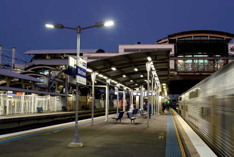
Prior to World War II, Blacktown was one of numerous semi rural towns on the Cumberland Plains to the west of Parramatta, it being located at the junction of the Richmond and Penrith railway lines. After the war, Sydney's Greater West experienced a population explosion, and Blacktown in particular developed in leaps and bounds, become the major commercial centre on the Plains between Parramatta in the east and Penrith in the west.
Blacktown is today the largest of any suburb or township in New South Wales and is one of the most multicultural places in Sydney. Only 50% of the people living in Blacktown were born in Australia. The most common countries of brith are India, Philippines and China. The City of Blacktown is the home to the largest Aboriginal population of any metropolitan local government area.
Marayong
Marayong is located approximately 32 kilometres north west of the Sydney central business district. The name 'Marayong' is derived from the Dharug language word 'Mariyung', which means emu or place of cranes. The name was first given by the New South Wales Railways to the railway station when it opened in October 1922. Around 1900–1905, large areas were subdivided and market gardens and poultry farms were established. The area was part of Quakers Hill but in 1926 the Marayong Progress Association applied to have Marayong made a suburb, in its own right.
The area was mostly rural until the 1960s. Housing Commission (public housing) estates, opened in the 1960s, marked the urbanization of the suburb predominantly south of the railway line. In addition, an industrial area was also released north of the railway line.
Quakers Hill
40 kilometres westnorth-west (WNW) of the Sydney central business district, Quakers Hill is colloquially known as 'Quakers'. The first recorded cartographic use in NSW of the 'Quaker' name is that of "Quaker's Row", today's Church Street, Parramatta. In November 1788 a second settlement was established by Governor Phillip at Rose Hill and was renamed in June 1791, Parramatta. In July 1790 he laid out his plan for the town, with High Street (now George) the main road with another starting at the south bank of the river where Phillip intended a town square with government buildings and an extended wharf. This he named Quakers Row.
As Parramatta grew, the religious conformist of the Quaker's Row inhabitants were moved further west to The Quaker's Hills, where they re-established themselves. The name Quakers Hill was in an 1806 report of the area by government surveyor James Meehan. The origin of the name is unclear and the next references are more than sixty years later when Thomas Harvey used it for his property in what is now western Quakers Hill.
of the river where Phillip intended a town square with government buildings and an extended wharf. This he named Quakers Row.
When the railway station was built in 1872, it was called Douglas' Siding for over thirty years. The catalyst for the name change came with the subdivision of Harvey's Quakers Hill property in 1904. The residents of the newly forming village preferred that name and in 1905, the name of the railway station was changed to Quakers Hill. In the 1960s, Sydney's suburban sprawl reached the Quakers Hill area and the five acre farms surrounding the village began to be subdivided.
addition, an industrial area was also released north of the railway line.
Schofields
45 kilometres north-west of the Sydney central business district, Schofields was once the home to the former Schofields Aerodrome and HMAS Nirimba and is now the suburb of Nirimba Fields.
The name recalls John Schofield (1803–1884) was transported from England to the Colony of New South Wales for stealing when he was just 17 years old. At the time he was a silk weaver from Cheshire. He was transported aboard HMS Minerva in 1821 and was assigned to work for Thomas Harley, a free-settler, on his farm at Baulkham Hills. In 1828, Schofield was granted a Ticket of Leave, which allowed him to live freely within the district of Parramatta.
The railway line from Blacktown to Windsor opened in 1864 and passed through Schofield's land. In 1872, a stopping place was recognised on Schofield's land and a small platform made from railway sleepers was built after that to make boarding the train safer. This platform was known as Schofield's Siding. The name changed over the years to Schofields.
Riverstone
A suburb of Blacktown, Riverstone originally settled in 1803 as part of a government stock farm, and as such is one of the oldest towns in Australia. Prior to settlement and colonisation of Australia, the area that was to become known as Riverstone was inhabited by the Darug tribe. Most of these people died due to introduced diseases following the arrival of the First Fleet, and the remainder were largely relocated to government farms and a series of settlements.
In 1803 a government stock farm was established in what was to become the Riverstone/Marsden Park area, on the basis of the abundant water supply and good grazing land there. Originally, beef cattle farmed in the area were driven overland to the Hawkesbury River for transport by sailing ship to the convict settlement at Sydney Cove. The construction of the Sydney to Richmond Railway line in 1864 both eliminated the need for this and opened up the region to non-rural development. An important meatworks was established there in 1878, undergoing various stages of rebuilding and expansion until it closed permanently in 1992.
In 1988, as part of a Federal Government programme to commemorate the 200th anniversary of European settlement in Australia, a heritage museum was established in the old Masonic hall.
Vineyard
50 kilometres west of the Sydney central business district, Vineyard is bounded in the west by Eastern Creek until its confluence with South Creek, a tributary of the Hawkesbury River. Vineyard takes its name from the vineyards in this area, since this suburb was originally part of Windsor's winegrowing district.
In 1803 a vineyard, the last of three to be established by the Colonial Government of New South Wales, was planted in what was then known as the Castle Hill area. Two French prisoners of war were brought out from France to oversea the operation. Some years later, John Paul Ouvrier (he changed his name from “Jean Pierre Ouvrier” to John Paul when he became a Naturalised Australian citizen in 1860), who had immigrated from France with his 2 sons around the 1830s, revived the operation. It enjoyed limited success, however the memory of its existence lives on in the name of the locality of Vineyard which recalls the project and identifies its location.
Mulgrave
White settlement of the district began in the period between 1794 and 1800. Lieutenant-Governor Grose named the locality 'Mulgrave Place' honouring Constantine Phipps, the second Baron Mulgrave, who had died in 1792. Baron Mulgrave had been an English naval officer and statesman and a colleague and friend of Joseph Banks.
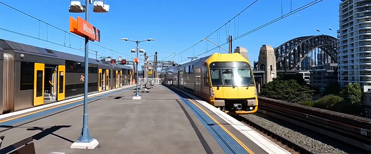
Mulgrave railway station is on the Richmond railway line. It is four stations from the terminus station at Richmond. Mulgrave station is 53 kilometres from Sydney's Central Station, which takes approximately 1 hour 6 minutes to travel by train during peak hour. The station along with the arrival of a steam train features in The Seekers at Home TV special, 1968. Filmed as the setting for the song "Angeline is always Friday", steam hauled services ceased to operate shortly afterwards.
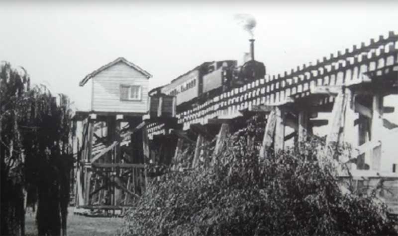
Photo: courtesy NSW Rail
Mulgrave Tank
Mulgrave Tank was located on the 400 metre timber viaduct spanning South Creek between Mulgrave and Windsor Railway Stations. The viaduct was first constructed with the opening of the Blacktown to Richmond line in 1864 then upgraded to take heavier rolling stock in 1876. The viaduct featured a water tank to provide water for the steam locomotives hauling the trains along the line. A steam driven pump was used to fill the tank mounted next to the track directly above South Creek. The platform opened in 1887 and closed in 1891.
In 1988, as part of a Federal Government programme to commemorate the 200th anniversary of European settlement in Australia, a heritage museum was established in the old Masonic hall.
Windsor
Richmond and Windsor are two of Australia's oldest towns and were established in the 1790s as centres for the fertile agricultural and fruit growing region of the upper Hawkesbury River. Both towns have a rich colonial heritage and are home to some of the finest Georgian sandstone buildings in NSW. Once a thriving inland river port through which produce in and out of the area passed, Windsor has retained its olde worlde charm thanks to a collection of fascinating, well maintained 19th Century buildings. Many of the oldest surviving European buildings in Australia are located at Windsor.
A day trip by train from Sydney to Windsor is a recommended day out for those who enjoy stepping back in time. Though the main attraction is the old buildings, the town is far more friendly and laid back than the big city and is a great place to take a slow wander, stop for morning tea or lunch when you feel like it, then head back to the city by train when you are ready.
Clarendon
Clarendon station was opened in 1870 and was known as Hawkesbury Racecourse. It was renamed Clarendon station in 1876. The suburb of Clarendon borders the RAAF Base Richmond, a Royal Australian Air Force base at Richmond which was established in 1923. The air base is currently the home to the RAAF's transport squadrons. During the Vietnam War logistic support and medical evacuations were supplied by the Hercules from RAAF Richmond. Clarendon takes its name of William Cox’s homestead, which in turn was named after an estate in England.
East Richmond
East Richmond railway station opened on 2 July 1939. Historically, East Richmond has been served by services operating from Sydney CBD/North Shore, branching off the Western Line at Blacktown. However, after a major timetable change for the Sydney Trains network on 26 November 2017, Cumberland line services started continuing out to Richmond, rather than terminating at Schofields, during the late night, taking over from the Richmond line.
Richmond
Richmond is the second largest of the Macquarie Towns, five towns created by Gov. Lachlan Macquarie in the Hawkesbury region during his ten years as Governor of NSW in the 1810s. It still has a substantial number of interesting, historic buildings, though it has been greatly changed by a population boom and the inevitable modern developments. The Battle of Richmond Hill took place in May and June 1795 between the Darug people and the European settlers. It is perhaps the first time that the colonial authorities sent in the troopers and expressly stated their intent to 'destroy' the whole local Aboriginal population of an area.
The expansion of the Sydney suburban area has almost reached Richmond and it is now considered to be an outer suburb of Sydney, even though it is around 65 km by road from Sydney. Richmond railway station is the terminus of the Richmond branch of the Western Line of the Sydney Trains network.
Kurrajong extension
In the 19th and early 20th century rockmelons, peas, tomatoes, beans and watermelons were cultivated at Kurrajong. Kurrajong was known then as the 'kitchen garden of Sydney.' The fertile soil, altitude and climate made the Kurrajong area suitable for growing citrus, apples, passionfruit, and grapes.
The construction of the railway between Richmond and Kurrajong did not receive Parliamentary authorisation until 1919, by which time roads were being improved to a standard that did not warrant a railway to bring the produce of the area west of the Hawkesbury River to the Sydney market. From its opening in 1926 until its closure in 1952 after the line was damaged in floods and was quickly removed, it remained a minor branch line.
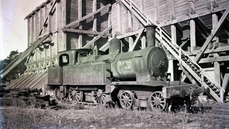
NSWGR M-40Z11 Class locomotive at the Yarramundi quarry, c.1950. Photo: courtesy Australian Railway Historical Society, New South Wales Division
Nepean Sand and Gravel Siding
The Nepean Sand and Gravel Company Siding was a privately owned railway siding on the Richmond-Kurrajong line which operated at Yarramundi Falls from April 1925 until 1928. The track diverged from the railway line along Kurrajong Road, Richmond and then ran along Yarramundi Lane and across the Yarramundi Bridge to the sand and gravel pit at Yarramundi on the bank of the Nepean River. Gravel from the quarry was used in the construction of Sydney Harbour Bridge.
Phillip
Opened 1928, closed 26-Jul-1952. A very short passenger platform was located on the eastern bank of the Hawkesbury river. It opened in 1928 with the misnomer of Nepean Bridge, and was renamed Phillip in 1934. The location was a favourite swimming and picnic spot.
North Richmond
Opened 8-Dec-1926, closed 26-Jul-1952. This station was located near the north western corner of Grose Vale Road and Bells Line of Road. The railway bridge over the Hawkesbury River was erected on concrete piers which were an extension of those supporting the adjacent road bridge. Upon leaving the river, the line ascended on a 1 in 36 grade through the western river bank and reached Bells Line of Road which it crossed at a 45 degree angle and entered North Richmond station, which had a 61 metre long platform with shelter and a goods siding.
Red Cutting
Opened Sep-1928, closed 26-Jul-1952. After leaving the station, the railway continued in a straight alignment, largely through the property of farmers. Being classed as a "pioneer line", the route was unfenced and the rails second-hand, laid on wooden sleepers with ash ballast. Stopping locations were established between North Richmond and Kurrajong, the first being Red Cutting.
The substantial Redbank Creek Culvert which took the line over Redbank Creek remains in good order and can be visited by following the public footpath that begins at the Redbank housing estate (park at Peel Park and follow the 2km path that hugs the creek).
Kemsley
Platform. Opened Sep-1928, closed 26-Jul-1952. The line from Kensley to Kurrijong passed orchards and small farms as it slowly climbed into what is the foothills of the Blue Mountains. Kemsley platform and the Kurrajong goods shed still exist (although the latter is now located in the Pioneer Village at Wilberforce). The platform was named after the property owner on which the station was built.
Thompsons Ridge Halt
Platform. Opened Nov-1928, closed 26-Jul-1952. The halts were used by orchardists and farmers to load their produce, by
farming families and schoolchildren travelling to Richmond, and weekend bushwalkers and tourists visiting the many guest houses in the region.
Nurri Halt
Opened Sep-1928, closed 26-Jul-1952
Duffys Halt
Opened Sep-1928, closed 26-Jul-1952. Embankments and cuttings became a feature of the line as it headed towards its terminus, Kurrajong station, which was located on a site carved from the side of the ridge on which the village was situated. A concrete slab station building stood on the platform. There was a run-round loop, and looped goods siding which served a goods shed and hand crane.
Kurrajong
Surrounded by farms dotted with grazing cattle and horses, passers-by will delight in the pastoral vistas leading to Kurrajong Village. Located just two minutes from the turn off on Bells Line of Road, it is the perfect location to take a break from your travels. Kurrajong gives the impression that you are far from the madding crowd, inviting you to linger and savour the country air. The village and surrounding area offers opportunities to enjoy dining in unique settings and browse boutique stores where you can buy something out of the ordinary. Superb views can be had from the land on which the church and churchyard of St. Gregory's (1845). It is 100 metres on the left from the intersection of Old Bells Line of Road and Bells Line of Road.