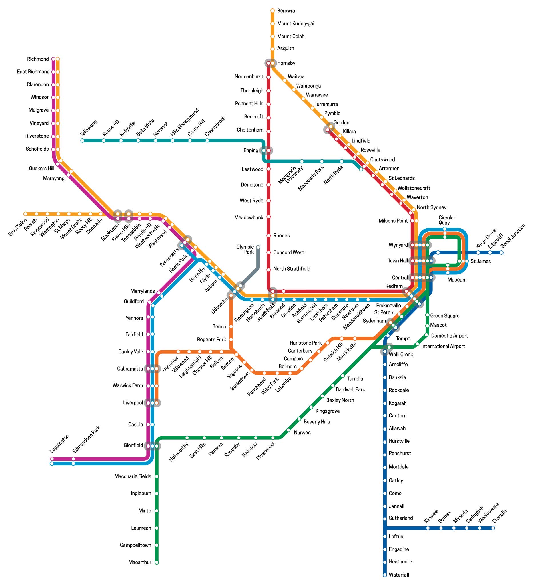
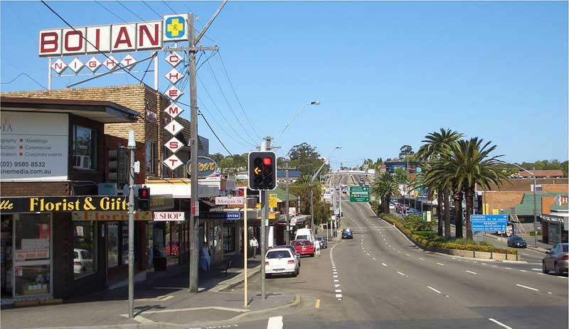
Airport and South Line, Sydney, NSW (T8)
The Airport and South Line serves the southern and south-western suburbs of Sydney. The service traverses the Airport Line to Wolli Creek, then along The East Hills Line to East Hills, and on to Macarthur. Opened to East Hills in 1931, the East Hills was extended to connect to the Main South line in 1987.
The Airport Line
The Airport Link (also known as the Airport Line or New Southern Railway) is Sydney's inner-southern railway line connecting Sydney Airport to the Central Business District and the south-western suburbs of Sydney. With the exception of Wolli Creek, the Airport Line stations are operated by a private company, the Airport Link Company, as part of a public private partnership. The Airport Link includes a four kilometre rock tunnel and a six kilometre soft ground tunnel. The tunnel is 23 metres below the earth's surface.
For most of its length, the line travels underground. It runs south from platform 23 at Central station across a viaduct to the tunnel portal beneath Prince Alfred Park near Chalmers Street. The tunnel roughly follows George Street underneath the suburbs of Redfern and Waterloo.
Construction began on 12 February 1995 with a view to improving facilities for air travellers ahead of the 2000 Summer Olympics. At the time, the main public transport link between the city and its airport were two Sydney Buses express routes, the 300 to Circular Quay and 350 to Kings Cross branded as Airport Express. A tunnel boring machine was used for the construction. The line opened on 21 May 2000, three months ahead of the Olympic Games, after the State Government had spent around A$700 million on the project and the Airport Link Company over A$200 million. As the stations commenced operation on 21 May 2000, the ownership of the four stations reverts to the state government on 21 May 2030.
The line runs westward under the Domestic and International terminals before continuing north-west underneath the Cooks River to reach the surface at Wolli Creek where it joins the East Hills line. The line is two tracks for its entire length.
The two new stations which were built for the airport's International and Domestic Terminals, feature larger lifts and wider ticket barriers to cater for passengers with baggage. Three new suburban stations were built – one each for the residential development areas of Mascot and Green Square, and an interchange station with the Illawarra line at Wolli Creek.
Following the completion of the Airport Line in 2000, most trains to Macarthur began running on the Airport Line to Wolli Creek, where they joined the East Hills Line. At Glenfield Junction, trains then followed the Main South line to Campbelltown and the Macarthur terminus. Following the completion of the quadruplication of the East Hills Line as far as Revesby in April 2013, regional trains heading southwest to Canberra and Melbourne from Sydney Central began to use the East Hills line to travel through metropolitan Sydney, instead of the Main Southern railway line via Granville and Strathfield.
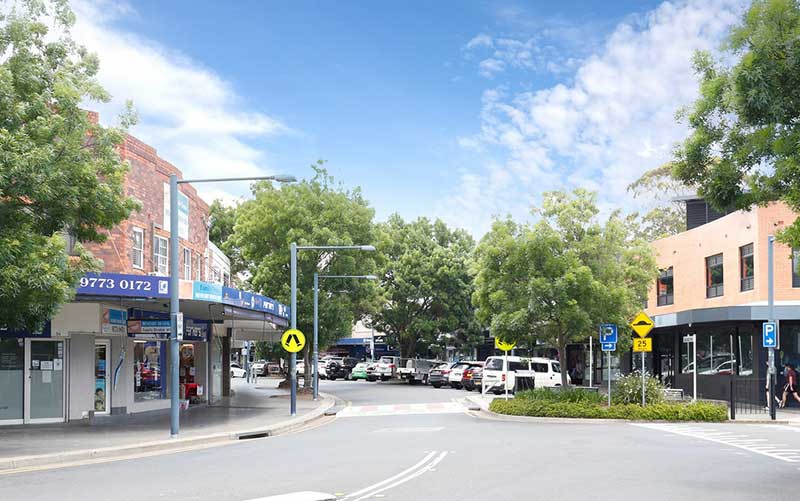
Green Square
Green Square is the first station on the Airport Line after trains leave Central Station. Green Square station is beneath the intersection of Botany Road, Bourke Road and O'Riordan Street. From there the line continues beneath Bourke Road to Mascot station, a block south of Gardeners Road. The five-way intersection where the station is situated is at the meeting point of the four suburbs, Alexandria, Zetland, Waterloo and Beaconsfield, which it serves.


Mascot
Like Green Square, Mascot is an underground station, which is beneath Bourke Street. It serves the suburb of Mascot. Station entry is accessed through a set of stairs and lift on Bourke Street, near the intersection of Coward Street. Mascot is staffed from 5:00am to 11:30pm everyday. From Mascot, the line roughly follows O'Riordan Street before turning sharply to the west once underneath Sydney Airport.
Domestic and International Terminals
Two stations which were built for the airport's International and Domestic Terminals. They feature larger lifts and wider ticket barriers to cater for passengers with baggage. The line runs westward under the Domestic and International terminals before continuing north-west underneath the Cooks River. A surcharge over and above the standard fare for rail travel applies to all passengers who pass through the International and Domestic Terminal stations.
Wolli Creek
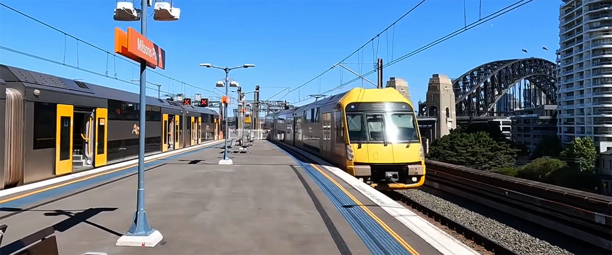
The Airport Line reaches the surface at Wolli Creek where it joins the East Hills line. Wolli Creek station is an interchange station with the Illawarra line, the latter crossing the Airport/East Hills line at a higher level. Building a station where two lines cross but on different levels gave the designers of Wolli Creek Station the opportunity to create something interesting visually, but they blew it by coming up with something that looks bitty and unfinished. Wolli Creek station was built as part of the Airport line opening on 21 May 2000. The station is located on a former industrial site and siding. Since the station's opening, the suburb has been significantly redeveloped with high density housing.
Wolli Creek Regional Park
The Wolli Creek Valley contains the only bushland of any size and the only large high-quality open space left in the heavily populated and industrialised suburbs of inner southern Sydney. Mangrove and saltmarsh flats were once common in the estuary of the Cooks River, downstream of Tempe. Today the creek is a lined channel upstream however the lower reaches to the Cooks River is largely in a "natural" state forming a defined but winding watercourse through the Wolli Valley.
A path alongside the creek makes for an enjoyable, easy walk. The park is a nature reserve with scattered grassed areas serviced by toilets, picnic and barbecue facilities. The most interesting part of the valley is the northern bank of the central section, which can be reached via a pathway leading east from the grassed area. The roofs of the valley's rocky overhangs have been blackened by the smoke of thousands of campfires and are the last remaining evidence that Aborigines who once lived here.
East Hills Line
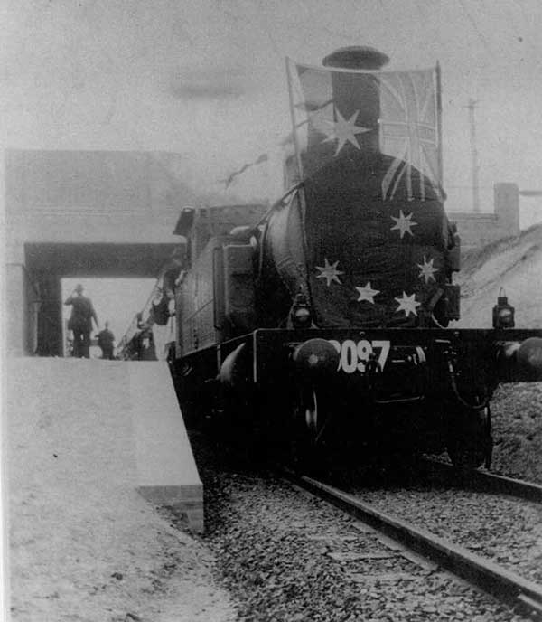
Steam Locomotive 3097 (The Squirt) decorated with an Australian flag at the official opening of the East Hills line between Kingsgrove & East Hills - 19 Dec 1931. Photo: Canterbury City Library's local history collection
The East Hills line branches from the Illawarra line at Wolli Creek Junction, between Tempe and Arncliffe railway stations. From Wolli Creek, the line heads west towards East Hills, where the alignment is within 2 km of the since-constructed M5 South Western Motorway. It then turns south-west through the new suburbs of Voyager Point and Wattle Grove to meet the Main South line at Glenfield Junction. The line is four tracks between Wolli Creek junction and Revesby station, then two tracks to Glenfield junction. The bridge over the Georges River at East Hills, opened in 1987, is the only significant engineering structure on the line.
Turrella
The name Turrella is derived from an Aboriginal word meaning 'a reedy place' or 'water weeds' which refers to the vegetation in Wolli Creek at Turrella. One of the earliest settlers in the area was William Favell who built a house here on a property called Hillside on the site of the present suburb. Orchards and small farms were developed alongside Wolli Creek and were not subdivided for the existing residential development until the arrival of the railway in 1931. At that time, the station was called Turrella but the post office was called Arncliffe West, then in 1948, Arncliffe West. In 1952 it was changed to Turrella.
Wolli Creek, Turella. The East Hills railway line follows Wolli Creek through its valley between Turella to Bexley North
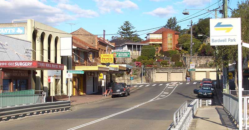
Bardwell Park
Bardwell Park is named after Thomas Bardwell, an early settler. The area was subdivided in 1881 when 1,600 acres of land was sold. The railway station opened in September 1931. Bardwell Creek is the major tributary of Wolli Creek, with its confluence located at Arncliffe some 2.5 kilometres upstream of the Cooks River junction. The upper reaches of Bardwell Creek arise in Hurstville to drain in a north- easterly direction through the suburbs of Hurstville, Bexley North, Bardwell Park and Turrella.
Though radically changed since pre-colonial days, Bardwell Valley is a pleasant area for walkers with pockets of natural bushland surviving amongst the introduced flora and grassed areas which dominate this reserve.
Bexley North
Bexley and Bexley North were named by James Chandler after Bexley Heath in England. Chandler was an English free settler who took up land here in 1822 which extended to the shores of Botany Bay. Subdivision into smaller farms began when a timber getters road leading to Gannon's Forest (Hurstville) was built through the property. Suburban development began with the coming of the railway to Hurstville in 1884. By 1909, Bexley was linked to Arncliffe station by a steam tram.
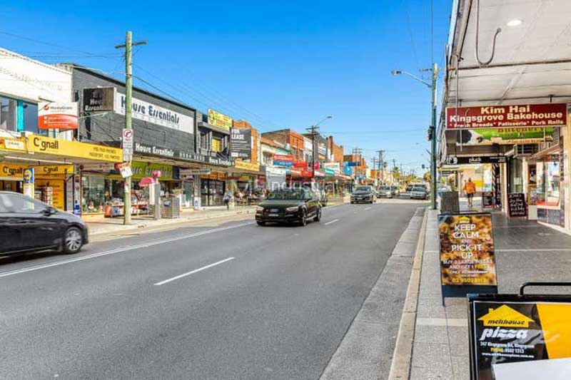
Kingsgrove
name Kingsgrove comes from the name given to land granted to Mrs. Hannah Laycock (1758-1831) in 1804 - King's Grove Farm. As the grant was given by Governor King, it was probably named in his honour. The grant of 500 acres was dated 11 August 1804. The area was bounded by Kingsgrove Road, William Street, Bexley Road and Stoney Creek Road. In time, the two words became the one word we know today. Kingsgrove was first used as the name of the first land grant in the Kingsgrove area as we know it today developed after the opening of the Tempe to East Hills railway in 1931. A rail line as far as Salt Pan Creek was recommended in 1923, then it was proposed as far as East Hills. The principal reason for the line was to relieve congestion on the Bankstown and Illawarra lines.
Beverly Hills
Captain John Connell and Dr. Robert Townson were the first grantees of the area. In 1830, Dr. Townson's grant came into the hands of John Connell - the area being known as Connell's Bush. Dumbleton (now Beverly Hills) seems to have been included in this grant. It's name was taken from Dumbleton Farm, which according to an old account in The Echo was still standing in the 1890's. With the advent of the East Hills Railway Line in 1931, considerable land development occurred, followed by a pattern of closer settlement, homes, shopping centres and factories. Dumbleton was renamed Beverly Hills in 1940 after the suburb of Los Angeles.
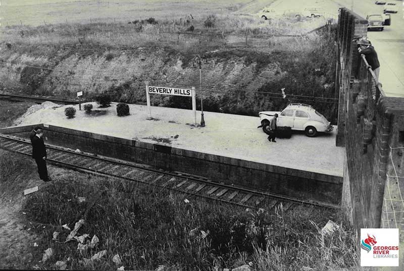
5 December 1963, scene at Beverly Hills railway station after motor vehicle ended up on train tracks blocking the railway line. The line was cleared with the car moved up onto the platform so a crane could later retrieve it.
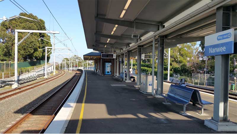
Narwee
Narwee's namr is from the Aboriginal word for the sun. Narwee Primary School is built on land given in 1809, to Richard Podmore, a free settler, who came to New South Wales as a soldier in the NSW Corps in 1792, on the ship Pitt. Land between today's Penshurst Road and King Georges Road belonged to Richard Tuckwell, another soldier from the same Company. At the time of the land grant, the area was covered with a very thick Ironbark forest.
Prior to development as a suburb, Narwee was called Bob the Gardner's Farm, and there were so few people living in the area that bushrangers could easily hide for weeks in the forest without being discovered. In the 1830's, the Sydney Hunt Club used to hold its hunting meetings in this area. The land south of Broadarrow Road was given to Dr. Robert Townson as sheep grazing land in 1809. When rumours that a new railway would be built through the district began to spread in Sydney, a land speculator called William Graham Cameron persuaded the family to sell Sunning Hill.
Riverwood
Riverwood was named after a popular watering place on the Kentish coast in England. When the railway to East Hills was opened in 1931, the station was named Herne Bay after a small arm of Salt Pan Creek. In 1958 the name was changed to Riverwood.
Brief history: from 1788 to 1810 the area was inhabited by Aboriginal tribes with an occasional visit from escaped convicts or hunters employed by the Government.
White settlement in the area officially began in 1810 with a series of land grants. Market gardeners and timber getters mainly occupied the area between Hurstville and Liverpool. Saw pits were dug and the sound of an axe and the rip of saws were heard across the land. The charcoal burners came, and many land owners in the area began finding deposits of ashes on their properties.
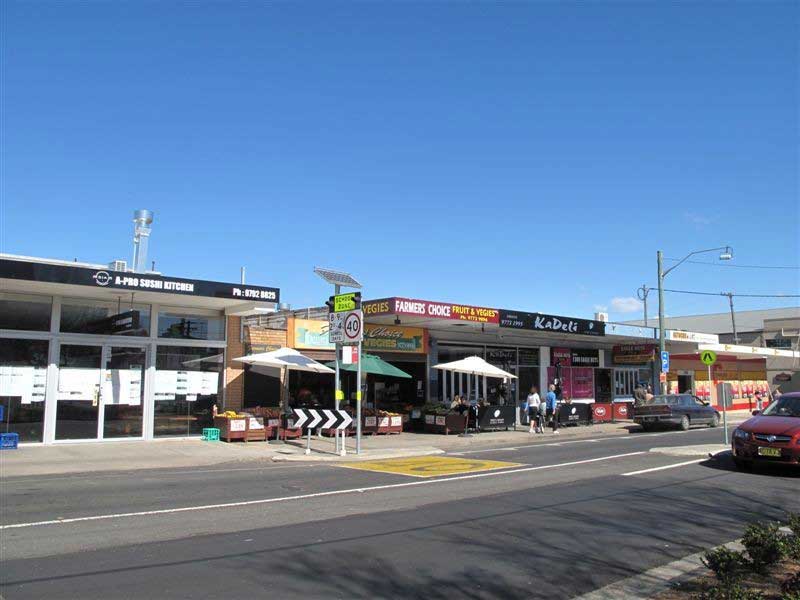
Padstow
Padstow and Padstow Heights originted as nsmes for the area's first real estate subdivision - Padstow Park Estate - which in turn recalls a town in Cornwall, England. Mixed farming was practised in the Padstow area until the arrival of the railway in December 1931, after which time the area underwent major residential development. Padstow's main growth and development took place in the boom post-war years of the 1950s.
Revesby
The names of Revesby and Revesby Heights recall Sir Joseph Banks' estates of Revesby Abbey in Lincolnshire, England. A painting of Banks as a child hangs in the Abbey. He was later known as the Squire of Revesby. It is believed this name was selected as the area once fell within the boundaries of neighbouring locality, Bankstown, named in honour of Sir Joseph Banks.
Though granted in 1804 to George Johnson (the man who arrested William Bligh in the Rum rebellion), european settlement did not commence in the Revesby area until the 1890s. The locality was subdivided in 1926, at which time the present street layout came into being. Revesby railway station, on the East Hills line, opened on 21st December 1931. Some of Revesby's street names follow themes, each being used for certain subdivisions. Some are named after famous British Generals and Lords; others recall Egypt; others in the south have astronomical names.
Panania
Panania is said to be an an Aboriginal word meaning 'sun rising in the east and shining on the hills'. The area now known as Panania was part of a much larger district known as East Hills, the first Europeans in the area were timber-cutters. Operators of small farms moved in during the 1890s and they were replaced by residential homes after the arrival of the railway in 1931. It was at this time that various names, including Nioka, Elmswood and Linden Park, were suggested for the new station and the locality, but Panania was the popular choice. A section of the new suburb, Picnic Point, was to later take the name of the geographical feature on the Georges River which forms one of its boundaries.
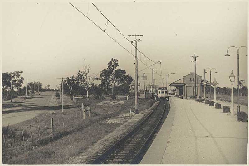
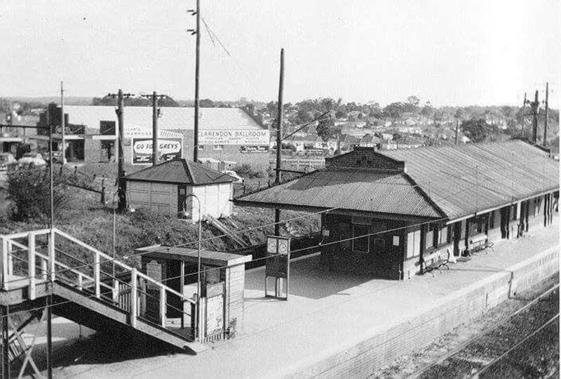
East Hills Station, 1960s
East Hills
The name East Hills was first used to describe the whole area south of Bankstown to the Georges River and east to The River Road. The name is commonly thought to be derived from that of the farmhouse of Robert Gardiner, a tenant of the area's first land grantee. Why that name was used is a mystery - it is not east of Sydney or its nearest neighbour, Bankstown, nor is it hilly. The fact that its neighouring suburb - Panania - was once part of East Hills may hold a clue. The name 'Panania' is derived from a reference to a location identified as being where the sun can be seen rising in the east over hills. Perhaps East Hills is simply the English version of the name or phrase by which the original Aboriginal inhabitants identified the location.
East Hills Line Extension
In 1987 the East Hills Railway Line was extended to meet the Main South Line just before Glenfield station, allowing through services to and from Campbelltown.
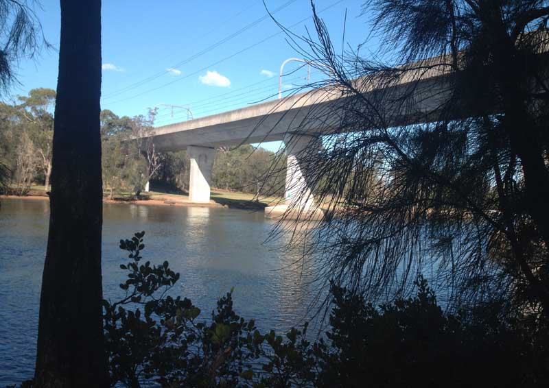
Voyager Point Railway Bridge
Voyager Point Railway Bridge, a dual track bridge over the Georges River, built in 1987 as part of the extension of the East Hills Railway Line.. From the time of it opening in 1931 until its extension in 1987, the line terminated at East Hills station. Originally the line was a single-track non-electrified extension from Kingsgrove station to East Hills. The single line between Kingsgrove and East Hills was opened for electric services on 17 December 1939. The line was duplicated between Kingsgrove and Riverwood in 1948, with points for terminating trains provided at both stations, and a passing loop at Revesby was opened in 1956. In 1985, the line was duplicated through to East Hills.
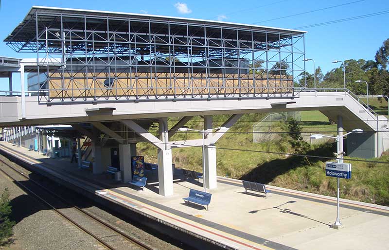
Holsworthy
Holsworthy was named after a quiet village in Devon, England by Gov. Lachlan Macquarie. It was at the ancient Church of St Peter and St Paul in Holsworthy that Gov. Macquarie married his second wife, Elizabeth Campbell, in 1807. Gov. Lachlan Macquarie gave the area its name on a journey to the Campbelltown area in 1810 at a time when a small community had emerged at what was then the navigable head of the Georges River. The settlement included farms, orchards, a mill and boat building facilities. Out of this settlement grew the town of Eckersley which emerged out of the subdivision and sale the larger grants in the area into small farms.
Many vineyards and orchards were established alongside the road from Liverpool to the Illawarra Region which passed through the area. The soil proved to be not as suitable to wine growing and orcharding as first thought and the settlement failed to grow. In 1810, Eckersley's fate was set when Lord Kitchener, on a visit to Australia advising on military matters, went to Liverpool and declared Holsworthy as the site for a permanent Army encampment. Once the Army took possession in 1913, the rural settlement of Eckersley was abandoned and drifted into history. The original name of Holsworthy was retained for the military establishment.
Main South Line
Glenfield
Glenfield takes its name from a 1500 acre grant, it was named after the village of Glenfield near Leicester, England, the birthplace of grantee and explorer Dr. Charles Throsby, a naval surgeon. Throsby served on Norfolk Island and at Newcastle and was awarded this land grant on his retirement. Ironically, none of present day Glenfield is part of the original Glenfield grant. The Glenfield property was located further north, near Casula, and only came as far south as The Crossroads.
In the 1880s, a railway platform named Glenfield was on the original Glenfield grant and stood close to where the East Hills line branches off the main southern line today. The platform was rarely used so in 1891 it was decided to move this now disused platform down the line to a new subdivision. The Glenfield name was retained for the station and applied to the new housing estate. Glenfield saw its greatest development as a residential area after World War II. Many of Glenfield's streets were named after early residents and family members of the developers. The streets of a 1970s subdivision are named after locations in New Guinea as a result of the town planner involved in the development having been a patrol officer in Papua New Guinea.
Macquarie Fields
Macquarie Fields was named after Macquarie Fields House, in honour of Lachlan Macquarie, Governor of the colony of NSW, 1809-1821. Much of Ingleburn and Macquarie Fields were part of the first land grant in the area, the recipient of which was James Meehan (1774-1826) who took possession in 1810. Gov. Macquarie always referred to it as Meehan's Castle. Meehan was an emancipated Irish convict who got caught up in the Irish Rebellion of 1798. Macquarie made him Deputy Surveyor of Lands and later Superintendent of Roads and Bridges, appointments that raised the ire of free settlers who objected to the elevation of former convicts to positions of authority in the colony.
Samuel Terry took over the property in 1835 died 3 years later, leaving the old Meehan grant to his daughter, Martha, for whom it is believed Macquarie Fields House was built. The area was subdivided into smaller farms soon after but remained farmland until the 1970s when its residential areas were developed by the Housing Commission. Its streets are named after Australian native trees and shrubs.
Ingleburn
The area was originally known as Soldier Flat, because this was where four soldiers of the NSW Corps took up farm grants in 1809.With the coming of the railway, a platform was built on the grantee William Neale's property, at the current site. Originally called Macquarie Fields, its name was changed to Ingleburn when the new village of Macquarie Fields was separated as part of a new subdivision. Many of Ingleburn's earlier streets have English connections, however many of the newer streets are named after birds and those towards the Georges River are named after makes of cars.
In 1939, the Australian Government purchased some 648 acres for about £20,000 from a Farmer MacDonald, for the Bardia Barracks. The land was part of the Denham Court Estate. A memorial pays tribute to the people who trained here and those who lost their lives in active service.
The origin of the name is not known. It is thought that the first white settler in the area, Richard Atkins, may have named his grant Ingleburn in 1793 after his hometown of Ingleburn in Devon, England. Atkins became NSW's second Advocate General after David Collins, returning to England with Bligh in 1809. Alternatively, the name may be derived from the Gaelic 'inge' (bend) and 'burn' (river). There are two very distinct bends in the Georges River where it forms Ingleburn's eastern boundary. Gov. Lachlan Macquarie was born and bred in the Gaelic-speaking Scottish Highlands and could have named the area during his first visit to it in 1810.
Minto
Minto was named in honour of Gilbert Elliott Murray-Kynynmond, Earl of Minto, British Governor-General of India (1807-13), by Gov. Macquarie under whom he had served before coming to Sydney. Dr. William Redfern, the first doctor in charge of Macquarie's rum hospital, was the first grantee in the area, and built a farmhouse here which he named Campbellfield. He retired here in 1818. The opening of the railway station in 1874 saw an increase in the steady growth and prosperity of the small farms and market gardens in the area.
Redevelopment for residential suburbs began taking place after World War II. Streets in the older section of Minto bear the names of earls, since Minto was himself an earl. Like those of Claymore, Airds and Macquarie Fields, the streets of the newer sections of Minto dating from the 1970s were designed as 'varied curves', with all streets deliberately curved to avoid blind corners. Streets in the new Minto section were given names with references to the life of William Redfern. Streets in a later part of the estate recall early land grantees and white settlers.
Leumeah
The name Leumeah is derived from an Aboriginal word meaning 'here I rest'. It was the name of the land grant of pioneer settler, John Warby. When the railway platform was being built in 1887, a local politician decided its name should be Holly Lea, which was the name of a property nearby that he had bought three years prior. Other farmers in the area were so infuriated, one defaced the platform sign the day it was erected. The farmers were united in the belief that the name should honour pioneer settler, John Warby, whose land grant of Leumeah stood to the south.
The first subdivision, creating plots for residences and small farms took place in April 1926 but few lots were sold. The biggest developments came after March 1959, when many of the area's rural back blocks were subdivided and sold as residential blocks. The first State Housing Commission subdivision was released in September 1961. Many of the names of Leumeah's early streets recall early residents and land developers. A 1966 subdivision's streets honour famous inventors; those around Angle Road recall Australian rivers; a 1971 Housing Commission subdivision recalls writers and poets; the 1971 Leumeah Heights subdivision recalls Australian deserts, lakes and river caves; the July 1980 subdivision's streets are named after Antarctic explorers.
Campbelltown
A thriving administrative centre for the Macarthur district on the south-west outskirts of the Sydney metropolitan area, it is easy to forget that Campbelltown was berthed in the formative years of the colony of New South Wales. The area that later became Campbelltown was inhabited prior to European settlement by the Tharawal people. Not long after the arrival of the First Fleet in Sydney in 1788, a small herd of six cattle escaped and weren't seen again by the British settlers for seven years. They were spotted, however, by the Tharawal people. In a rock art site called Bull Cave near Campbelltown, they drew a number of cattle with pronounced horns. The Tharawal described the cattle to British explorers and in 1795 the British found a herd of around 60 cattle grazing in the area now known as Camden.
The name Campbelltown is derived from Campbell Fields, the name of the property of William Redfern, given in honour of Governor Macquarie's wife, Campbell being her maiden name. When Gov. Macquarie made his first visit to the area in November 1810, he was so impressed with the small farming community here he formed a new district on the land between Bunbury Curran Creek and the Georges River and called it Airds. Among the settlers were William Redfern, Henry Kable, James Underwood and James Meehan. By the 1820s the district had so grown he named the village which had formed Campbelltown, recalling both his wife and the name of Redfern's farm. Campbelltown is the regional centre for the Macarthur District.
Macarthur
The Macarthur region geographically forms the foothills between the Blue Mountains and Southern Highlands regions. It is one of the fastest-growing regions in the Sydney metropolitan area, with many new modern suburbs sprouting up in recent decades. The region is generally regarded as the area where the city of Sydney meets rural countryside of regional New South Wales. It is perfect for day trips out of Sydney, and it is reached by driving south east out of Sydney along the Hume Highway.
The region is one of the more recent areas to be developed, though it was one of the first to be opened up for agriculture after the arrival of the Frist Fleet in 1788. It is named after Elizabeth Macarthur and John Macarthur who were founders and pioneers of the Australian wool industry. Founded on land owned by the Macarthurs and surveyed by Sir Thomas Mitchell, the town of Camden was named for Lord Camden, who, during his brief tenure as Secretary of State for War and the Colonies had secured the initial land grant for John Macarthur who was then in England.