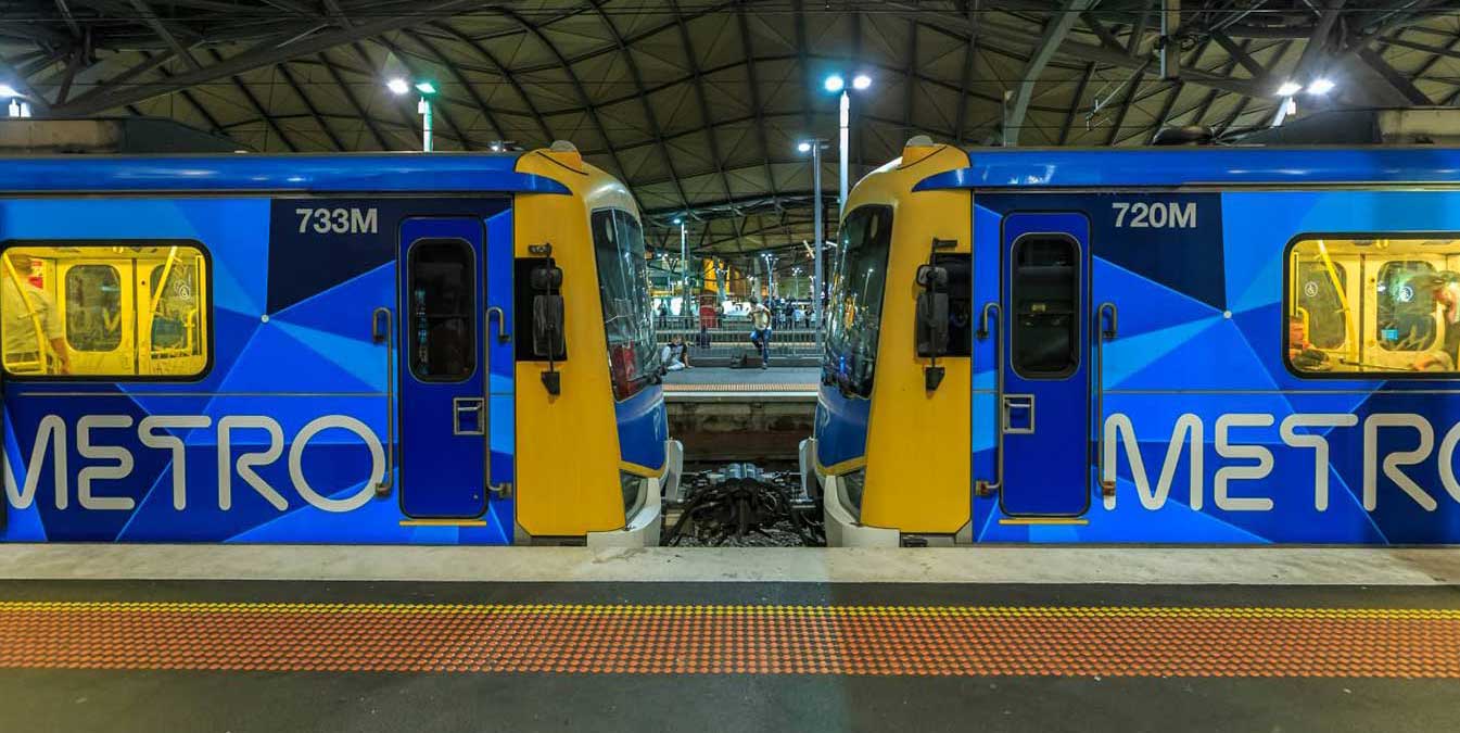
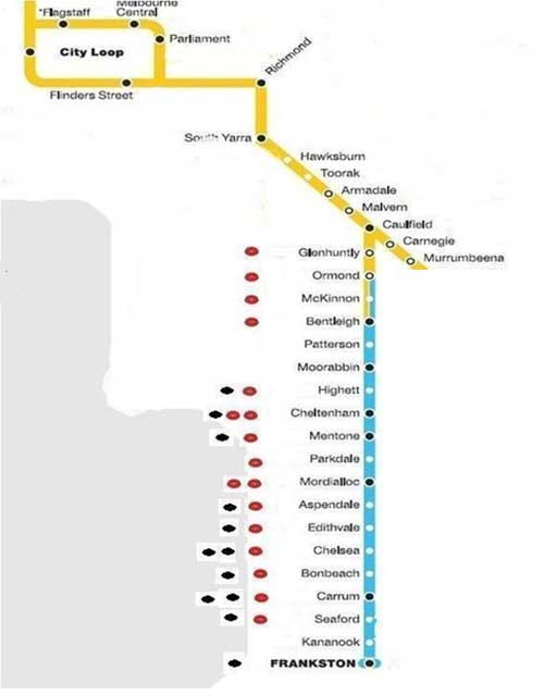
The Frankston line is the city's third-longest metropolitan railway line, at 42.7 kilometres. The line runs from Flinders Street station in central Melbourne to Frankston station in the south-east, serving 28 stations via South Yarra, Caulfield, Moorabbin, and Mordialloc. The line continues to Stony Point on the non-electrified Stony Point line. The line operates for approximately 20 hours a day (from approximately 4:00 am to around 11:30 pm) with 24 hour service available on Friday and Saturday nights. During peak hour, headways of up to 5 to 10 minutes are operated with services every 10–20 minutes during off-peak hours.
Sections of the Frankston line opened as early as 1881, with the line fully extended to Frankston in 1882. A limited number of stations were first opened, with infill stations progressively opened between 1881 and 2017. The line was built to connect Melbourne with the rural towns of Caulfield, Moorabbin, and Frankston, amongst others. Significant growth has occurred since opening, with a plan to extend the Frankston line along part of the Stony Point line to Baxter.
After leaving the Melbourne Central Business District, the train passes the Melbourne Cricket Ground (left hand side of the train).
Although the Melbourne Cricket Ground is arguably one of the two most important cricket grounds in the world, it is much more than a cricket ground to the people of Melbourne. It is one of the great icons of this city, and even Australia. By the 1950's, Melbourne's reputation as the sports capital of Australia was so firmly entrenched that it was a foregone conclusion that the city would host the 1956 Olympic Games and that the MCG would be the Games' main stadium.
The MCG underwent a $430 million redevelopment on the northern side of the stadium between 2002 and 2006; the upgrade was in part to prepare it as the main venue for the 2006 Commonwealth Games, which were hosted by Melbourne. The redevelopment involved the demolition of the Pavilion, Ponsford and Olympic Stands. The present capacity (including seating and standing room) of the MCG is just over 100,000. Up until October 2002, the capacity of the ground was 96,308.
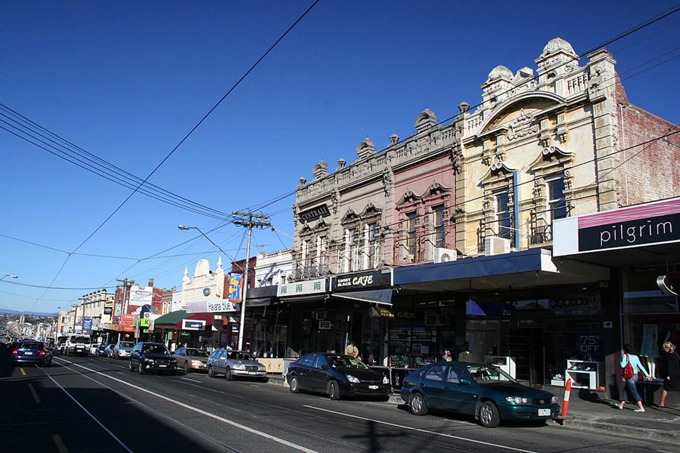
Best known for its bargain designer and seconds shopping along Bridge Road and Swan Street, vibrant Richmond is also the place to go for Greek or Vietnamese food, languid all-day breakfasts and great live music. Though a number of designer and seconds shop have moved out of the area in recent times, there are still plenty there to please the bargain hunter. Church Street is the place to go for designer furniture and objets d'art.
Bars and live music thrive in Richmond, the Corner Hotel being one of Melbourne's most famous intimate live-music venues, hosting big-name bands alongside obscure newcomers. Just across Swan Street, Dizzy's Jazz Club is known for its quality acts. Sip a cocktail in refined surrounds at Der Raum, or celebrate the hops and tour the Carlton and United Breweries' brewhouse in Abbotsford.
Nearby Victoria Street, or Little Saigon, in North Richmond, is the heart of Melbourne's Vietnamese community. Wander among the long stretch of eateries, bakeries, butchers, fishmongers and grocers and grab a bite along the way. Don't expect white linen tablecloths and hovering waiters - Victoria Street is about the hustle and bustle of fast, fresh and exceptional Asian food at a bargain price.


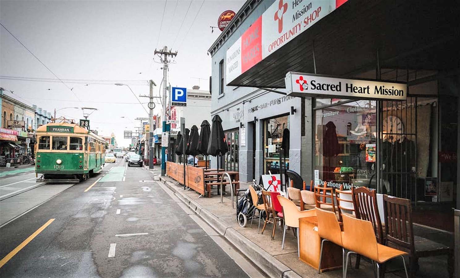
South Yarra is one of Melbourne's oldest and most affluent inner-city suburbs, bordered by the Yarra River and Richmond to the north, Prahran to the south and Toorak to the east. Shopping, fashion, dining and entertainment are the main features of South Yarra's extensive commercial precinct.
The South Yarra section of Chapel Street has a reputation for being the most fashionable and upmarket end. A major landmark is The Jam Factory, and old factory converted into an upmarket shopping centre and cinemas. The Como Centre is a large shopping centre on the corner of Toorak and Chapel Streets, which combines with an office building, South Yarra s tallest, which houses the headquarters for ATV-10 and Global Television's TV production facilities.
The Prahran Market, located in South Yarra, is one of Melbourne's most popular and historic fresh produce markets. Toorak Road runs off Chapel Street and although not known as well as Toorak Village, is a popular strip that contains a wide range of shops. Chapel Street and Toorak Road also has some of the best nightlife in Australia.
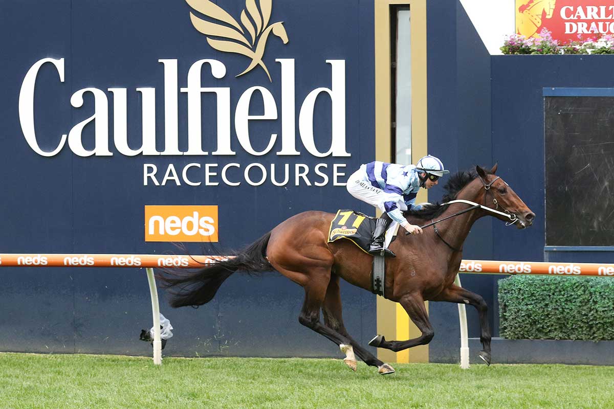
Caulfield, a residential area with a prominent metropolitan racecourse, is on Dandenong Road, 10 km. from Melbourne. Until 1994 Caulfield was also a municipal city. The origin of the name is uncertain, although John Caulfield, a builder who arrived in Melbourne in 1837, has been suggested as a source. The name Caulfield was in use on maps around 1857, generally in the vicinity of the present racecourse.
In 1859 horse racing was held on a rough bush track and the Melbourne Hunt Club held occasional meetings in Caulfield. A racecourse was laid out on the site where the Hunt Club kennel was kept. In 1876 the Victorian Amateur Turf Club was formed and obtained the site for its metropolitan race course. The first Caulfield Cup was run in 1879.
Glen Huntly, 11 km south-east of Melbourne's Central Business District, is a small suburb, approximately 1 km from north to south and 800 metres east to west at its widest point. Its borders are Neerim Road in the north, Booran Road in the west, Grange Road in the east and Woodville Avenue and Oakleigh Road in the south. Glen Huntly is named after a ship, the Glen Huntly, that arrived in Port Phillip in April 1840, after setting off from Greenock, Scotland carrying 157 new immigrants, skilled manual labourers who were heading for the new colony settled in Melbourne. The suburb is serviced by tram route route 67 and Glen Huntly railway station on the Frankston railway line.
12 km south-east of Melbourne's Central Business District, he suburb of Ormond is named after pastoralist, politician and philanthropist Francis Ormond. The original housing stock of Ormond was generally constructed between 1890 and 1950, with some minor infill occurring after that time. Californian bungalow-style houses are common, and many "dog box" cream brick apartment buildings were constructed in the 1960s.
The Ormond shopping strip is located primarily on North Road, and has declined since its heyday in the middle of last century, as North Road carries large volumes of traffic. It is home to an impressive array of restaurants however, with upwards of 10 different cuisine styles on offer. This variety reflects the multiculturalism of Melbourne.
McKinnon station opened on 1 September 1884, almost three years after the railway line from Caulfield was extended to Mordialloc. The station gets its name from McKinnon Road, which was reputedly named after a local settler. The suburb of McKinnon expanded in the early 1900s due to the McKinnon railway station. McKinnon Road features McKinnon's main shopping strip and many back alleys run along the rear on either side. During the 1990s there was a gradual decline in the variety of shops on McKinnon's main shopping strip, however, in recent years the shopping strip has begun to reinvent itself with the emergence of a small but noticeable cafe culture.
Bentleigh is a residential suburb 12 km. south-east of Melbourne, immediately to the north of Moorabbin.. Bentleigh and Bentleigh East lie along the axes of Henry Dendy's Special Survey of 1841 when he took eight square miles extending inland form the Brighton shoreline.
The area was known as East Brighton before being named Bentleigh in 1908 after the Victorian Premier, Sir Thomas Bent. East Brighton was occupied by stock runs until the early 1850s, when the increasing metropolitan population resulted in market gardens being established.
Patterson is a railway station located in the suburb of Bentleigh on the Frankston railway line. Patterson station opened on May 28, 1961. The station is named after Patterson Road, which is located immediately south of the station and also provides access, construction of the station commenced in 1958.
Moorabbin is a residential and industrial suburb 16 km. south-east of Melbourne on the Nepean Highway about 3 km. from the coast of Port Phillip Bay. It was also a municipality between 1871 and 1994. The name is thought to have been derived from an Aboriginal word meaning mother's milk, as Moorabbin was reputedly a place where mothers and children stayed while male tribesmen went further afield.
In the 1850s the pastoral runs in Moorabbin, were subdivided for increased settlement, but the district relied on the Brighton township and smaller villages at Sandringham and at Cheltenham. Moorabbin grew as a farming and market garden area. Moorabbin Airport is home to the Australian National Aviation Museum.
Highett station serves the south-eastern Melbourne suburb of Highett, and opened on 19 December 1881 as Highett Road.Highett station opened when the railway line from Caulfield was extended to Mordialloc. Like the suburb itself, the station was named after William Highett, a local landowner and a member of the Victorian Legislative Council. Highett station is to be elevated as part of a project to remove seven level crossings on the line. Further details, designs and a construction timeline were to be released closer to the opening of the new station in 2029.
Southland railway station serves the south-eastern Melbourne suburb of Cheltenham. The first proposal for a railway station between Highett and Cheltenham, at Bay Road, occurred during the construction of the Frankston line in the early 1880s.
When Westfield Southland (then known as Southland Shopping Centre) opened in September 1968, discussions were raised on whether a railway station would be built on the Frankston line, but no station eventuated. Almost 130 years after the original proposal, planning for the station resurfaced in November 2010, during the Victorian state election. Both the government and opposition pledged to construct the railway station during the next term (2010–2014). It was finally opened in November 2017.
Cheltenham was one of the earliest areas to be settled in the parish of Moorabbin. It initially consisted of 625 acres of land purchased at auction by Josiah Morris Holloway on 11 May 1852. He subdivided this land into 370 allotments that were offered for sale in 1853. Many of the blocks were two acres in size and this gave the community its first name, Two Acre Village.
The area experienced a spurt of growth in the 1880s after the Cheltenham railway station opened in 1881. A branch of the English, Scottish and Australian Bank opened in 1885. It was still in use as a bank until the 1960s. Much residential development occurred in the second half of the 1940s after World War II ended and this growth continued into the 1980s.
Mentone, a waterside residential suburb on Port Phillip Bay, is 22 km. south-east of Melbourne. Before the formation of the township the area was known as Balcombe, after the name of the occupier of land between Balcombe Road and the Bay, west of Warrigal Road, where central Mentone is now situated. When the railway line between Caulfield and Frankston was opened in 1881 the station was named Balcombe's Road and remained so until 1884.
Sir Matthew Davies was chiefly responsible for laying out the Mentone Township Estate. It was named after the British Prime Minister Gladstone's favourite Italian Mediterranean resort and contains Italian Mediterranean street names such as Venice, Naples, Florence and Como. Whilst the foreshadowed residential development did not equal expectations, the population was sufficient by 1889 for a primary school to be opened.
Parkdale is a residential suburb 23 km. south-east of Melbourne, occupying parts of the Mordialloc and Mentone postcode areas. It was named after W. Parker, an early landowner in the area, and was given when the Victorian Railways opened the station in 1920. Most early residential development favoured the area between the beach and the railway line. By 1933 there were over twenty-five shops near the railway station, mostly in Como Parade.
Mordialloc, a bayside residential suburb, is 25 km. south-east of Melbourne. The name's antecedents are a squatting run "Moodi Yallo" (1837), a census taken in 1841 at "Moode Yallock" and Georgiana McCrae's visit to "Mordy Yallock" in 1844. The name is thought to be derived from Aboriginal words meaning (1) creek named Moodi or Marida or (2) meaning "near little sea" or "small tidal stream". The Mordialloc creek is both tidal and of more than usual width where it enters the bay. In the nineteenth century a sandbar often made the creek mouth a shallow inlet.
Aspendale is 26 km south-east from Melbourne's central business district. Europeans began farming the area in the 19th century and displaced local inhabitants. When European appropriation began, the land was occupied by the Bunurong people. The geography and ecology of the area has undergone radical changes as a result of European settlement. Much of the wetlands have been drained, and only modest remnants of the sand dunes exist today near the beach.
Edithvale is 28 km south-east from Melbourne's central business district. The suburb is best known for its long beach of pure white sand and historic bathing boxes. Residents groups have set up the Kingston Boatshed Association to protect these historic treasurers originally constructed by their owners for family activities such as swimming and fishing. The waters of Port Phillip Bay provide an excellent reflection as the sun sets directly facing the shore. Edithvale railway station opened on September 20, 1919.
The name Chelsea was proposed by a local resident for the new railway station when it was opened on the Caulfield to Frankston line in 1882. Chelsea Heights is situated on an ancient coastal sand dune, which was formerly surrounded by the Carrum Swamp. Parts of the area were leased for grazing - particularly during the Summer - in the 1850s, and one settler gave his address as the Islands of Wannark Laddin, a name which persisted at least until 186. The so-called islands were the dunes raised above the lower swamp lands. In 1912 the area was subdivided and named Chelsea Heights. Its census population the year before was 230.
Bonbeach is 31 km south-east from Melbourne's central business district in the City of Kingston. At the 2006 Census, Bonbeach had a population of 4992. Bonbeach Post Office opened on 19 November 1922 (closing in 1923, then reopening in 1926 on the opening of the railway station) and finally closing in 1985. The name is somewhat descriptive, having been coined by developers when the area was first subdivided for residential use. The suburb is disected by the Patterson River.
Carrum station opened on 1 August 1882, when the railway line from Mordialloc was extended to Frankston. Like the suburb itself, the station was named after the nearby Carrum Swamp, the name believed to be derived from an Indigenous word describing a boomerang. The former swampland is occupied by Bangholme, Braeside, Carrum Downs, Chelsea Heights, Keysborough, and parts of Aspendale, Patterson Lakes and Seaford. Carrum Swamp's waters came from the Dandenong Creek (with headwaters in the moist Dandenong Ranges, and the Eumemmerring Creek with headwaters at Narre Warren.
The suburb of Seaford i 36 km south-east from Melbourne's central business district. Prior to European settlement, the area teemed with wildlife and supported large numbers of the Bunurong Aboriginal people, who found it a rich source of food. In the early 20th century. During the 1950s and 1960s, people were attracted to the suburb due to its affordability and close proximity to the beach and Frankston. The name was first used as the name of the estate when the area was first opened up for residential subdivision.
Kananook is an unmanned railway station on the Frankston railway line, situated between the Frankston Freeway and Wells Road in Seaford. It is named after nearby Kananook Creek, which in turn retains its Aboriginal name. Its meaing is not known.
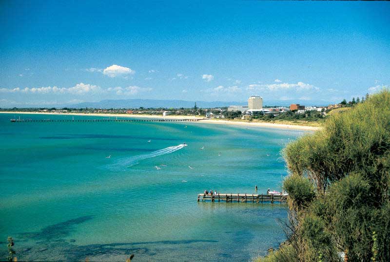
Frankston is a small city 39 km south-east from Melbourne's central business district. Due to its geographical location, the suburb is often referred to as "the gateway to the Mornington Peninsula". Prior to European discovery, the Frankston area was populated by Indigenous Australians known as the Kulin people.
Mordialloc became the site of horse-riding activities - the Melbourne Hunt Club, the Findon Harriers (from Mill Park) and the Epsom Racecourse (1880s). The creek was a popular boating venue, and the foreshore a regular destination for picnics.
Aspendale
Aspendale station was built primarily to cater for patrons as the Aspendale Racecourse in the early part of the 20th century. The racecourse closed in the 1920s, and nothing remains of it. Aspendale Gardens Primary School is the newest part of the Aspendale area. The suburb adjoins the Edithvale Wetlands.
Edithvale
Chelsea
Bonbeach
Carrum
Seaford
Kananook
Frankston
Europeans first set foot in the Frankston area as early as January 30, 1803, thirty two years before the founding of Melbourne, when Captain Charles Grimes and his party went ashore searching for freshwater, and met with around 30 local inhabitants. After the settlement of Melbourne in 1835, James Davey took up a large land holding in 1846, which extended from Olivers Hill to (what is now his namesake) Daveys Bay.
Olivers Hill was named after local fisherman, James Oliver, who built a cottage atop the hill from where he kept an eye out for fish in the waters below. The first official land sales in the area were held in 1853, and Frank Liardet (the eldest son of prominent settler, hotelier and descendant of French nobility, Wilburham Liardet), established the "Ballam Ballam" estate in 1854. The estate was the earliest officially recorded settlement in Frankston, and was located to the east of Port Phillip Bay. Liardet's original homestead "Ballam Park" remains today, and is now heritage-listed. Frankston is taken from Liardet's christian name, Frank.


Design by W3layouts