The Metropolitan Goods Lines were a series of lines designed to divert goods trains off passenger lines and avoid unnecessary delays for both forms of transport. They spread throughout the Sydney area from 1916 and played a major role in the development of the city and suburbs. Many of the lines are no longer used and have been abandoned, while others have been turned over to light rail. This article focuses on those sections of the line.
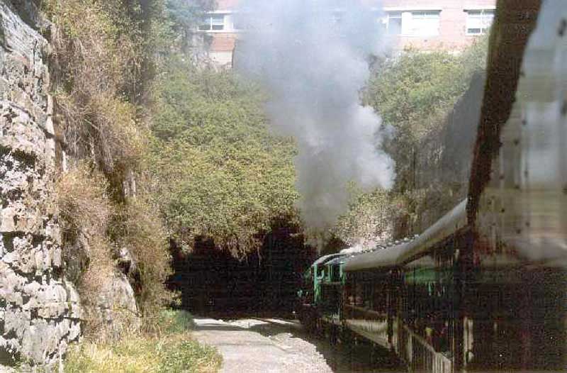
The Rozelle/Darling Harbour sections of the Metropolitan goods lines originally ran from Wardell Rd Junction to Darling Harbour passing through the suburbs of Dulwich Hill, Summer Hill, Lewisham, Haberfield, Leichhardt, Annandale, Glebe, Pyrmont as well as Darling Island, then under Pyrmont Bridge Road at Pyrmont Bridge to enter Darling Harbour and continue through to rejoin the Main line near Mortuary Station. In its heyday it was the main route for coal, wheat and other goods into and from Rozelle Goods Yard as well.
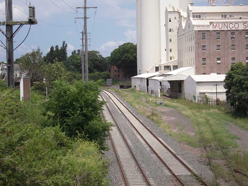
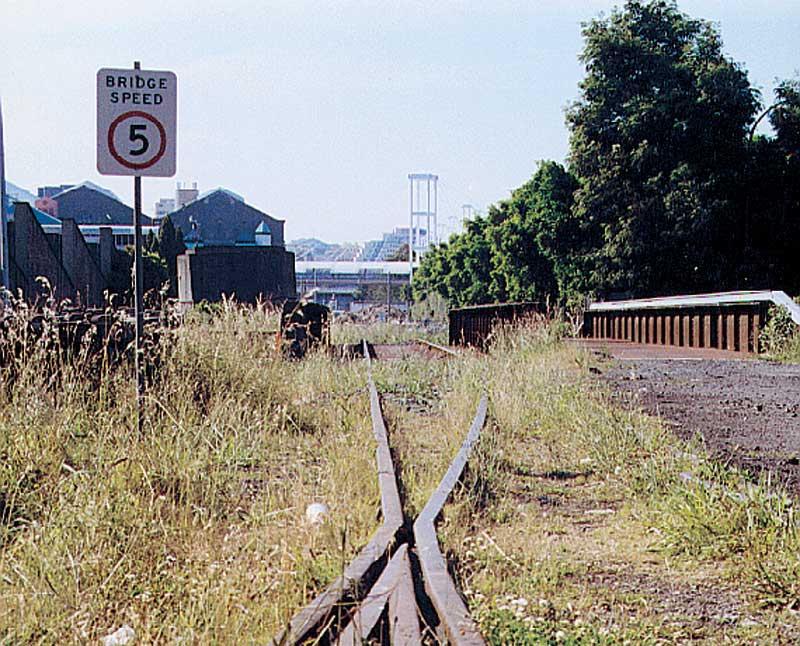
The Long Cove siding provided entry to and from the Australian Army Ordinance Stores located between the rail line and the Hawthorne Canal. In its heyday the double track Metropolitan Goods Line had up to forty train movements a day. The line was closed in January 1996, by which time it saw only weekly use to the Edwin Davey Flour Mill (adjacent to Metro Light Rail's Wentworth Park station).
During World War II the line was extremely busy with Troop and Ordinance trains making up the majority of the traffic. Troop trains headed towards Darling Island and the freight being carried was not always on display although aircraft (with wings made elsewhere) were often seen on wagons. The tracks are now in use again by Sydney Light Rail which runs a service from Central Station along the Western Goods Line from Darling Harbour to Lilyfield. Tracks of the disused Darling Harbour Goods line can still be seen behind the ABC Building in Harris Street, Ultimo.
Between Darling Harbour and Rozelle, a series of bridges, viaducts and tunnels were constructed to carry the line through the suburban landscape. The construction of brick arch underbridges occurred in two periods: 1892 for the duplication of the line from Granville to Picton, then from 1914 to 1922 mostly for main line duplications. The former had bricks supplied from private brickworks whereas the latter's supply came from the State Brickworks at Homebush.
At the time of the goods line project, railway bridge engineers had standardised the span-ranges for the three most common types of riveted steel bridges to be used in NSW: plate-web girder spans from 40 to 80 feet (12 to 24m), half-through truss spans with no overhead bracing from 80 to 120 feet (24 - 37m), and full-height trusses with overhead bracing for spans 120 feet or more. The widths of streets crossed by the goods line were such that only plate-web girders and half-through trusses were necessary. The bridges were all designed for loads much greater than contemporary use so as to be long-serving structures as rail traffic loads and speeds increased over time.
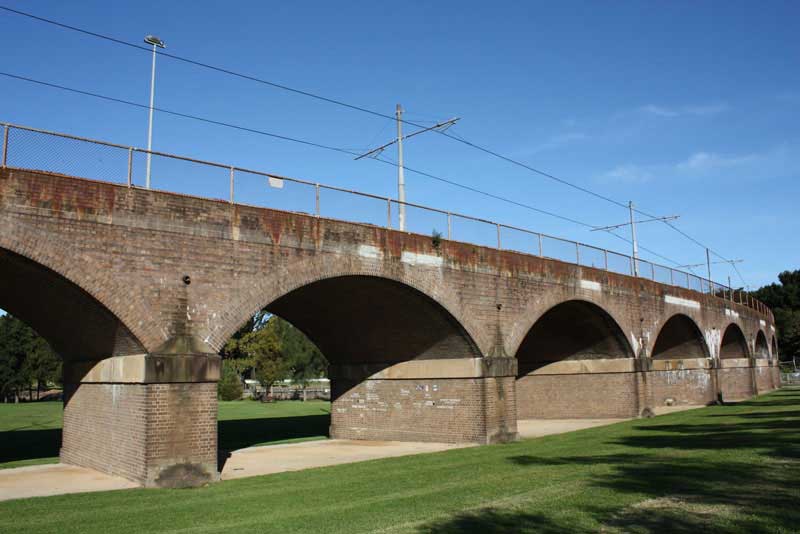
Wentworth Park Viaduct
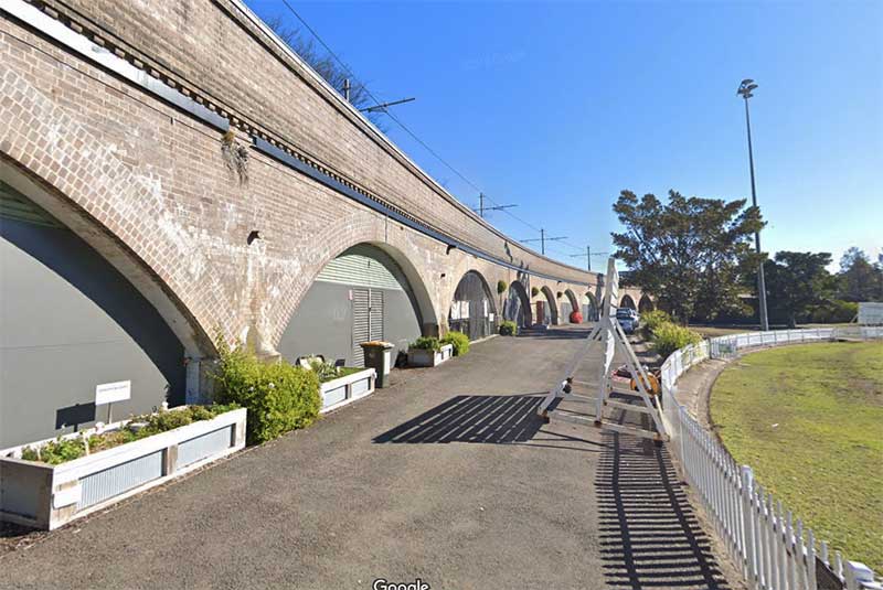
The two brick and stone viaducts on the Western Goods Line, both elegant structures built on a curve with well detailed arches, were built across Wentworth Park and Jubilee Park in 1919. Stretching approximately 446.5 metres, the 28-span Jubilee Park viaduct is the longest section of brick arch viaduct on the NSW system and the largest viaduct structure to survive in Australia. The arches are evenly spaced, being 28 x 10.06m (33 feet) clear spans. The Wentworth Park viaduct consists of a long, curved brick arch viaduct of 11 x 10.97m (36 feet) clear spans and 10 x 11.58m (38 feet) clear spans. The viaduct is estimated to contain 1.4 million bricks and stretches approximately 274 metres across the park, making it the second longest brick viaduct in the NSW system after the Jubilee Park viaduct which is part of the same line.
Jubilee Park Viaduct
They are a major engineering work, as they were built using timber piles driven into the ground below them, to shore up the structures, as both parks through which they pass had been themselves created on land resumed from swamps and sandflats. The viaducts constitute one of the first major infrastructure projects to use bricks from the State Brickworks at Homebush, with more than 3 million bricks used in their construction. The bricks are laid in English bond pattern with soldier courses defining the archways, which are are evenly spaced.
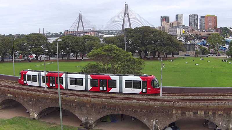
The line was closed in January 1996, by which time traffic had dwindled to one weekly visit to the Edwin Davey Flour Mill (adjacent to Metro Light Rail's present terminus at Wentworth Park station). The tracks are now in use again by the Metro Light Rail which runs a service from Central Station along the Western Goods Line from Darling Harbour to Lilyfield.
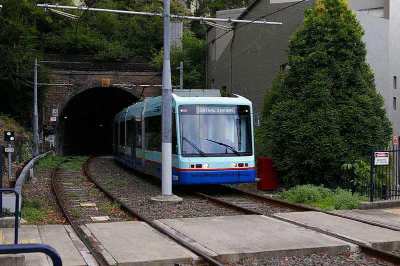
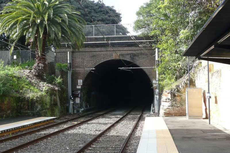
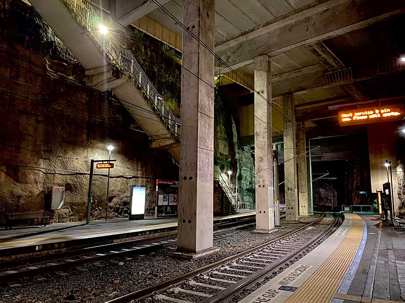
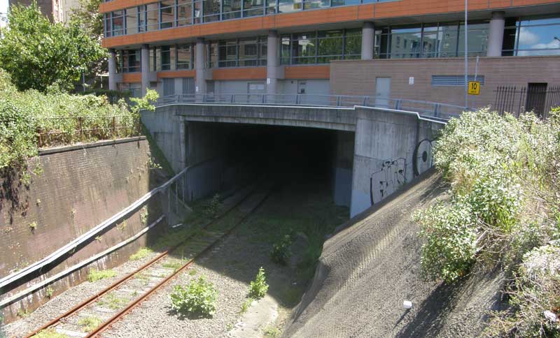
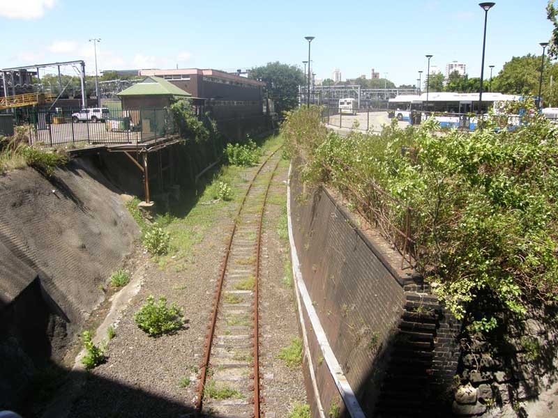
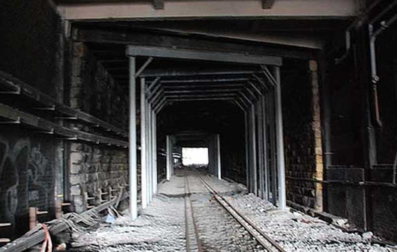
Glebe railway tunnel
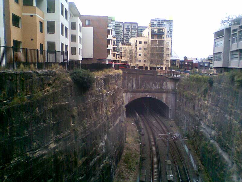
The Glebe and Pyrmont tunnels on the Line are important relics of the inner city rail freight system, having remained virtually intact, as the line was never electrified. The 4.1 km long section of track which passes through them was opened on 23rd January 1922 and closed to goods rail traffic 74 years later to the day. The line's corridor lay dormant until it was brought back into use by Metro Light Rail which operates a service to Lilyfield using the goods line's tracks, viaducts, bridges and tunnels.
The brick-lined Glebe tunnel is 744.8 m long and runs from Lower Avon Street, Glebe (adjacent to the metro light rail Glebe stop) to Jubilee Park, passing below Glebe Point Road. The western portal is adjacent to the former Rozelle Tram Depot. The tunnel's portals now frame Metro Light Rail's Glebe and Jubilee Park Stations.
John Street Station
Pyrmont's John Street Tunnel was built, opened and closed for traffic simulatanous to the Glebe Road tunnel. A curved, brick-lined 123.8 metre long tunnel, its takes the line under the sandstone heart of the Pyrmont peninsula. This tunnel is bored through the escarpment and is brick-lined. It exits near Jones Street at Saunders Lane and the line continues in a cutting.
The cutting is a two-track-wide, straight-sided excavation through the ridge of the peninsula from the commencement of Jones Bay Road, where the line deviated from the wharf sidings (now removed), until it enters the tunnel near John Street opposite Mount Street. At the Glebe end of the tunnel, it progressively opens out on the western side before falling ground levels bring the line on to the brick viaduct near the intersection of Jones and Allen Streets. John Street Station was created within the cutting beyond the eastern portal of the John Street Tunnel.
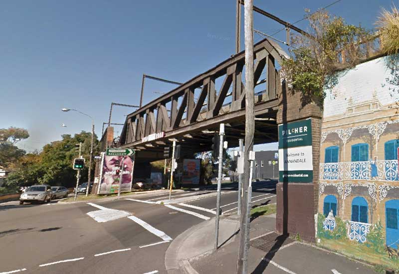
The steel railway bridges that take the Western Goods Line over Johnston Street, Annandale, were built at the same time as the Glebe Railway Viaducts. The railway bridge at Railway Street, Annandale, is an example of a modified, riveted-steel Pratt half-through truss design bridge. The Pratt truss design was preferred for railways use in NSW after 1892, with riveted-steel construction for railway bridges becoming the standard from this time. Nearly all the underbridges - a mix of brick arches, steel girders and steel trusses - are still in use by the light rail service through the area.

In 1919 the NSW Government Railway built the first reinforced concrete railway bridge on its system over the northern end of Bellevue Street, Glebe (above). The experimental single span was restricted to 6.5 metres in length and supported the goods line from Rozelle to Darling Harbour that was being built at the time.
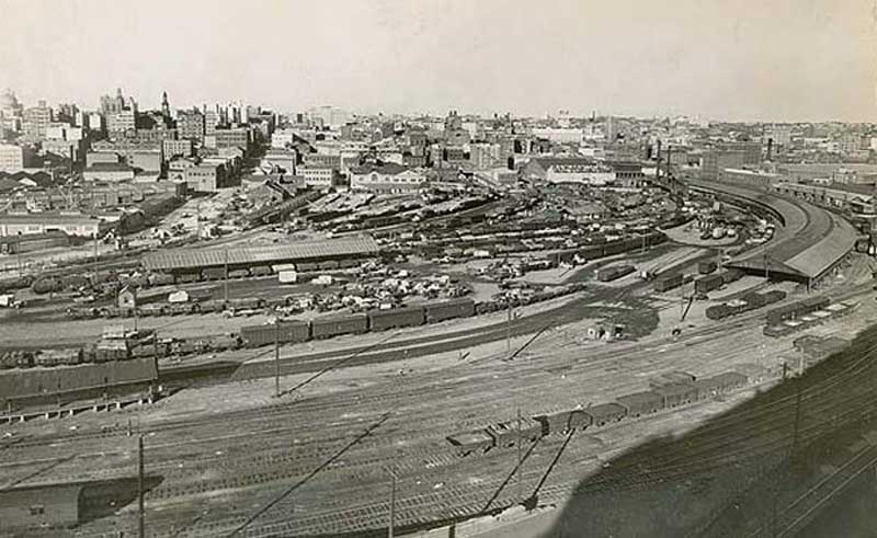
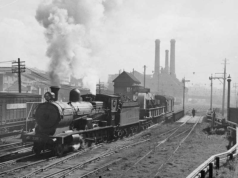
Darling Island Goods Yard, 1950s
Darling Island goods yard, on the western side of Darling Harbour, could be accessed from the parcels office and post office that once existed near Central station via a line that still exists. It passes under Broadway and Lee Street via a tunnel, emerging in the abandoned railway corridor parallel to Harris Street, Ultimo, behind the ABC building. The monorail once travelled along this corridor, joining it at the end of Macarthur Street. The Darling Island Jctn. signal box appears briefly in the movie, Strictly Ballroom, being used as the home of the parents of the girl who danced with Paul Mecurio. A '49' class Loco appeared briefly in front of the house. The signal box was located where the buses stop at Star City Casino today. Once the light rail leaves the Casino stop and proceeds into the cutting it is travelling on the alignment of the No. 1 siding of the Pyrmont Power House storage sidings.
Darling Harbour itself was known before the 1830s as Cockle Bay due to the extensive Aboriginal shell middens on its shores, so it is more than likely that the site of the Darklingoods yard was at least intermittently visited or occupied by Aboriginal people in the course of gathering food or making camps. European occupation began in the 1790s when much of the land in the Pyrmont/ Ultimo peninsula was granted to members of the military. By 1804 John Harris had consolidated much of these holdings into the Ultimo Estate, Governor King had granted this part of the Ultimo Estate to Harris in December 1803. In 1830-31 a strip of land along the north side of George Street was sold as town allotments, with buildings indicated to the east of the subject site by 1836.
Pyrmont Bridge opened in 1857, and it was intended that there should be a rail and bridge interchange or terminus, so that goods could be brought across the Bridge from Sydney (and indeed the Darling Harbour wharves) and thence transported by rail, and vice-versa. The Government's reclamation of the southern end of Darling Harbour led to the construction, in 1874, of the Iron Wharf. This was the first substantial wharfage on the western side of the Harbour and was conveniently located close to the railway to enable its use.
By the 1910s Darling Harbour south of Pyrmont Bridge was becoming too shallow for large vessels and was largely reclaimed in the late 1920s using fill from Sydney's underground railway excavation. The Iron Wharf was demolished and operations concentrated further to the north. By this time the goods yards had been built. By the 1960s many of the nearby woolstores and other port functions were moving out of Sydney. Road transport was often a less expensive medium than rail for transhipment of goods. The functions of the railway decreased significantly.
Finally in the 1980s the Darling Harbour Redevelopment spelt out the final chapter of the Darling Harbour goods yards, which were demolished and redeveloped in 1985-88. Trains have not generally used the Ultimo railway line since the 1980s with the exception of occasional use to bring steam trains to the siding at the PowerHouse Museum. In the 1990s the line north of Hay Street was utilised for the light railway through Pyrmont, accessed from Hay Street, and thus continuing the traditional use of this corridor.
Entrance to bridge carrying the Darling Harbour goods line under George Street
The Darling Harbour goods line, which linked Darling Harbour Goods Yard to the main Sydney-Parramatta line at Redfern, was part of the first railway opened in New South Wales in 1855. The current corridor corresponds with that purchased from the Harris family in 1853 for this purpose. It therefore has a high degree of significance as a place. The Ultimo Road Bridge is believed to be constructed in the 1850s, and is therefore one of the only remaining features of the original railway which joined Darling Harbour and Granville (Parramatta Junction) in 1855.
The railway cutting next to Central Station that carries the Darling Harbour goods line to Redfern
The land was sold in 1853 to the Sydney Railway Company, however, like most international private railway companies, the it fell into financial difficulties and was taken over by the NSW Government in 1854. The railway, ultimately connecting Darling Harbour and Parramatta, was opened in 1855. The railway reserve of 1853 follows the current corridor and extended almost to Pyrmont Bridge. A series of embankments, bridges and a cutting carried the railway to Darling Harbour via a cutting the original Sydney railway terminus at Redfern.
The siting of the railway along what was the edge of Darling Harbour strongly influenced the development of Pyrmont and Ultimo. Because of it, wool stores, engineering works and other industries were built here after the 1870s, giving this part of Ultimo its industrial, rather than residential, flavour. The site also contains two railway bridges.
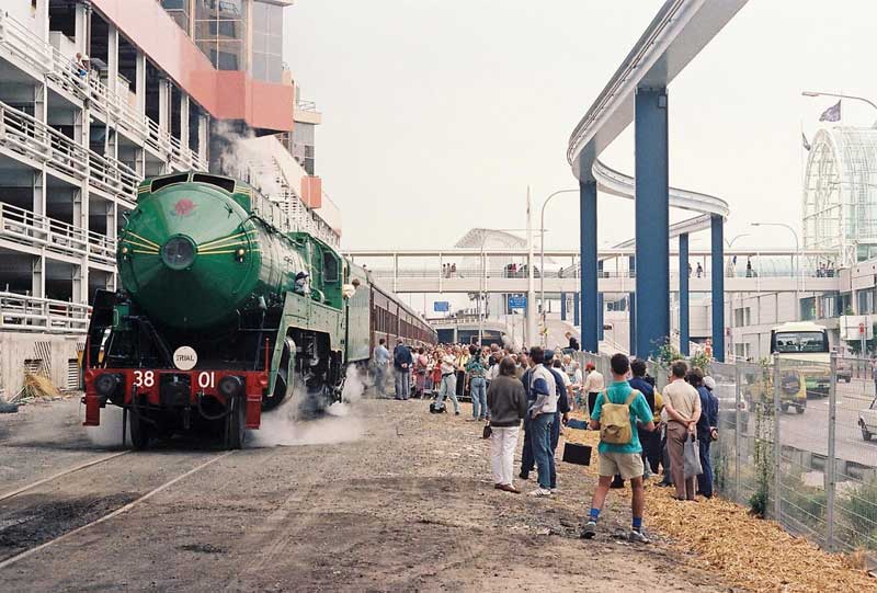
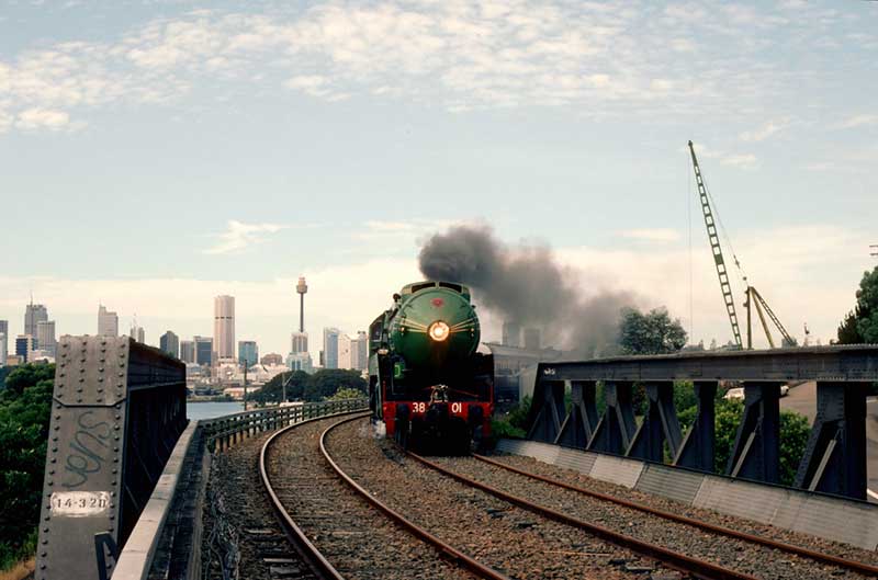
Steam locomotive 3801 on what was the last remaining line of track at Darling Harbour during the 1988 Bicentennial celebrations
The Ultimo Power House was built in 1898-99 on the railway line by which it was supplied with coal, as was the Pyrmont Power Station some ten years later. Following the Government resumptions after 1901 and subsequent wharfage developments at Jones Bay and Darling Island, the railway expanded and fostered the industrial boom first predicted in the 1850s.
The railway tunnel under George Street, Broadway
A sandstone bridge still carries the roadway of Railway Square over the railway cutting. The overbridge built in 1855 is historically significant as the oldest railway bridge to be constructed and still in use in New South Wales. The Ultimo Street railway underbridge is a mid 19th century construction with classic revival inspired cast iron columns and mid 19th century sandstock brick abutments.
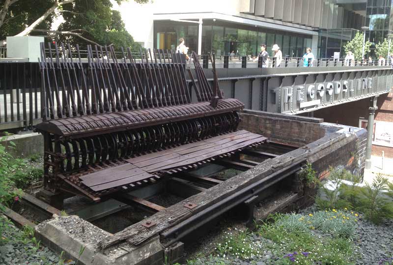
Part of the disused Darling Harbour Goods Line corridor has been converted into a shared pedestrian and cycle path. Known as The Goods Line Precinct, the walkway starts at Ultimo Street and connects Ultimo with Darling Harbour. It incorporates the steel railway bridge over Ultimo Street. The Precinct is today surrounded by some of Sydney's most important cultural, educational and media institutions, such as the ABC, UTS, TAFE and the Museum of Applied Arts & Sciences (Powerhouse Museum).
Above: a goods train passes over the Ultimo Street underbridge along what is now the Goods Line Precinct
Below: site of The Goods Line Precinct, 1987


Design by W3layouts