North Shore Line, Sydney, NSW (T1)
Note: The North Shore & Western Line (numbered T1, coloured orange) serves the North Shore, parts of the Inner West and Western Suburbs. These were originally known as the North Shore, Northern & Western Lines. As most commuters still travel on sections of the line as they once were named, our Sydney suburban train journeys detail those sections.As early as 1874, people dreamed of a railway in the North Shore. In that year, a petition was made for a line from Pearce's Corner (Wahroonga) to Sydney Harbour. When one local was approached, he said: "If I live to be as old as Methuselah, I will never see a railway". In 1875, a committee was formed at the Greengate Hotel (Killara). The Public Works Department was opposed, saying "either then or now, the line would run from nowhere to nowhere".
In 1879, surveyors proved that a line between Pearce's Corner (the point where Pennant Hills Road joins the Pacific Highway in the suburb of Wahroonga, near Hornsby) and Blue's Point was practical. Sadly, in September of that year, the records of that survey were destroyed in the Garden Palace fire. In that year, Sir Henry Parkes tried to win votes in St Leonards by advocating a railway line and Harbour Bridge. There was much controversy where the line should terminate, and consequently it didn't go ahead. In 1884, it was proposed that a new line to Falcon Street (Crows Nest) would be built, and tenders were called. Completed in May 1899, the North Shore Line was opened on 1 January 1890 as a single track between Hornsby and St Leonards. No Sunday service was given until the line was extended to the Sydney Harbour foreshore at Milsons Point on 1 May 1893. Transport between this original Milsons Point station and central Sydney was by ferry boat. The opening of the line was the catalyst for the development of the North Shore and ts suburbs that we see today.
The construction works for the Sydney Harbour Bridge necessitated truncation of the southern terminus from Milsons Point to Lavender Bay. When the Sydney Harbour Bridge was opened on 19 March 1932 a new Milsons Point station (on the bridge approach) came into operation and the North Shore Line was extended through it and over the Sydney Harbour Bridge to link with the underground lines of central Sydney. The result is that the two ends of the North Shore Line link to the Sydney railway system at Central and Hornsby.
The North Shore Railway Line follows the Pacific Highway from Milsons Point on Sydney Harbour to Hornsby, which in turn began as a pathway that followed the ridges north, used by the indigenous people for thousands of years.
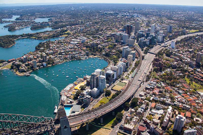
Milsons Point
Milsons Point station was constructed between 1929 and 1932 as part of the northern approaches of the Sydney Harbour Bridge. It was initially called Kirribilli Station, but was changed to Milsons Point before its opening. On 19 March 1932, Milsons Point station was officially opened as part of the larger bridge opening celebrations to roadway, railway and pedestrian traffic. Until then, the North Shore Line finished on Lavender Bay on the site of Luna Park, where a ferry took passengers across the harbor to the City of Sydney. The original line remains as a branch line from near Waverton station, and is used today for storing suburban trains.
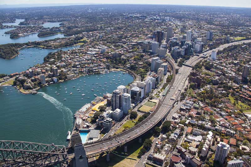
The western platforms were connected to the North Shore line with the eastern pair originally used for a tramway service between Wynyard and the northern suburbs. The tramway and its associated platforms were removed in 1958 as part of the conversions of lanes 7 and 8 of the Harbour Bridge to become the Cahill Expressway.
From the western side of Milsons Point station (left hand side when approached from the city) it is a short walk to North Sydney swimming pool, historic Luna Park fairground, the shores of Lavender Bay and Wendy’s Garden, a wonderful maze of plantings down the hillside created by the wife of famous artist Brett Whiteley in memory of her husband.
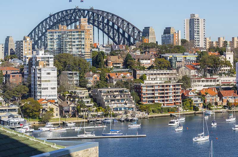
On the eastern side of the station is the suburb of Kirribilli. Lookouts offer views across the harbour to the Opera House and Circular Quay. Neutral Bay adjoins Kirribilli; it is a pleasant walk through gardens and the old submarine base on Neutral Bay.


North Sydney
North Sydney station opened on 20th March 1932 at the same time as the North Shore line ad its connection to the City Circle via the Sydney Harbour Bridge. The station was built in a rock cutting with a street level overhead concourse above the platforms. At the Waverton end of the station there are four tunnels which have been cut into the rock. Unused tunnel stubs of 260 metres for proposed lines to Newport (Barrenjoey Peninsula) and Northbridge were cut at the same time with Chief Design Engineer John Bradfield calculating that without these, later construction of these lines would interfere with the North Shore line. Neither of these lines were built.
North Sydney station, 1960s
From 1932 until 1958, two of the rail tracks designed for the bridge were used by trams, the latter being diverted onto Blue Street just before they would have entered North Sydney Station. After 1958 the tram tracks were removed from the Sydney Harbour Bridge and replaced by the Cahill Expressway. North Sydney Travelodge was built over the station in 1968. The station became totally enclosed with the opening of Zurich Insurance House in 1984.
Waverton
Waverton Railway Station was opened on 1 May 1895 when the area was barely settled. At the time, the station was named "Bay Road" but on 20 May 1929, "Bay Road" was renamed "Waverton" - the name it carries today. The main line from Waverton station to the harbour bridge was not built until 1931. Before then, trains used what is now a branch line down to the terminus station on the shore of Lavender Bay. This line, which passes through a tunnel and over a viaduct, still exists - the station became the North Sydney Electric Car Sidings, and the track used for storage of rolling stock between the morning and afternoon peak periods.
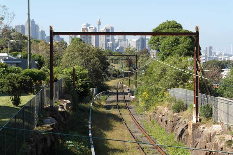
Lavender Bay siding
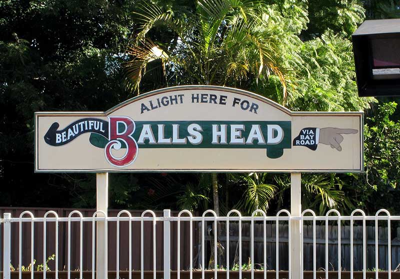
Flanked by Berrys Bay and Balls Bay, the Waverton peninsula is blessed with tracts of both virgin bushland and parkland, heritage-listed Aboriginal rock engravings as well as a number of iconic former industrial sites. These include the circa-1910 Balls Head coal loader and BP Refinery, both with heritage significance.
Balls Head Reserve
Balls Head Reserve, the bushland peninsula, is a popular picnic destination especially when there are harbour fireworks. Its one-way road system also forms part of a favoured route for walkers and joggers. Waverton Park, on the banks of Berry's Bay with stunning views of Sydney Harbour, is another recreation focal point.
Wollstonecraft
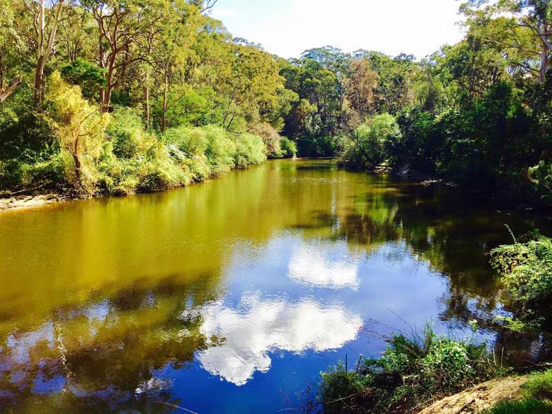
Wollstonecraft station opened on 1 May 1893 when the North Shore line opened from St Leonards to Milsons Point. Originally named Edwards Road, it was renamed on 1 September 1900. The platform is located on a sharp 200-metre radius curve, leading to complaints from residents about the squeal from train wheels. The affluent harbourside suburb of Wollstonecraft is distinguished by its fine homes and million dollar views of Balmain, Hunters Hill and Birchgrove.
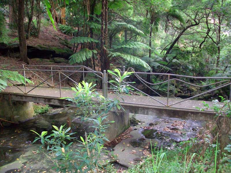
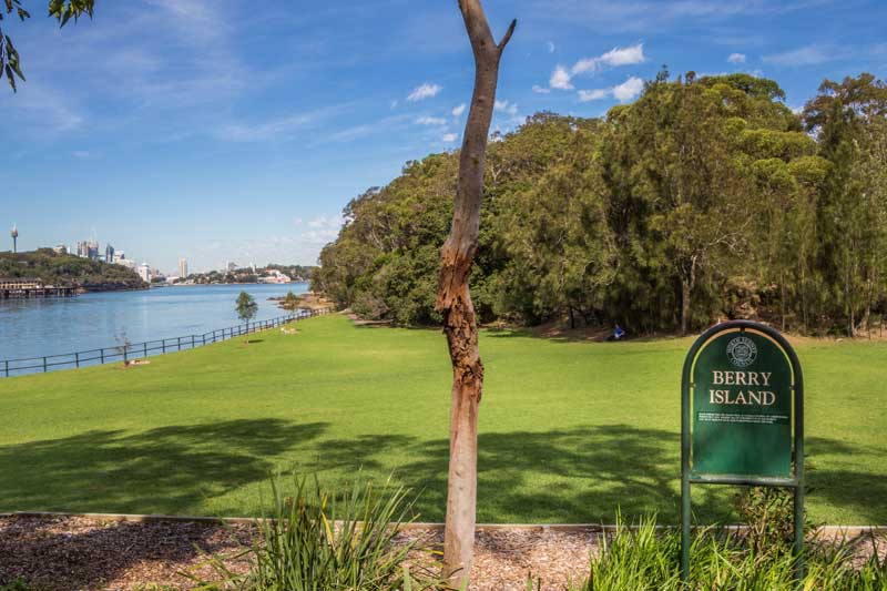
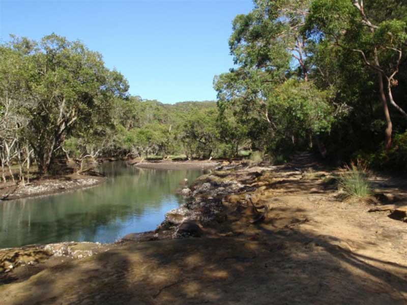
Just 20 metres from the railway station exit is Smoothey Park (above), a pleasant bushland reserve through which flows Gore Creek, bouncing its way over rocks and through splashing pools on its way to Gore Cove. A walking path alongside it meanders towards the harbor and Berry Island. A walk around Berry Island includes Aboriginal rock art and harbour views to the city. The picturesque walk from the station to Berry Isld via Smoothy Park, and on to Shirley Rd. is 1.6 km in length.
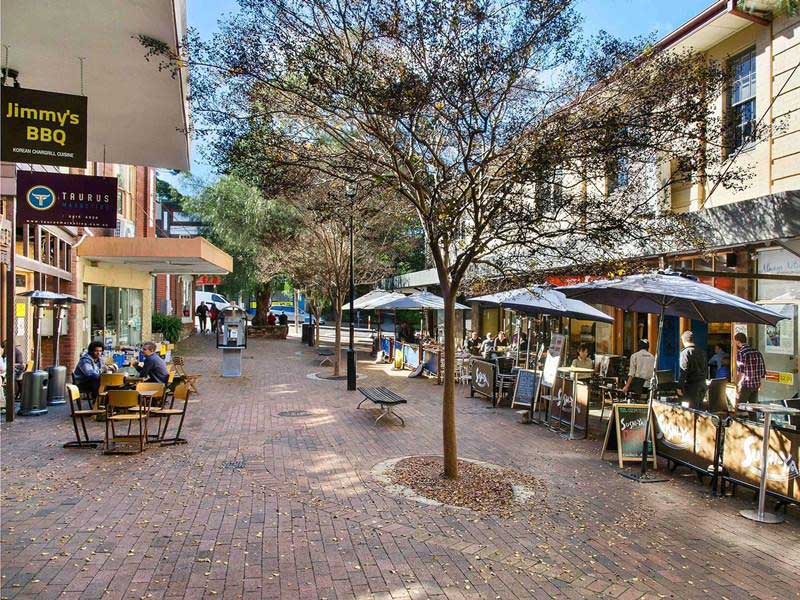
St Leonards
The name St Leonards was first used for the whole of the Lower North Shore. St Leonards station opened on 1 January 1890 as the terminus station of the North Shore line from Hornsby, being extended to Milsons Point in May 1893.
In August 1989, the station was relocated to a temporary station south of the Pacific Highway to allow the station site to be redeveloped. The new station was completed in February 2000 as part of The Forum shopping plaza development.
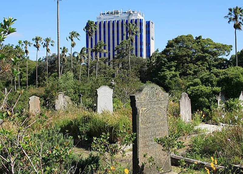
Gore Hill cemetery
St Leonards is a close neighbour to Crows Nest, so close in fact that it is difficult to identify where one stops and the other stops apart from a line on a map. Of the two, St Leonards is more the commercial centre, whereas Crows Nest is predominantly retail. The nearby Gore Hill cemetery was established on Pacific Highway in 1868 and was the main burial site for the area until its closure in 1975. It is still maintained as a heritage site.
Artarmon
A temporary Artarmon station opened on 6 July 1898, before the present station opened on 7 October 1900. In April 2015, work commenced on the construction of a new footbridge that includes lifts at the northern end of the platform. Artarmon was, until recently, the centre for television broadcasting in Sydney. All the major stations had their studios and headquarters there, as evidenced by the numerous broadcasting towers that line the ridge top.
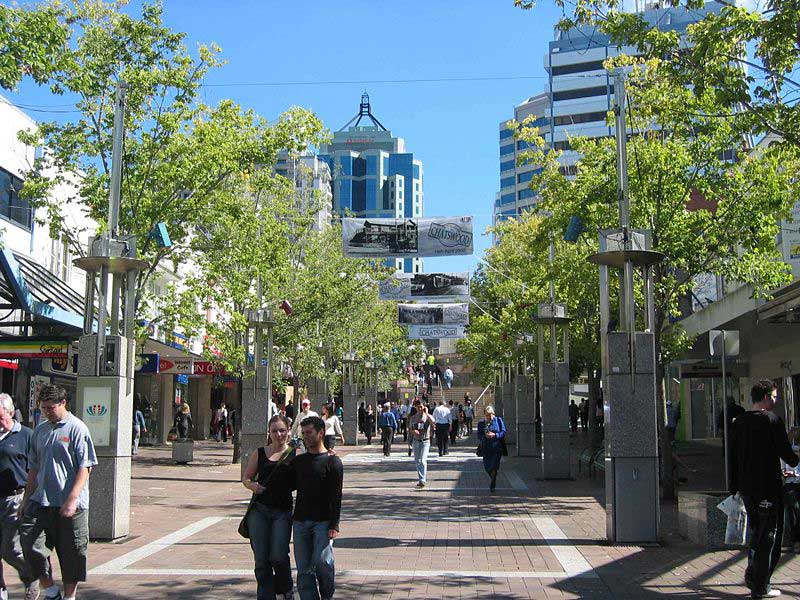
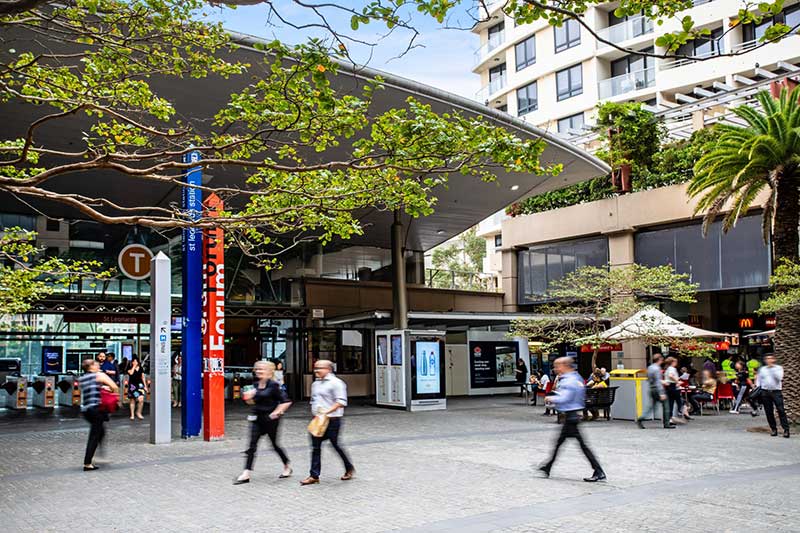
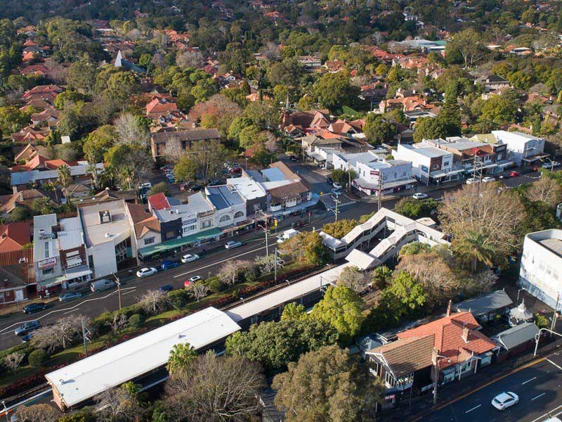
Chatswood
Chatswood station opened on 1 January 1890. By 1919, a small goods yard for parcel deliveries, similar to the one at St Leonards, was added to the western side of the station, beyond the northern end of the platforms. With the construction of the Chatswood to Epping line (now considered part of the Metro North West Line), the station was redeveloped to accommodate Chatswood's new role as a junction station, incorporating a bus interchange and pedestrian pathways connecting the precinct to the surrounding streets.
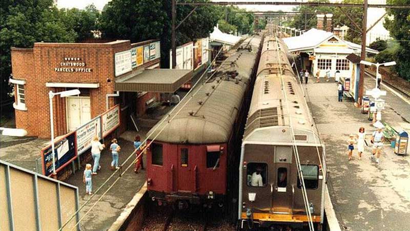
Chatswood station, 1983
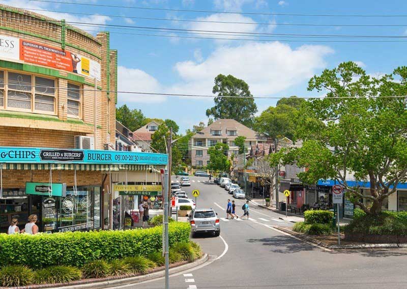
Ten kilometres north of the Sydney central business district on Sydney's North Shore, Chatswood is the administrative centre centre of the local government area of the City of Willoughby. Known for its large Chinese community, second only to Haymarket, it is also a major commercial and retail district.
The remnants of Chat's Wood
Chatswood’s name is derived from Chat’s Wood, a section of forest where the wife of an early resident, Charlotte Harnett, loved to go bush walking. Remnants of Chat’s Wood still survives. Residential settlement of Chatswood began in 1876 and grew with the installation of the North Shore railway line in 1890 and also increased with the opening of the Harbour Bridge in 1932.
Roseville
Roseville station opened on 1 January 1890 as Rossville when the North Shore line opened from Hornsby to St Leonards. Characterised by its lush and leafy roadsides, parks, and gardens, the North Shore suburbs of Roseville, Roseville Chase and East Roseville are named after orchardist George Wilson's stone cottage, Rosa Villa, which was demolished to make way for the railway through Roseville.
The area has numerous bush walks. The Little Diggers Track follows Moores Creek (above) through several reserves in east Roseville and East Lindfield. The track is named after William Morris "Billy" Hughes, Australia's 7th Prime Minster, who once lived in the area. The walk explores the ferns and sandstone overhangs of the area, and there are several small waterfalls on Moore creek, which are worth the very short detour to visit. Officially, the Little Digger track finishes near the bottom of the Carlyle Road Service Trail.
Lindfield
Lindfield station opened on 1 January 1890 when the North Shore line opened from Hornsby to St Leonards. Lindfield contains residential housing of mainly California bungalow and federation style. Native bushland in Garigal National Park and Lane Cove National Park borders the suburb. Lindfield was named after a property owned by a Mr List, who was born in Lindfield, a suburb of Hayward's Heath in Surrey, England. When the railway was built in 1890, the name of his property was used for the station nearby. Before that time, the Lindfield district was sparsely populated by orchardists. Lindfield saw its greatest period of growth after World War I.
Seven Little Australian Park opens a window to the natural bushland along the valley of Gordon Creek, which flows into Middle Harbour Creek to the north of Roseville. While living nearby at 1 Werona Street, Lindfield, 21 year old Australian author Ethel Turner visited the park and received the inspiration for her first novel, Seven Little Australians. Turner Lookout also recalls her early years living in Lindfield.
Killara
Killara station opened on 10 July 1899. The present island platform and station building were completed in 1906 in anticipation of the line being doubled. This occurred in 1909.
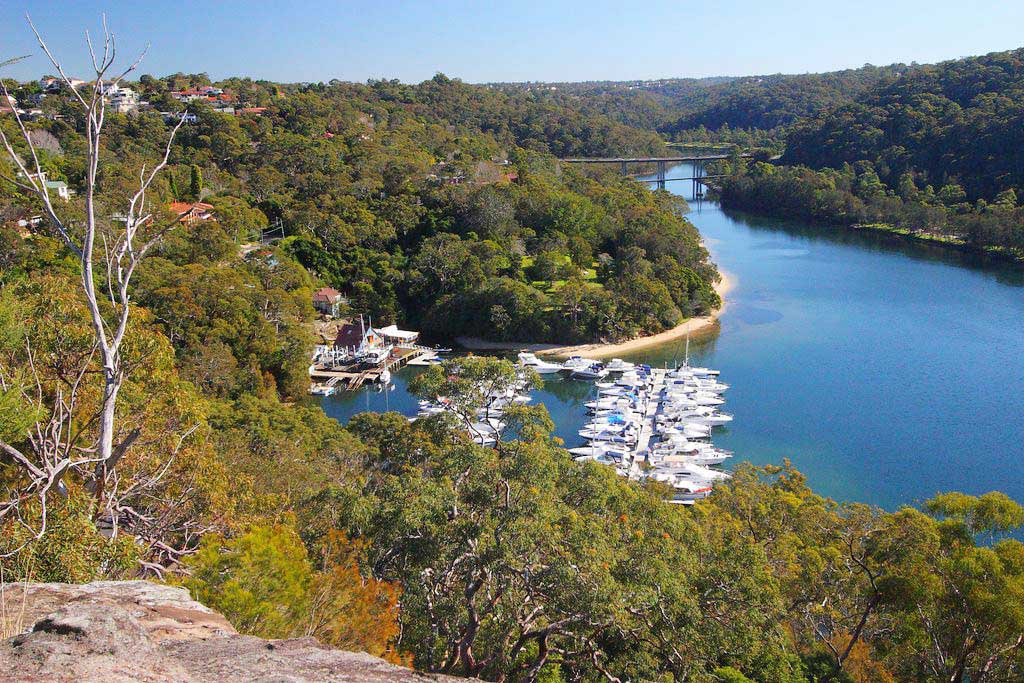
Lane Cove River from the site of Fidden's wharf
During much of the 19th century, Killara remained virgin bush but was cleared of much of its timber. One of the most well known timber getters was Joseph Fiddens, an emancipated convict who logged Killara's blue gum forest. Orchards were scattered through the bush until the arrival of the railway in 1899. A hostel, erected in 1835 and later replaced by the original Green Gate Hotel, was a landmark for stage coach travellers. It was the residents of Killara who first lobbied the government in 1875 to construct a railway through the Upper North Shore region.

Gordon
Gordon Railway Station was opened on 1 January 1890. In 1909 the single line was duplicated between Hornsby and St. Leonard's and a goods siding for local parcel deliveries added. In the 1920s, Gordon was considered to be one of the healthiest suburbs on the North Shore line. Situated 116 metres above sea level on the ridge which divides the Lane Cove upper valley from the Upper reaches of Middle Harbour, and at the time in a bushland area, it attracted people who wanted to build their homes in a peaceful, away-from-it-all atmosphere, and yet close to the city.
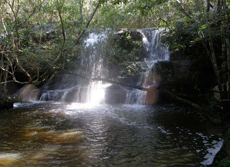
St Johns Falls, Blackbutt Reserve, Gordon
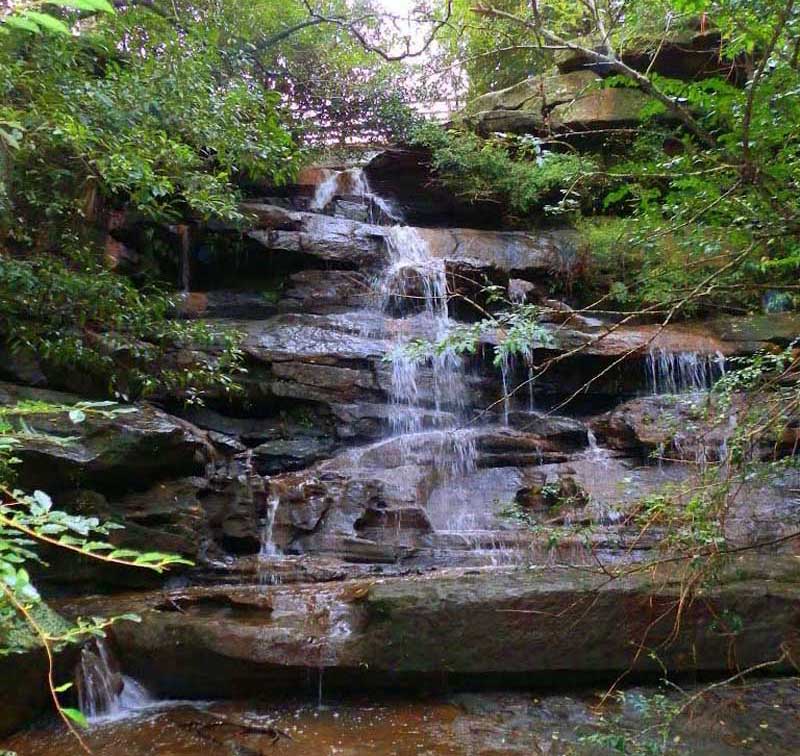
There are many small waterfalls and rapids on the creeks of Sydney's upper north shore and one is within walking distance of Gordon station. Located in St. Johns Bush, it is a short, easy walk from the lower end of St Johns Ave , beyond the Gordon Golf Course (1.8 km by road or on foot from Gordon Station). A bridge crosses the creek above the falls though the view of the falls there says is partly obscured by bush. A walking path leads to the falls, which has two drops of approx. 3 metres each.
Pymble
16 kilometres north-west of the Sydney Central Business District on Pacific Highway, Pymble is a predominantly residential area with tree-lined streets, many substantial homes and gardens, numerous parks, nature reserves, and active pockets of commercial activity.
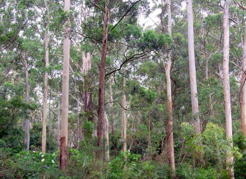
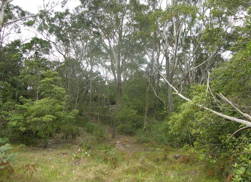
There are a numerous untouched bush reserves which offer a taste of the original natural beauty of the region, Sheldon Forest (above) being a prime example. A 7ha strip of original bushland wedged between the suburbs of Turramurra and Pymble, it is a rare example of the high forest which once covered the whole of the Upper North Shore.
Turramurra
Turramurra station opened on 1 January 1890 as Eastern Road but was soon renamed Turramurra. On Turramurra's south-eastern boundary, bordering with Pymble is Sheldon Forest (above), which has some of the best preserved examples of blue gums and turpentine high forest.
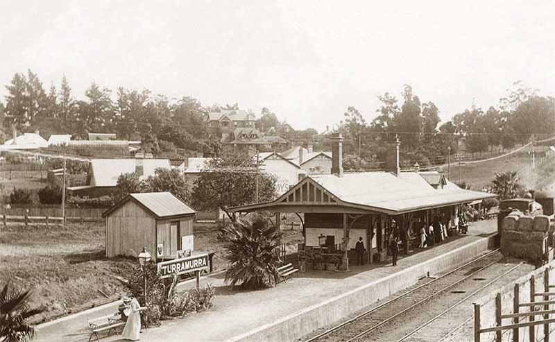
Turramurra was on a main Aboriginal travelling route from Lane Cove to Cowan Waters and the hilltop here was a resting place for Aborigines making the journey. The white settlers called it Eastern Road. Much of the high forest had been cleared by the 1840s when orchardists began moving into the area. North Turramurra was the site of 'Irish Town', so named because it contained many families of Irish extraction who established orchards here around that time.
Warrawee
Warrawee station opened on 1 August 1900. A new footbridge was installed in 1977, which had a steel roof added in 1995 for weather protection. In 2009, the platforms were repaired and resurfaced. In August 2020 the station was upgraded and a lift was installed. Located 17 km north-west of the Sydney central business district, Warrawee is predominantly a small residential suburb with few commercial entities. Notably, its railway station provides no commercial activity which is uncommon on the Sydney train network.
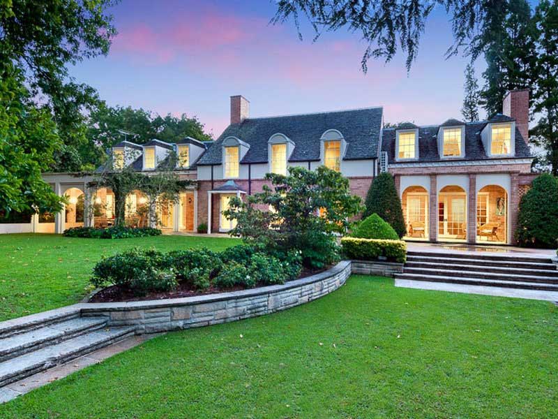
As all North Shore suburbs with aboriginal names, Warrawee was the name of a railway station which became attached to the surrounding suburb. It is recorded as meaning 'meaning rest a while'. Warrawee had developed in the 1900s as an exclusive residential district with no shops, offices, post office, public school, churches or through roads. All the blocks were kept to between one and four acres and the form of houses tightly controlled. The suburb is rich in architectural history, with a number of houses designed by prominent architects. The earliest significant homes were Pibrac (1888), Cheddington (1890) and Wirepe (1893), all very fine houses.
Wahroonga
When opened in January 1890, the station was called Pearce's Corner, which was the name of the junction of Pacific Highway and Pennant Hills Road where a timber getter, Aaron Pierce, had built a slab hut on land he purchased in 1835. The name was changed to Wahroonga in August 1890. The provisional name for the station here had been Noonan's Platform, as the station land bounded the property of Patrick Noonan. Wahroonga is said to originate from an Aboriginal word meaning 'our home'.
The first farmer in the area was Thomas Hyndes who received a 640 acre grant by Gov. Ralph Darling. Upon Hyndes' death, the property was sold to John Brown and it became known as Brown's Paddock. Upon his death, it was re-surveyed and a large section, through which Fox Valley Road passes today, was subdivided as the Fox Ground Estate.
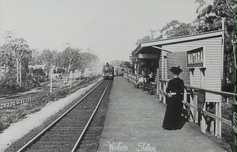
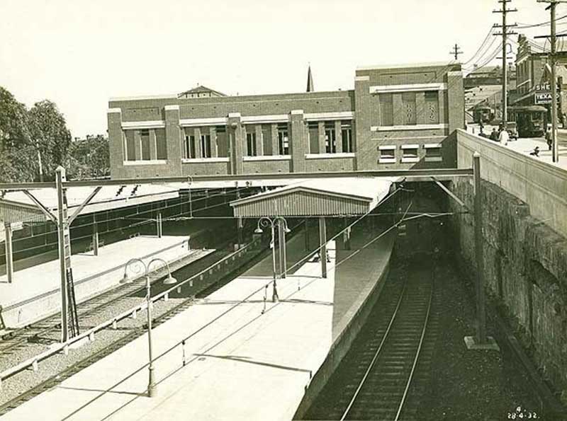
Waitara railway station, 1907
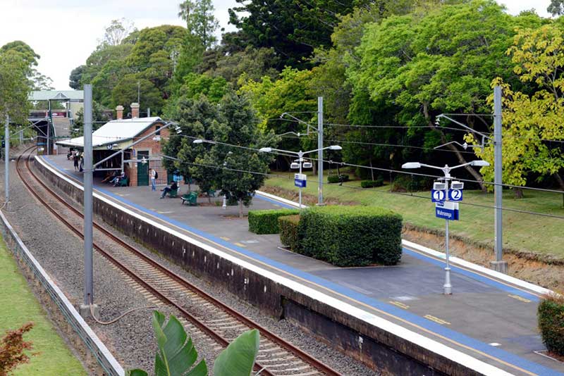
Waitara
Waitara is a word in the Maori language that means hail, pure water or hail, wide steps. (There is also a town in New Zealand named "Waitara".) The suburb takes its name from the Waitara River in New Zealand, where Australian troops fought as Imperial volunteers during the Maori Wars. Waitara station opened on 20 April 1895. The original station was replaced by the present structure in 1909 when the line was duplicated.

Waitara is a centre for all things automotive, car dealerships both new and used, car maintenance and smash repairers. Waitara has just one hotel, the Blue Gum Hotel. There has been a hotel on the site since 1884, but two fires have destroyed the older buildings. The current building dates from 1962. Waitara also has a Rugby League Club, called Asquith Rugby League Club.
Hornsby
Built originally as a station on the main north line from Strathfield to the Hawkesbury River, it opened on 17 September 1886 as Hornsby, but was renamed Hornsby Junction on 1 November 1894 after it became a junction station with the opening of the North Shore line to St Leonards. The regional centre that is Hornby today grew up around the station. Hornsby has long been associated with Ginger Meggs, a cartoon which has appeared in Australian newspapers since 1921. Its creator, Jimmy Bancks, grew up in Hornsby.
Callicoma Track
Hornby is surrounded on nearly all sides by virgin bushland. Within the Hornsby Shire there is over 6,000 hectares of public bushland and 174 Parks including 134 playgrounds and 12 garden parks. The Great North Walk track, which links Sydney and Newcastle, passes through Hornsby, It has been designed for people of all ages and levels of experience.