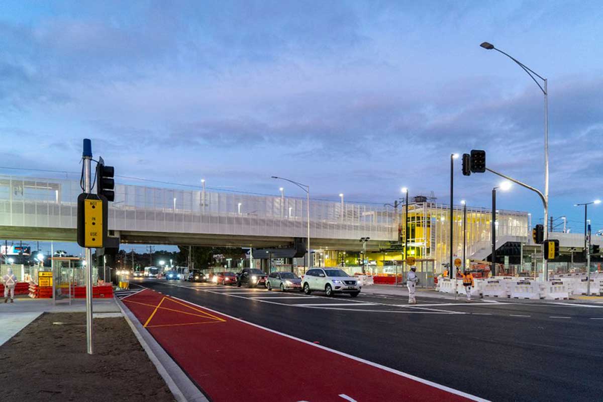
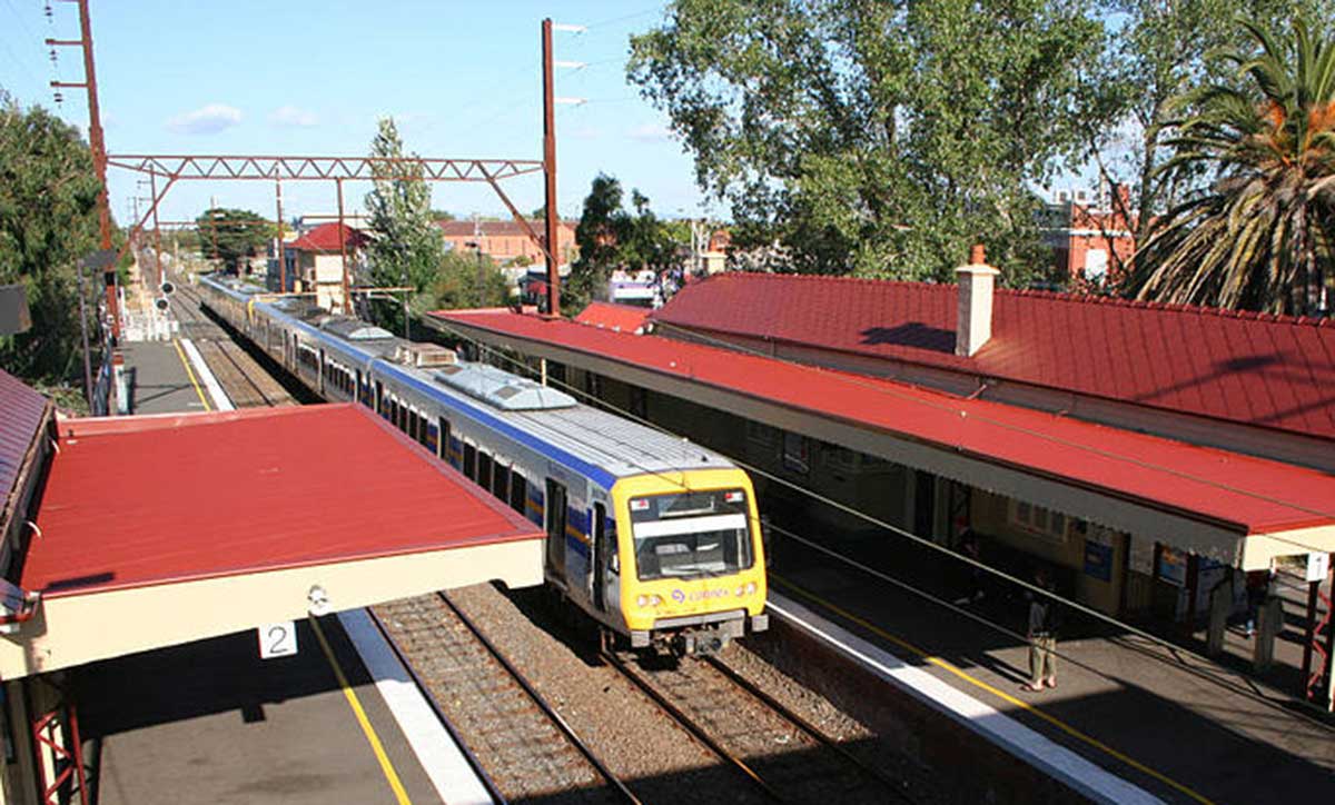
Noble Park railway station
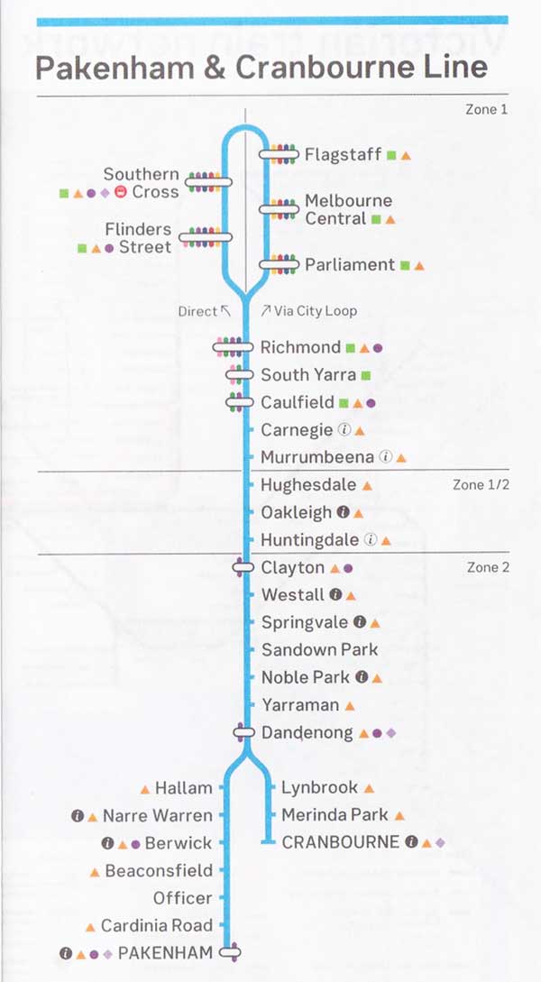
The Pakenham line is the city's longest metropolitan railway line at 57 kilometres. The line runs from Flinders Street station in central Melbourne to Pakenham station in the south-east, serving 27 stations via the City Loop, South Yarra, Caulfield and Dandenong. Sections of the Pakenham line opened as early as 1859, with the line fully extended to Pakenham in October 1877. A limited number of stations were first opened, with infill stations progressively opened between 1879 and 2012. The line was built to connect Melbourne with the rural towns of Caulfield, Oakleigh, and Dandenong, amongst others. Significant growth has occurred since opening, with a plan to extend the Pakenham line one stop east to a new station in Pakenham East as part of the Level Crossing Removal Project.
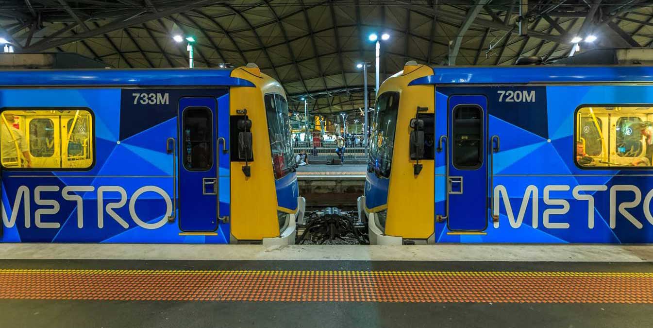
The line operates for approximately 20 hours a day (from approximately 4:00 am to around midnight) with 24 hour service available on Friday and Saturday nights. During peak hour, headways of up to 5 to 10 minutes are operated with services every 20 minutes during off-peak hours. Trains on the Pakenham line run with a seven-car formation operated by High Capacity Metro Trains
The underground City Loop is at the centre of Melbourne's busy suburban railway system. It's quite an unusual design, being made up of four completely independent single track tunnels, some of which change direction half way through the day. From Flinders Street station, trains travel across the Flinders Street Railway Viaduct to Southern Cross Station. Upon leaving Southern Cross, trains travel underground through Flagstaff. Melbourne Central and Parliament stations, emerging from the underground loop at East Melbourne.
Although the Melbourne Cricket Ground is arguably one of the two most important cricket grounds in the world, it is much more than a cricket ground to the people of Melbourne. It is one of the great icons of this city, and even Australia. By the 1950's, Melbourne's reputation as the sports capital of Australia was so firmly entrenched that it was a foregone conclusion that the city would host the 1956 Olympic Games and that the MCG would be the Games' main stadium.
The MCG underwent a $430 million redevelopment on the northern side of the stadium between 2002 and 2006; the upgrade was in part to prepare it as the main venue for the 2006 Commonwealth Games, which were hosted by Melbourne. The redevelopment involved the demolition of the Pavilion, Ponsford and Olympic Stands. The present capacity (including seating and standing room) of the MCG is just over 100,000. Up until October 2002, the capacity of the ground was 96,308.
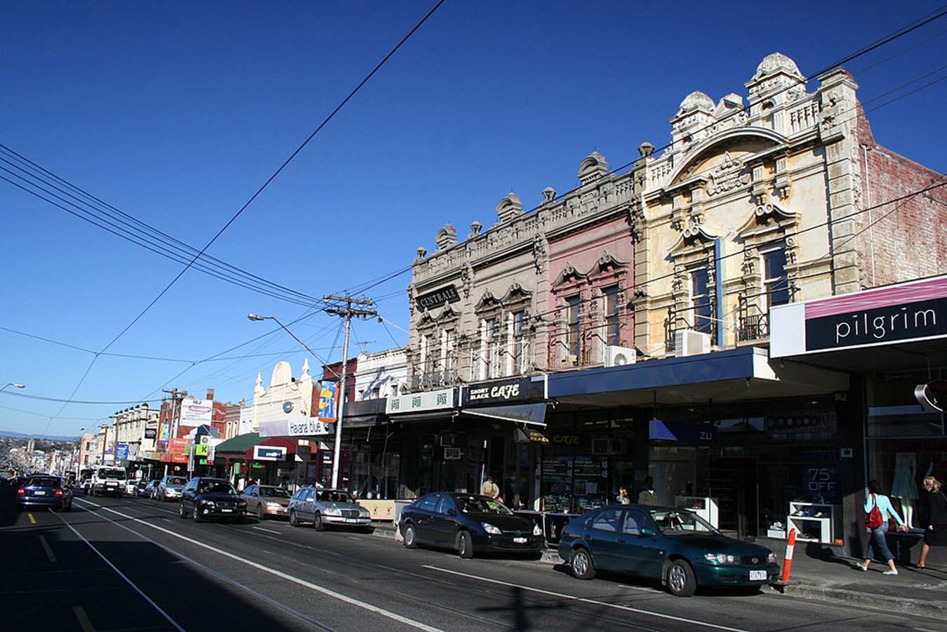
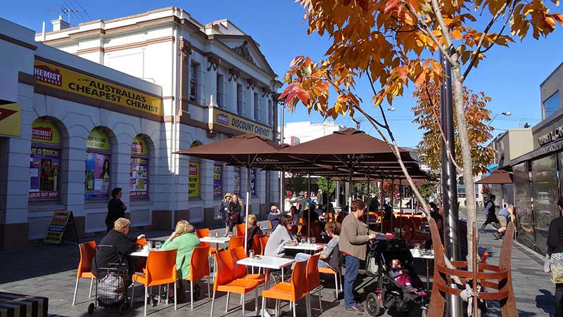
Best known for its bargain designer and seconds shopping along Bridge Road and Swan Street, vibrant Richmond is also the place to go for Greek or Vietnamese food, languid all-day breakfasts and great live music. Though a number of designer and seconds shop have moved out of the area in recent times, there are still plenty there to please the bargain hunter. Church Street is the place to go for designer furniture and objets d'art.
Bars and live music thrive in Richmond, the Corner Hotel being one of Melbourne's most famous intimate live-music venues, hosting big-name bands alongside obscure newcomers. Just across Swan Street, Dizzy's Jazz Club is known for its quality acts. Sip a cocktail in refined surrounds at Der Raum, or celebrate the hops and tour the Carlton and United Breweries' brewhouse in Abbotsford.
Nearby Victoria Street, or Little Saigon, in North Richmond, is the heart of Melbourne's Vietnamese community. Wander among the long stretch of eateries, bakeries, butchers, fishmongers and grocers and grab a bite along the way. Don't expect white linen tablecloths and hovering waiters - Victoria Street is about the hustle and bustle of fast, fresh and exceptional Asian food at a bargain price.


South Yarra is one of Melbourne's oldest and most affluent inner-city suburbs, bordered by the Yarra River and Richmond to the north, Prahran to the south and Toorak to the east. Shopping, fashion, dining and entertainment are the main features of South Yarra's extensive commercial precinct.
The South Yarra section of Chapel Street has a reputation for being the most fashionable and upmarket end. A major landmark is The Jam Factory, and old factory converted into an upmarket shopping centre and cinemas. The Como Centre is a large shopping centre on the corner of Toorak and Chapel Streets, which combines with an office building, South Yarra s tallest, which houses the headquarters for ATV-10 and Global Television's TV production facilities.
The Prahran Market, located in South Yarra, is one of Melbourne's most popular and historic fresh produce markets. Toorak Road runs off Chapel Street and although not known as well as Toorak Village, is a popular strip that contains a wide range of shops. Chapel Street and Toorak Road also has some of the best nightlife in Australia.
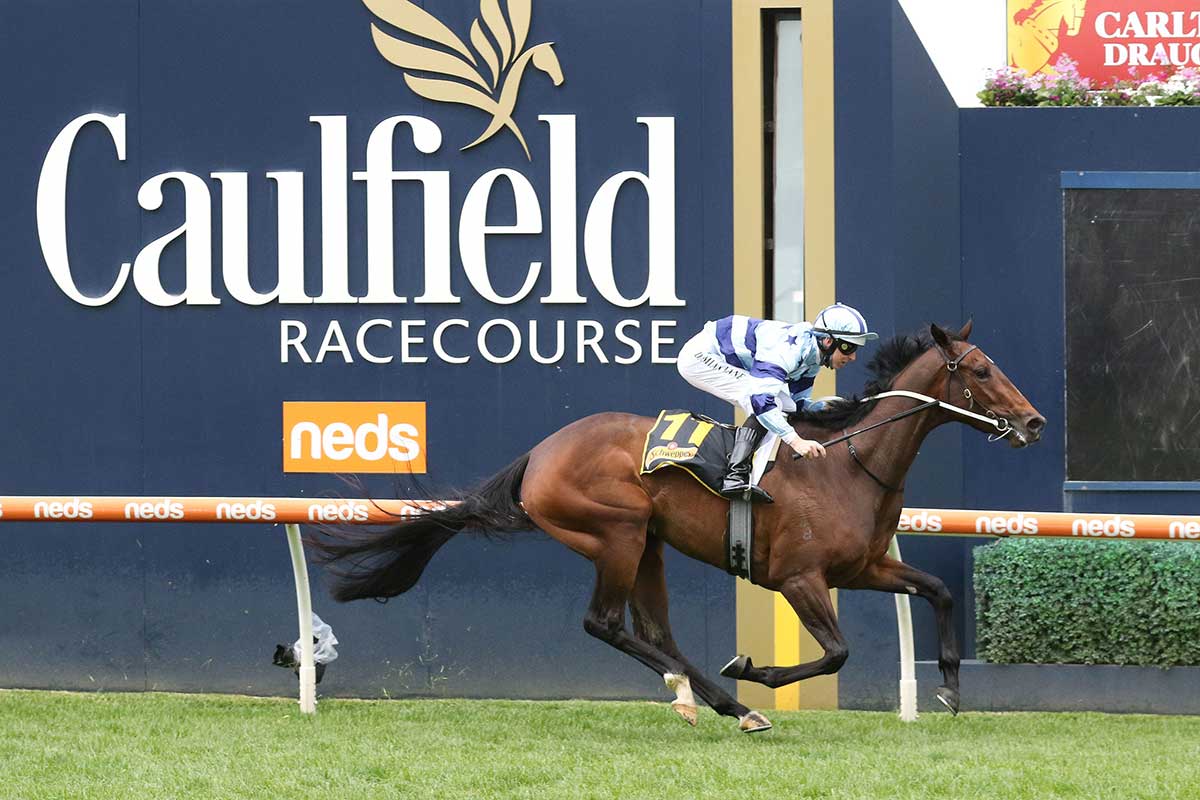
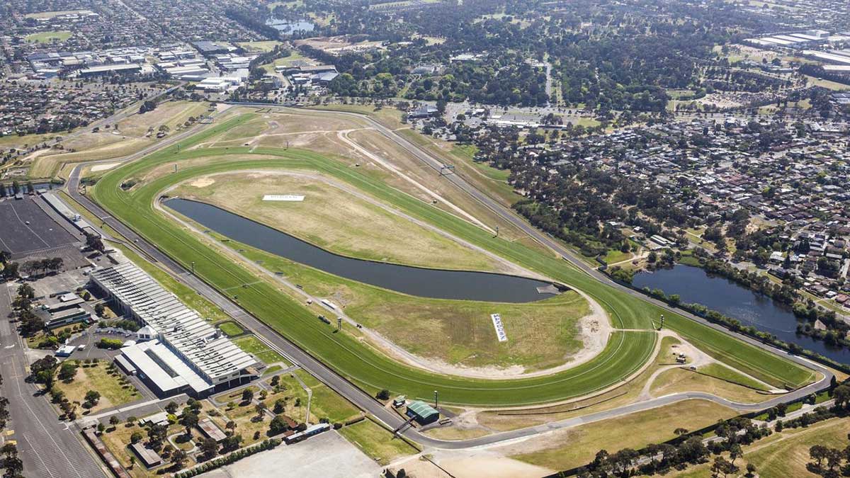
Caulfield, a residential area with a prominent metropolitan racecourse, is on Dandenong Road, 10 km. from Melbourne. Until 1994 Caulfield was also a municipal city. The origin of the name is uncertain, although John Caulfield, a builder who arrived in Melbourne in 1837, has been suggested as a source. The name Caulfield was in use on maps around 1857, generally in the vicinity of the present racecourse.
In 1859 horse racing was held on a rough bush track and the Melbourne Hunt Club held occasional meetings in Caulfield. A racecourse was laid out on the site where the Hunt Club kennel was kept. In 1876 the Victorian Amateur Turf Club was formed and obtained the site for its metropolitan race course. The first Caulfield Cup was run in 1879.
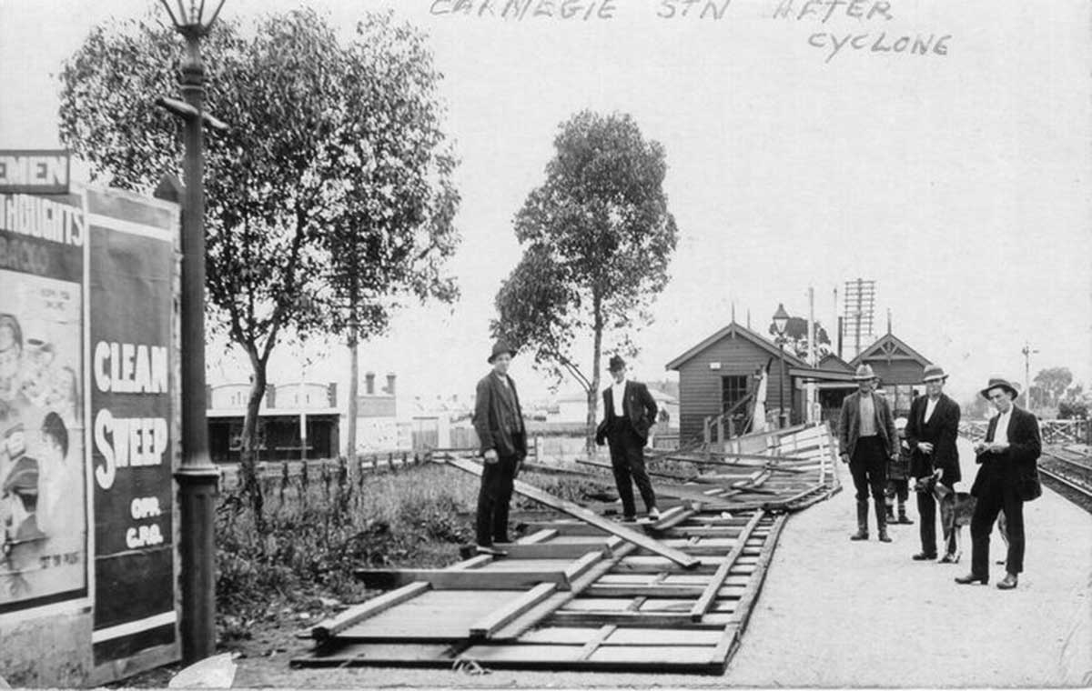
Carnegie Railway Station after a cyclone, 1917. Photo: Rohan Russell. Culture Victoria
The residential suburb of Carnegie lies 12 km. south-east of Melbourne on the railway line between Caulfield and Oakleigh. The area was originally known as Rosstown after William Ross, an entrepreneur who constructed a railway line through the area from Oakleigh to Elsternwick. In May, 1909, the railway station was renamed Carnegie, allegedly with the support of residents and the progress associations who thought it would be an inducement to obtain funds from the American Carnegie Foundation for a library. Neither did the funds appear nor is there contemporary documentary evidence of the idea, but no better explanation has been given. By the turn of the century estates were being opened up in the vicinity of the railway station.
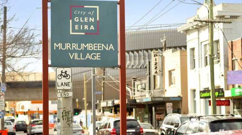
Murrumbeena is 13 km south-east from Melbourne's central business district. Its Local Government Area is the City of Glen Eira. At the 2006 Census, Murrumbeena had a population of 8232. Murrumbeena is quite small, and is generally known for its parklands. It is close to the larger suburbs Caulfield and Bentleigh. Murrumbeena railway station, on the Pakenham and Cranbourne railway lines, was opened on May 14, 1879. The name is of Aboriginal origin.
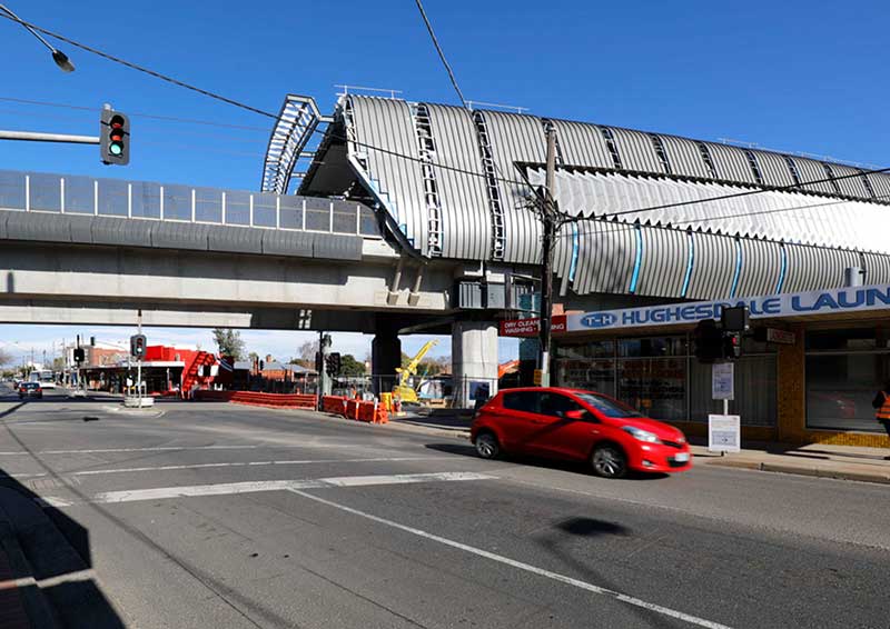
Hughesdale, 14 km. south-east of Melbourne, is positioned on the border (Poath Road) between the former Caulfield and Oakleigh cities and now Glen Eira and Monash cities. Hughesdale was the sit of the diversion of the Outer Circle Railway line (1890) from the Gippsland Line, but the area had no railway station until 1924. Coincidentally, an ill-fated line known as the Rosstown Railway diverged from the Gippsland line just east of Hughesdale, ending at Elsternwick, in 1891. The name came from Oakleigh's Mayor James Hughes, who, with the Poath Road Railway Station League, succeeded in having a railway station provided.
The residential suburb of Oakleigh, with its considerable secondary industry and predominantly Greek population, is 15 km. south-east of Melbourne, immediately beyond Caulfield and Malvern. Until 1853 the area was known as Scotchmans Creek, when the name Oakleigh was given to it. The name may derive form she-oaks growing near Scotchmans Creek, from Oakleigh Park, near Malvern Hills, Hertfordshire, England, or from an early settler, Mrs. Oakley.
In 1840 John McMillan leased the Scotchmans Creek grazing run, stretching over land from Mount Waverley to Oakleigh, which was later administered by a Shire named Oakleigh (1871-91) and then by Oakleigh borough (present day Oakleigh) and Oakleigh shire. Oakleigh shire was renamed Mulgrave in 1897. The connection between Oakleigh and Mulgrave was predominantly along Ferntree Gully Road, which began near the original Oakleigh township on Dandenong Road, known locally as the Broadway.
Oakleigh has a large historic Central Business District spanning some nine city blocks. Atherton Road is Oakleigh's historic commercial main street while Drummond Street is its former civic spine. This area contains many older commercial buildings including banks and retail complexes dating back to the early days of the city. There are a small number of multi-storey office buildings which date back to the city's growth period. The thriving shopping district has an abundance of butchers, bakeries, beauty salons, and specialty shops selling sweets. There are also multiple laneways with Greek-themed cafés.
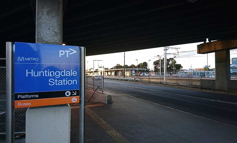
Huntingdale, formerly East Oakleigh, is a residential and industrial suburb 17 km. south-east of Melbourne, between Oakleigh and Clayton. Part of Huntingdale was occupied by the Melbourne Hunt Club from 1887 to 1929, and the link between them gave the area its name. The Hunt Club's land was acquired by the Eastern Golf Club, resulting in the opening of the Huntingdale Golf Club in 1940 (now in the Oakleigh South post code area). The golf course ultimately came to host the Australian Masters' Tournament, the first one being held in 1979.
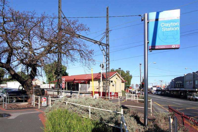
Initially an industrial suburb 18 km. south-east of Melbourne on the Oakleigh to Dandenong railway line, Clayton today has an extensive residentiasl area. The area was first occupied for farming purposes in the 1850s. The first township was on Dandenong Road where Clayton North is now situated. The construction of the railway line about one kilometre south of Dandenong Road in 1878 prompted the start of a second township where the line crosses Clayton Road. The origin of the name, however, is from a property near the station, Clayton Vale, owned by John Clayton during the 1860s-70s.
Monash University is the largest university in Australia, ranked in the world's top 100 and a member of the prestigious Group of Eight. Named after prominent World War I general Sir John Monash, it was founded in 1958 and is the second oldest university in the state. The university has a number of campuses, four of which are in Victoria (Clayton, Caulfield, Peninsula, and Parkville), one in Malaysia and another one in Indonesia. Monash also has a research and teaching centre in Prato, Italy, a graduate research school in Mumbai, India and graduate schools in Suzhou, China and Tangerang, Indonesia. Monash University courses are also delivered at other locations, including South Africa.
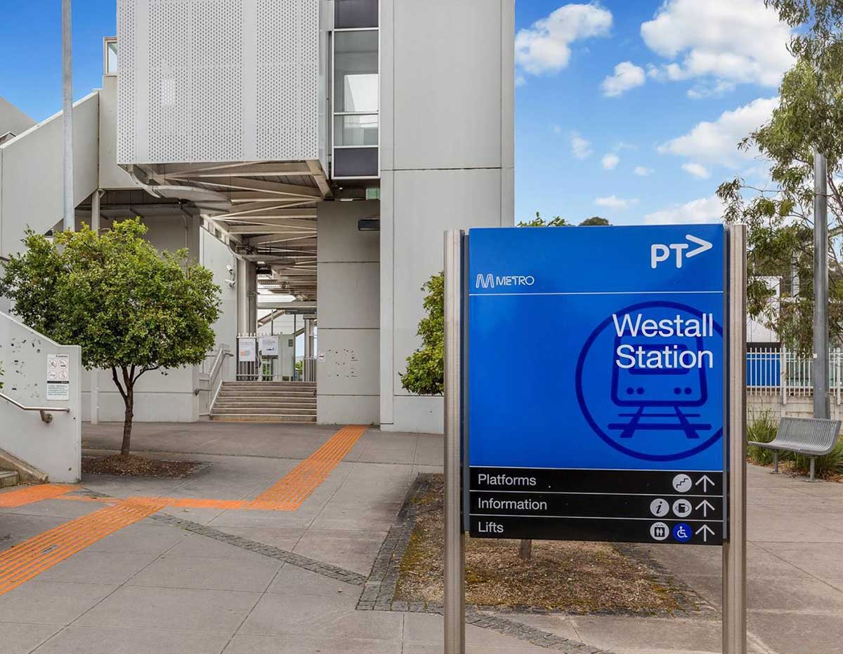
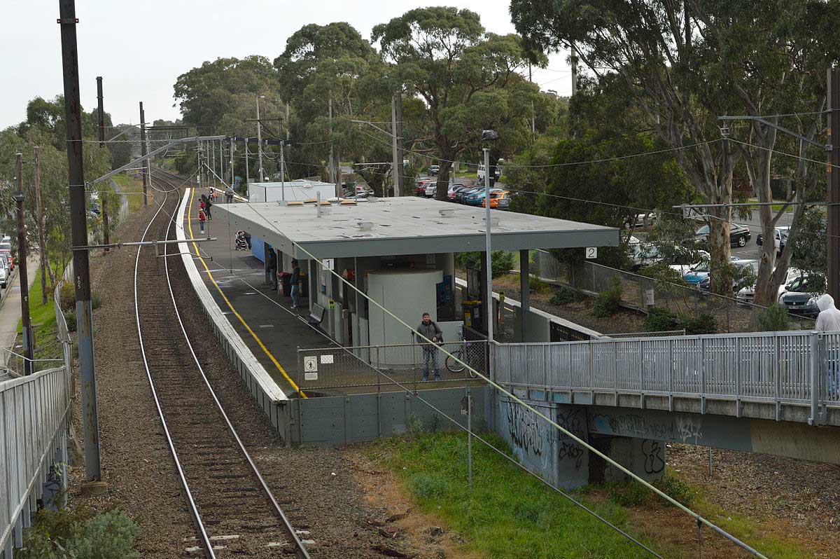
Westall is a railway station located in the suburb of Clayton South, on the Pakenham and Cranbourne railway lines. Westall station was opened as a workers only platform on October 16, 1954. It was provided for the adjacent Martin and King railway coachbuilding factory. The station was opened to the public on June 1, 1959 when all trains on the line were altered to stop there. In 1997 the Westall train maintenance centre was opened in the former goods yard, as part of the decentralisation of train stabling and maintenance from the former Jolimont Yards.
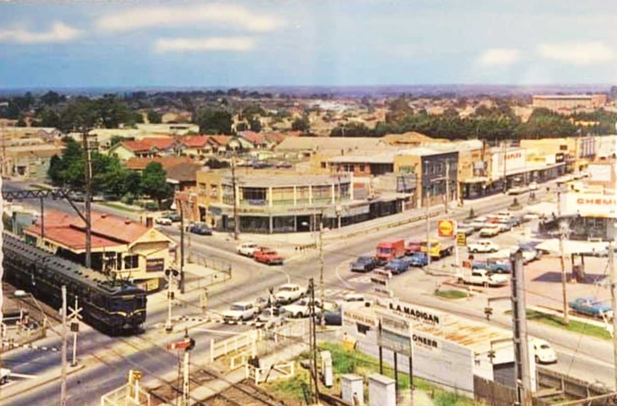
1960s Springvale
The name Springvale arose from permanent water sources for stock and travellers between Melbourne and Dandenong. In the 1850s a Spring Vale hotel was built near a newly surveyed route between Oakleigh and Dandenong, and its proprietor chose that name because of the natural springs in the area and its association with a place near the Bog of Allen in his native Ireland. The inn was located on the road to Dandenong where it intersected the track from Brighton and another running north south (i.e. the present Princes Highway, Centre/Police Roads and Springvale Road).
The Gippsland railway line (1879) had a Spring Vale Road stopping place, and in 1886 sales of subdivided land occurred (after rail fares had been reduced by extending the suburban fares zone from Oakleigh to Dandenong). The subdivided land adjoined the railway station, nearly two kilometres south of the hotel and school on Princes Highway. The railway station was opened on 1 September 1880 as Spring Vale. In 1887 a Wesleyan church was opened near the railway station along with the Sandown Park racecourse next to the railway line in 1891.
The suburb of Springvale is today Melbourne's Little Vietnam. During the 1970s and 1980s, many Vietnamese people moved to Springvale as a result of displacement during the events in the Vietnam War. Today, they make up the largest ethnic group in the area and Springvale is renowned for its Vietnamese shops, markets, and community. Nonetheless, Springvale is one of the most diverse suburbs in Australia.
The remnant of a former branch line, which went to Spring Vale Cemetery station, was located at the Down end of the station. It was provided with overhead wiring in 1922. The majority of the line was dismantled in 1952, with the remaining portion of the line becoming a siding. In mid-2013, construction commenced on a grade separation project to eliminate the Springvale Road level crossing immediately north of the station. As part of this project, a new station was constructed below street level, which opened on 22 April 2014.
Sandown Park is a railway station located in the suburb of Springvale, on the Pakenham and Cranbourne railway lines. The Sandown Racecourse and Sandown Greyhound Track are located near the station. Sandown Park station opened in 1889 as Oakleigh Racecourse, and was renamed Sandown Park in 1892. The station closed in 1955, and reopened with the current station 10 years later, in 1965.
Noble Park, 16 km. south-east of Melbourne, is bordered by Springvale on the west and the Dandenong Creek on the east. It is mainly residential and contains Harrisfield and Yarraman. The Oakleigh to Gippsland railway line had stations at Springvale and Dandenong and as land near the Springvale station underwent subdivision into small farm holdings, owners down the line subdivided their land.
Until the year after the second world war, Noble Park was mainly a farming community concentrated on market gardens, dairying and poultry. Small amounts of industry were near the railway station, along with housing. The town had six shops in 1923, and the 1933 census recorded 1,506 persons.
Yarraman is a railway station located in the suburb of Noble Park, on the Pakenham and Cranbourne railway lines. Yarraman station opened on December 21, 1976. Yarraman Park was the name of the local subdivision when the area was opened for residential development in the late 1950s. In 2015, the Level Crossing Removal Authority announced the grade separation of the nearby Chandler Road level crossing. Construction began in 2016, with the level crossing removed in 2018. Unlike with many level crossing removal projects, the station was not rebuilt.
Australian entertainer John Farnham received some of his schooling at Yarraman Park primary school. It was to his Aunt Mary's house in Yarraman Park (10 Joan Court, Noble Park) that John and his family went to live upon arrival as migrants from England, just four days after John's 10th birthday. Not long after their arrival, the Farnham family was given a lottery ticket and they won £10,000 which they used to build two brick veneer houses, one for the Farnhams (12 Doonbrae Avenue, Noble Park) and another nearby for John's grand parents.
A major regional centre, Dandenong is situated 31 kilometres south-east of Melbourne on the outskirts of the city. The name is thought to be a corruption of an Aboriginal word meaning lofty mountains, and referred to the ranges which overlook the area. The country is flat to undulating and was originally densely forested with red gum.
A road was made from Melbourne, reaching Dandenong, by the late 1850s, an important staging post for travellers into Gippsland. It became known as the 'gateway to Gippsland'. A township was surveyed in 1852. Milling of the red gum timber became an important industry, and charcoal burning, tanning, quarrying and brick making also flourished. A stock market was established in 1866. By 1861, there were 40 houses in the township housing 193 people. Dandenong Shire was proclaimed in 1873.
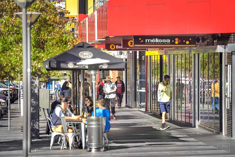
A regional transport hub and manufacturing centre of Victoria, Dandenong is located at the junctional region of the Dandenong Valley Highway, Princes Highway, Monash Freeway and Dingley Freeway, and is the gateway town of the Gippsland railway line into West Gippsland. At the start of the 20th century, Dandenong was an important regional city with its own suburbs. During the mid-20th century it became a major manufacturing and commercial area, and eventually an incorporated satellite city of the expanding Greater Melbourne conurbation. A business district, the former town centre covers much of its area and is one of the largest in Greater Melbourne. It is currently undergoing major transit-oriented urban renewal, which was first planned in the Melbourne 2030 strategy.
s
Hallam is 35 km south-east from Melbourne's central business district. Its Local Government Area is the City of Casey. At the 2006 Census, Hallam had a population of 9652. The post office opened on 1 May 1889 as Hallam's Road Railway Station and was renamed Hallam's about 1910 and Hallam about 1925. It closed in 1981, but reopened in 1994. As part of the Level Crossing Removal Project, the Hallam South Road level crossing was abolished on 2 April 2022, and was replaced with a rail bridge over the road, and included a new, rebuilt elevated station. The rebuilt station opened on 2 May 2022.
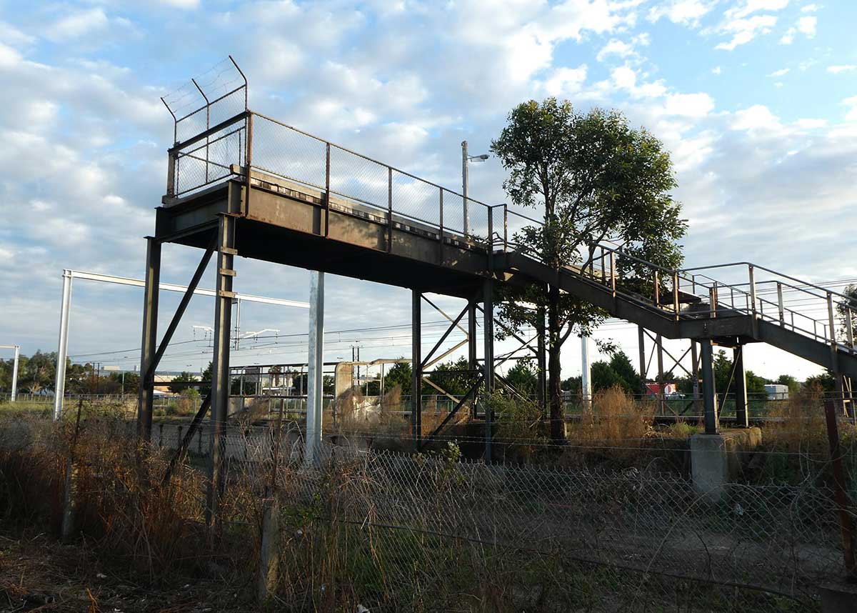
Disused GMH station
A disused station that serviced the GMH plant is located between Hallam and Dandenong stations. Work on the General Motors Holden factory at Dandenong commenced with the purchase of 152 acres of land in 1951, later expanding to 318 acres, the factory cost £9 million. Construction commenced in 1955, and was completed in 1956. The factory, along with the neighbouring International Harvester plant and Heinz factory had an immediate impact on the area. In 1986, a joint venture turned it into the sole plant for Toyota Corolla and Holden Nova production. The agreement between GMH and Toyota dissolved in 1991. Some assembly operations continued at Dandenong until 1994.
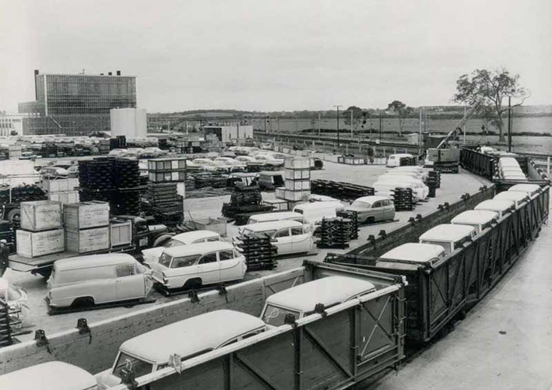
Above: a shipment of FB Holdens is being unloaded at GMH's own siding at the now-disused General Motors station. Further back are 1960-model Chevrolet Belair and Pontiac Laurentian bodies which had been shipped by rail from Adelaide.
The station was opened when construction of the General Motors Holden factory was completed in 1956. General Motors paid for the construction of the station, located at the site of a number of private railway sidings, at a time when suburban services to Pakenham did not exist. As a result, only a single platform was provided on the north side on the Down track, and services operated as extensions of Dandenong trains at factory opening and close times.
In 1991, when General Motors closed, the station was essentially isolated. A notice was issued stating that the station was to close from November 1991, however it remained open for a further eleven years, despite the closure and demolition of the factory, and the fact that the footbridge now led to a fenced-off, empty paddock where the factory had once stood. By the time the station was closed, only eight trains stopped at the station each day, four each way. Station announcements on the line continued to announce that trains would stop at "all stations except General Motors" until April 2007.
Narre Warren is a suburb in Melbourne, 37 km south-east from Melbourne's central business district. Over the years Narre Warren has grown from a semi-rural residential town to become a part of a major growth corridor in the south-east of Melbourne. The original Main Street is some distance from present-day central Narre Warren, beside the railway line, causing development to occur away from the original settlement, and the building in which the general store also served as the post office, still exists as a local landmark, established 1857. A multitude of new housing developments have seen Narre Warren expand to such an extent that it now adjoins neighbouring suburbs such as Berwick.
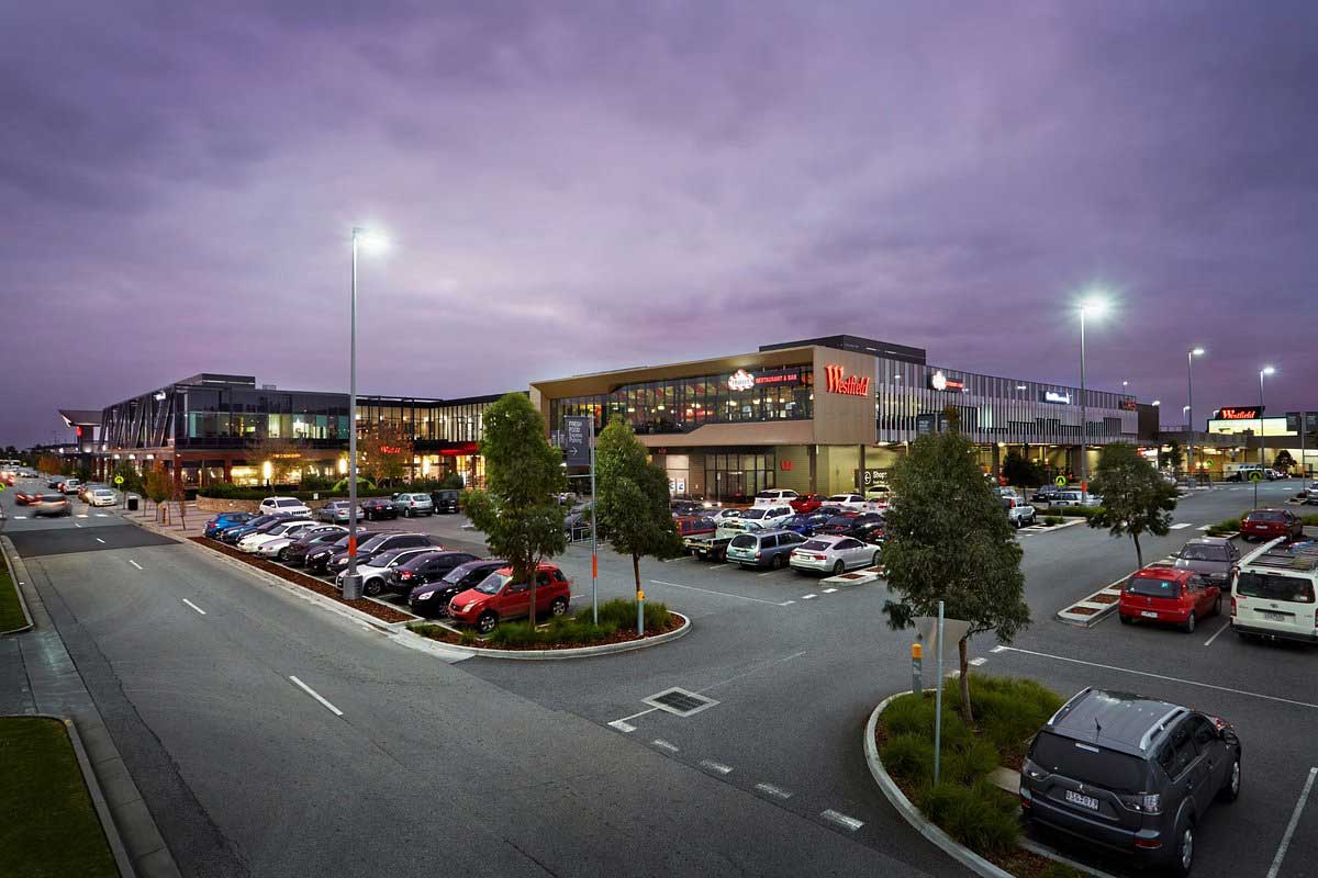
Kim Cang Temple, a Vietnamese Buddhist temple, is located in the suburb. Westfield Fountain Gate (named after one of the earlier subdivisions) is at the heart of the main commercial precinct in Narre Warren. It is one of the largest shopping centres in Australia, housing many of Australia's major retailers. The centre has been made famous by the popular Australian television show Kath & Kim, parts of which were also filmed at Westfield Southland.
The name comes from the Aboriginal ' Nerre Nerre Warrene', believed to mean ' little hills'. In the first part of the 19th century, the Colonial Secretary approved a large area alongside Dandenong Creek at Narre Narre Warrene to be secured as the site of anAaboriginal Protectorate and for the Native Police Reserve. Here the Aboriginal men of the Native Police Force were allowed to hunt, fish and work the gardens but were required to forgo all other tribal activities except for those activities that would benefit the police in their work, which entailed defending settlers against Aboriginal freedom fighters.
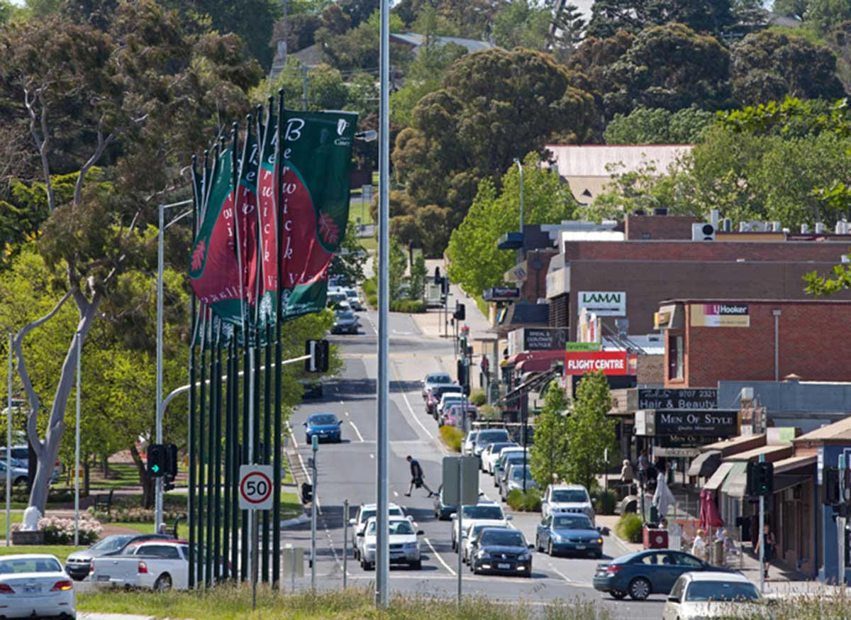
Berwick, once a small agricultural town, and now an outer suburb, is located 43 kilometres south-east of Melbourne. The area was part of Cardinia Creek run and was named by an early leaseholder, Robert Gardiner, after his birthplace, Berwick-on-Tweed. Land was subdivided in 1854 and soon a store, post office, hotel and other businesses were established. Wheat, barley and potatoes were grown on the fertile soil, with a flour mill operating for a while. Later dairy farming and cheese making became the main activities.
The construction of a coach road from Melbourne to Gippsland, and then the railway from Melbourne in 1877, spurred continued development. Wilson's quarry, opened in 1859, supplied ballast for the railway line. A spur line connected with Berwick railway station to transport the metal. The quarry was an important industry, working fairly continuously over the years.
Beaconsfield, 46 km east of central Melbourne on Cardinia Creek, was originally known as Little Berwick. It is immediately to the east of Berwick. A small settlement grew up in the vicinity of Bowman's Inn, a coaching stop on the road to Gippsland. In the 1870s gold was found in the gullies north of Beaconsfield. Timber getters followed the prospectors. The foothills were found to be suitable for orchards and fruit trees, particularly apples and lemons, were planted. In 1881 a railway station was opened on the Gippsland line and named Beaconsfield after the prominent statesman Disraeli, Lord Beaconsfield. The name had already been used for the post office at Beaconsfield Upper for several years but was transferred to the railway station and surrounding settlement.
Officer is 49 km south-east from Melbourne's central business district. The suburb is named after the Officer family, who were early settlers in the area. A timber industry was established, and by 1870 timber was being transported from the railways sidings named Officer's Wood Siding. This was shortened to Officer's and later, Officer. A brickmaking industry began in the 1880s, but died away after the collapse of the land boom. The population was sufficient to justify a Post Office opening on 16 December 1885 The railway station was known as Officer's Siding until 1888. It has the retutation of being the least used station on Melbourne's suburban rail network.
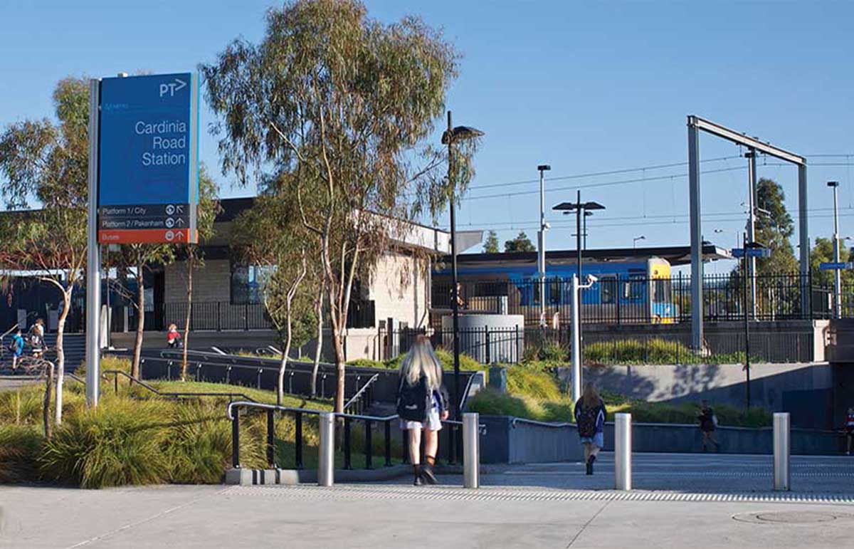
Cardinia Road railway station was opened on 22 April 2012 to service new subdivisions to the west of Packenham. Construction works commenced in October 2010, and the station opened eighteen months later. On 6 December 2020, as part of the Level Crossing Removal Project, the level crossing was grade separated, and replaced with a road overpass. The boom barriers, flashing lights and bells were dismantled in February 2021.
Lakeside Recreational Reserve, Packenham
Pakenham is a satellite suburb of Melbourne on the edge of the West Gippsland region, located 56 km south-east from Melbourne's central business district. At the 2006 Census, Pakenham had a population of 19,644. Pakenham is in some aspects still considered as a regional suburb. It was named after Sir Edward Pakenham, a British general who fought in the Peninsular War. Pakenham Post Office opened on 1 February 1859; Pakenham Railway Station Post Office opened on 11 June 1888 and was renamed Pakenham East in 1908.
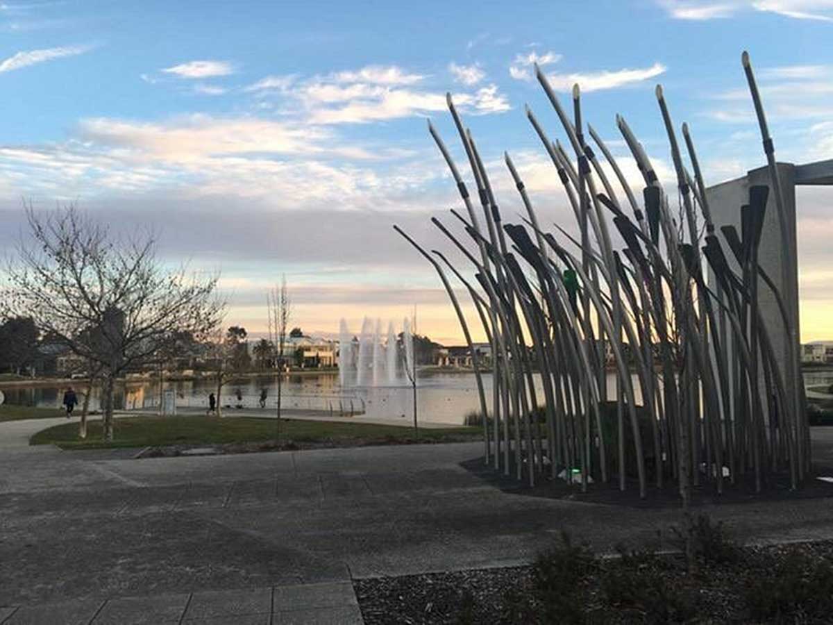
Pakenham serves as a major retail centre in the Cardinia Shire, with outlets including an Aldi supermarket, two Woolworths supermarkets, four Coles supermarkets, two Bunnings and two McDonald's. The town has become a major growth area in south-eastern Melbourne as new housing developments have boosted its population and infrastructure, as exemplified in the development of the Lakeside, Heritage Springs and Cardinia Lakes estates.


Design by W3layouts