Wollongong
The Illawarra is a coastal region situated immediately south of Sydney, extending from the southern hills of the Royal National Park in the north to the Shoalhaven River in the south. It encompasses the cities of Wollongong (the third-largest urban area in New South Wales), Shellharbour, the town of Kiama, Lake Illawarra, and a northwardly narrowing strip of coastal plain alongside the Illawarra escarpment, which leads up to the south-west fringe of Greater Metropolitan Sydney.
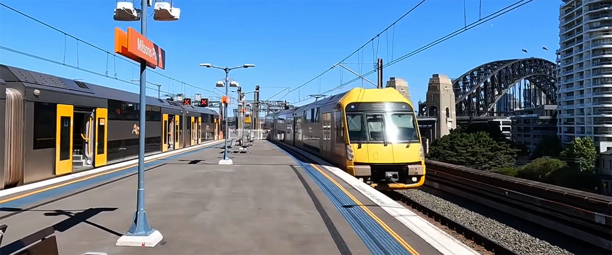
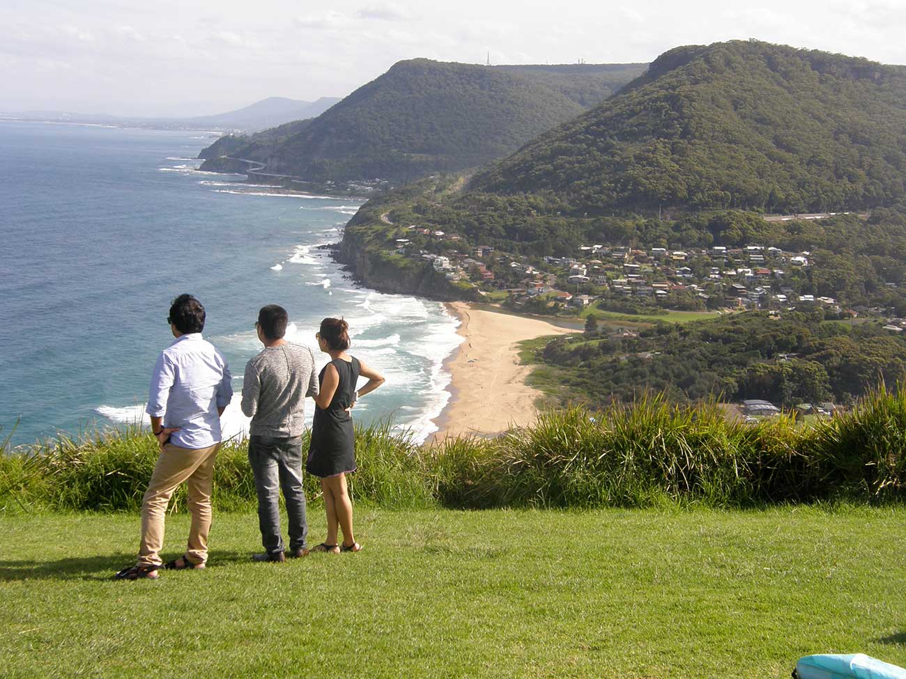
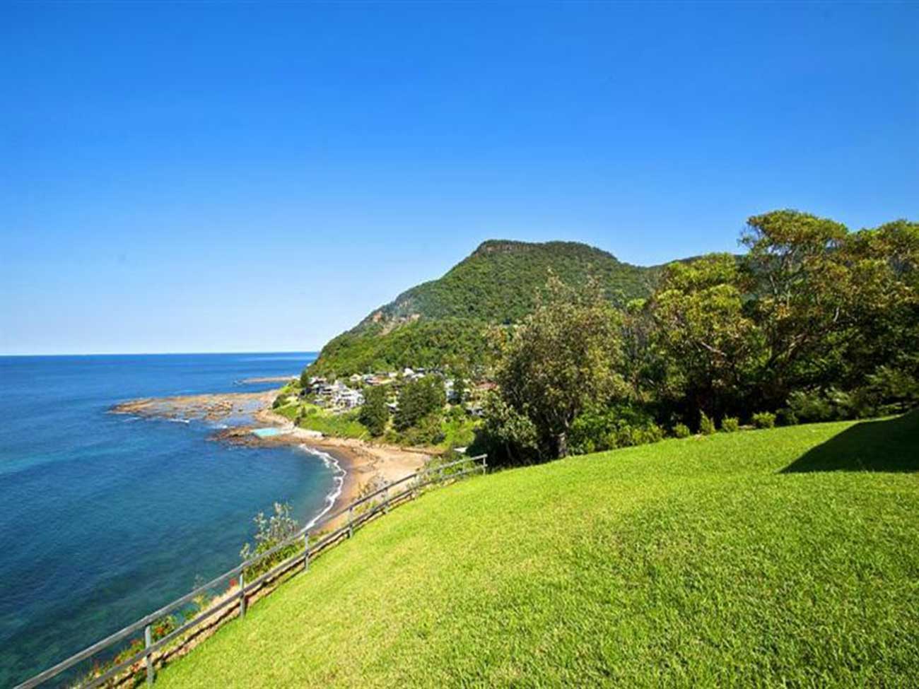
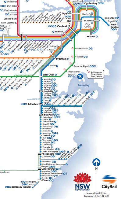
The Illawarra railway line provides a frequent, effecient and inexpensive train service to the area from Sydney. Entering the area at the southern end of Royal National Park, through what is now known as the Sea Cliff Coast, to Wollongong, and then Kiama, the line passes by many beaches and through numerous towns, giving the one-day visitor to the region a muliplicity of choices of places to go, and things to see and do on this picturesque stretch of coast.
Travel Times (from Central station):
Sydney to Wollongong: 1 hr 40 mins
Wollongong to Kiama: 49 minutes
Trains to the Illawarra region, Wollongong and Kiama leave the Sydney metropolitan area via the Illawarra line. Trains on the South Coast line stop at the suburban stations of Redfern, Wolli Creek, Hurstville and Sutherland.
Selected services continue on to Nowra and Berry from Kiama.
It is a common belief that the parish, township and shire of Sutherland were named after Forby Sutherland, a sailor with Lieut. James Cook's Endeavour who died and was buried at Kurnell, which is within the shire's boundaries, in 1770. This is not so - historical records show that in 1835 Sir Thomas Mitchell named the first parish south of the Georges River the Parish of Southerland, presumably because it was the most southerly parish of the Sydney region. The "o" was accidentally left out when the name was gazetted, leading some to believe that Mitchell came up with the name of Sutherland.
To further cloud the issue, the railway station appears to have been named after John Sutherland, Minister for Works 1860-1872, who was the driving force behind the extension of the railway line across the Georges River to the Parish of Sutherland. The township which grew up around it took its name from the station. The railway link opened in December 1885


Engadine, to the south east of Sutherland, is bounded by The Royal National Park to the east, Heathcote National Park to the south west and the Holsworthy Military Reserve to the west beyond the Woronora River. Visitors to the suburb can view across the Sydney Basin from its southern edge across to the Sydney CBD. The area also features rolling sandstone slopes and cliffs in places, with an abundance of native trees throughout.
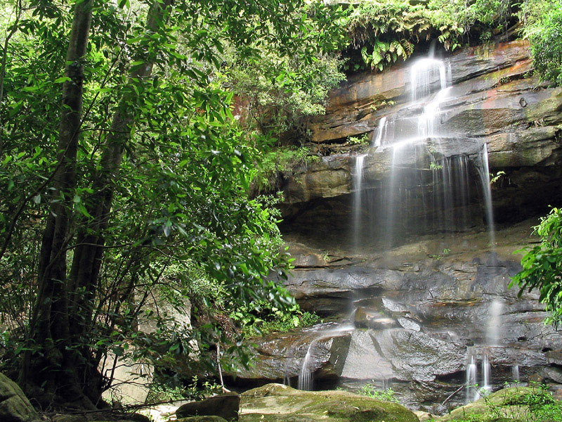
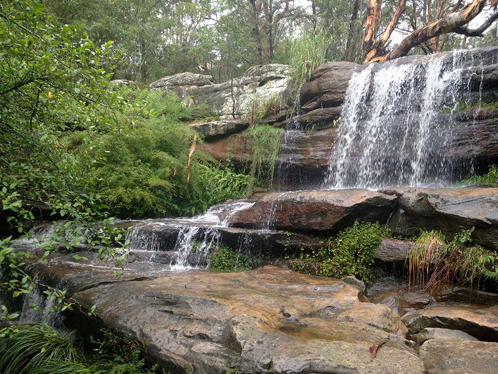
The very pretty Engadine Falls, on Engadine Creek, are the closest falls in Royal National Park to a railway station. As its name suggests, that station is Engadine. To reach the falls, enter the National Park from the station entrance and take the track almost immediately to the left. The falls are less than a kilometre down the track. This line is serviced by Sydney to Waterfall trains. Sydney to Wollongong/Kiama trains do not stop at this station.
Bottle Creek falls on Bottle Creek
Heathcote was named by Sir Thomas Mitchell in 1835 in honour of a fellow officer during the Peninsular Wars (1809-14). The village here was originally called Bottle Forest; Bottle Creek, a tributary of Heathcote Creek, still flows through it. The original township was surveyed in 1842 and is now East Heathcote. The name Heathcote was used in 1887 for a home built there by Isaac Harber, a brick manufacturer. Today an outer suburb of Sydney, Heathcote has retained much of its natural environment, a fact reflected in many street names which recall the natural flora of the area. This line is serviced by Sydney to Waterfall trains. Sydney to Wollongong/Kiama trains do not stop at this station.
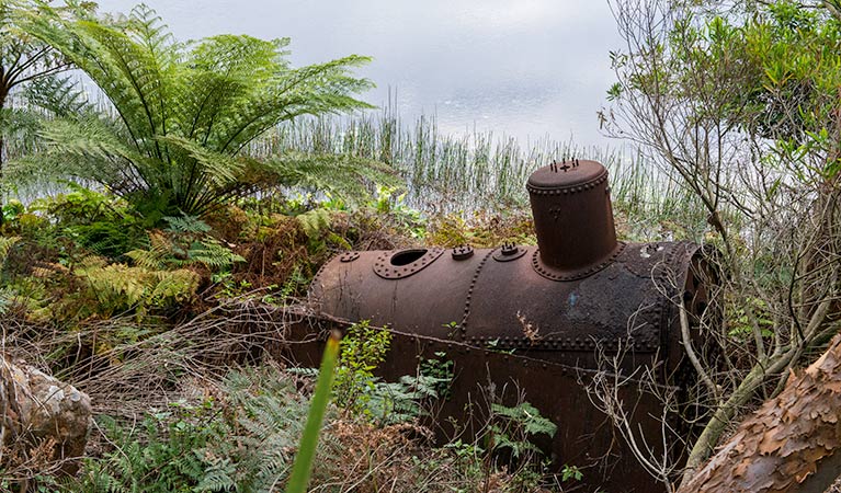
Steam driven pump at Lake Toolooma
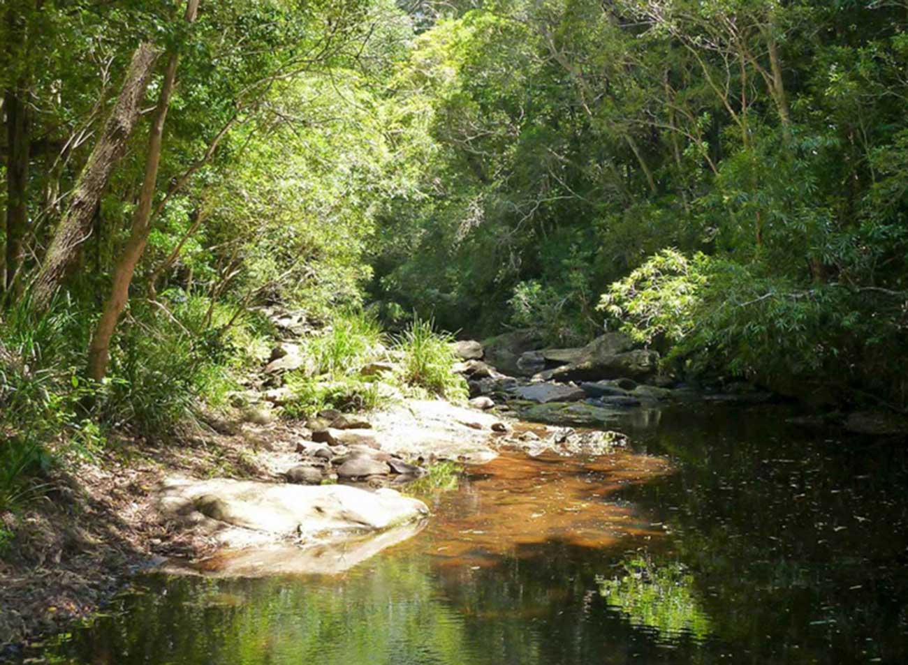
The lovely Lake Toolooma Trail bushwalk may only take a couple of hours to complete, but the wonderful sense of solitude it promotes gives you a real feeling of escape. Lake Toolooma trail leads you through uninterrupted bushland to a scenic secluded dam that offers great birdwatching. Though it can be quite steep at times, the trail, like most of the walks in Heathcote National Park, is easily accessed from Waterfall train station. Soak up picturesque views including Sydney sandstone vegetation and lovely water glimpses as you hike along this rough track. Keep your eyes peeled for birds like honeyeaters, wattlebirds and delicate fairy wrens.
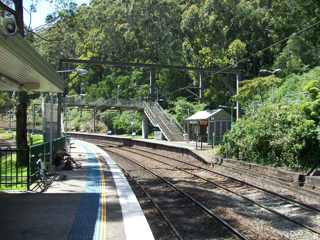
Waterfall, one of the most southerly localities in the Sydney region, is 38 km south of the Sydney central business district. Waterfall is bounded by The Royal National Park to the east, and Heathcote National Park to the west. Waterfall railway station is the terminus for the CityRail suburban Illawarra line. However some trains do terminate one stop further on at Helensburgh. Waterfall is also a stop on the south coast railway. Platform 1 to Sydney terminal, platform 2 to Port Kembla, Dapto and Kiama.
Waterfall was created by rail workers who built the line from Sydney to Wollongong in the late 19th century. Waterfall is the highest point on the line, with a steep rising gradient one end, and a falling gradient the other ends, and sidings were provided in both directions to allow freight wagons to be stowed and shunted. Waterfall derived its name from the waterfalls close to the railway station. McKell Avenue, the southern border of the Royal National Park, was originally called Waterfall Road.
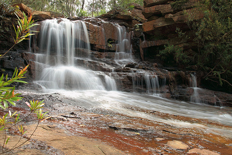
National Falls, within Royal National Park, are the waterfalls that gave the locality of Waterfall its name. National Falls is, in fact, a two-tiered waterfall in which the upper falls drops some 6 metres onto a rocky platform before plunging deep into the valley below via the second falls. A novel feature is the ability to walk into the overhang over which the upper falls cascades, allowing access behind the water as it falls. Located beside The McKell Drive not far from the Waterfall park entry point but are best accessed by road.
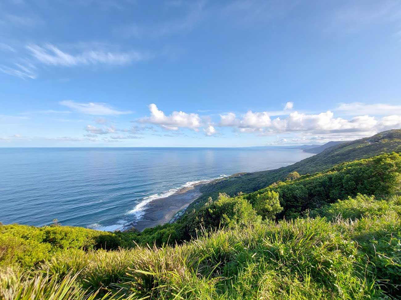
The South Coast Railway Line passes through Royal National Park. The Park is the second oldest national park in the world, offering spectacular scenery from sub-tropical rainforests and sandstone heathlands, to dramatic coastal cliffs and unspoilt ocean beaches. "The Royal" is home to many great walks that hug the park's coastline, taking you along the cliffs, beaches and escarpments ranging from 1km to 26km.
Uloola Campground
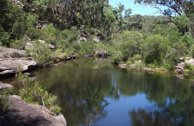
Now that the Royal National Park railway branchline is used only by trams from the Loftus Tramway Museum, the only direct access to the northern end of the Park by rail is from Heathcote or Waterfall stations. They are joined by a track that wanders through the western section of the park. From Waterfall station, take the fire trail at the east end of the oval on The McKell Avenue to the south of the station. Known as the Uloola Track, it leads past Callaghans Tor and Uloola Swamp to Uloola Falls. On the north side of the Uloola Brook above the falls, take the the Karloo Track to Uloola Pools and Karloo Pool, a large swimming hole on Kangaroo Creek. Continue on to Heathcote station for the return train trip to Sydney. Allow 4 to 6 hours. Moderate walk.
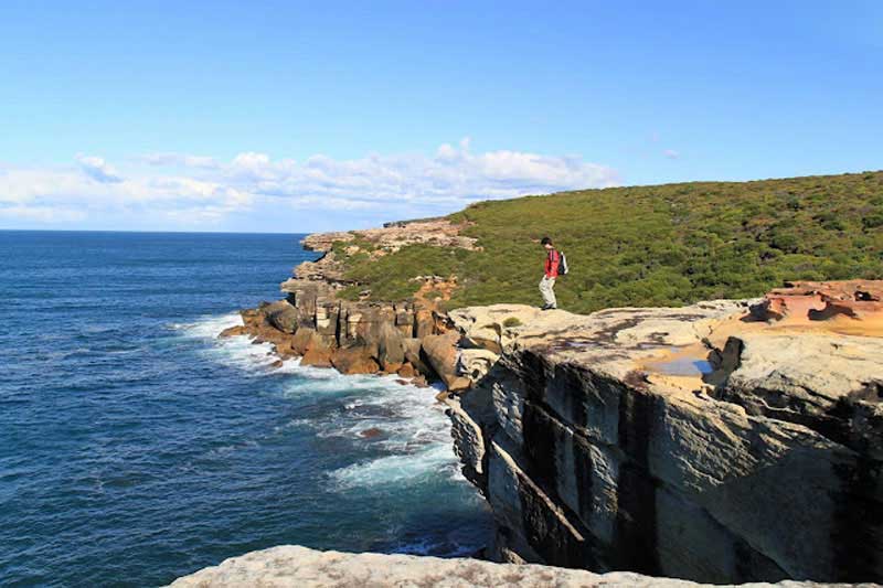
For over 100 years, the Royal National Park Coastal Track has been a "must-do" walk for visitors to Sydney who want to explore a little of what is beyond Sydney on foot. This walk commences at Bundeena and follows the coast for about 30 km past some of the most dramatic coastal scenery you could every wish to see. Along the way you'll pass The Waterrun and Curracurrong Waterfalls (which plunge in spectacular fashion off the cliff top to the ocean below); Wattamolla (picnics, camping, lagoon and swimming, waterfall); Garie (swimming, surfing); North and South Era (swimming, surfing, wildlife, camping); Burning Palms (swimming, surfing, camping); Palm Jungle (forest of palms and vines). Join Cliff Track at Garrawarra Ridge, continue south then take track through bush near Lady Wakehurst Dr to Otford, or start from Otford and do the walk in reverse.
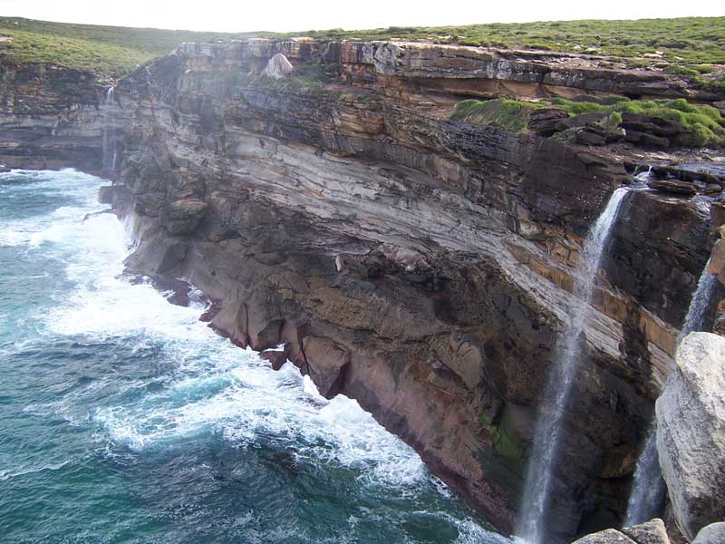
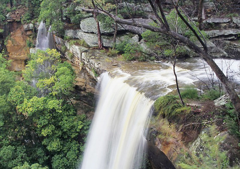
The dramatic Curracurong Falls, a pair of waterfalls which plunge of the cliff face into the sea after rain
For a half or full day walk, begin at either end and allow enough time to return before dark or in time to catch ferry or train back (check timetables before embarking on this trip). To walk the full length of the coastal track, allow 2 days with an overnight camp along the way. Easy to moderate walk.
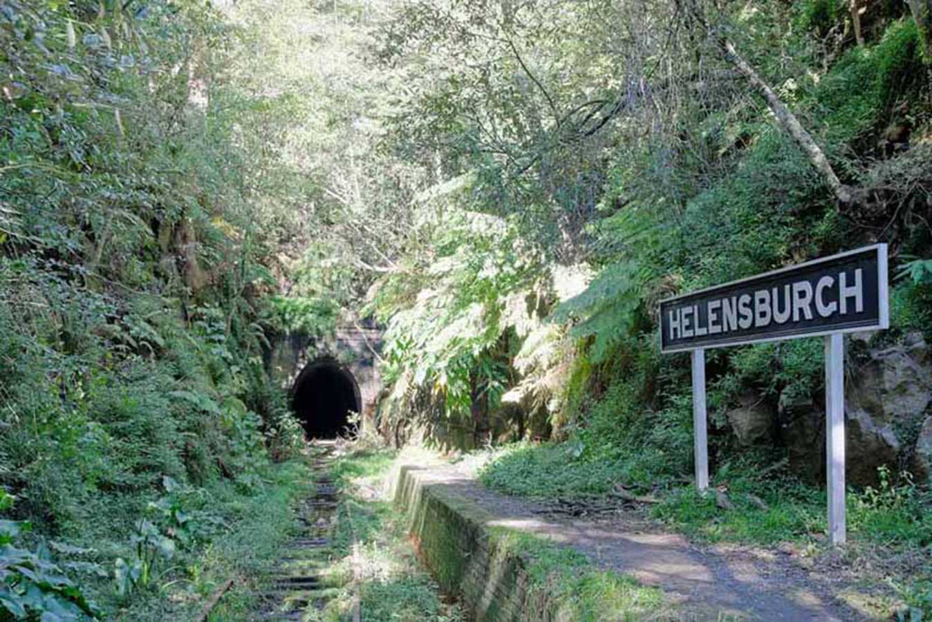
The small town of Helensburgh is known as the gateway between the cities of Sydney and Wollongong, as it is located roughly halfway between the two (45km south of Sydney's CBD and 34km north of Wollongong). The town is on the Woronora Plateau. It is separated from Otford to the south by a high hill and Otford Road. It is separated from Waterfall by tight twists of railway descending from the South Coast Line's highest point at Waterfall to Helensburgh Station.
Kelly's Falls
Helensburgh is surrounded by the bushland of Royal National Park, the Garawarra State Conservation Area and the water catchment of the Woronora Dam and adjacent Heathcote National Park, so is environmentally sensitive, though picturesque and naturally bound. This bushland location also makes Helensburgh susceptible to damage from frequent summer bushfires. The drysclerophyll bush is home to several walking tracks and lyrebirds are not uncommon nearby. From Helensburgh you can access lookouts over Kelly's Falls, a waterfall that marks the top of the Hacking River and serves as a great backdrop for a picnic or bush walk.
The sleepy village of Otford is situated in the Otford Valley, north of Stanwell Park and Stanwell Tops. The town is on the southern tip of the Royal National Park and is used as the southern entrance to the park for both motorists and bushwalkers as well as the start/finish point for walks through abandoned railway tunnels between Otford and Helensburgh. The Otford lookout, across the waters of the Pacific Ocean at the southern end of Royal National Park, is in walking distance from the station.
The original line was built in 1885. The current railway tunnel between Otford and Stanwell Park was built in 1917 as the buildup of smoke in the unventilated route and the steep descent led railways to build a different route. The abandoned, original railway tunnel between Otford and Stanwell Park was used for a mushroom farm but is now disused. Otford railway station once had award winning gardens and picturesque buildings, but is now a stark concrete and brick commuter stop.
Stanwell Tops rests on the Illawarra escarpment, overlooking the Pacific Ocean and the neighbouring village of Stanwell Park. It is bounded on all sides by state-forest reserves and other forested crown lands, which are contiguous with the Royal National Park and the Garawarra State Conservation Area.
Though Stanwell Tops is actually a small residential town, the name is generally used to identify Bald Hill, a flat area above the ocean cliff face near the village. Bald Hill, at the apex of Lawrence Hargrave Drive, is a mecca for paragliding and hang gliding activities, with many gliding from Bald Hill down to Stanwell Park beach, which lies nested between the high sea cliffs.
Stanwell Tops is not on the railway line, the closest station being Otford. The walk from the station to the lookout is 2.2 kms and take just under 30 minutes each way.
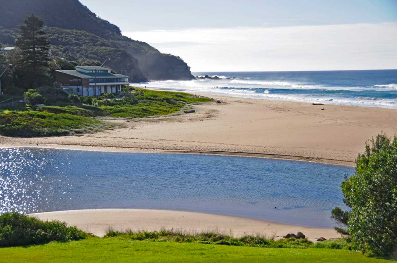
Stanwell Park is a picturesque coastal village at the northernmost point of the Illawarra coastal strip too the south of SRoyal National Park. It is situated in a small valley between Bald Hill to the north, Stanwell Tops to the west and Mount Mitchell to the south. It has two lagoons from the villages two creeks, Stanwell and Hargrave Creeks and a pretty swimming beach running between headlands. It has a very pleasant picnic area.
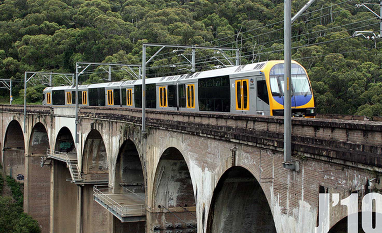
One of the village's most famous places of interest is the curved railway viaduct over Stanwell Creek Gorge. It was built in the 1910s when problems with the old railway route forced the construction of a new track higher up the mountainside. At 65 m above the creek bed, surrounded by profuse rainforest vegetation and containing an estimated five million bricks, it is the largest railway viaduct in Australia.
The coal in the escarpment, which gives the coastal village of Coalcliff its name, had been known of since early colonial days, but it was not until 1850 that it began to be excavated. The Coalcliff Railway Tunnel No. 8 (also known as the Clifton Tunnel) is owned by the State Railway and was the first tunnel built on the Illawarra Line. The line and tunnel were opened on 25 July 1888, extending the then isolated line so that passengers could transfer by coach at Coalcliff to the operating line between Waterfall and Sydney. Lined with 3 million bricks, the Heritage-Listed tunnel is the second longest tunnel on the Illawarra line.
Leeder Park, situated on Paterson Road, is a rest park and children's payground which provides access to Coalcliff's tidal rock pool. The Sea Cliff Bridge surrounding the coal cliffs was opened on 11 December 2005 and offers a spectacular walkway and cycleway above the ocean and along the escarpment. There are splendid views offered towards Wollongong and Port Kembla in the south, and towards Bald Hill and the Royal National Park in the north. Coalcliff Beach fronts the valley, but because of three dominant rips, bathers are recommended to use the Coalcliff's rockpool, situated south of the beach.
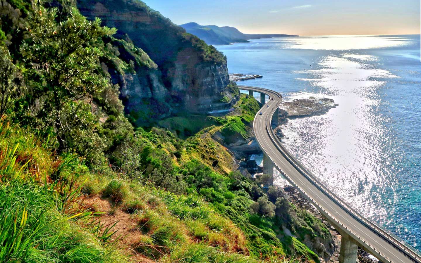
Sea Cliff Bridge, located is one of only seven off-shore parallel to coast bridges in the world. It was built to replace a section of Lawrence Hargraves Drive which followed the shoreline between the coastal villages of Coalcliff and Clifton. This roadway had been carved out of the cliff face in the area, but the increase in road traffic combined with the occurrence of boulders falling onto the road, demanded a safer means of travel. The solution was this balanced cantilever bridge.
Featuring two lanes of traffic, Sea Cliff Bridge boasts spectacular views and is a feature of the scenic Lawrence Hargrave Drive. The bridge was named by 11 Year old schoolgirl Makenzie Russell (St. Brigids) following a naming competition opened to local primary school students.
The bridge can be seen from the train between Coalcliff and Scarborough stations. If you would like to visit the bridge, alight at Coalcliff station and walk south along Lawrence Hargraves Drive for 1.3 km (18 minutes each way).
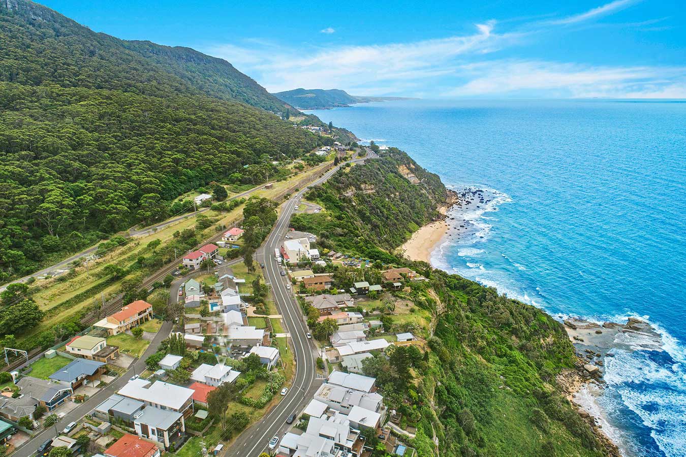
Like its neighbours, Scarborough sits on a narrow stretch between the Illawarra escarpment and sea cliffs. The escarpment behind Scarborough is approximately 300 metres above sea level. Scarborough is a popular surfing beach and hosts a number of surfing competitions. The Scarbough Hotel was built in 1885 to coincide with the opening of the South Clifton (Scraborough's original name) to Wollongong. Its Seacliff Garden and Horizonal Balcony, which offer commanding views out to sea and along the coastline, have ensured the hotel remains a favourite spot to relax with family and friends over a drink or meal.
The escarpment is a very striking feature of the environment. There are two main areas of rock fall and these are along the coastline in the Coalcliff/Scarborough area and along the scarp. The former area is subject to frequent small rock falls due to the rate of erosion of the toe of the cliffs by wave and salt spray action.
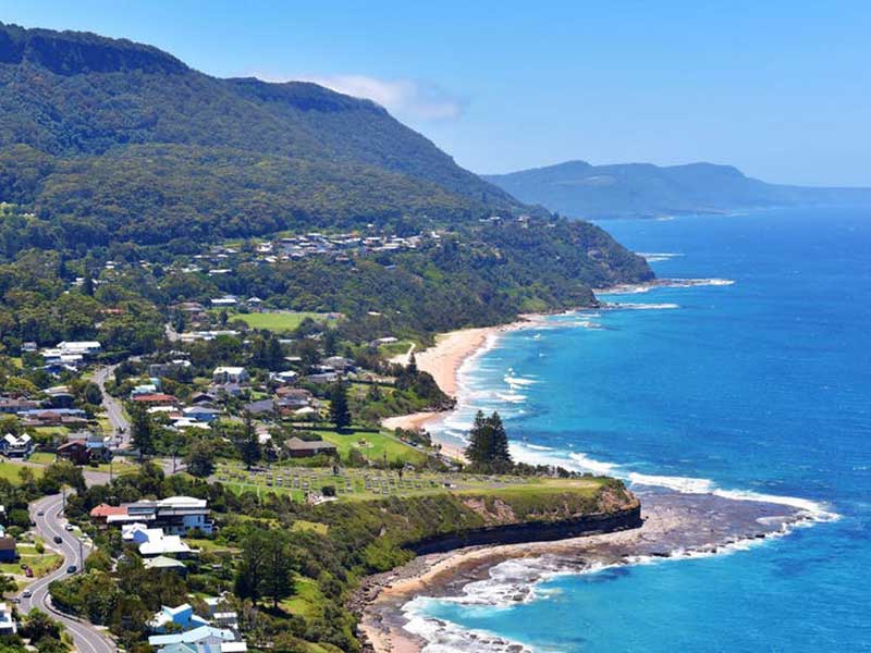
Photo: Visit NSW
Wombarra which lies between the escarpment and the Pacific, in a thin strip with Scarborough to the north and Coledale to the south. On a rock platform with cliffs rising above it is a large, clean pool. It is idyllic and seems to be rarely used. The Scarborough Wombarra Cemetery which is set on a headland and, although much smaller, is the South Coast's panoramic equal to Bronte's iconic Waverley Cemetery.
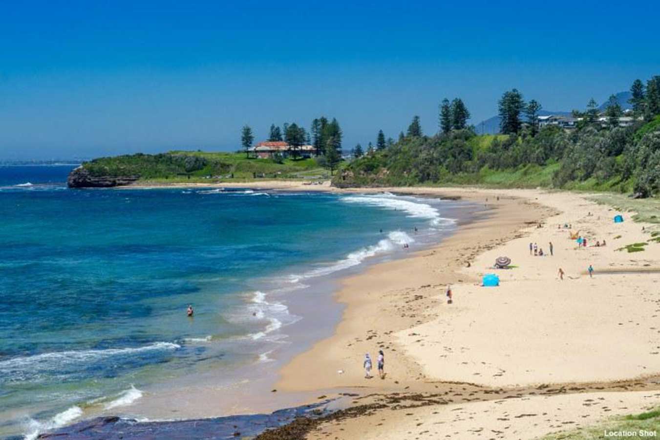
Coledale is a small sea-side village located 18 km north of the Wollongong's central buasiness district. Coledale Beach is a great place to swim, surf, fish, dive, or just sit back, enjoy the views and the pounding of the surf at your feet. Regular visits by dolphins playing just off the beach and close views of migrating Humpback and Southern Right whales just add to the experience. Coledale Beach is also a haven for campers, with a reserve right on the beach edge. There are fantastic views of the waves, and both ends of the beach are closed in with rock formations.
Previously spelt Coaldale, the name refers to the coal deposits in the area. The first coal mine was opened in 1889, the last mine closed in 1926. The escarpment foothills, between the Illawarra railway and the escarpment face, are steep and generally forested and form the low level backdrop to the plains and coastline.

Austinmer Beach is one of Wollongong's most popular beaches, located just 25 minutes north of the central business district. Its popularity dates back to the 1900s when people came by train to stay at several guest houses. The relatively small beach is wedged between two low headlands and their extensive rock platforms. Two large rock pools lie on the southern rock platform. A second smaller and unpatrolled beach lies directly to the north of Austinmer beach, and is known locally as "Little Austi".
Austinmer attracts large summer crowds to its patrolled beach (between September to April), and has ample parking, picnic facilities, shops and eateries to cater for the seasonal influx of visitors. As a result, Austinmer is one of the best places on this coastal strip to visit on weekdays, when the number of visitors is down, but the cafes, restaurants and hotel are still open for business.
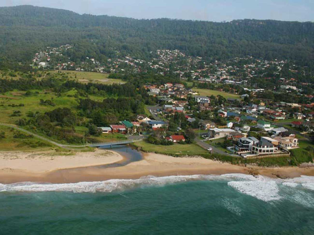
The oceanside town of Thirroul lies between the Pacific Ocean and a section of the Illawarra escarpment known as Lady Fuller Park, adjacent to Bulli Pass Scenic Reserve. The town's major commercial area lies between an area just north of Bulli Pass, where the Princes Highway splits to form the Lawrence Hargrave Drive, to Thirroul Station. The boutique clothing and jewellery shops, florists, conveniences stores, news agencies and other shopping essentials have made Thirroul the main shopping area for the northern suburbs of Wollongong. Many cafes can be found in Thirroul's main commercial area, adding to its popularity as a seaside holiday town.
The Beaches Hotel and Ryans Hotel are lively pubs for locals and tourists alike, both located on the main road. Thirroul has many fashion, gift and lifestyle shops along the main streets. It is also home to King's Theatre (1913), which is now known as Anita's Theatre.
The annual Thirroul Seaside and Arts Festival is held over a weekend in the first week of April. It includes activities such as art exhibitions and workshops, kids activities, live stage entertainment, buskers, a variety of stalls, pony and carnival rides and face painting.
Located on the northern outskirts of Wollongong, the chic coastal village of Bulli in the Illawarra region of NSW boasts beaches, colonial streetscapes and mining heritage. The mining of coal – nicknamed black diamonds – began in Bulli in the 1860s. Learn the stories of the coal miners, mining tragedies and underground heroism at Bulli Black Diamond Museum Heritage Centre, found in the heritage-listed Bulli Railway Station, which was built in 1887.
Bulli’s heritage also comes to life on the streets through well-preserved pubs, churches, timber cottages and public buildings. The grand three-storey Bulli Heritage Hotel has been serving thirsty locals since 1889.
A suburb of Wollongong, Bellambi lies on the flat northern Illawarra coastal plain, with views of the escarpment to the west, one of note being Broker's Nose, 440 metres high. To the east is Bellambi Beach and a creek inlet in a reserve, and to the south of the inlet is Bellambi Harbour and Bellambi Point. Bellambi Lagoon Reserve, at Bellambi Point, is a protected reserve area in which are the lagoon and small islands of that name, mostly forested in swamp oaks (casuarina), coastal sclerophyll and saltmarsh.
Bellambi beach is part of one beach immediately north of Bellambi Point. There is a large playground and reserve with public toilets. The beach is at the southern end of a two kilometre stretch of beach and is backed by a reserve with mountain views. There is a boat ramp and small harbour nearby. There is a surf club with a large car park available. Bellambi beach is patrolled during the summer.
Corrimal, a northern suburb of the city of Wollongong, takes its name from a point on the bordering Illawarra escarpment which was known as Mount Corrimal (named after the Aboriginal Dreamtime warrior Kurimul) and now called Broker's Nose. It could also mean Black Mountain (corri mala) as it is a coal belt. Corrimal station opened in 1887, when bullock teams ceased transporting coal from the mine to the railway and were replaced by a private colliery mine constructed by the Southern Coal Company, which had taken over operations from Bertram. In 1889 Broker's Nose Colliery was renamed Corrimal Colliery, which closed in 1985.
Corrimal is the birthplace of ice cream manufacturer Streets. Edwin (Ted) Street started making ice cream in a small churn, just after the depression, to supply his milk bar in the 1930s. It tasted so good that other shops wanted to buy it and before long, Mr. Street was supplying ice cream to dozens of shops in and out of the area.
Fairy Meadow was named to describe the area, with grassed open meadow and stream of fresh water, noted for its 'fairy-like' beauty. It was previously known as Para Meadow and Ferrah Meadow. Major features of the area include the University of Wollongong Innovation Campus, Science Space, Puckeys Estate, Wollongong Surf Leisure Resort, Towradgi Beach Hotel, North Dalton Park, Fairy Meadow Beach and Thomas Dalton Park.
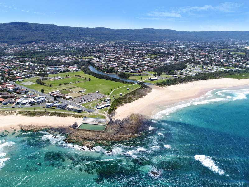
82 kilometres south of Sydney, Wollongong is the business and adminstrative centre of the Illawarra region. A large city with a population around 300,000, Wollongong is noted for its heavy industry, its port activity and the quality of its physical setting - the narrow coastal plain between an almost continuous chain of surf beaches and the cliffline of the rainforest-covered Illawarra escarpment. In the area of music the city is home to various music and jazz ensembles.
The main beaches of central Wollongong are North Wollongong (or simply North) Beach, extending from the harbour up to the Para Creek lagoon and Puckeys Estate Reserve, and Wollongong City Beach, extending south from Flagstaff Point and into Coniston Beach. Wollongong's Blue Mile located along Cliff Road is the best vantage point from which to absorb the beauty of the South Pacific Ocean to the east and the Illawarra Escarpment to the west. The boardwalk along the harbour and foreshore are perfect for a casual walk or jog, or stop for a coffee or lunch at one of the many seaside dining options along the way.
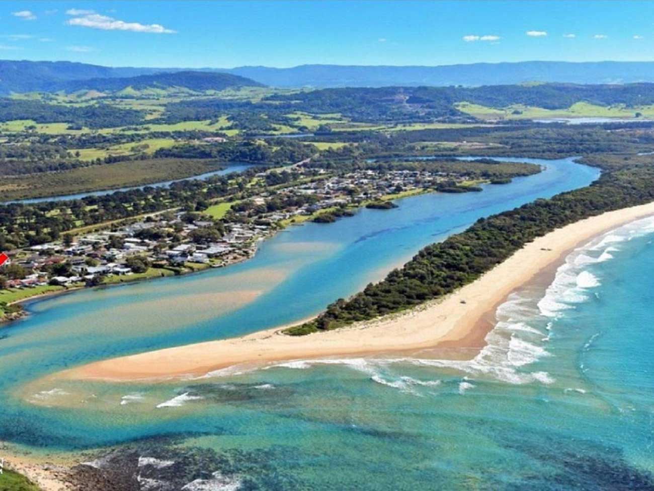
The Minnamurra River marks the northern border of the Kiama area. Minnamurra, meaning 'plenty of fish' in the local Aboriginal language, is is a beautiful residential suburb, home to the mouth of the Minnamurra River, having wound its way down the Illawarra escarpment through the rainforest and Jamberoo Valley to the sea.
The mouth of the river is a perfect spot for snorkelling, fishing , stand up paddle boarding and kayaking. From here you can paddle or across to the southern end of Killalea State Park and Mystics, a beach famous within the surfing community.
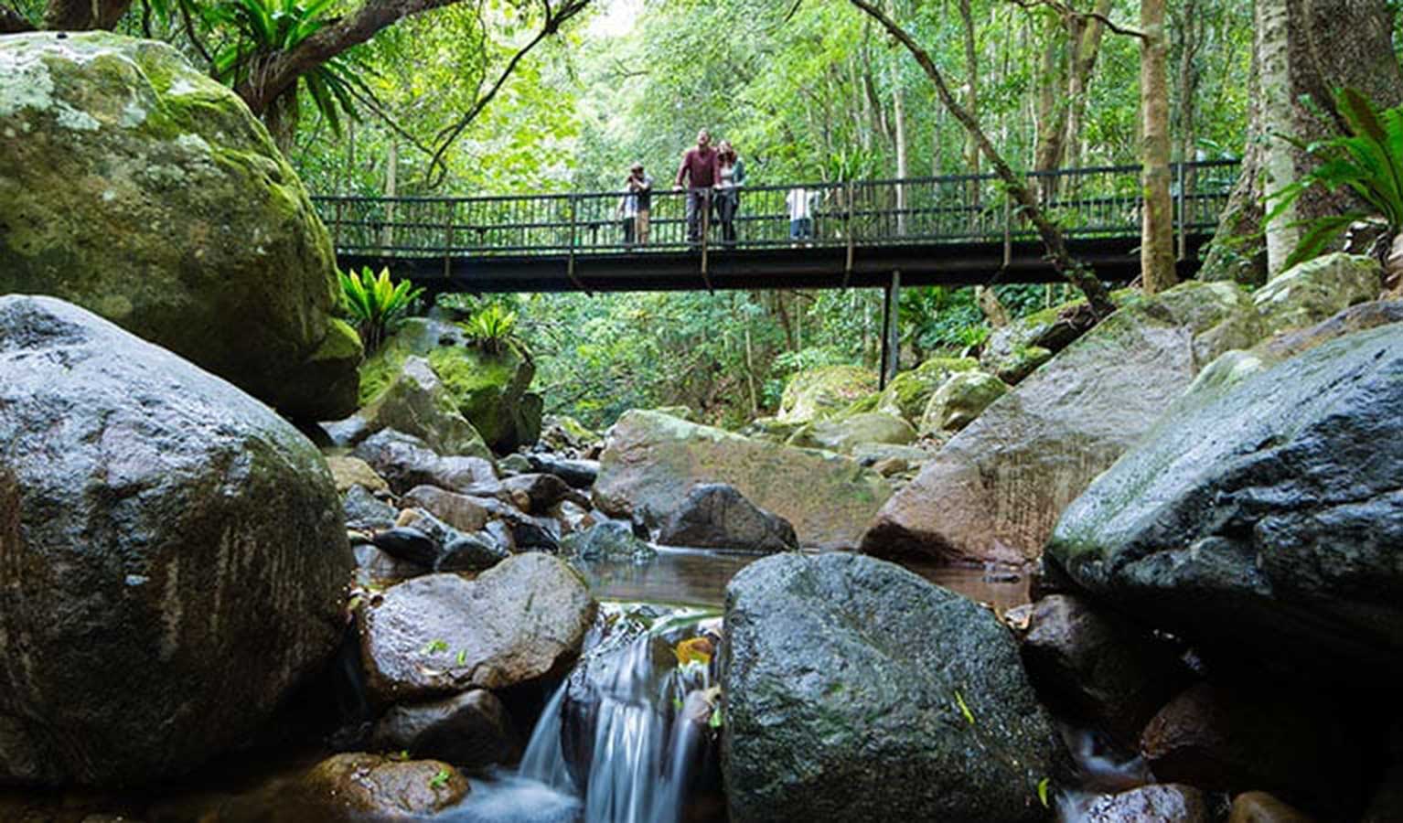
Minnamurra is best known for the the Minnamurra Rainforest Centre, located some 20 kms away. The centre offers visitors an opportunity to experience a rare rainforest remnant which is representative of the once extensive rainforests of the Illawarra region. The sandstone canyon in which the centre is located enables visitors to experience the various types of rainforest and examine the diversity of ferns species.
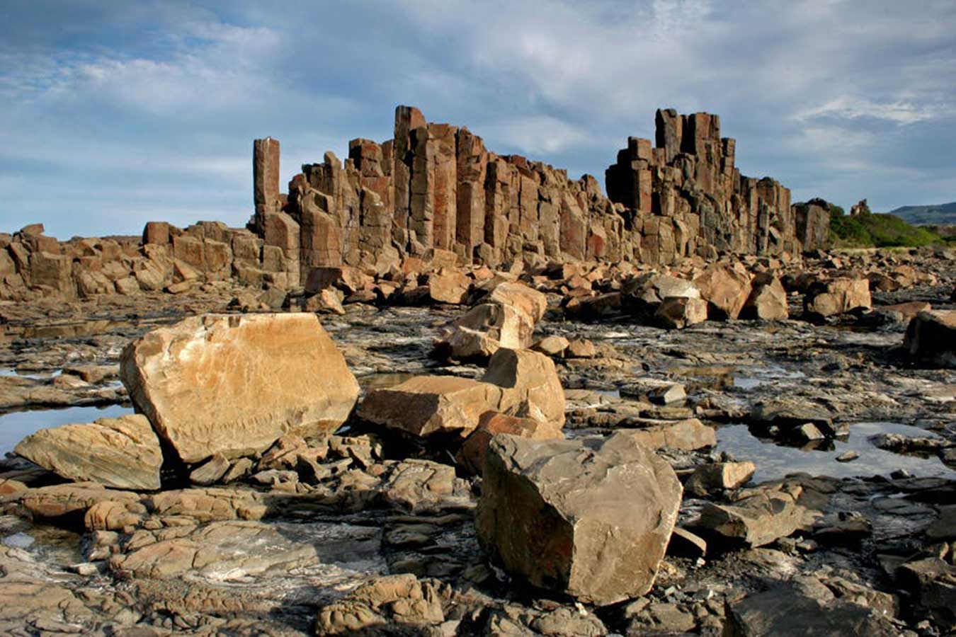
Truly an area like no other, the unusual basalt columns of Bombo Headland make it feel as though you're walking on the moon. These rock formations are a product of the region's rich mining history and blue metal quarrying in the 1880s and 1900s, along with centuries of exposure to the powerful ocean forces.
The area is often featured in television commercials and photo shoots, and is the perfect place to test out your photography skills - especially at sunrise.
The quarry here was owned by the Metropolitan Water, Sewerage and Drainage Board and it was proposed that a pollution control plant be constructed on the floor of the disused quarry. It also made an appearance in Mighty Morphin Power Rangers: The Movie as part of the planet Phaedos.
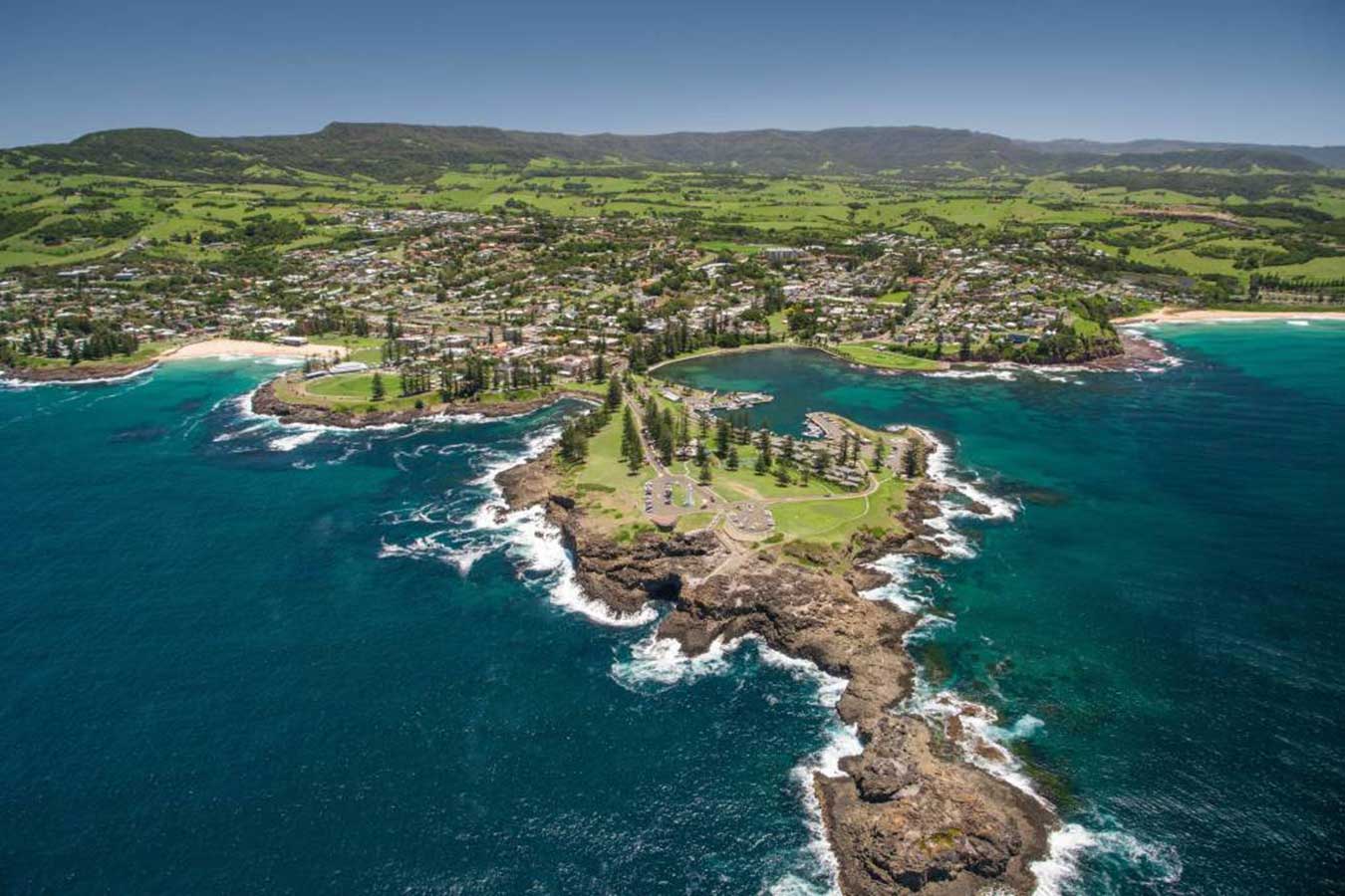
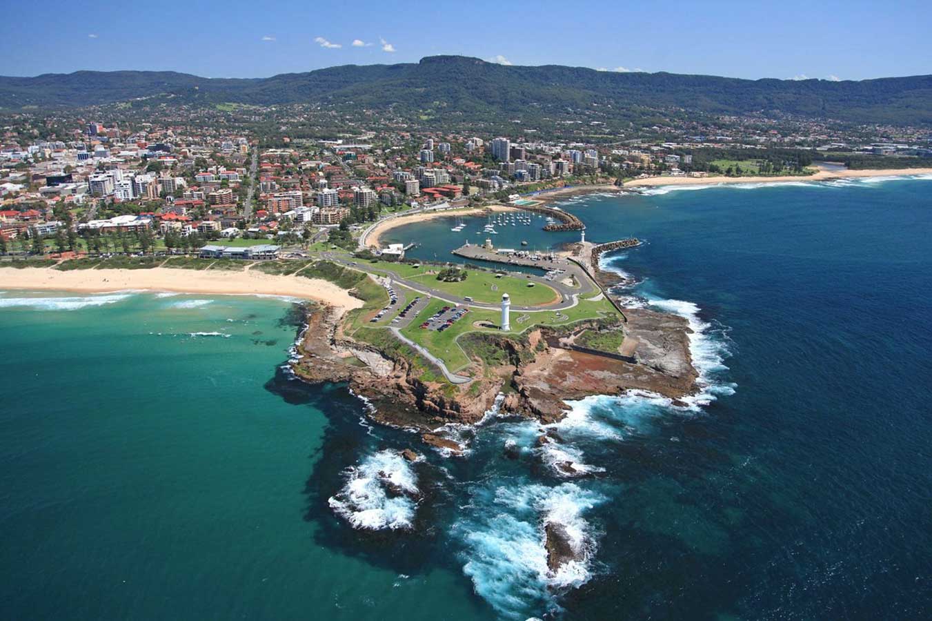
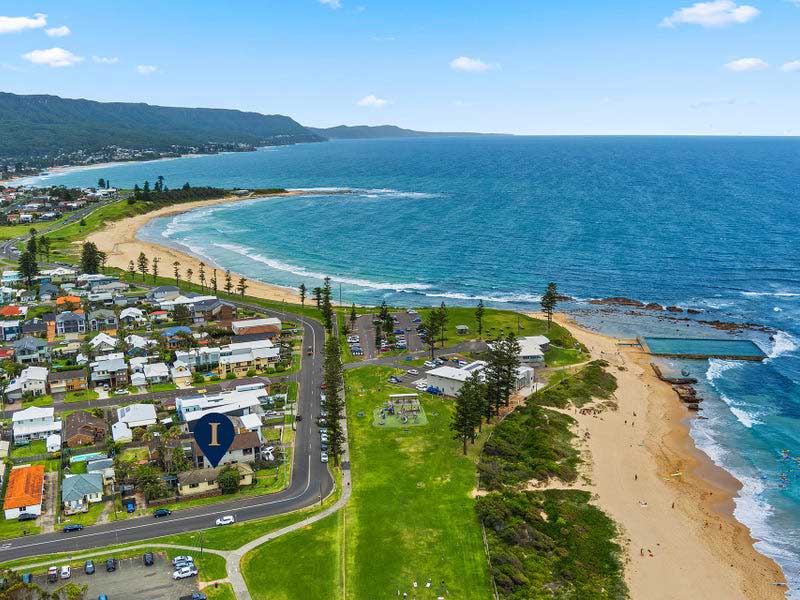
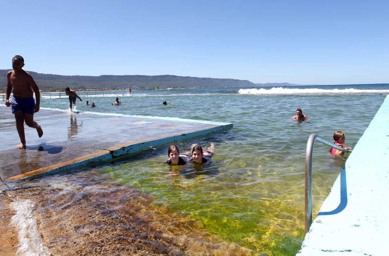
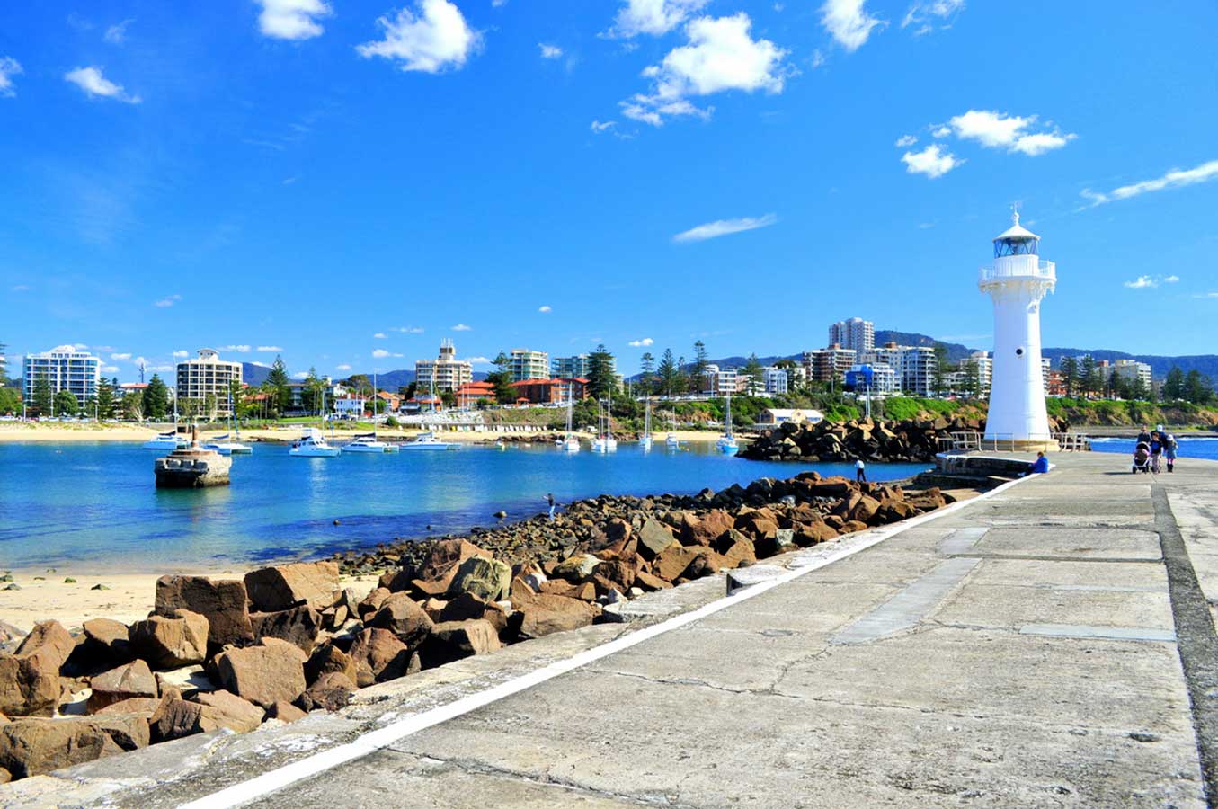
A popular holiday destination towards the southern end of the Illawarra coast, Kiama is a classic seaside town with great beaches, and surrounded by pastures and forests. Kiama is famous for its blowhole. On the cliffs at Blowhole Point, waves surging into an underground cavity are compressed and forced upwards, exploding high into the air and accompanied by a loud 'oomph'. The strength varies according to the wind, waves and tides, and when it's pumping, it always draws a crowd.
Situated on Blowhole Point adjacent to the Visitors Centre, the Pilot's Cottage Museum tells the story of Kiama's colourful past, from the time of the cedar cutters to the basalt quarrymen and dairy farmers. Kiama Terrace, the row of weatherboard cottages along Collins Street, was constructed in 1886 to house quarry workers and their families. Don't miss the Kiama Lighthouse. You can take in the area's stunning coastline along the Kiama Coast Walk and visit the Kiama Blowhole and Lighthouse.
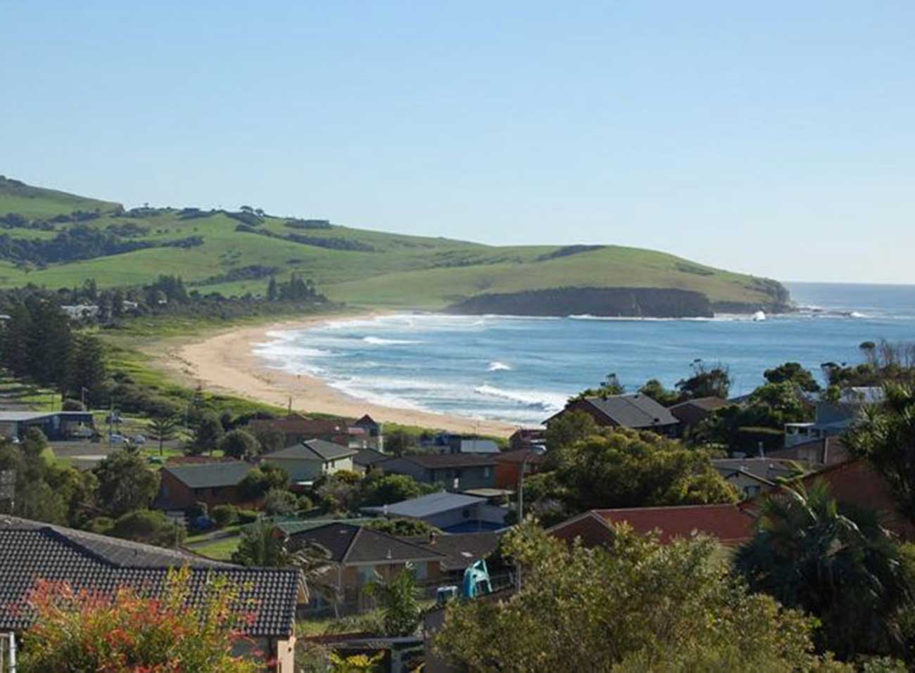
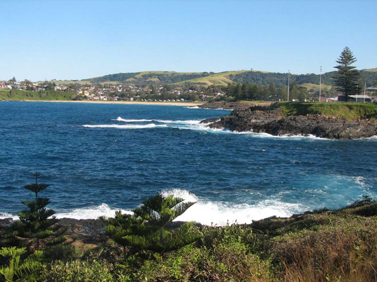
Gerringong is ideally located for outdoor fun at the beach. Werri Beach is one of the best surfing beaches on the South Coast while Seven Mile Beach is one of the best for wind surfing. You can learn to surf at either beach with local experts. Be sure to also check out Werri Beach. Werri is distinguished by having point breaks at both ends of the beach, so there's often a nice wave peeling nicely off either the north or south headland.
This hilltop village overlooks a great swathe of blue ocean that promises long days of sport and sunshine. Stay around town a while and you'll discover this atmospheric town also has a taste for the finer things in life, including wines, great fishing and golf. There are seven courses in close proximity to Gerringong.
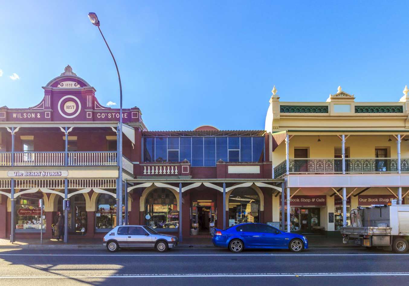
Rolling green hills and the Cambewarra range provide a picturesque backdrop for the pretty village of Berry. Famous for its gardens, trees, arts and crafts, antiques and markets, Berry has become a very trendy destination for daytrippers and weekenders from the cities of Sydney and Wollongong.
One of the area's oldest settlements, Berry's and the Shoalhaven's rich history is reflected in this quaint town. Berry boasts some fine early architecture with various buildings, some beautifully restored, protected by their National Trust Classification in recognition of their significance to the heritage of the region.
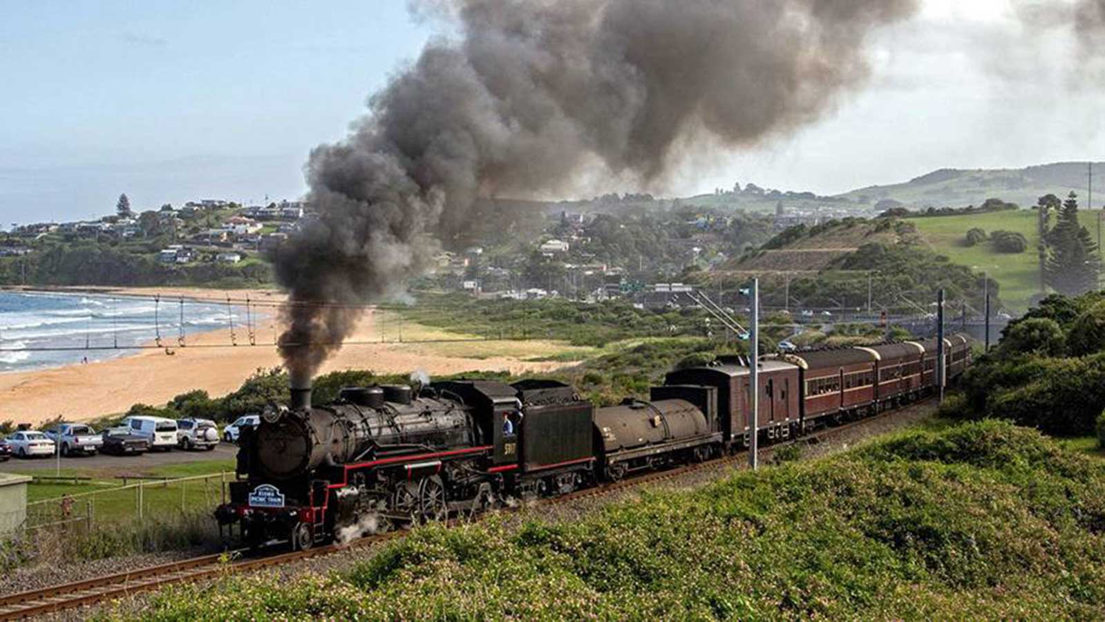
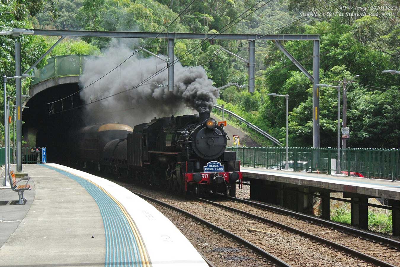
The Kiama Picnic Train is a special service that operates between Sydney's Central Station and Kiama on the South Coast Line. Vintage carriages are hauled by steam locomotive 5917, built by Baldwin (USA) in the 1950s for the NSW Government Railways. The Picnic Trains are day tours which are scheduled at various times throughout the year, see their website for details.


Design by W3layouts