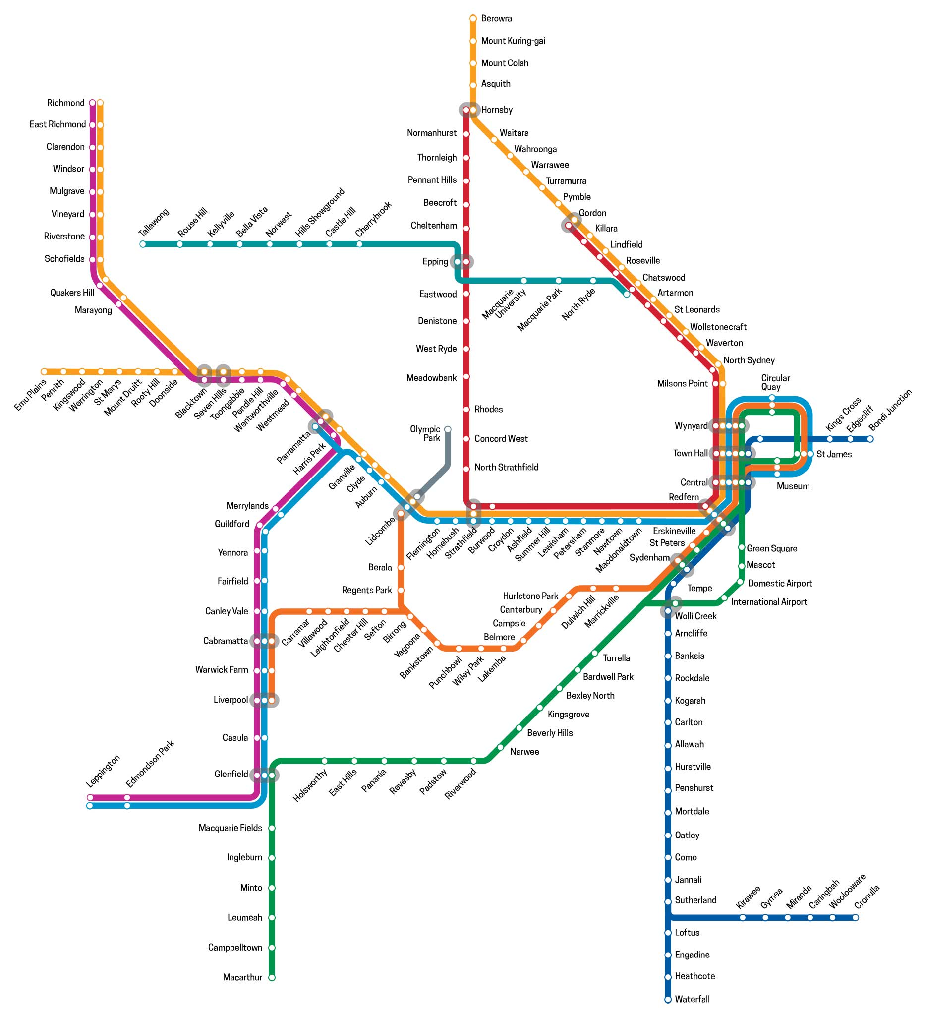
Main Suburban Line (Redfern to Parramatta)
The Main Suburban railway line is the technical name for the trunk railway line between Redfern railway station and Parramatta railway station in Sydney, but now generally refers to the section between Redfern and where the Old Main South Line branches off at Granville Junction. The railway line then continues on as the Main Western line towards the Blue Mountains.
The line between Redfern and Granville was the first railway line to be constructed in New South Wales. It roughly followed the route of the first rural road built in the colony 60 years previous, linking Sydney and Parramatta. It was a single track line, built by a private company which went bankrupt 23 days before the inaugural train journey was scheduled to be made. The Government stepped in, enabling the project to be completed on time. From thereon, the railway was to play a significant role in suburban development in Sydney's inner and outer west, and later the south and north.
What would soon be called the Main Suburban railway line opened on 26 September 1855, from Sydney to Parramatta Junction (near Granville Station), with stations at Newtown, Ashfield, Burwood and Homebush. The Sydney terminal station was on the south side of Devonshire Street, just south of the current Central Station. Although the vicinity was sometimes referred to as Redfern, it was not near the current Redfern station.
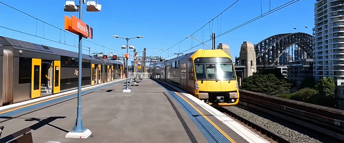
The Main Suburban line commences at the Illawarra Junction south of Redfern station, the junction point of the Illawarra railway line.
Redfern
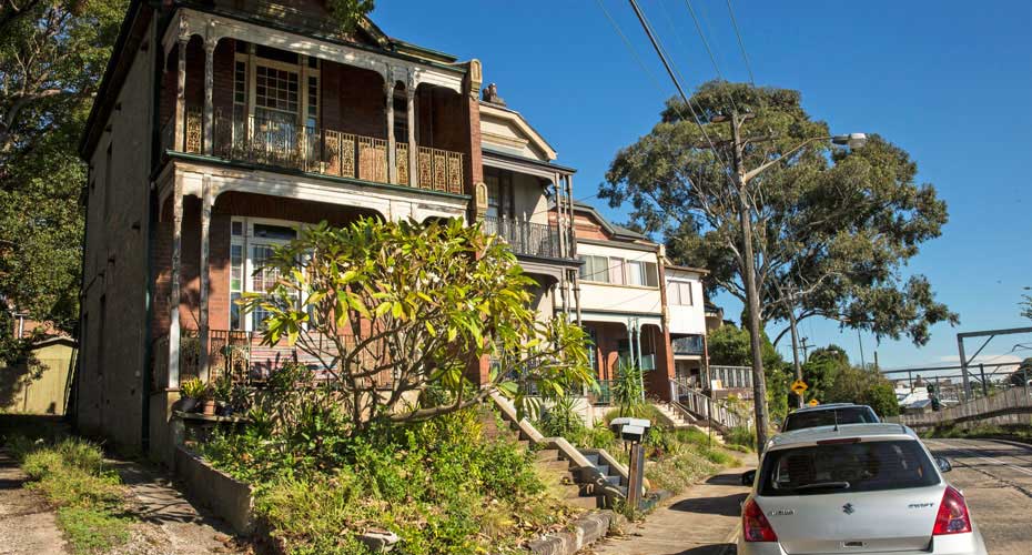
Redfern, an inner-city suburb of Sydney, is located 3 kilometres south of the Sydney central business district. Redfern has many fine examples of Victorian terraced housing similar to other inner suburbs, such as Surry Hills and Paddington. Over the years, Redfern has been characterised by migrant populations that have lived in the area. Australian Technology Park now occupies the site of the former Eveleigh railway yards, which are some of the finest historic railway engineering workshops in the world. It is the home of a growing community of researchers, entrepreneurs, incubator businesses, start-ups, mature technology companies and education organisations.


Macdonaldtown
An error about the naming of Macdonaldtown is often repeated in publications - viz. "A Mr Macdonald, who owned a large ironmongery at the corner of George and Market Streets in the city, lived near the present Macdonaldtown station and was a major property owner here." The reality is a very different story, involving a scandal of forged documents consigning Devine's property to a convict. In 1846 the property in the south of Erskineville owned by Stephen Macdonald was subdivided and advertised with the name "Macdonald Town". Macdonaldtown, the whole suburb, was incorporated as a local government area in 1872 and was renamed as Erskineville in 1893.
When the railway was built in 1855, a station was built near Mr. MacDonald’s house and the station called MacDonaldtown. Erskineville was created as a separate suburb in 1893. A creek, the line of which is followed by the railway through the middle of the Eveleigh Railway Workshops and south to Erskineville station, was the dividing line between the two suburbs.
Newtown
Newtown is one of the most ethnically diverse and colourful areas of Sydney. Due in no small degree to it being on the doorstep of the University of Sydney, it is an enclave of alternative art, an ethnic eatery paradise and a hub of commercial activity. It is all a far cry from the small village settled nearby two centuries ago to service the many farms in the area. The area took its name from a grocery store opened there by John and Margaret Webster in 1832, at a site close to where the Newtown railway station stands today. The main shopping strip of Newtown is the longest and most complete commercial precinct of the late Victorian and Federation period in Australia.
The first indigenous Australian to receive a Christian burial was Tommy, an 11-year-old boy who died of bronchitis in the Sydney Infirmary. He was buried in Camperdown Cemetery, in a section now located outside the wall. The cemetery also contains a sandstone obelisk erected in 1944 in memory of Tommy and three other indigenous Australians buried there: Mogo, William Perry and Wandelina Cabrorigirel, although their graves are no longer identifiable.
Stanmore
Prior to settlement by the British the site was populated by coastal aborigines known as the Gadigal clan of the Eora people. Land to the west of Sydney Cove was first allocated to colonial officers by Governor Phillip between 1793 and 1810, including Major George Johnston. Serving in the New South Wales Corps, Johnston was a key figure in putting down the Castle Hill convict rebellion in 1804, and led the rebellion against Gov. William Bligh - later known as the Rum Rebellion - four years later. The final subdivision of Major Johnston's South Annandale estate took place in 1905.
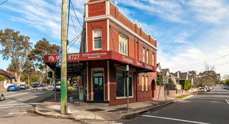
Stanmore was named by a saddler, John Jones, who settled on the land in 1835 where Newington College now stands and called it the Stanmore Estate. Jones named it after his birthplace of Stanmore, now a north-west suburb of London. Stanmore became a desirable location, booming in the 1880s and 1890s with the opening of Newington College and the Percival Road shopping area. The naming of streets after English colonies between Derby and Stafford streets reflected the English values of the time.
Petersham
Major Francis Grose sent workmen to the area in 1793 to clear the bush and plant corn and wheat. He named the area Peters-Ham or Petersham after his native village in Surrey, England. Petersham remained an agricultural area, being acclaimed for producing some of the best crops and stock in the colony in 1803. Kangaroo hunting was also popular in the area. The name was also used for the surrounding parish.
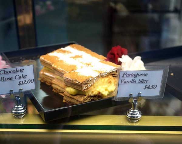
Like the surrounding Inner West suburbs of Summer Hill and Stanmore, Petersham is predominantly terrace houses, a far cry from the early colomial days of the late 18th century when Kangaroo hunting was also popular in the area. It was here that the notorious Wild Colonial Boy bushranger Jack Donohue - terrorised the local residents and travellers on the road between Sydney and Parramatta. The suburb today has a high number of persons born in Southern Europe, mainly from Portugal and also Italy and Greece. Petersham is known for its large Portuguese community which is reflected in the many Portuguese businesses and restaurants.
Lewisham
Driving through the neighbouring suburb of Lewisham, it is hard to picture it as the little village on the banks of Long Cove Creek that sprang up around the termination point of the first train journey in the NSW colony in 1855. Lewisham was the termination point for the first train journey in the NSW colony in 1855, although the railway station was not built until 1885.
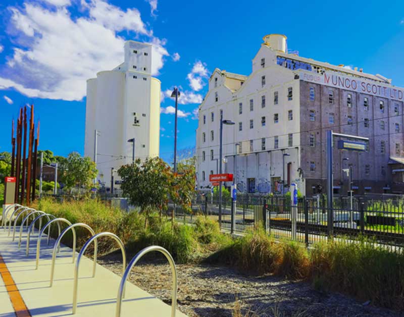
The whipple truss bridge over Long Cove Creek was constructed 1885-1886 featuring North American technology developed by Squire Whipple. It is probably the most significant railway bridge site in Australia, certainly in NSW. It has the unique distinction of four different types of bridges from different eras. Engineers Australia designated the Viaduct in 1994 as an historic engineering marker. There are two stations serving Lewisham on the Inner West Light Rail. These are Lewisham West, adjacent to the former flour mill on the border with Summer Hill, and Taverners Hill, near Parramatta Road.
Lewisham took its name in 1834 from the estate of Joshua Frey Josephson, a German-born businessman who would later become mayor of Sydney. The estate was named it after the London borough of Lewisham, which means Leofsa's village or manor.
Summer Hill
Originally named Sunning Hill, the name of settler Nicholas Bayly's property. First Fleeter and former convict and jailor Henry Kable was the first landowner here after his emancipation. He sold his property to James Underwood, a merchant, distiller and shipbuilder whose name is recalled in Underwood Street, Sydney, which is where his shipbuilding facility was located.
The area south of the present day railway line was set aside for quarantined sheep in 1832. The railway arrived in 1879 at which time the Underwood Estate was subdivided into town lots and the area saw significant growth. A sheep quarantine ground was subdivided and sold in 1885.
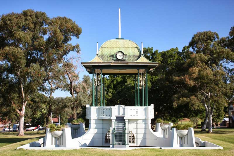
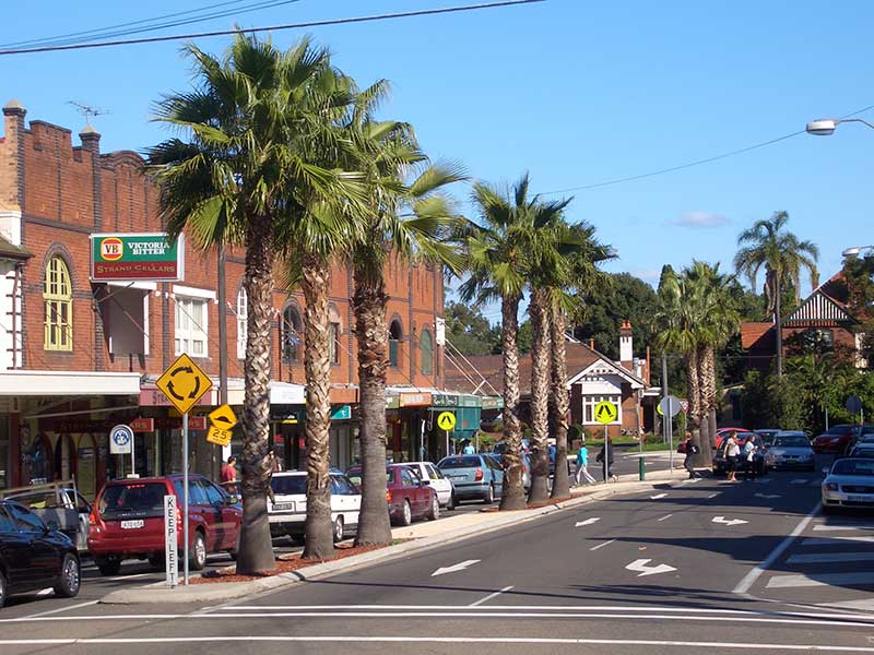
Ashfield
A surbub in Sydney's Inner West, Ashfield is about 8 kilometres south-west of the Sydney central business district. Ashfield's population is highly multicultural. Its urban density is relatively high for Australia, with the majority of the area's dwellings being a mixture of mainly post-war low-rise flats (apartment blocks) and Federation-era detached houses. Amongst these are a number of grand Victorian buildings that offer a hint of Ashfield's rich cultural heritage.
Prior to colonial development, the land was heavily wooded with tall eucalypts covering the higher ground and a variety of swampy trees along Iron Cove Creek native animals and fish. The area was occupied by Wangal aboriginals who hunted here. The first colonial land grant in the area was made to Rev Richard Johnson in 1793 and by 1810, all of what is present-day Ashfield had been granted. The suburb's name originates from Ashfield Park, named by colonial Merchant, Robert Campbell, whose father was the laird of Ashfield in Scotland.
Croydon
Prior to the arrival of Europeans, the area now known as Croydon was part of the land which the Wangal tribe. Their focus of tribal land was believed to be centred on Concord and stretched east to the swampland of Long Cove Creek. From around 1800 to 1860, development in the area was slow with the forests gradually being cleared for orchards and grazing land. The area was a haunt of bushrangers in the 1820s with two major thoroughfares, Parramatta Road to the north and Liverpool Road to the south providing regular opportunities for holdups.
The railway station building on platforms 1 and 2 was erected in 1941 in an architectural style described as Railway Stripped Functionalist (Moderne), a style common among railway station buildings on the line between Crodyon and Penrith. Moderne style developed by Australian architects who visited Europe during the 1930s depression years and studied the effects of the Modernist movement on contemporary architecture, which was to create buildings in which functionality was more important than style. There are
Burwood
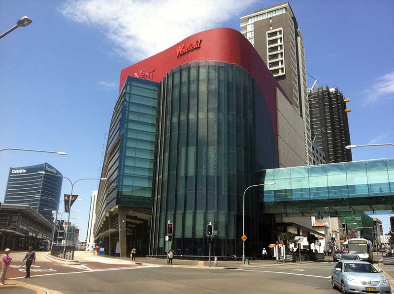
The inner-west suburb of Burwood is 10 kilometres west of the Sydney central business district and is the administrative centre for the local government area of Burwood Council. Burwood has a mixture of residential, commercial, and light industrial developments (along Parramatta Road). The main shopping strip runs along Burwood Road, beside Burwood railway station. Westfield Burwood is a large regional shopping centre, north of the railway line, on Burwood Road opposite Burwood Park.
Prior to European development, the area was part of the much larger hunting grounds of the Wangal aboriginal clan. Captain Thomas Rowley (1748–1806) received a grant of 260 acres (110 ha) in 1799, and called his property Burwood Farm after Burwood Park, England. Captain Rowley ran merino sheep on the property. The first house, Burwood Villa, was built in the area in 1814, the same year that a stagecoach began running between Sydney and Parramatta. Burwood became a staging post along the road and the beginnings of a settlement started to develop.
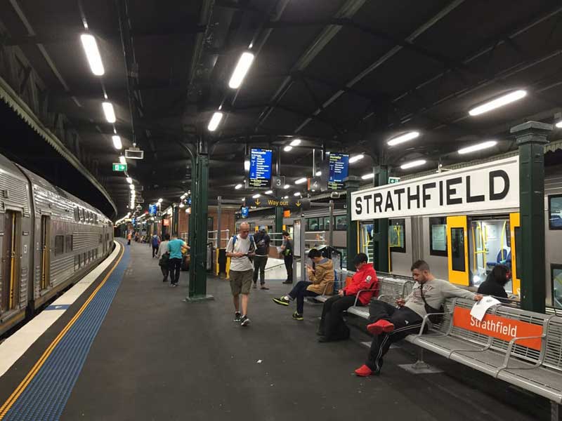
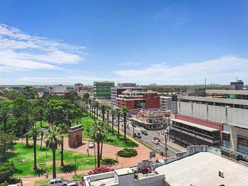
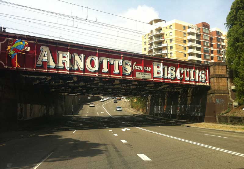
Strathfield
Strathfield is a suburb and regional centre in Sydney's Inner West, some 14 kilometres west of the Sydney central business district. Being at the junction of the Northern and Western railway lines, Strathfield station is one of the more significant stations on the western line, and one of the few suburban stations were interstate and country trains stop. In the early 1900s, grand mansions were constructed here and in neighbouring Burwood as the country homes of wealthy merchants, many of which have been recognised for their historic value. Follow the link below for a walk around Strathfield to see homes associated with names like Arnotts, Lysaght, PM Billie Hughes, Sir Samuel Hordern, William J. Coote, of Angus & Coote, as well as recording artists The Bee Gees, The Easybeats and AC/DC.
The Strathfield area was the stamping ground of Australia's first bushranger, John Cesar, who roamed the area and robbed travellers at musket point. He was shot dead at nearby Liberty Plains (Flemington) in 1796 after a price was placed on his head.
Homebush
The suburb of Homebush, in Sydney's west, is located 16 kilometres west of the Sydney central business district. Homebush became a household name across in the world in the 1990s when it was chosen as the site of the main stadium and other venues that her built to host to 2000 Sydney Olympic Games.
Homebush was originally part of the area known Liberty Plains, which in the early years of the 19th century, was plagued by bushrangers who targetted travellers on the Sydney to Parramatta Road. In the 20th century, Homebush Bay on the Parramatta River became a centre of heavy industry, with large scale land reclamations to accommodate industrial facilities. When industrial operations scaled down, the bay became a dumping ground for a large range of unwanted material. A drive to regenerate and rehabilitate the bay began in the 1980s. This led to the construction of Bicentennial Park, including a program to regenerate some of the mangrove wetlands and saltmarshes which existed around the bay pre-development. During preparations for the 2000 Sydney Olympics,
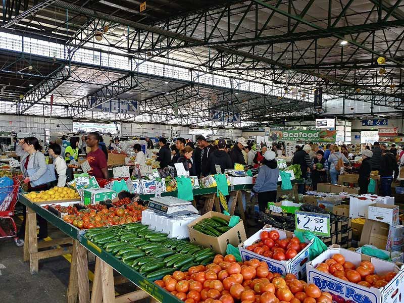
Flemington
Liberty Plains was the stamping ground of Australia's first bushranger, John Cesar, who roamed the area and robbed travellers at musket point. He was shot dead in the Flemington area in 1796 after a price was placed on his head. The area south of the railway was part of the Glebe (Church Lands) until 1841 when it was acquired by Joseph Hyde Potts (see Birrong). Some streets in this area recall his family members. Many of Flemington's streets are named after members of Strathfield Council at the time of subdivision. Flemington is home to Sydney's fresh produce markets.
Lidcombe
The Lidcombe area was first known as Haslam's Creek after Samuel Haslam who took up a grant here in 1804, the northern boundary of which was the creek which bares his name. Haslams Creek flows into Homebush Bay on the Parramatta River. His neighbours included Joseph Potts, an accountant of the Bank of New South Wales, after whom Potts Point is named. Potts called his 1,000 acre grant Hyde Park. He extended it several times to include what today are Berala, Rookwood, Auburn and Potts Hill, which recalls its former owner.
Haslam's Creek, one of the larger tributaries of Parramatta River, enters the river at Lidcombe. Haslam's Creel station, located near the site of Lidcombe station, was one of the first stations on the Sydney to Parramatta railway in 1855. Three years on it was the site of the first major railway accident in New South Wales which resulted in two deaths. When Rookwood Cemetery was opened in 1867, it was named Haslam's Creek Cemetery but the name was changed in 1876 after residents complained that the name associated their suburb with the cemetery. Ironically, when the cemetery's name was changed, so was the railway station - it became Rookwood!
Auburn
When the railway station was being built (1877), the Railways Department rejected Burford, the name suggested by a prominent local, Mr J.G. Mills after a village in Oxfordshire, England, as it feared it may be confused with Burwood on the same line. Mills came up with Auburn as an alternative, after Auburn, the subject of Oliver Goldsmith's poem, The Deserted Village. Subdivision began in 1878 with the advent of the railway.
Auburn prides itself as one of the most multicultural communities in Australia. In the late 20th century, Auburn became a popular point of settlement for successive waves of immigrants. In the post-World War II era, immigrants from the Ukraine, Russia, Italy and Greece settled in Auburn, who were succeeded in the 1960s by immigrants from Turkey and Vietnam. More recently, a large number of immigrants have settled in Auburn from China and Afghanistan.
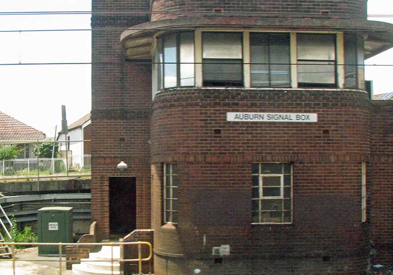
When the current Auburn Signal Box was opened in 1954, it was the first of four Functionalist style boxes between Auburn and Blacktown, these being Auburn, Clyde, Granville and Blacktown. The style was only used from Auburn to Granville as the railway system was largely in place by this time. These boxes represented the last time when conventional, elevated signal boxes were built utilising the traditional model of a ground floor relay room and an upper level where the interlocking frame was operated.
Clyde
The railway station here was originally named Rosehill Junction when it was first opened in 1882. It was changed to Clyde Junction in 1901 as a nearby subdivision of land released for sale in 1878 had been called New Glasgow. Railways commisionery Edward Eddy suggested n 1904 the name be shortened to Clyde as "New Glasgow is close by, and as Old Glasgow is watered by the Clyde, to which Duck River may be likened, perhaps Clyde would not be unacceptable."
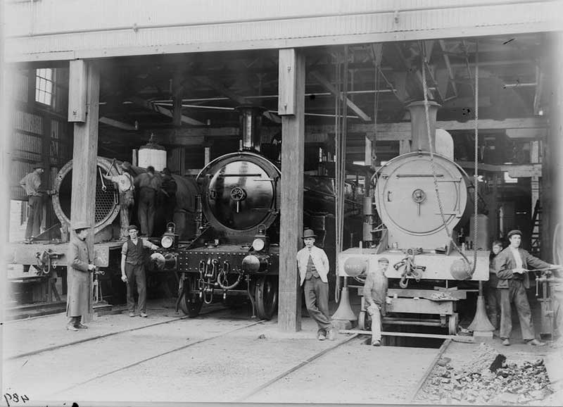
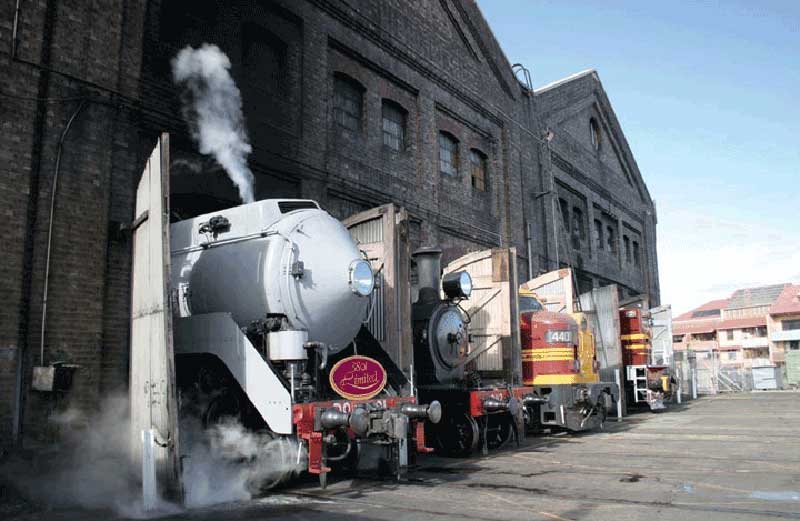
Clyde Engineering was a manufacturer of locomotives, rolling stock, and other industrial products. It was founded in September 1898 by a syndicate of Sydney businessmen buying the Granville factory of timber merchants Hudson Brothers. The company won contracts for railway rolling stock, a sewerage system, trams and agricultural machinery. By 1923 it had 2,200 employees. After contracting during the depression it became a major supplier of munitions during World War II.In July 1996 it was taken over by Evans Deakin Industries. In March 2001 Evans Deakin was taken over by Downer Group to form Downer EDi.
Granville
The land was part of an original grant to a consortium of settlers including John Harris and W.C. Wentworth which they named Drainwell Estate. When the railway arrived in September 1855, the station here, which was the terminus on the Parramatta end of the Parramatta to Sydney railway, was named Parramatta Junction. The line was officially opened on 26th September 1855, though it only went as far as the temporary Parramatta Junction terminus (Granville) at Dog Trap Road (Woodville Road).
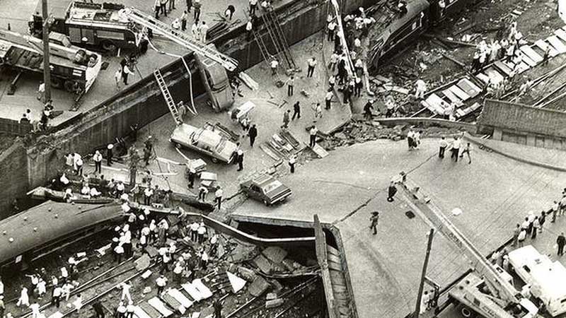
On 18 January 1977, the Granville railway disaster, Australia's worst rail disaster, occurred resulting in the death of 83 people, approximately 200 metres west of the station.
Harris Park
Harris Park is named after John Harris, surgeon of the New South Wales Corps. John Harris arrived as surgeon to the NSW Corps in 1790 and was granted land near James Ruse's Experimental Farm at Parramatta which he later purchased. Farming was practised on the land until the 1870s when the land was subdivided and sold as town lots under the name Harris Park Estate.
Parramatta
Parramatta holds great significance in the history of Australia, being the first European inland settlement, and the second settlement overall after Sydney Cove to be established by Australia's British colonists of the late 18th century. As one might expect, Parramatta has some excellent examples of early colonial architecture including Old Government House, Elizabeth Farm, St John s Cathedral, the Lancer Barracks and the Linden House Museum.
Today's Parramatta is a modern city with a range of cafes and restaurants exploring cuisines from around the globe, large shopping centres, cinemas, theatre and the Rosehill Racecourse. Parramatta is best a understood with a visit to the visitors centre which features Parramatta: People and Place, a major exhibition that traces the development of Parramatta, and can then be explored following a walking map.


The information on this website is compiled from material obtained by us, and is published as information only. The publishers are not responsible for its accuracy and inclusion of information on this site or other sites linked to it does not constitute any representation or offer by us. Readers are advised to do their own research. Please direct enquiries about places and services featured to the relevant service provider.
Design by W3layouts