Swan View Tunnel and the Eastern Railway, Perth, WA
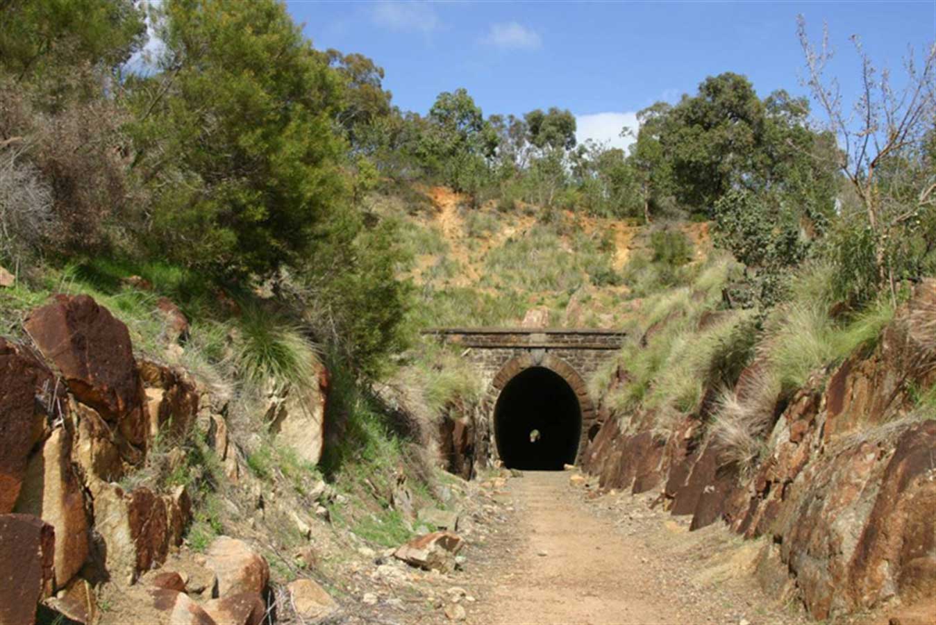
The Swan View Tunnel, in John Forrest National Park, is a reminder of when the rail link to the rest of Australia once passed that way. It is the only railway tunnel ever constructed in Western Australia and is now part of the John Forrest Heritage Trail, which runs through the park. The original Mahogany Creek line, built in 1884 between Midland to Mundaring, was so steep a deviation had to be built which included this tunnel. Cut through solid rock, the tunnel was completed in 1895 at a cost of about £12,000.

Work began in 1894, with the two bores meeting on 18 April 1895.. The tunnel opened on 22 February 1896. The unstable nature of the jointed granite, along with clay seams, caused difficulties during construction of the tunnel. A masonry-lined face prevented rock falls, but reduced the inner diameter. The tunnel is 340.7 metres in length.
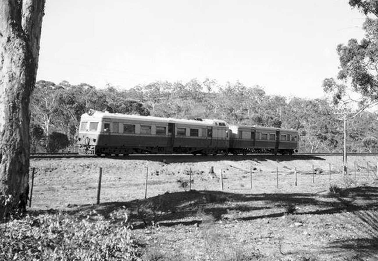
The new line, along with the single track tunnel, was opened on 1 July 1896. The 340.7 metre long tunnel's small diameter combined with the steep gradient (1:49) led to poor ventilation, heat and noxious fumes from the locomotives within the tunnel sometimes led to drivers and firemen being overcome with the first recorded driver death in 1942 from carbon monoxide poisoning. This forced the government to find a suitable deviation line which was built around the tunnel in 1945, which was used by the 'up trains', while the 'down' trains continued to use the tunnel. The tunnel ceased to be used for rail traffic after the new Avon Valley rail route was opened in 1966.
The deviation from the original railway line, and the tunnel in particular, was a "significant technical feat for the time"; Engineers Australia awarded the deviation an Engineering Heritage Marker as part of its Engineering Heritage Recognition Program.
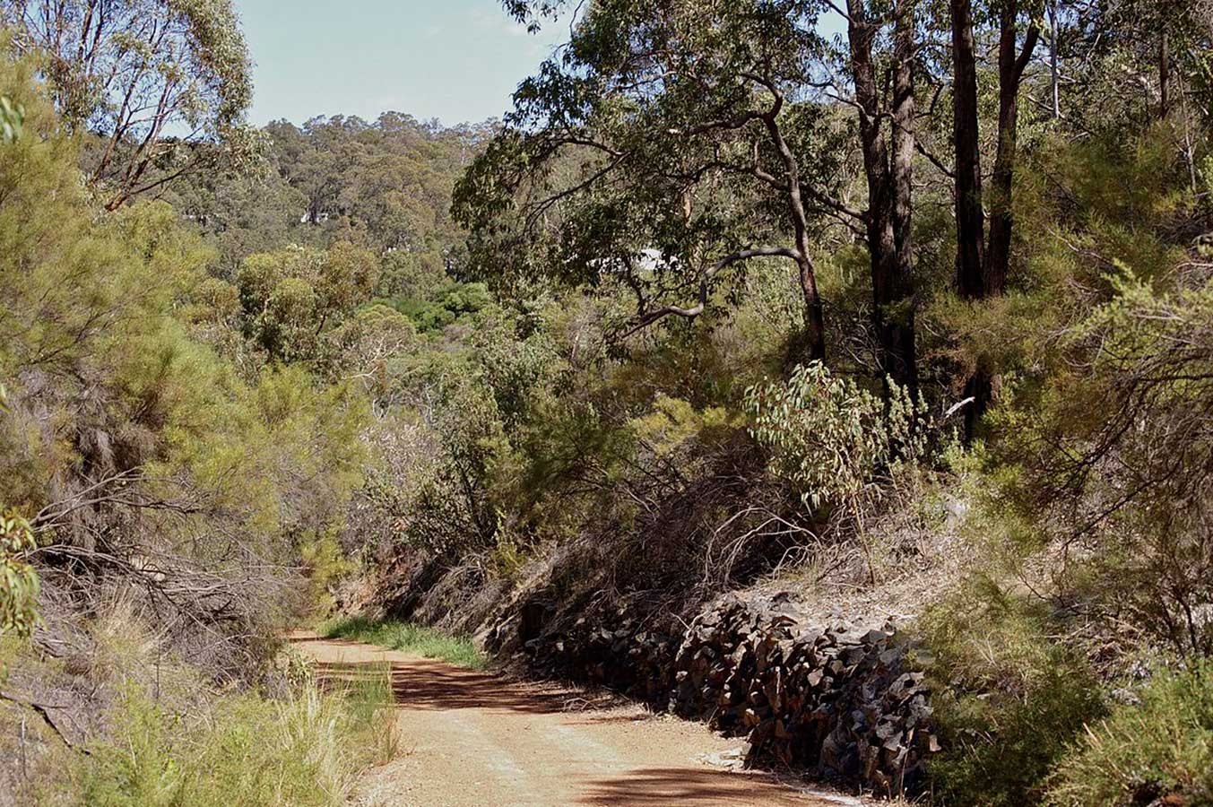
Although the trains are now long gone, the old railway alignment remains, clearly delineated by the embankments, bridges and the tunnel. Although the trains are now long gone, the old railway alignment remains, clearly delineated by the embankments, bridges and the tunnel.
Although the trains are now long gone, the old railway alignment remains, clearly delineated by the embankments, bridges and the tunnel.
The Eastern Railway
The First Route over the Darling Scarp, from Guildford to Chidlow, was opened on 11 March 1884. The route ascended the escarpment around Greenmount Hill passing through Boya, Darlington, Glen Forrest, Mundaring and Sawyers Valley before turning north to Mount Helena.
It soon became apparent that the section between Bellevue and Mount Helena was too steep for the increasingly heavier trains and engines required for the route. As a result, the Second Route known as the Mundaring Loop, was quickly devised in the 1890s.
Also known as the Parkerville deviation or Mahogany Creek deviation, the Second Route via Swan View, John Forrest National Park, Hovea, Parkerville and Stoneville to Mount Helena, opened a little over a decade after the First Route, on 1 July 1896.
As traffic increased the newer route was duplicated in the 1930s, with the Tunnel Junction signal box established to manage traffic through the still single-track tunnel. A single-track diversion of the tunnel was completed on 25 November 1945, allowing trains heading uphill towards the east to avoid the tunnel and providing double-track operation along the entire line. The Second Route closed on 13 February 1966, coinciding with the opening of the Third Route.
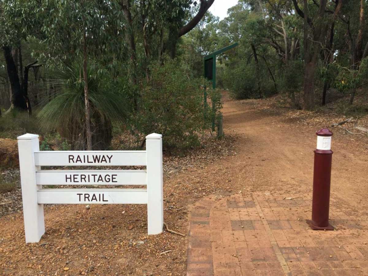
Walking/riding trails, known collectively as the Railway Reserve Heritage Trail, now follow the various routes taken by the Eastern Railway and its numerois deviations.
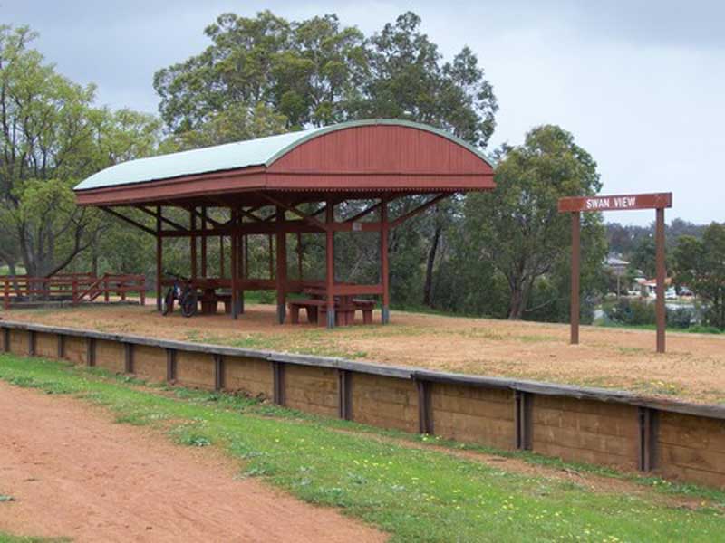
Swan View Station
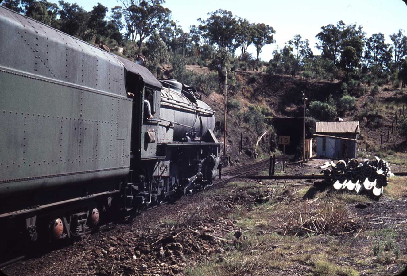
The Swan View railway station played a significant role in the day-to-day running of the Eastern Railway. In all Working Timetables (WTT) during the operation of this line, the station was the point of control for the Swan View Tunnel. The station masters house was adjacent to the station. Due to the volume of traffic passing through, various accidents were regular either at the station or in the vicinity, particularly in and around the tunnel.
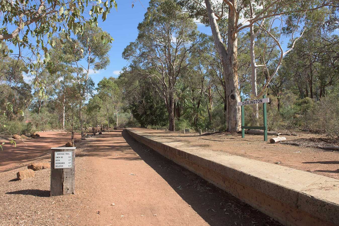
The station was closed in 1966 at the time of the Avon Valley rail route being opened, and the old Eastern Railway route became superfluous to WAGR needs. Since the closure and removal of the railway line, and the development of the Railway Reserves Heritage Trail the Swan View station site is one of the very few on the trail to have the railway platform retained.
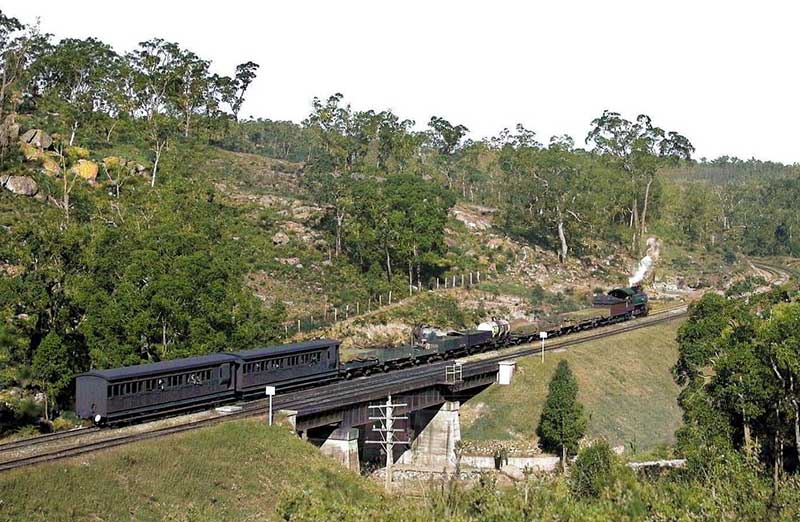
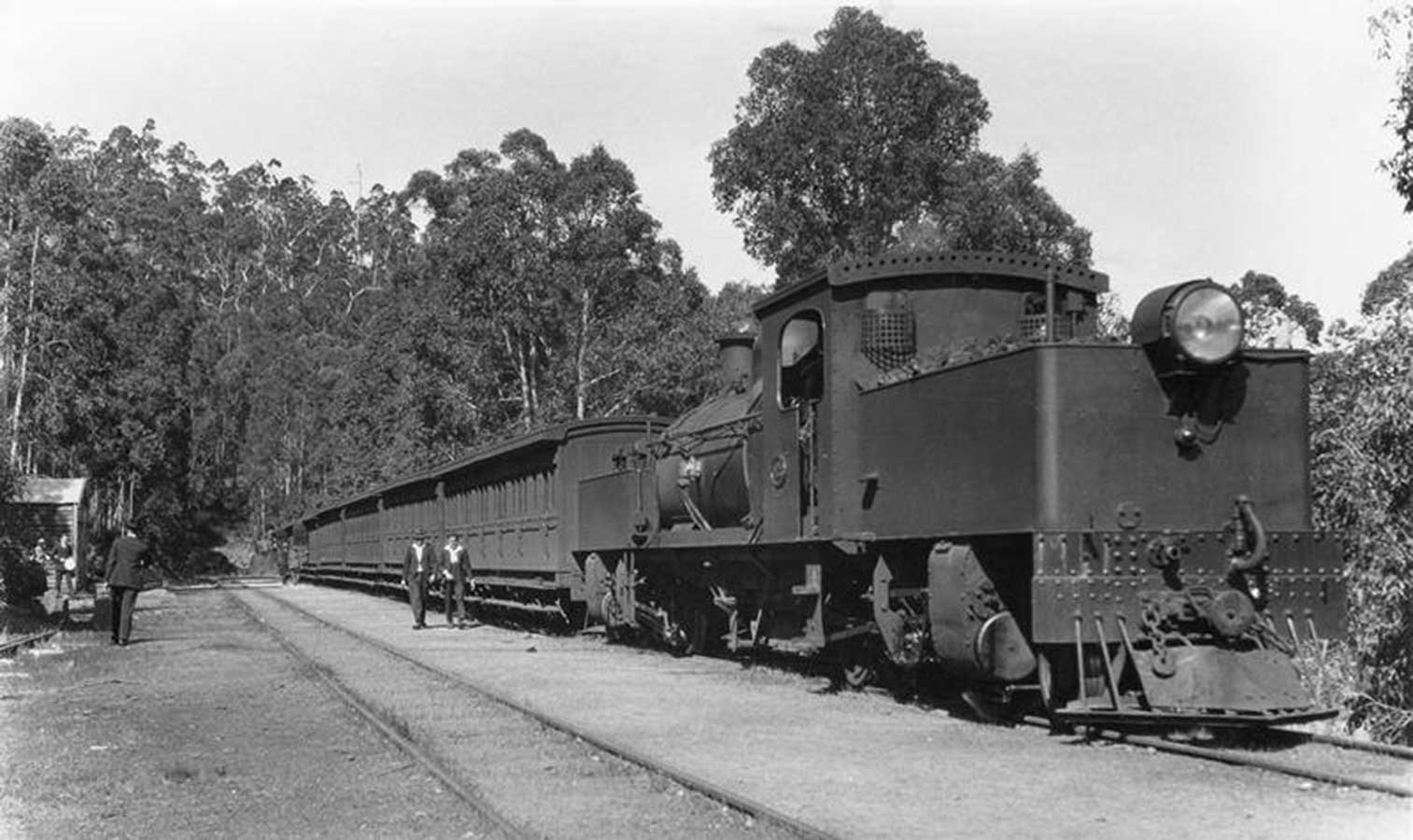
A steam-hauled train passes over the Jane Brook railway bridge. Photo: John Findlay Collection
John Forrest National Park
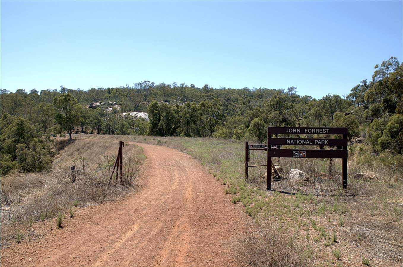
After passing through the tunnel, the walking trail enters John Forrest National Park, which was declared a conservation reserve in 1947. Proclaimed as a national park in November 1900, it the first national park in Western Australia and the second in Australia after Royal National Park. The reserve has 3 wooden railway bridges - Jane Brook Bridge, Deep Creek Bridge and Hovea Falls Bridge all which span Jane Brook waterway.
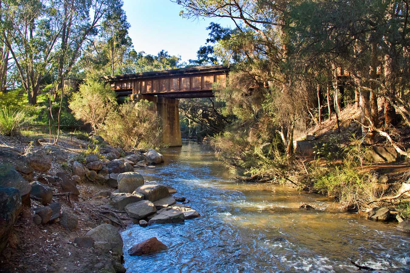
The Hovea Falls railway bridge today
The first Jane Brook bridge was built during the construction of the railway line in 1895. Wooden posts and beams of locally-cut jarrah formed the 62.12m long bridge. In the 1920's the bridge started to shake when trains passed over it. To steady the structure, gravel was carted from nearby pits and dumped at either end to form an embankment. In 1928 the bridge structure was changed to steel and concrete to carry larger engines and heavier loads.
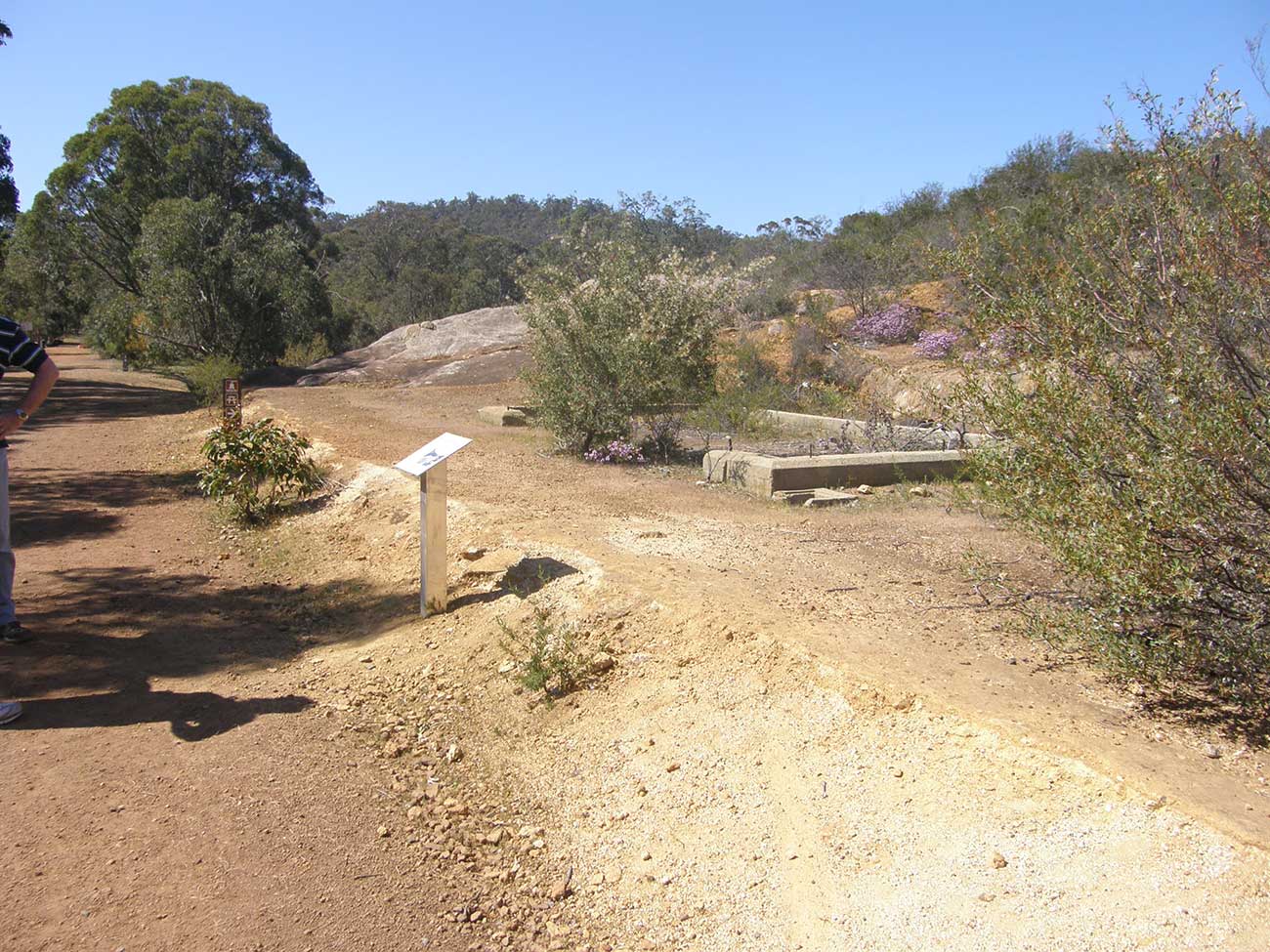
Remants of National Park railway station
John Forrest National Park quickly became a popular railway excursion location while the railway was in existence (1890s to 1960s). Initially Hovea was the nearest railway station but in 1936 the National Park railway station was built. During the 1930s depression, sustenance workers built the rock gardens, paths and pool weir in the main picnic area on the banks of Glen Brook not far from the railway station. The historic remnants provide opportunities for visitors to reflect upon and learn about bygone days.
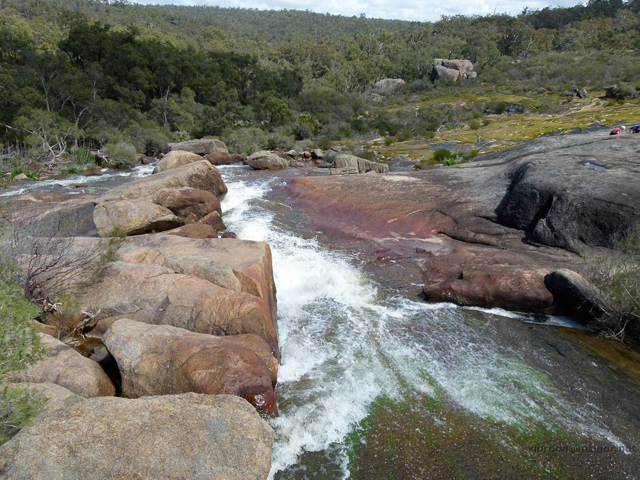
Also known as National Park Falls, Hovea Falls are accessed by taking the main walking path through the Jane Brook valley that follows the route taken by the old Swan View deviation railway line through the park. Hovea Falls are featured in the Eagle's View Walk in John Forrest National Park. The circuit walk offers great views across the Swan Coastal Plain to Perth city and the ocean in the distance. The trail is a bushwalker's delight, covering a variety of relatively pristine habitats, passing beautiful waterfalls and boasting spectacular wildflower displays in spring.

Parkerville
During the railways construction 1894-1895 the department of Lands realised the demand for fertile land along Jane Brook. The Perth City council quarry opened in Parkerville in 1897 supplying blue metal to pave the city streets of Perth until 1919. The quarry was a major employer in Parkerville and declared a town site in 1900.
Stoneville
The Perth suburb of Stoneville is named after Edward Albert Stone, who was Chief Justice of Western Australia when the place was named in 1905. The name was chosen by the local residents who were developing the district for fruit growing.
Mt Helena
In 1882 settlement began when White's Mill was established to provide sleepers for the railway line. Timber from this mill was used in Woodbridge House at Guildford and in the interior of St Georges Cathedral in Perth. White's Mill closed in 1888 and was replaced by Lion Jarrah Mill which patented a new type of flooring known as 'pavodilus", in which floor boards fitted together with nails. In 1896 Lion Mill exported jarrah paving blocks to England. The township was renamed Mt Helena in 1924 and fruit growers and poultry farmers kept the town going after the closures of the sawmills.
With the completion of the Mundaring Branh railway in 1999, Mt Helena became the junction of the two railway lines. From Mt Helena, the main eastern railway continued east. Walkers have the choice of continuing on to Chidlow or taking the Mundaring Branch Railway Trail (see below), passing through Sawyers Valley, Mundaring, Mahogany Creek, Glen Forrest, Darlington Boya and on to Bellevue, where the trail rejoins the main Eastern Railway Trail.
Chidlow
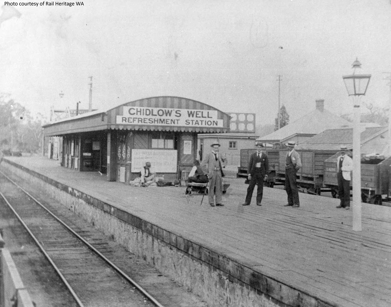
Chidlow was originally known as "Chidlow's Well" after William Chidlow in 1831 and was an important section of the Eastern Railway. The Chidlow's Well Railway Station was completed in 1884 and was listed as a refreshment stop on the timetable. It was also an important stop for watering of the trains from the well and the huge water towers in the station. These demands on Chidlow's Well led to Lake Leschenaultia being created in 1898 as a railway reservoir, where water was pumped by steam-powered pumps into the station yard water towers.
Mundaring Branch Railway
The Mundaring Branch Railway is an historical section of the original Eastern Railway main line across the Darling Scarp. The Branch commenced at Bellevue railway station, moving up the slope to Greenmount. Steep gradients and deviation inclines occurred through to Glen Forrest.
At Mount Helena, the branch line connected with the line we have been following. Mundaring was the junction point where another branch line - to Mundaring Weir - commenced. Traffic ceased running in 1954; the line was closed by Parliament in 1966. Following closure, it eventually became part of the Railway Reserve Heritage Trail. Following the construction of the second route of the Eastern Railway, the Mundaring line served as an alternative to the second route at the time of accidents and derailments, until its closing to traffic in 1954.
There was confusion in the naming of the Mahogany Creek Deviation. The Mahogany Creek railway stopping place was on the Mundaring Branch Railway between Glen Forrest and Mundaring. However the Mahogany Creek Deviation was the incorrect name for the new line that followed the line of the Jane Brook to Mount Helena that passed through the Swan View Tunnel.
Sawyers Valley
This section of the tour documents the Mundaring Branch Railway trail back to Bellevue. Sawyers Valley is sited on the Great Eastern Highway about 40 kilometres from Perth. The community began as a sawmill and railway siding to process timber from the forest surrounding the Helena River to the south. Local employment included forest and Goldfields Water Supply Scheme maintenance, small orchards, and the Midland Railway Workshops. The suburb's name comes from the occupation of many of the first European settlers to the area in the 1860s, who were sawyers working at the local saw-pits.
The Sawyers Valley Tavern, which sits on the Highway opposite the Railway Reserve Heritage Trail, was first established in 1882 and the Sawyers Valley railway station was built in 1884. Timetabled passenger services on this Mundaring Branch line (until closure in early 1954) tended to terminate at Sawyers Valley.
Mundaring
Mundaring is the Aboriginal name of the area "Mindah-lung", said to mean "a high place on a high place", was anglicised to become "Mundaring". The Eastern Railway passed through Mundaring on its first route through to Chidlow. Mundaring railway station, and the branch railway leading from it – the Mundaring Weir Branch Railway were significant locations for the construction of the Mundaring Weir.

The line through Mundaring was known as the Mundaring Loop to railway administration in its later years of operation, while in earlier years it was known as Smiths Mill Branch (the earlier name for Glen Forrest). The line served a small population but played an integral part in the development and history of Mundaring.
Mahogany Creek
Mahogany Creek’s name is derived from the historic Mahogany Inn, constructed in about 1880, and situated on what was the York Road, now known as the Great Eastern Highway. The inn is heritage listed. "Swan River Mahogany" was the name by which Eucalyptus marginata, one of the colony's earliest exports, was known in its European market. There was a railway station on the original route of the Eastern Railway, and there have been a number of shops close to the railway station. Only one remains, now an antique shop.
Glen Forrest
Glen Forrest lies to the south of John Forrest National Park, west of Mahogany Creek, east of Darlington, and north of the Helena River. The area was originally named Smith's Mill, after A. C. Smith & Son's jarrah saw mill, established in October 1877. In 1915 local residents petitioned to change the area's name to Glen Forrest, to honour Sir John Forrest, first Premier of Western Australia.
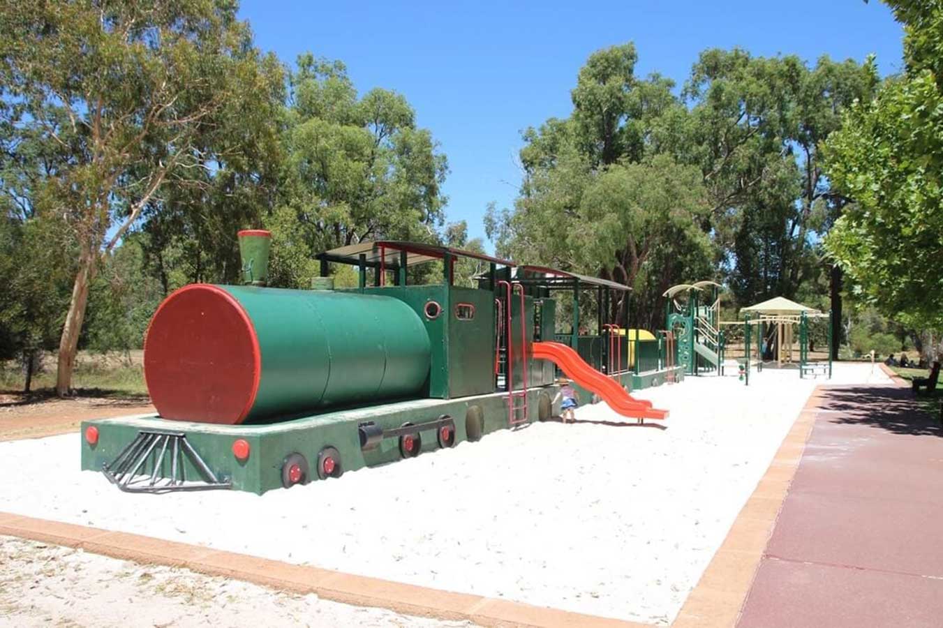
The suburb is bisected by the path of the disused Eastern Railway. Darlington has two commercial areas - one adjacent to, and just north of the former railway station site, and the other at the intersection of Hardey Road and Great Eastern Highway. The railway station site features a railway-themed childrens playground.
Darlington
Darlington developed as a locality from the establishment of the Darlington Winery in the late nineteenth century. Unlike Glen Forrest and Greenmount, Darlington was unplanned. Darlington Hall was originally built for the winery.
Very early on, because of its altitude and separation from the Swan Coastal Plain, Darlington became established as a popular picnic area, country drive destination, and a place for holiday homes. Writers, artists and others seeking to be separate from Perth's extensive suburban sand plain had sought the location for its natural surroundings. The artists gained the most publicity for their residence, while the writers and others tended to keep their privacy.
From 1890 to 1954, Darlington was served by the Mundaring Loop on the Eastern Railway, which bisected the town. Darlington was included in "picnic" and "excursion" train itineraries in the 1930s and 1940s. In 1966, the line was officially closed by act of parliament and the tracks removed. The Railway Reserves Heritage Trail, or Bridle Trail as it is known by locals, now occupies the former railway route, and has become a popular walking and bike trail.

Boya
About one kilometre to the west of Darlington and lower on the Darling Scarp lies the locality of Boya. Between Darlington and Boya there are two abandoned quarries: C. Y. O'Connor's "Fremantle Harbour Works Quarry", now known as "Hudman Road Amphitheatre", and the Mountain Quarry which is also called Boya quarry. They are situated on the southern slope of Greenmount Hill which is defined by the Great Eastern Highway to the north, and the Helena River to the south.
Travel Australia

