


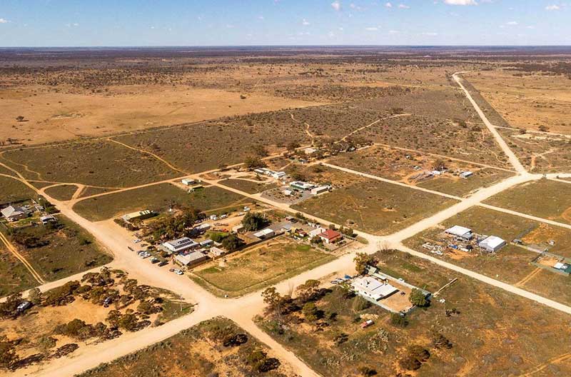
Bower is situated to the east of the Regional town of Eudunda and the settlement of Sutherlands. Bower is approximately halfway between Eudunda and Morgan on the Thiele Highway. Though it only has a population or around 50, Bower has a strong community spirit, headed by the ‘Bower Progess Association’ (BPA). The area was originally the territory of the Ngadjuri people.
The small town of Bower was surveyed and established in 1899 a long way outside of Goyder’s line showing land suitable for agriculture and farming. Like most settlements on the Murray Flats it was created as a service town on the most viable railway line in South Australia – from Adelaide to Morgan. The name honours David Bower, a South Australian Member of Parliament (1865 – 1887) who donated land in the state for institutional purposes. Bower died the year before the town was founded in 1898. Remembered as a charitable man, David Bower arrived in SA in 1846 and set himself up as a timber merchant in Port Adelaide. He entered parliament in 1865 and remained a politician until his retirement in 1887.
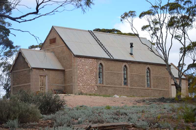
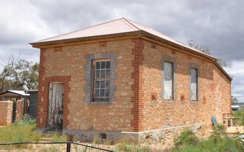
Immanuel Lutheran Church, Bower
The Murray Flats district was settled mainly by German background farmers in the 1880. Like many German settlements it soon had two Lutheran churches from two different Lutheran synods. St Peter’s congregation was formed in 1880 with the church being erected in 1890 and Immanuel Lutheran congregation was formed in 1892 with their church being built in 1899. Both churches had their own Lutheran schools until 1917 when an act of parliament closed all Lutheran schools. A government school had been established in the town in 1899 and that continued offering education until it too closed in 1961.
Most families came to the area as mixed farmers but struggled, producing only a little grain and sheep grazing, particularly in the drought years. Most walked of the land, abandoning the cottages, the ruins of which are scattered throughout the district today. By 1916, Bower had become a dispatch centre for lime, mallee timber and roots that wre shipped to Adelaide by train. The economic mainstays of the town became wood cutting for Eudunda's farmers and lime burning in kilns just outside of the town. Lime was in high demand around 1900 as it was the base material for mortar for brick building and stone had gone out of fashion at that time and new houses were being built in brick. The historic Lime Kiln Ruins on Bower Boundary Road are listed on the South Australian Heritage Register.
Mount Mary
Mount Mary is a small town on the Thiele Highway between Eudunda and Morgan in South Australia. Mount Mary is situated 8 km east of Bower. Mount Mary was established in the second wave of European settlement in South Australia's mid-north after the droughts of the 1880s and, like most towns of that era in the region, it sprang up as a result of the coming of the railway.
It soon had a Lutheran Church (1885), a government school (1886) and a Post Office (1883). The general store which is still standing here became the third Eudunda Farmers Store in 1899. The area was always developed for sheep grazing and wood cutting but wheat crops never thrived here. Farmers cleared the Mallee scrub and sold the cut Mallee and stumps to Eudunda Farmers’ Co-operative through the Mount Mary railway station. Sheep grazing and firewood were the main sources of income for residents.
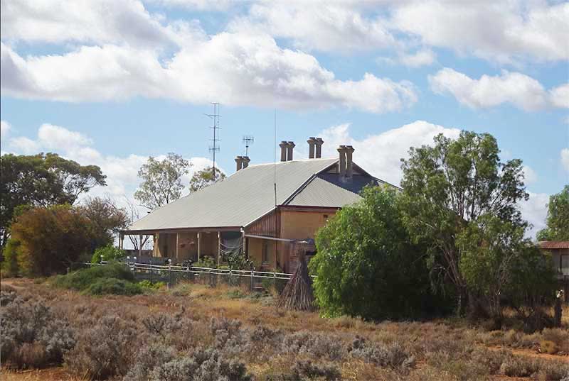
Mount Mary was served by the Morgan railway line from 1878 until 1969 and is named for the Mount Mary railway station on that line. As such it was a bustling railway town with mainly timber, mallee stumps and cut wood, livestock and some grains being shipped by rail from the station. The town itself was mainly settled by railway workers who maintained the train line between Adelaide, Eudunda and Morgan. Two joined stone railway workers houses (photo above) are all that remain of the railway station.
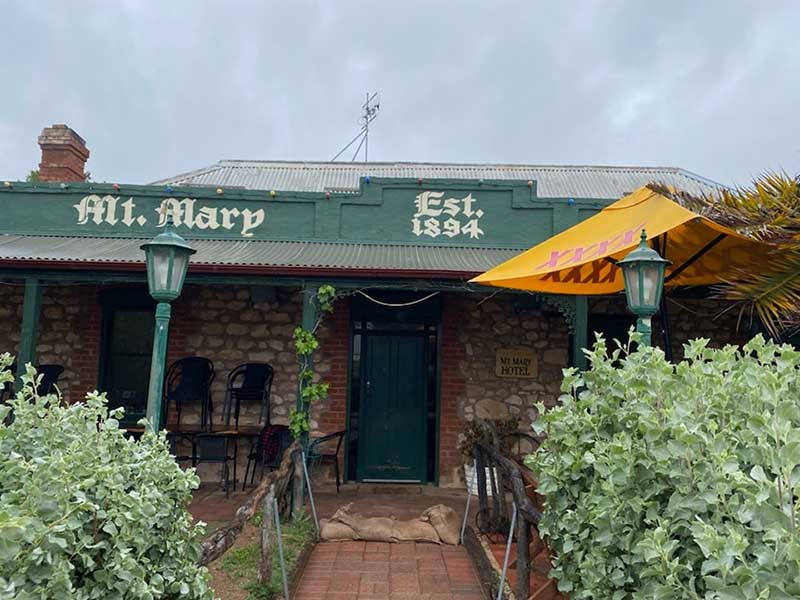
The main focus of the town was and has remained the Mt Mary Hotel (photo above). The historic hotel was established in 1894, and today is packed with memorabilia from by-gone days and now acts as a living museum. Mount Mary was established after the droughts of the 1880s.
Mount Mary Schoolhouse
Being the the hundred of Krichauff, the town was originally surveyed and named Krichauff in 1883 for Friedrich Krichauff, it was then renamed Mount Mary in 1940 to match the name of the railway station. The Krichauff Post Office was opened in 1887 its name was changed to Mount Mary; the school when it opened in 1902 was the Mount Mary School. The name for the hundred in which the town is found was officially changed from Krichauff to Beatty in 1918 during World War One at a time when German names were being changed because of the nagative connotation of things German at that time. The town was not officially changed to Mount Mary until 1940.
Despite the town's name, the terrain is essentially flat. There are two explanations usually offered fior its name; firstly, that the town was named after the sister of an early pastoralist who had a small mound named after her; or secondly, that a shepherd named Mont lived in the area with a daughter named Mary and when she was lost in the bush and buried on a small mound it became known as Mary’s Mount.

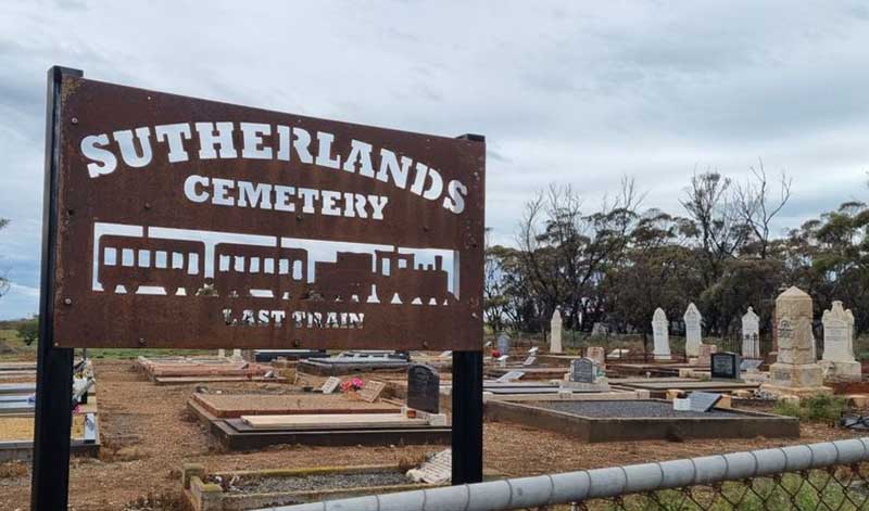
St John's Lutheran Cemetery, Suthlands
Sutherlands
With a population of around 300, the town of Sutherlands is located 12 kilometres east of Eudunda on the Thiele Highway. Once the centre of a thriving farming community on the Morgan railway line, today, as with most small towns, Sutherland's main attraction and meeting place is the Sutherlands Hotel. Sutherlands is lucky to currently have all remaining houses occupied and still have many families living throughout the district.
Sutherlands was named after William Sutherland who took up 2,000 acres here in 1879 and subdivided some of this land two years later to create a small township on the Eudunda to Morgan railway which first passed through the locality in 1878. Being just to the east of Goyder’s Line of 1865, the town is situated in marginal farming country where little grain has ever been grown successfully, and certainly not enough to support the young community here. The town got a major boost in its early years from the timber cutting trade as the Mallee scrub was cleared by the local farmers. The timber was sold through a farmer's co-operative established in Eurdunda, which still operates 21 IGA supermarkets throughout the region.
Morgan Railway Line
The railway line to Kapunda, which passes through Hampden and became the Morgan Railway Line, was the first extension of the Adelaide and Gawler line. It was built initially to service the copper mining at Kapunda, and opened on 13 August 1860, and then extended to Morgan on the Murray River in 1878 to provide a more efficient freight and passenger connection between the Murray paddle steamers and both the city of Adelaide and Port Adelaide for ocean transport.
The line passed through Roseworthy from where the Peterborough line later branched. The line headed northeast from Roseworthy to reach Freeling, then the line crossed the River Light just south of Kapunda. The extension continued through Hansborough, running across the River Light once again and Pine Creek before reaching Hampden, then turning south and going through a steep descent into Eudunda. From there, the line curved northwards towards the junction for the Robertstown line, then heading west across the plains adjacent to what is now the Thiele Highway to Morgan. The Robertstown line branch opened in 1914 from Eudunda to Robertstown, passing through Point Pass along the way. The Eudunda to Morgan section of the line was closed on 2 November 1969, the Kapunda to Eudunda section closed on 11 March 1994.