


Robertstown is the hub of a small broadacre farming community on the Worlds End Highway 23 kilometres north of Eudunda between Eudunda and Burra. Robertstown had its beginnings in 1868, when the government approved the surveying of the locality into town blocks, calling it Emu Flats. As English and German settlers began moving into the area, one of them, John Roberts, opened a general store and post office, applying for a post mark ROBERTS-TOWN, and so the town which had never been gazetted, received it’s official name.
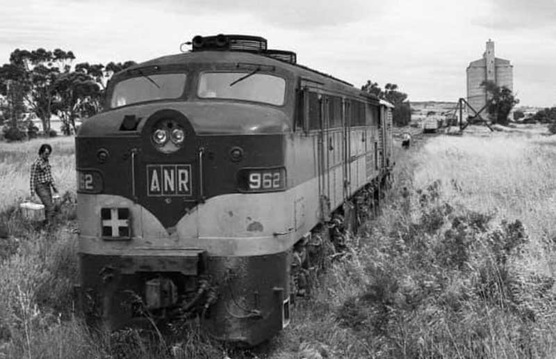
AN diesel locomotive 962 at Robertstown about to work the goods train back to Dry Creek in March 1981. Photo credit: Bob Sampson.
On 9 December 1914, Robertstown became the terminus of the Robertstown railway branch line beginning from a junction with the Morgan line at Eudunda and running 21.6 kilometres via Point Pass to Robertstown. A railway triangle was built for locomotives to turn around. The broad gauge (1600mm/5 ft 3 ins) line was used by both passenger and freight trains, though the regular passenger service on the line was withdrawn on 23 September 1962 due to failing patronage.
Seasonal grain trains serving the Robertstown silos were among the last traffic to use the line in its later years. Train Tour Promotions ran the last passenger train using diesel locomotive 804 on 20 May 1989, with the last freight train being a grain train on 21 February 1990. The line formally closed by AN (Australian National) on 25 September 1990. The tracks were lifted in the years following, with all stations on the line being demolished. The only significant railway remnants left are the former Robertstown station sign and the former Scotch Derrick design goods crane. What was once the Railway yards is now landscaped with native plants, making it a great place for travellers to stop and refresh.
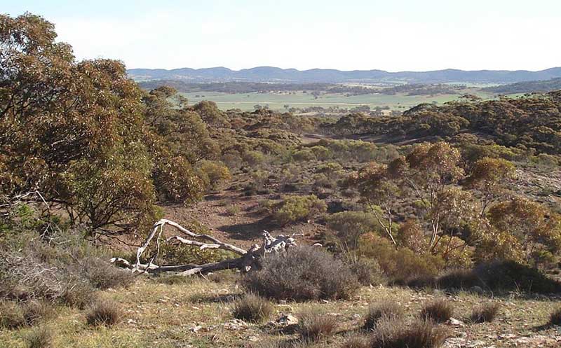
Robertstown occupies a unique position as the only surviving town of any significance in a huge area of marginal country between the Murray River and the Barrier Highway. The town is sited in a unique landscape, encompassing a varied topography, rainfall and vegetation. It is situated where the north Mount Lofty Ranges rise out of the edge of the Murray flats. From the environmentally significant Tothill Range in the west (696 m above sea level and an average rainfall of 500 mm) the land falls in a series of steps, crossing Goyder’s Line to the Murray Flats (100 m above sea level and an average rainfall of 250 mm).
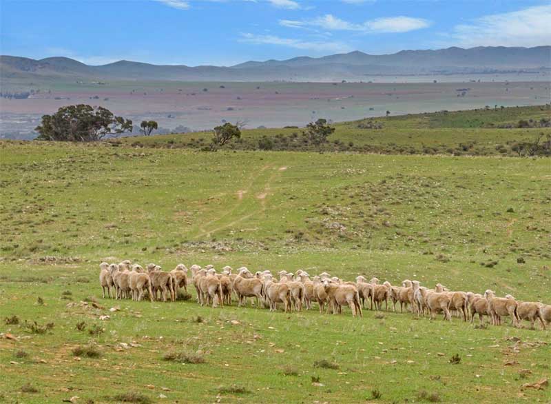
Inspiration Point Lookout (above) offers magnificent views to the east over Robertstown and beyond Goyder's Line to the Murray Flats and the Tothill Range. Birdlife is prolific along the narow corridor of woodland.
The flora of the district changes dramatically from west to east. The Tothill Range has many rare and threatened species. The table land area is sprinkled with towering red and blue gums and a diverse understorey, whilst the natural vegetation of the flats includes mallee, bluebush and saltbush.

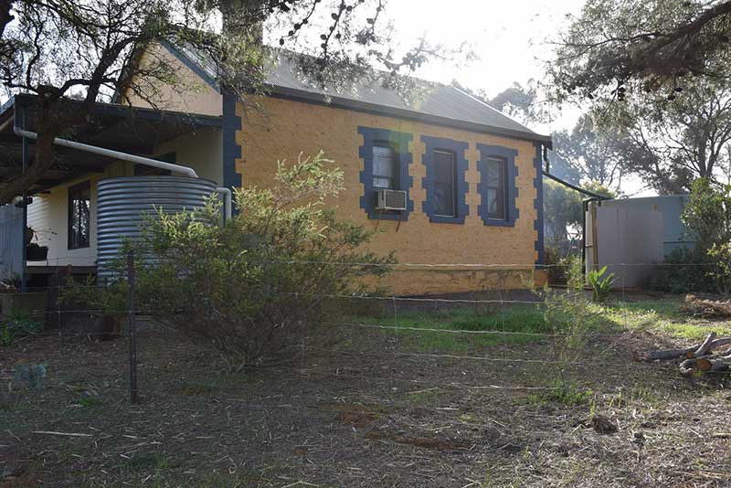
Former Julia State School
Julia
Julia (16.4 km south) is today nothing more than a scattering of homes, a Lutheran church and a community hall. Named after the local watercourse, Julia Creek the name was bestowed by the Governor of South Australia, George Gawler (1795-1869), and honours his daughter. Gawler was the second Governor of South Australia, at the same time serving as Resident Commissioner, from 17 October 1838 until 15 May 1841. The town is located 10 kilometres north of Eudunda. At 14, Julia sketched a view of South Australia after her arrival in Australia in 1838. Dated Saturday, 13th October 1838 it depicts the tents on the beach where the family lived before moving into Government House.
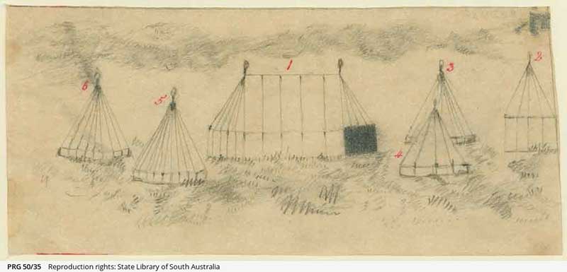
Julia Gawler's sketch of "a view of South Australia" after her arrival in Australia in 1838
Like many an 'accomplished' young gentlewoman, Julia learnt to play the piano, she also sewed and did embroidery. When the explorer Edward John Eyre set out from Adelaide on 18 June the two Misses Hindmarsh, Miss Conway, and Miss Gawler had made a silk flag for him to plant when he reached the Tropic of Capricorn. Julia returned to England with her family in 1841, never to return to South Australia.
A Lutheran congregation at Julia was formed in January 1910. It met in private homes and a wheat shed before a church was built, opening in August 1911. The church was extended in 1928. Julia Primary School opened in 1910 and closed in 1950. Author Colin Thiele, who was raised outside Julia, attended the school from 1926 to 1932. A post office at Julia opened in February 1881 and closed in April 1886. A postal receiving office subsequently opened in December 1908 and closed in July 1981, having been operated by a local woman out of a room of her house for 19+1⁄2 years. A public hall at Julia opened in 1909, and was replaced twice, in 1926 and 1958.
Author Colin Thiele AC grew up in the area around Julia. Julia State School was the first school he attended (1926–32) before going on to Eudunda and Kapunda schools. Colin Thiele’s career as a writer started in the 1940s with poetry and ABC radio scripts. Burke and Wills (1949) was a successful radio verse play. He has written or edited a total of 101 books. Storm Boy (1963), his most famous book, was adapted as a film in 1976. The Sun on the Stubble (1961), The Shadow on the Hills (1977) and the Valley Between (1981) form a loose trilogy about his childhood in the Eudunda district and, with Uncle Gustav’s Ghosts (1974), provided the scenes and characters for an ABC series, Sun on the Stubble, in 1996.
Hallelujah Hills
Hallelujah Hills is a beautiful rural locality nestled in the last hilly range between the grasslands and grassy woodlands of the Mid-North and the semi-arid mallee shrublands of the Murray River flats. 14 kilometres north of Robertstown, it includes the 413 ha former Hallelujah Hills pastoral property, now held for conservation purposes by Worlds End Conservation Pty Ltd. Worlds End describes the site as "the last range of hills and ridges between the mid-north and the mallee plains", and home to rare and threatened flora and fauna. It is home to a large population of the endangered Spiller's wattle (Acacia spilleriana). Worlds End Highway marks the eastern boundary of the locality. Hallelujah Hills Road is the only road through Hallelujah Hills itself. The area was originally the territory of the Ngadjuri people.
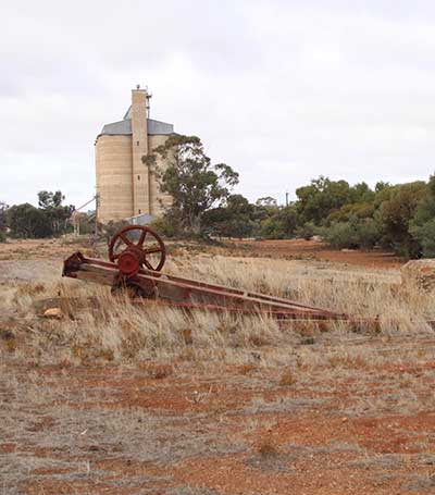
Robertstown grain silo
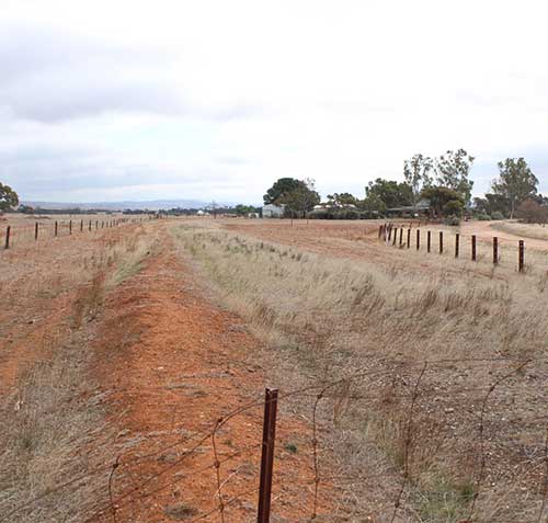
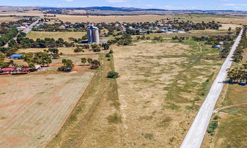
Site of the railway junction at Eudunda, looking north towards Robertstown.