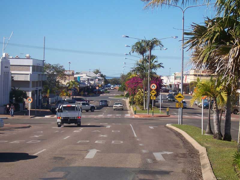
The quintessential graceful Queensland port town, Bowen is located on the north-east coast of Australia, at exactly twenty degrees south of the equator. In fact, the twentieth parallel crosses the main street. A major Queensland centre for the growing of mangoes, Bowen is halfway between Townsville and Mackay, and 1,130 kilometres by road from Brisbane.
A town of over 7,500, Bowen sits on a square peninsula, with ocean to the north, east, and south. On the western side, where the peninsula connects with the mainland, the Don River's alluvial plain provides fertile soil that supports a prosperous farming industry. Bowen enjoys a diversified and prosperous economy based on agriculture, fishing, tourism, and mining.
Just north of Bowen is the Abbot Point coal loading port (see below). The mining of Coal from the Bowen Basin is a growing operation. Abbott Point is Australia's most northerly coal shipping port, with its modern deepwater port complex and extensive facilities both onshore and offshore. It plays a vital role in the States $8 billion coal export industry. Forecasts suggest that over the next 5 to 10 years the volume of coal exported from the Abbot Point Coal terminal will triple to approximately 50 million tonnes.
Bowen featured prominently in the 2008 feature film, Australia, directed by Baz Luhrmann and starring Nicole Kidman and Hugh Jackman. In the film, Bowen represented Darwin during the war years.
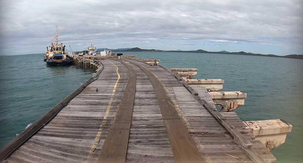
Bowen was the first port established in North Queensland. The settlement was officially proclaimed on 11 April 1861 and named Bowen after Queensland's first Governor, Sir George Ferguson Bowen. The township of Bowen quickly grew to support the northern pastoral industry as a strategically placed supply centre. Bowen soon became a major administrative and commercial centre and was declared a municipality on 17 March 1863. It was eclipsed in importance by Townsville by the 1870s.Bowen needed a jetty to function effectively as a port, however, it was not until 1865 that the Department of Harbours and Rivers commenced construction.
Completed in May 1867, the jetty accommodated vessels drawing 12 feet (3.7m) at the outer end and seven feet (2m) at an inner berth. The scale of the jetty and harbour, and the depth of the berths considered adequate for the port at Bowen, reflected the size of the shipping at the time. The loading facilities reflected the way in which cargo was transported in ships. Many commodities that are now transported in bulk were once bagged. Railway tracks (still extant at Bowen) were provided so that the cargo could be railed out to the jetty head. Cranes or derricks (no longer extant at Bowen) then loaded the cargo into the holds of the ships.
About Bowen jetty
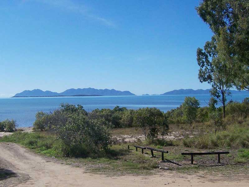
Gloucester Island
Lieut. James Cook named Cape Gloucester on his voyage of exploration up the Australian coast in 1770. This "cape" turned out to be Gloucester Island which dominates the view from Bowen's eastern beaches. Behind the island is a bay that forms an excellent port, which the town came to be built around. This bay was eventually discovered in 1859 by Captain Henry Daniel Sinclair, in response to a reward offered by the colony of New South Wales for finding a port north of Rockhampton. Sinclair named Port Denison after the colonial governor of New South Wales.
Two years later, Sinclair led one group of settlers by sea, and George Elphinstone Dalrymple led another party overland from Rockhampton. They met on 11 April 1861 at Port Denison and founded the town of Bowen on the next day, 12 April 1861. By this time, the separate colony of Queensland had been established, and the town was named after Queensland's first colonial governor, Sir George Ferguson Bowen. In 1863, the new settlers discovered a sailor, James Morril, who had been shipwrecked 17 years previously just to the north of Bowen. Morril made his home in the new town, and his grave is still to be seen in the Bowen cemetery.
Between the 1860s and the 1880s, early colonists and settlers forecasted Bowen as the "capital of a new North Queensland Colony". Relics of this particular ambition can be seen today in Bowen's exacting road grid and town plan, and the avenue-like width of its central streets.
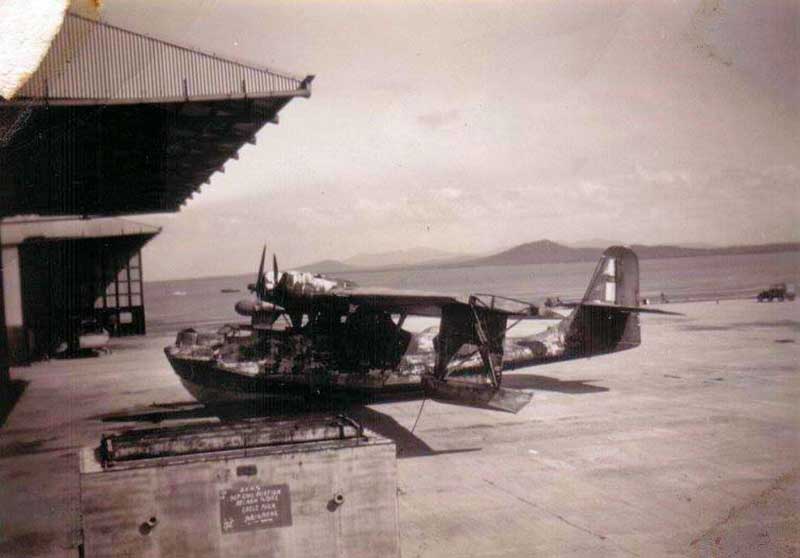
Bowen Air Force Base (World War II). Photo: Oz At War
The coral reefs around Bowen have several shipwrecks, including the SS Gothenburg which sank in 1875 with a loss of more than 100 lives. Numerous relics of Bowen's history, from the Aboriginal past onwards, are on display at the Bowen Historical Society's museum. During World War 2 Bowen hosted an air force base, flying PBY Catalina flying boats to search for enemy ships and submarines.
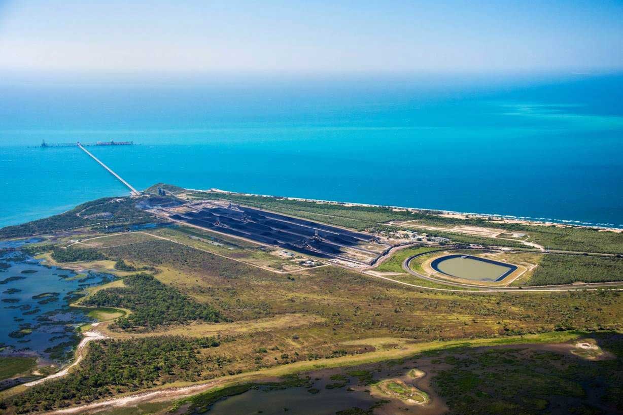
Photo: Abbot Point Operations
The Port of Abbot Point is Australia’s most northern coal export port. In naturally deep water, the port is located 25 kilometres north of Bowen and incorporates the North Queensland Export Terminal (NQXT) with a current export capacity of 50 million tonnes per annum. The Port is of significant strategic value to North Queensland Bulk Ports Corporation, as there are very few locations along Queensland's eastern seaboard where deep water (above 15 metres) is so close in-shore. North Queensland Export Terminal has been operating for 35 years exporting coal, however the port's location is sometimes considered controversial given it is about 200 km from the Great Barrier Reef, a UNESCO world heritage site.
The port is planned to provide export facilities for coal mined from the Galilee Basin. The terminal has approvals to be expanded with the addition of a second wharf and shiploader as well as an additional onshore stockyard and machines, however this was tabled due to the sizing down of the Carmichael Mine. The road and railway to the port have been targeted at times by non-violent direct action by environmentalists opposed to coal exports.


Design by W3layouts