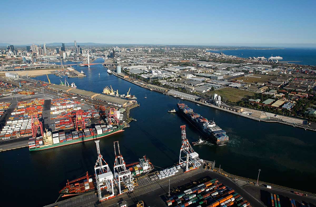
Swanson, Appleton and Victoria Docks. Photo: Port of Melbourne
The Port of Melbourne is the largest port for containerised and general cargo in Australia. It covers an area at the mouth of the Yarra River, downstream of Bolte Bridge, which is at the head of Port Phillip, as well as several piers on the bay itself. Since 1 July 2003, the Port of Melbourne has been managed by the Port of Melbourne Corporation, a statutory corporation created by the State of Victoria.
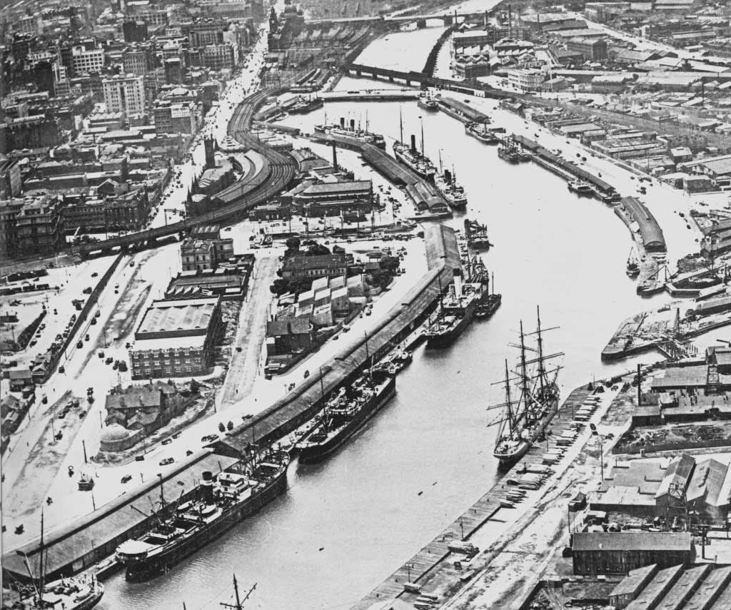
Riverside wharves upsteam from Victoria Dock in the 1920s
Most of the port is in the suburb of West Melbourne and should not be confused with the Melbourne suburb of Port Melbourne although Webb Dock and Station Pier, parts of the Port of Melbourne, are in Port Melbourne. Port Melbourne (or Sandridge as it was known until 1884) was a busy port early in the history of Melbourne, but declined as a cargo port with the development of the Port of Melbourne in the late 19th century. It retains Melbourne's passenger terminal however, with cruise ships and ferries using Station Pier.
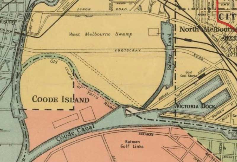
In 1877, Victoria's government resolved to make the Yarra more navigable and engaged English engineer Sir John Coode to devise a solution. His solution was to change the course of the river by cutting a canal south of the original course of the river. This shortened it by a mile and made it much wider. It also created Coode Island, a name still used today although the northern course of the river has long since disappeared.
With these works, ships were now able to sail as far up the river as Queensbridge where a turning basin was constructed. Coode also oversaw the construction of Victoria Dock in swampland to the west of the city. This opened in 1889.
Over time the docks moved progressively downstream as ships became larger and road bridges were built across the Yarra. The construction of the Spencer Street Bridge in 1928 and the Charles Grimes Bridge in 1975 each closed access to docks to the east. The barque Polly Woodside lying in the old Duke and Orr drydock, the warehouses of South Wharf and the Mission to Seafarers building are now the only reminders of the maritime history of this area.
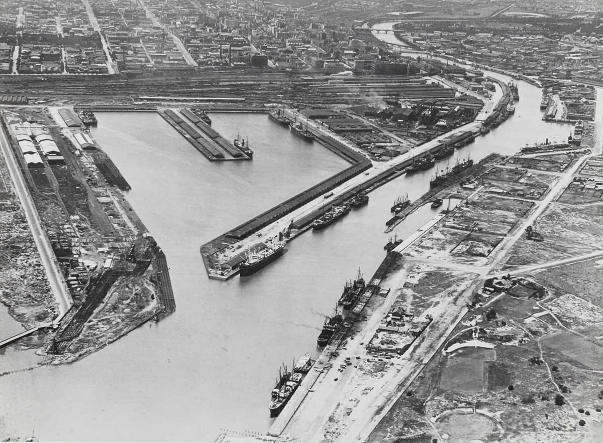
Victoria Dock, 1958. Photo: Museums Victoria Collection
Under the guidance of British civil engineer John Coode, a major engineering project began in the 1880s to reroute the course of the Yarra River, which resulted in the widening of the river for shipping and the creation of a new Victoria Dock (the name was previously used by one at Queens Bridge as early as the 1850s). The dock was lined with wharves and light industry grew around the nearby western rail yards of Spencer Street railway station (now Southern Cross railway station), which were used for freighting the goods inland.
During the wars, Victoria Dock was used as the main port for naval vessels and most of the Victorian troops returned from both wars to the docks. By the 1920s, with shipping moved from the Yarra turning basin at Queensbridge, Victoria Dock and surrounding port had become Melbourne's busiest. With the introduction of containerisation of Victoria's shipping industry in the 1950s and 1960s, the docks along the Yarra River, east of the modern Bolte Bridge, and within Victoria Harbour immediately to the west of the Central Business District, became inadequate for the new container ships.
Coode Island. Photo: State Library Victoria Collection
Coode Island, an almost uninhabited industrial area, is 4 km. west of Melbourne, was formed in 1886 when canal was cut through the Sandridge swamp to provide a straightened stream for the Yarra River. The boundaries are the Coode Canal on the south (now viewed as the normal flow of the river), the Maribyrnong River on the west and the Yarra meander on the north and east. Its area was 97 ha. It was named after Sir John Coode, an English harbour engineer who was engaged by the Melbourne Harbor Trust to select the optimum route for the canal as part of the Port of Melbourne.
Coode chose the canal route so as to avoid dangerous tidal ebbs and inflows that would occur along one that went straight from the Yarra River docks to Hobsons Bay. Inflows endangered flood-prone land upstream as far as Gardiners Creek, by the banking up of stream waters. The route also ensured that the Yarra waters would discharge into the river mouth, scouring the bay and reducing silt deposition.
The meander at Humbug Reach was known as Fishermens Bend. Later the name Fishermens Bend came to be applied to the land opposite Coode Island, on the other side of the canal, and even to Sandridge Beach, Port Melbourne west, which became Garden City.
By 1909 the marshy surface of Coode Island was being filled for reclamation. Its chief use was as a quarantine station for stock, and buildings were erected there in the event of the need for a bubonic plague sanitarium. Much of the native vegetation had been replaced by exotics, probably from abandoned ships' ballast. By the late 1930s the meander had almost disappeared as the "island" had over time been joined to West Melbourne, but the name continued to be used.
Appleton Dock. Photo: Port of Melbourne
In 1929 the construction of Appleton Dock on the south-east corner of Coode Island was begun. It was opened in about 1956 by the Melbourne Harbor Trust, and is named after MHT commissioner William Thomas Appleton (1859-1930), who was a staunch advocate of harbour improvements in the early 20th century.
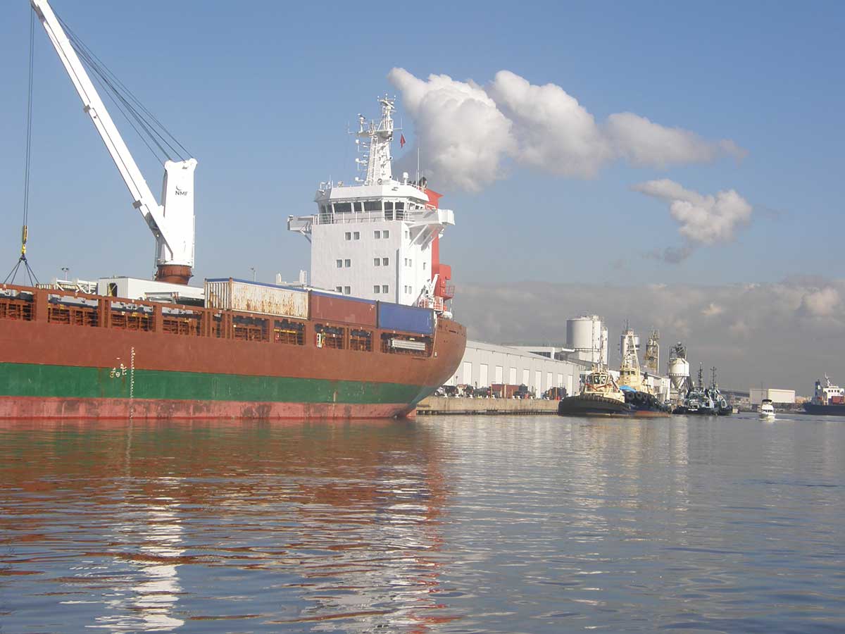
Following the construction of Spencer Street Bridge over the Yarra River in 1929, the wharves on the upper section of the river were blocked to shipping, so the provision of replacement wharfage became necessary. The Harbor Trust had commenced works at the outlet of Moonee Ponds Creek in 1929, which became Appleton Dock. It had been planned since the 1930s but, because of interruptions caused by the Second World War, it was not completed until 1956. At the same time, South Wharf was extended to the west. Appleton Dock handles bulk grain and coal and, since the 1960s, some container shipping.
Swanson Dock. Photo: Port of Melbourne
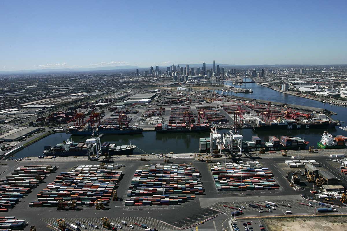
Established during the infancy of containerisation in Australia, Swanson Dock has matured over 50 years to become the centrepiece of Australia’s international container trade. Swanson Dock was excavated out of Coode Island near its south-west corner when containerized cargo services began in the 1960s. MacKenzie Road was constructed southwards, west of Swanson Dock, and bulk petro-chemical storage tanks were built along it, beginning in 1960. The liquids were unloaded from Maribyrnong No. 1 berth on the western bank of Coode Island.
The dock is named after the instigator for Melbourne to build a dedicated container dock, Victor Swanson, who was Chairman of the Melbourne Harbour Trust, one of the predecessor organisations to Port of Melbourne Operations. Swanson had taken a strong interest in all matters to do with international shipping and cargo and had made the decision to establish a dedicated container dock in Melbourne in 1965.
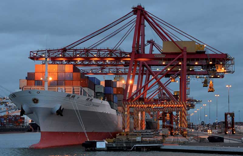
Swanson Dock. Photo: Sealite
The first international ship to use Swanson Dock West 1 berth was the Encounter Bay – a former P&O vessel with a beam of 30.48 metres and an overall length of 227 metres. Its gross tonnage was 27,000 tons and it boasted a nominal capacity of around 1600 TEU. It is interesting to compare this first vessel to the largest arrival at Swanson Dock to date which is the Pangal at 304 metres in length and a capacity of over 6500 TEU. Today, Swanson Dock sits at the heart of the supply chain system for south-eastern Australia to service a new generation of customers, cargo owners, shipping lines and the wider community.
Webb Dock. Photo: AW Maritime
Formerly known as the River Entrance Dock, Webb Dock commenced operations in the 1950s primarily to transport cargo and motorists to and from Tasmania. International container handling was also an essential feature of the facility for many years up until the 1990s. Webb Dock has since evolved to become the largest automotive terminal in Australasia for the export and import of cars, handling around 1000 motor vehicles per day on average.
The dock is named in honour of former Melbourne Harbor Trust commissioner, J. P. Webb OBE, who was Chairman and Managing Director of the Victorian Producers’ Co-operative Company Limited and was first appointed to the Trust in 1941 as an exporters’ representative.
The Port of Melbourne is made up of the following:
Swanson Dock West has four berths and is used for containerised cargo, managed by DP World
Swanson Dock East has four berths and is used for containerised cargo, managed by Patrick
Appleton Dock berths B,C and D are used for general cargo, managed by DP World
Appleton Dock E is used for general cargo destined for or from Tasmania
Appleton Dock F is used for bulk dry cargo
Maribyrnong (Coode Island) is a bulk liquid facility
Webb Dock West is a roll-on-roll-off facility for motor vehicles, managed by Toll Stevedores
Webb Dock East 1 is managed by Toll Domestic Forwarding for Tasmanian general cargo
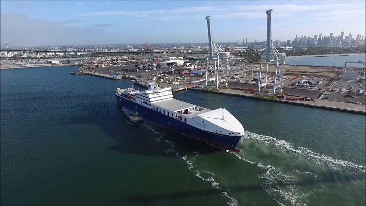
Webb Dock East 2 is managed by Searoad for general Tasmanian cargo.
Webb Dock East 4 & 5 is utilised for containerised cargo, is managed by Victoria International Container Terminal, a division of ICTS
Gellibrand Pier is operated by ExxonMobil Australia and has a direct pipeline to the Altona Refinery
Holden Dock handles refined petroleum products
South Wharf berths 26 to 33 handle general cargo
From May 2003 till May 2004, approximately 3,400 ships from 42 different lines called at the Port of Melbourne. The port handled 64.4 million tonnes of cargo, including a throughput of 1.9 million twenty-foot equivalent units (TEU) of cargo. In 2006-07 it became the first Australian port to handle two million TEU in a year.
Railway goods sidings serve both Swanson Dock East and West, permitting the transfer of shipping containers between sea and rail transport. Originally provided in the 1960s with the development of the port, they were later removed and not restored until 2003 as a 1500 metre long siding. Rail sidings at Appleton Dock reopened in 2000 to serve a new export grain terminal at the port. Dual gauge access is provided to the majority of sidings in the area. Extensive sidings once served the Victoria Dock area, as well as Webb Dock which had a dedicated line.
Port of Melbourne Website
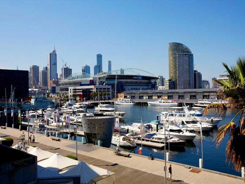
The site of modern-day Docklands was originally swamp land that in the 1880s became a bustling dock area around Victoria Dock as part of the Port of Melbourne, with an extensive network of wharfs, heavy rail infrastructure and light industry. Following the containerisation of shipping traffic, Docklands fell into disuse and by the 1990s was virtually abandoned, making it the focal point of Melbourne's underground rave scene.
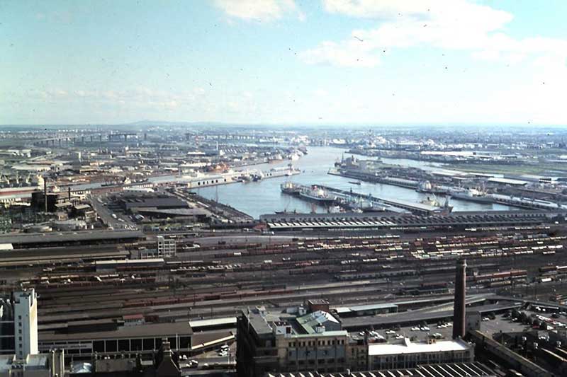
Docklands, 1974. Photo: Development Victoria
The construction of Docklands Stadium in the late 1990s attracted developer interest in the area, and urban renewal began in earnest in 2000 with several independent privately developed areas overseen by VicUrban, an agency of the Victorian Government. Docklands subsequently experienced an apartment boom and became a sought-after business address, attracting the national headquarters of, among others, the National Australia Bank, ANZ, Myer, Medibank, and the Bureau of Meteorology, as well as the regional headquarters for Ericsson, Bendigo Bank and television networks Channel Nine and Seven Network Broadcast Centre.
The centrepiece of Docklands, Victoria Harbour includes the extension of Collins Street and Bourke Street to meet at the water's edge. It has an area of 280,000 square metres, with 3.7 kilometres of waterfront. The 12-year construction plans for Victoria Harbour included residential apartments, commercial office space, retail space, community facilities and the development of public spaces such as Grand Plaza, Harbour Esplanade, Docklands Park and Central Pier.


Design by W3layouts