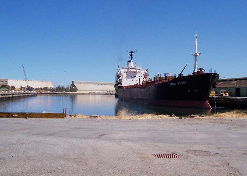
Port Adelaide Inner Harbour
Prior to European settlement Port Adelaide was covered with mangrove swamps and tidal mud flats, and lay next to a narrow creek. The entrance to this creek, the Port River, was first reported in 1831. It was explored by Europeans when Captain Johnny Jones entered in 1834. The creek's main channel was then fed by numerous smaller creeks, and was 2-4 fathoms (4-7 m) deep. The navigable channel was narrow and the creek soon faded into swamps and sandhills. At low tide the channel was surrounded by mudbanks. Dry and solid land ended near present-day Alberton.
Colonel William Light began closely exploring the area in late 1836 while deciding on a site for the colony of South Australia's port. After initial trepidation, he reported to the Colonisation Commissioners that the location was a suitable harbour. By this time it had acquired the name "the port creek". Light's choice of separating the port and Adelaide was strongly opposed by a few merchants, a newspaper and Governor John Hindmarsh. This opposition was largely based on the distance between them. The division of power in the colony meant that the final decision was Light's alone. He kept Adelaide and the port separate principally due to the lack of fresh water at the port.
The development of the Lefevre Peninsula and Port Adelaide began in 1849 when the Semaphore area was surveyed by the Government, even lthough Semaphore was widely used a harbour as early 1837-38. Two years later the original Semaphore Hotel opened on the south corner of Blacker Street and The Esplanade. In 1856 a telegraph line was extended to Semaphore from Port Adelaide. Three years later, Port Bridge opened, connecting Semaphore and Port Adelaide.
In 1878 after the completion of the Jervois Bridge, a railway line from Semaphore to Port Adelaide was opened and Semaphore began to grow. It became popular both as a residential suburb for Port Adelaide as well as a seaside resort for metropolitan Adelaide and towns near the country railways.
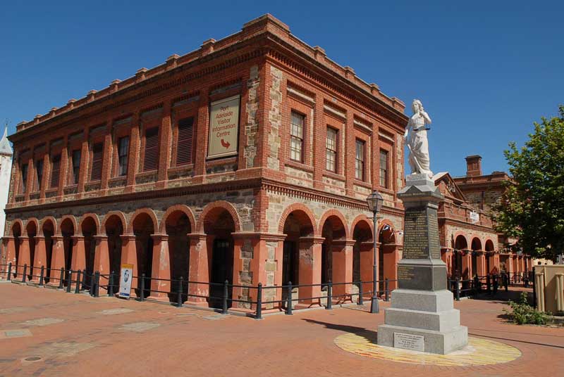
Port Adelaide was officially proclaimed as a harbour in 1837. Its original name, Port Misery, is said to have been adopted because it was a mosquito-infested swamp when the first settlers landed there. It has also been suggested the name described the unsatisfactory handling of goods at the site. In 1839, the name was changed to Port Adelaide. Today, it still maintains the port working-class feel but it is slowly becoming gentrified, especially along the Port River. The suburb has many old colonial buildings, such as the Port Adelaide Uniting Church, primarily near the wharves (St Vincent Street, Lipson Street and Divett Street), that have been placed under State heritage listing.
From 1838 to 1906, sixty differently named hotels had been run on 38 different sites within Port Adelaide. Many old pubs still serve up excellent counter lunches, helping to make the whole place come alive again. The British Hotel is the longest continually licensed. It opened 1847 as a single storey building, and was rebuilt with two further storeys in 1876 for then-owner Henry Ayers. Dockside Tavern is one of the few Late Victorian style buildings remaining in the Port. It was opened as the Britannia Hotel in 1850 then was rebuilt on site in 1898, in contemporary style.
The port is now home to the Dacou Aboriginal Art Gallery, a seashorse farm, the South Australian Maritime Museum, the National Railway Museum (one of, if not the country's best), the South Australian Aviation Museum, Australian Museum of Childhood and cruisers that take visitors dolphin spotting on Port River. Port Adelaide is known for its well preserved 19th-century pubs and hotels, reflecting the area's maritime history in catering to the sailors of trading ships. The earliest recorded was the Port Hotel. It opened in 1838, two years before the port was officially declared.
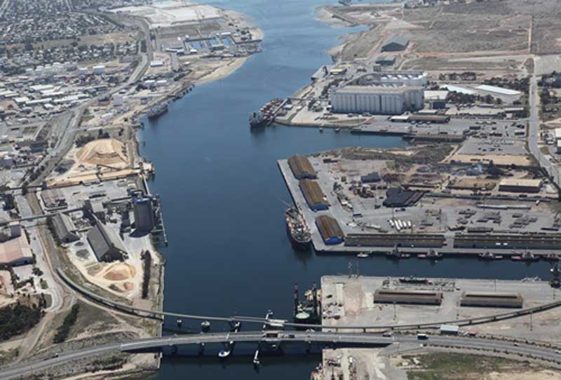
The Port River is the western branch of the largest tidal estuary on the eastern side of Gulf St Vincent. It extends inland through the historic Inner Harbour of Port Adelaide, to the constructed salt-water West Lakes in the north-western suburbs of Adelaide. The lower reaches of the Port River flow between the Lefevre Peninsula, and the Section Bank and Torrens Island, and form the sea entrance to the port facilities of Adelaide, and connect to the Barker Inlet to the east via the North Arm and Angas Inlet which surround Garden Island.
Before European settlement of Adelaide's western suburbs and the construction of various flood mitigation channels and levees, the Port River formed one of the outlets of the River Torrens. The Port Adelaide area was covered with mangrove swamps and tidal mud flats, and lay next to a narrow creek. The entrance to this creek, the Port River, was first reported in 1831. It was explored by John Jones, captain of the schooner Henry from Van Diemen’s Land (Tasmania) in 1834, who described it as a fine harbour with an island in the entrance and an anchorage inside. The Henry visited Kangaroo Island before proceeding up St Vincent’s Gulf and “put exploration parties ashore at various points ... and returned to Launceston making a report on the suitability of the country for settlements.” Jones recommended Cape Jervis and the eastern shores of Gulf St Vincent as most suitable for settlement.
When Jones visited the area, the creek's main channel was then fed by numerous smaller creeks, and was 2-4 fathoms (4-7 m) deep. The navigable channel was narrow and the creek soon faded into swamps and sandhills. At low tide the channel was surrounded by mudbanks. Dry and solid land ended near present-day Alberton.
About John (Johnny) Jones
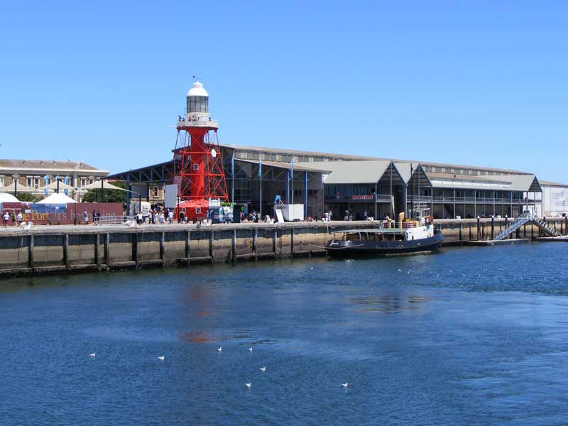
No. 2 Dock, now redeveloped as an historical maritime precinct
The banks of the river are largely industrialised and have some of Adelaide's wharves, bulk cargo and container handling facilities, although there are some remnant mangroves. One of its main attractions other than transport is the Port River dolphins, which are the only wild dolphins in the world that live within a city.
Besides shipping using the river's main channel, a fishing fleet operates out of the North Arm which also has a speed boat club. Recreational boating marinas are located in the Angas Inlet and on the Lefevre Peninsula. The ASC (formerly the Australian Submarine Corporation) has its construction and maintenance facility and dock at Osborne, and there is a heritage-listed former Quarantine Station on Torrens Island.
Several power stations including the Torrens Island Power Station and the Pelican Point Power Station, draw seawater from the Port River for cooling purposes. The Port Adelaide Rowing Club has rowed on the river for one hundred and thirty years, and the river was formerly a frequent venue for the Intervarsity eights race.
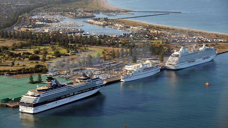
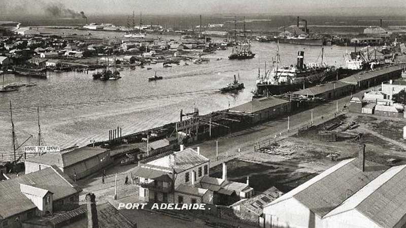
Outer Harbor was established at the beginning of the 20th century, due to the increasing size of ships and the length of time it took to sail up the Port River to the inner harbour of Port Adelaide. The first ship to dock there was the RMS Oruba. on 16 January 1908. The shipping channel leading to the Outer Harbor was dredged to a depth of 14.2m to accommodate Panamax-sized ships with the work being completed in February 2006.
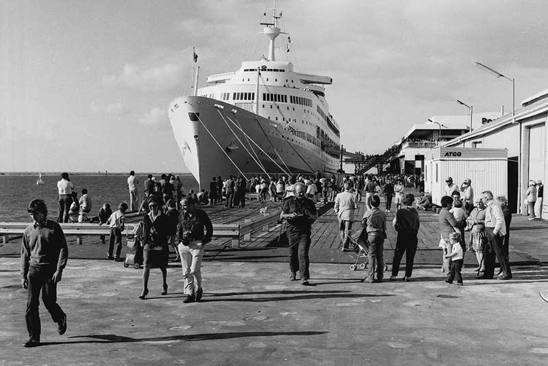
SS Canberra, Port Adelaide Outer Harbour Passenger Terminal


Design by W3layouts